
Choose the Right Apache Trail Route for Your Vehicle
Choose a paved Tortilla Flat outing or the full Apache Trail crossing with realistic timing, Fish Creek Hill guidance and Canyon Lake closure details.
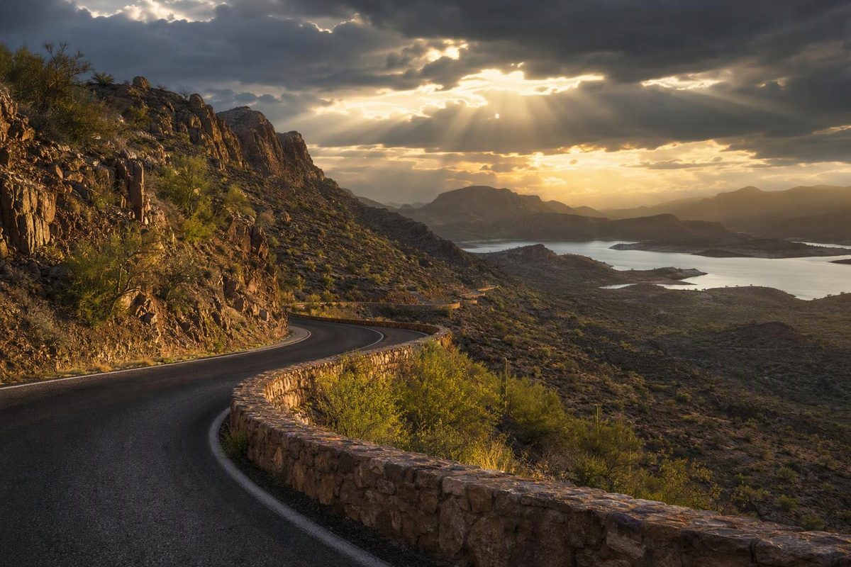
The simplest Apache Trail Arizona scenic drive is SR 88 from Apache Junction to Tortilla Flat and back: about 33 miles round trip, entirely on pavement. Allow 1½–2 hours of driving or 4–6 hours with stops. The full crossing toward Apache Lake and Roosevelt Dam is a different commitment, with steep, narrow, winding dirt road at Fish Creek Hill; plan on high-clearance four-wheel drive and a full day.
Canyon Lake recreation sites are closed for a drawdown, but SR 88 remains open through the closure area. Plan a desert-and-canyon drive, not a Canyon Lake swimming, marina or cruise outing. The Forest Service closure order runs through February 28, 2027, unless rescinded.
Choose your turnaround and vehicle; check the route recommendation beside the controls.
Apache Trail Route Check
This checks route suitability, not live access. Follow posted signs and check AZ 511 before departure.
Paved Return to Tortilla Flat
- Route Distance
- ~33 miles round trip
- Driving Allowance
- 1½–2 hours
Allow 4–6 hours with a meal and one substantial attraction.
The simplest standard-car outing. Turn back at Tortilla Flat to stay on pavement.
Canyon Lake recreation sites are closed under an order through February 28, 2027, unless rescinded. SR 88 remains open through that closure area.
Sources: ADOT vehicle and access guidance; Arizona Highways and NPS route distances; Forest Service closure order. Times are article planning estimates, not official ETAs. Distances start in Apache Junction.
Three Routes With Different Commitments
| Route | Distance | Driving Only | With Stops |
|---|---|---|---|
| Tortilla Flat return | About 33 miles round trip | 1½–2 hours | 4–6 hours |
| Fish Creek Vista return | About 47 miles round trip | 2–3 hours | 4–6 hours |
| Full SR 88 crossing | Roughly 45–50 miles one way | 3–4 hours | Full day with return via Globe |
The return-trip distances use Main Street/SR 88 in Apache Junction as the starting point. The full crossing ends at SR 188 near Roosevelt Dam; its distance varies with your Apache Junction starting point. Fish Creek Vista requires driving on dirt, unlike the Tortilla Flat outing.
These are planning allowances, not measured travel times or official ETAs. They leave room for curves, narrow crossings and slow progress on dirt. The Tortilla Flat day-trip allowance includes a meal and one substantial attraction; the Vista allowance includes a meal and viewpoint stops. Add travel between your Phoenix-area accommodation and Apache Junction separately.
Arizona Highways’ western-route description places Tortilla Flat at approximately mile 16.5 and Fish Creek Vista at 23.6 miles from Main Street/SR 88. The National Park Service’s directions, last updated in 2020, describe a 47-mile Apache Junction–SR 188 route. Use that page for geographic context, not current access: its closure notice predates ADOT’s reopening.
Fill up in Apache Junction. Do not make the trip depend on finding fuel along SR 88; carry enough for your return route or a reversal if the through-road becomes unavailable.
Fish Creek Hill Requires More Than a Reopening Notice
The five miles between Fish Creek Vista, milepost 222, and milepost 227 near Reavis Trailhead Road reopened in September 2024 after the long closure caused by 2019 flood damage. The reopening was an interim repair, not a conversion into an ordinary paved highway. ADOT’s project page still identifies this section as unpaved.
That page contains a mixed message: its current alert says four-wheel-drive-only and no-trailer signs are posted, while the body says there are no vehicle restrictions currently in place at Fish Creek Vista. Do not read the latter as assurance that a sedan or trailer is suitable. Follow the signs you encounter and confirm access with ADOT if your vehicle choice depends on that distinction.
Standard Cars and Rentals: Turn Around at Tortilla Flat
Tortilla Flat is the simplest turnaround for a standard car. SR 88 is paved there and for several miles beyond, according to ADOT’s warning-sign guidance. Check your rental agreement before driving any unpaved section.
Continuing to Fish Creek Vista adds dirt road before the overlook. Assess the surface and weather rather than assuming an older passenger-car description applies after every storm. Reaching the viewpoint does not establish that your vehicle is suitable for the hill beyond it.
Full Crossing: Plan on High-Clearance Four-Wheel Drive
Use a high-clearance four-wheel-drive vehicle and a driver comfortable with exposed, narrow mountain road. Clearance and traction do not remove the need to negotiate blind bends and passing traffic.
Do not plan to cross Fish Creek Hill with an RV, boat or trailer. Apache Lake can be approached from the Roosevelt/SR 188 side without traversing that hill, as ADOT’s access guidance explains. That guidance also identifies Fish Creek Vista as the last eastbound turnaround before the steep hill.
Before departure, check AZ 511 for SR 88 closures and roadwork, then check the weather forecast. A reopening date is not a same-day road-condition report.
Build the Paved Day Trip Around One Main Stop
From US 60, take exit 196 for Idaho Road/SR 88 and follow the signed Apache Trail northeast. Tortilla Flat’s official directions describe approaches from both US 60 and Loop 202.
Choose one substantial stop near the western end rather than fitting every attraction into the drive.
Lost Dutchman State Park: Allow 60–90 minutes for a short walk and mountain views, not a Flatiron summit hike. The park offers a Native Plant Trail as well as much more demanding routes. Its current entry fee is $10 for a vehicle with one person or $20 for two to four people; check the park’s official page before visiting.
Goldfield Ghost Town: Allow about an hour for a look around, longer if adding the mine tour, museum or train listed by the operator. It is a developed visitor attraction, not an untouched abandoned settlement.
Continue toward Canyon Lake and Tortilla Flat. The paved route has hairpin turns and two one-lane bridges, described in Arizona Highways’ route guide. Slow down for the bridges and use designated pullouts rather than stopping in the travel lane.
At Tortilla Flat, budget 45–75 minutes for food and a brief walk. The town’s official website lists the restaurant, country store and small museum. Turn back here for the all-paved outing.
If conditions and your vehicle permit, continue to Fish Creek Vista. Allow roughly 20–30 minutes for the short paved viewpoint trail described by Arizona Highways. Those stop durations are suggested budgets, not published visit times. Do not descend Fish Creek Hill simply because the overlook parking area was easy to reach.
Canyon Lake Recreation Stops Are Closed
The closure includes Acacia, Palo Verde, Boulder, Laguna, Canyon Lake Marina and Tortilla Campground. Tortilla Campground is not the town of Tortilla Flat. SR 88 remains open, but closed recreation-site parking and access roads are not substitutes for roadside pullouts. Stay out of the exposed lakebed; the Forest Service order lists the affected sites and boundaries.
SRP’s drawdown fact sheet estimates about 16 weeks of work beginning September 16, 2026. That estimate does not override the longer Forest Service closure order. Verify reopening before booking a lake-based visit.
Driving through the forest does not by itself require a Tonto recreation pass. Selected developed stops charge fees; the Forest Service currently lists an $8 Tonto Daily Pass. A pass does not grant access to a closed site.
Return Via Globe to Avoid Crossing Fish Creek Hill Twice
For the through-drive, continue on SR 88 past Apache Lake to Roosevelt Dam and SR 188. Take SR 188 toward Globe, then US 60 west to Apache Junction for a paved return that avoids retracing Fish Creek Hill.
In addition to the 3–4-hour SR 88 allowance, budget roughly another three hours for that return as a planning margin, before sightseeing. Make the crossing a daylight, full-day plan rather than adding it late in the afternoon.
Carry drinking water, food, offline maps, a serviceable spare and the equipment needed to change a tire. Check tires, brakes and cooling before committing to the dirt section. Use an appropriate lower gear on descents instead of continuously riding the brakes.
Cooler weather makes walking stops more workable, but storms still matter. ADOT warns that Fish Creek Hill’s surface can change after every rainfall. If heavy rain is forecast or recent damage is reported, keep the trip to the paved western section—or postpone it rather than relying on four-wheel drive to solve a road-condition problem.