
Drive Capitol Reef Out And Back, With Optional Canyon Detours
Map Capitol Reef’s paved Scenic Drive and two canyon detours, with round-trip mileage, driving allowances, fees, vehicle limits and road-condition checks.
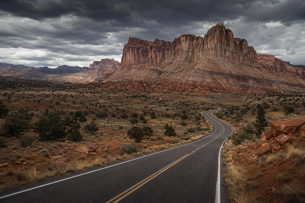
Capitol Reef National Park’s Scenic Drive is a 7.9-mile paved road, not a loop: allow 15.8 miles out and back from the visitor center. An ordinary passenger car is sufficient for the pavement. Adding both dirt-road detours—Grand Wash and Capitol Gorge—brings the round trip to about 23.2 miles, provided conditions allow access. NPS road guide
Choose your canyon detours to see the round-trip mileage and driving allowance.
Round-Trip Route Planner
Round trip from the visitor center
~45–60 minutes driving; planning estimate.
| Route | Round Trip | Drive Time |
|---|---|---|
| Pavement only | 15.8 mi | ~45–60 min|
| With Grand Wash | 18.4 mi | — |
| With Capitol Gorge | 20.6 mi | — |
| With both | 23.2 mi | ~90 min |
All routes return the same way. Times exclude sightseeing, hikes and parking delays. — means no separate driving allowance is supplied for that option. Dirt-road access depends on current conditions; avoid the canyon roads when storms are possible.
Sources: NPS Scenic Drive guide and Reef Ride Bike Days road descriptions. Mileage is calculated from published road lengths; ~90 minutes with both spurs is NPS guidance. Pavement-only time is an editorial estimate.
Allow An Hour For Pavement Or A Half-Day With Stops
| Planning Detail | What To Allow |
|---|---|
| Pavement only | 15.8 miles round trip; roughly 45–60 minutes driving |
| Both canyon roads | About 23.2 miles round trip; about 90 minutes driving |
| Drive and brief stops | Roughly 2–3 hours with both canyon roads |
| Walk and picnic added | Roughly 4–5 hours total |
| Entrance | $20 per private vehicle; qualifying federal recreation passes accepted |
| Fuel inside the park | None |
The paved distance and NPS’s recommendation of about 90 minutes round trip with both dirt spurs come from the NPS Scenic Drive guide. The other time ranges are planning estimates, not measured travel times, and exclude delays finding parking. The 23.2-mile total is calculated from the published road lengths, counting each spur in both directions.
The $20 private-vehicle fee was checked October 8, 2026. See the NPS fee schedule for accepted passes and other entrance categories.
On October 7, 2026, NPS listed Scenic Drive, Grand Wash and Capitol Gorge as accessible to standard 2WD vehicles. That is a dated observation, not a guarantee for your visit. Check the NPS road-condition report before committing to the canyon detours.
Start At The Visitor Center And Return The Same Way
Fruita Leads To The Paid Scenic Drive Section
Turn south from Utah Highway 24 at the visitor center. Stop here for the latest road and weather advice before continuing through Fruita. The fee station is just south of the campground; this is where the paid Scenic Drive section begins.
There is no park-entry reservation or timed-entry ticket requirement, as checked October 8, 2026. See the NPS entry requirements.
The paved drive gives you views of layered red rock, sheer sandstone cliffs and the tilted formations of the Waterpocket Fold without requiring an unpaved-road outing. If you have only an hour, stay on pavement and turn back at its southern end rather than trying to fit in both canyon roads.
Grand Wash Adds The Shorter Canyon Detour
Grand Wash Road branches off the Scenic Drive and runs 1.3 miles one way to the Grand Wash and Cassidy Arch trailheads. It follows the wash into a tall canyon, adding 2.6 miles to your round trip. Choose it if you want a canyon detour but have limited time. NPS publishes the lengths of both dirt spurs in its spur-road descriptions.
Reaching the parking area is not the same as completing a hike. NPS lists Grand Wash at 2.2 miles one way and Cassidy Arch at 1.7 miles one way, with Cassidy Arch rated strenuous. Neither belongs inside a quick driving-only allowance. The NPS trail guide also lists the walks reached from Capitol Gorge.
Capitol Gorge Adds A Longer Canyon Road And Walking Stop
At the southern end of the pavement, Capitol Gorge Road continues 2.4 miles one way through a winding canyon to the Capitol Gorge and Golden Throne trailheads. Driving it out and back adds 4.8 miles. Return along the paved Scenic Drive afterward; the gorge is not a through route to Highway 24.
For a half-day visit, make Capitol Gorge your main walking stop rather than stacking several hikes. Its trail is listed as easy, one mile each way, with historic inscriptions and access to the waterpockets known as the tanks. Allow extra time for the climb toward the tanks.
NPS warns that many trailhead parking areas fill by 9 a.m. and remain crowded until after 4 p.m. Be flexible about which walk you take rather than treating a particular parking space as guaranteed.
Vehicle Limits And Weather Can Rule Out The Dirt Spurs
A standard sedan is sufficient for the pavement. The two canyon spurs are usually passenger-car roads in suitable conditions, but “2WD” is a condition report—not a promise about tomorrow’s surface.
For RVs, confirm access with rangers. The NPS roads and Scenic Drive pages give differing spur-road length limits of 23 and 27 feet. Use the lower figure for planning, and do not assume the larger figure applies to your vehicle or towing combination.
Avoid driving or hiking in Grand Wash and Capitol Gorge when storms are possible, and do not drive the paved Scenic Drive in heavy rain. Its dips cross washes that can flood. Snow, ice, mud and flood debris can also close these roads. Never drive through floodwater. See the NPS flash-flood guidance.
Before leaving town, check the NPS road-condition report, then call 435-425-3791, press 1, then 4 for road conditions. NPS says the phone line is more current than its weekly website updates.
Two September 2027 Dates Have Vehicle Closures
NPS has announced Reef Ride Bike Days on September 18 and 25, 2027, closing the Scenic Drive beyond the campground to vehicles from sunrise to mid-afternoon. Highway 24 and Fruita will remain accessible. The event details are on the NPS spur-road page linked above.
Fuel In Torrey Or Hanksville Before Entering
There are no gas stations or restaurants inside the park. NPS identifies fuel in Torrey, 11 miles west of the visitor center, and Hanksville, 37 miles east. Some nearby businesses close during winter or on Sundays. Check the NPS local-services information before relying on a stop.
Bring lunch, drinking water, sun protection and offline navigation; do not rely on cell reception. A drive with canyon walks needs supplies beyond what you would carry for a brief paved-road outing.
Highway 24 And Fruita Offer A Shorter Visit
If time is short or the Scenic Drive is closed, keep the visit centered on Highway 24 and Fruita, where conditions permit. The Fremont Culture petroglyph panels along Highway 24 are accessible by two wooden boardwalks and make a useful short stop. See the NPS petroglyph access guide.
This is a sightseeing alternative, not a flood-safe bypass: Highway 24 can also be affected by flooding.