
Apache Trail Scenic Drive: Choose the Paved Trip or Full Crossing
Plan the Apache Trail scenic drive with realistic timing, paved and dirt-road options, Fish Creek conditions and the 2026–27 Canyon Lake closure.
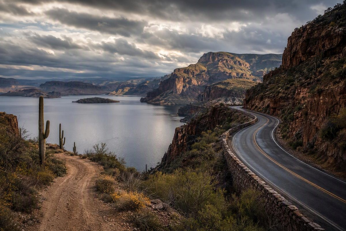
For most visitors in a standard car, the simplest Apache Trail scenic drive is Apache Junction to Tortilla Flat and back. It delivers Superstition Mountain scenery, winding pavement and views toward Canyon Lake without committing to the steep dirt-road descent at Fish Creek Hill.
The full SR 88 crossing toward Roosevelt Dam is a different trip: longer, partly unpaved and more dependent on weather, vehicle capability and driver confidence. ADOT reports the road reopened, but that does not make it an ordinary highway drive. ADOT project update
Important for fall 2026 and winter 2027: Canyon Lake recreation sites are closed for a dam-maintenance drawdown. The Forest Service order runs September 8, 2026, through February 28, 2027, unless rescinded. It closes the marina, lakebed, Acacia and Boulder recreation sites, boat launches and Tortilla Campground—but explicitly leaves SR 88 open. Do not build this season’s itinerary around swimming, a lake cruise or lakeside picnicking. Forest Service closure order
Route at a glance
| Trip choice | Distance | Driving budget, without stops | Sensible total outing |
|---|---|---|---|
| Apache Junction–Tortilla Flat–return | About 33 miles round trip from Main Street/Apache Trail | 1.5–2 hours | 4–5 hours |
| Apache Junction–Fish Creek Vista–return | About 47 miles round trip from the same intersection | 2.5–3.5 hours | 5–6 hours |
| Full crossing toward Roosevelt Dam | ADOT’s designated historic road is 40 miles—not the full circle route | Allow 3–4 hours one way | Reserve a full day, including your return route |
Distances to Tortilla Flat and Fish Creek Vista follow Arizona Highways’ route description; the historic-road length comes from ADOT’s scenic-road inventory. Timing ranges are conservative planning allowances, not measured travel times. They exclude your drive from Phoenix or elsewhere in the Valley.
- Surface: Pavement through Tortilla Flat and several miles beyond; dirt farther east. ADOT surface description
- Conditions: Reopened after repairs, but vulnerable to storm damage; check AZ511 immediately before departure.
- Fuel plan: Fill in Apache Junction and plan to complete your chosen drive without an intermediate fuel stop.
- Fees: No scenic-road entry ticket; individual parks and recreation sites may charge separately. Tonto National Forest fee guidance
Is the Apache Trail open—and do you need four-wheel drive?
ADOT reopened the five-mile section between Fish Creek Vista, milepost 222, and milepost 227 near Reavis Trailhead Road in September 2024. Its project page, checked October 7, 2026, says there are no vehicle restrictions now at Fish Creek Vista, while warning that weather or rockfall can change that. It describes the 1.5-mile Fish Creek section as especially steep, winding and narrow. ADOT project update
That differs from ADOT’s original reopening announcement, which warned that the Fish Creek descent was for high-clearance four-wheel-drive vehicles and UTVs only, with no trailers. Those older rules should not be presented as the current blanket requirement. Equally, the absence of a restriction is not an assurance that every sedan, campervan or rental vehicle is suitable. Original ADOT reopening guidance
For a low-clearance car, an unfamiliar rental or a driver uncomfortable with exposed dirt-road curves, choose Tortilla Flat as your turnaround. Check any rental agreement before taking an unpaved extension. For a full crossing, favor a capable high-clearance vehicle and a driver comfortable negotiating narrow mountain roads; obey whatever restrictions are posted on the day.
Storm closures remain a real planning issue. On July 23, 2026, ADOT announced reopening the Fish Creek Hill–Roosevelt Dam section after crews cleared rockfall, drains and storm damage. That reopening is not a substitute for checking today’s alerts. ADOT July 2026 update
The straightforward half-day plan
From US 60, take exit 196 for Idaho Road, head north and follow signs onto SR 88/Apache Trail. Tortilla Flat’s access directions
Choose one stop near Apache Junction. Lost Dutchman State Park is useful if you want a desert walk beneath the Superstition Mountains. Its Native Plant Trail is a more manageable addition to a driving day than a major mountain hike. As checked October 7, 2026, the park lists vehicle admission at $10 for one person or $20 for two to four people; day-use gates operate 6 a.m.–8 p.m. Lost Dutchman State Park
Continue through the mountain curves toward Canyon Lake. The road itself is the attraction this season. Keep moving past closed recreation entrances, and stop only where parking is legal and safely clear of traffic. The drawdown does not permit walking onto the exposed lakebed: SRP warns of unstable shorelines, deep mud and sudden drop-offs. SRP drawdown guidance
Use Tortilla Flat for your main break and turnaround. Its restaurant, country store and small museum make a practical food-and-walking stop; allow roughly 45–75 minutes and check opening hours before relying on lunch there. Tortilla Flat visitor information
When the longer drive makes sense
Fish Creek Vista is an optional extension, not part of the all-paved outing. Arizona Highways places it about 23.6 miles from Main Street/Apache Trail, with pavement ending around mile 22. Use those mileages for orientation, not as a current road-condition report. Check conditions first and turn back if the surface exceeds your vehicle’s clearance or your comfort level. Route and mileage description
For the full crossing, continue beyond Fish Creek toward Apache Lake and Roosevelt Dam only with suitable conditions and enough daylight. To avoid driving the dirt section twice, connect to SR 188 south, then US 60 west through Miami and Superior for the return toward Apache Junction. The Forest Service identifies the SR 188 connection from Claypool, between Globe and Miami; the library’s historic account describes the circle’s westbound return on US 60. This is not a short add-on to the Tortilla Flat trip. Forest Service access directions, Apache Junction Public Library’s historic route account
If Apache Lake is your destination but Fish Creek is unsuitable, approach from SR 188 near Roosevelt instead. This is also the eastern access ADOT identifies for motorists towing boats, though it still involves unpaved SR 88. ADOT access guidance, Forest Service road description
Before leaving Apache Junction
Prefer a dry-weather, daylight drive. Cooler weather makes walking stops easier, but rain—not just summer heat—can change the road choice. Postpone the dirt crossing when storms threaten rather than trying to beat a closure.
Check tire condition and pressure, cooling-system health and your spare or manufacturer-specified puncture equipment. Carry drinking water for everyone, snacks, sun protection, offline maps and a charged phone. Tell someone your route and expected return time. Leave enough daylight to turn around: choose an itinerary you can shorten without losing your way home.