
Choose Your Talimena Route From Mena And Budget The Stops
Compare the 18-mile Arkansas section with the full Talimena crossing, including return time, Queen Wilhelmina stops, fuel gaps and mountain road checks.
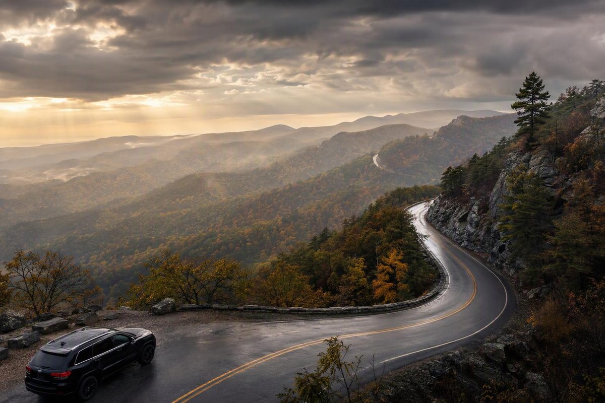
The Arkansas portion of the Talimena Scenic Drive is 18 miles one way, not the full 54-mile byway. From Mena, follow Arkansas Highway 88 west through the Ouachita National Forest, past Queen Wilhelmina State Park, to the Oklahoma line. Return to Mena for a manageable half-day outing, or continue on Oklahoma Highway 1 for the full crossing toward Talihina. Arkansas Tourism confirms the route and mileage.
Choose your route; compare scenic mileage and time before adding hikes or town-access legs.
Choose A Route From Mena
Allow ~1.5–2 hours behind the wheel in favorable conditions.
Several short viewpoints and a park visit fit this budget. A meal or full trail walk can extend it.
| Route | Scenic Miles | Driving | With Stops |
|---|---|---|---|
| Arkansas return | ~36 | ~1.5–2 hr | ~3–4 hr |
| Full one way | 54 | ~1.5–2 hr | ~3–5 hr |
| Full return | ~108 | ~3–4 hr | ~6–8 hr |
What These Budgets Exclude
The full byway ends at US-271, about eight miles from Talihina. Town-access legs are extra. A one-way crossing does not include your return to Mena. Longer hikes need additional time.
No gas stations are on the scenic drive. Road conditions can make these favorable-weather allowances unsuitable.
Sources: Arkansas Tourism route mileage; FHWA driving guidance. ~ marks the article’s planning estimates, not measured travel times.
Budget For The Return, Not Just The Crossing
| Route From Mena | Scenic Miles | Driving Allowance | With Stops |
|---|---|---|---|
| Arkansas out-and-back | ~36 | 1.5–2 hours | 3–4 hours |
| Full byway, one way | 54 | 1.5–2 hours | 3–5 hours |
| Full byway, out-and-back | ~108 | 3–4 hours | 6–8 hours |
These are planning allowances in favorable conditions, not measured travel times. The Federal Highway Administration gives a broad one-to-two-hour driving estimate and five hours to enjoy the byway. The full-route driving allowance above uses the slower end of that range; the sightseeing budgets depend on your stops.
The full out-and-back budget includes sightseeing and a meal, but longer hikes can extend it. Town-access legs are additional. A one-way crossing also leaves you needing a separate return plan if you are staying in Mena.
There are no gas stations along the scenic drive, according to Oklahoma Tourism. Fill up before entering rather than treating an overlook or park stop as a fuel opportunity.
There is no fee to drive the byway; meals, lodging and camping are separate. The Forest Service lists it as open year-round, but that designation does not establish whether the road is safe or open on your travel day.
The Arkansas Out-And-Back Fits A Half-Day
Follow AR-88 west from its junction with US-71 in Mena. Make Queen Wilhelmina State Park your main stop, continue to the state line if visibility is good, then return on the same road.
The park is about 13 miles from Mena, according to its information brochure. Continuing to the border and returning gives you approximately 36 miles of scenic-road driving.
Reserve 1.5–2 hours behind the wheel and 3–4 hours overall for that round trip with several short viewpoint stops and a park visit. Those are conservative planning estimates, not official drive times. A meal or full trail walk can extend the outing.
This is the better choice for a Mena-based visit when you want the ridge-top views without committing to a two-state crossing. You can give the park a proper stop instead of spending most of the available daylight reaching the far end and returning.
The Full Byway Ends Outside Talihina
For the full crossing, continue across the border on OK-1, following Rich Mountain and Winding Stair Mountain to the western entrance at US-271. Although the route is commonly described as Mena–Talihina, the scenic road’s western entrance is about eight miles from Talihina itself. The Forest Service identifies the western junction and town distance.
Include that town-access leg when planning fuel, lunch or lodging. The 54-mile figure describes the scenic byway, not every mile needed to reach services or get back to your accommodation.
Retracing the entire byway means about 108 scenic miles, not a 54-mile day. Using the one-way allowance, expect 3–4 hours behind the wheel before stops or town-access legs. A suggested day budget is 6–8 hours with sightseeing and a meal, with more time needed for hiking.
If your available time is closer to a half-day, keep the Arkansas out-and-back rather than planning a full crossing and leaving the return unaccounted for.
Queen Wilhelmina Is The Main Arkansas Stop
Queen Wilhelmina State Park sits atop Rich Mountain and offers a lodge, Queen’s Restaurant, picnic areas and trails. It combines a longer break with views, making it a useful anchor for the Arkansas portion rather than another quick pullout.
| Park Visit | Suggested Allowance | What It Covers |
|---|---|---|
| Views and a break | 30–45 minutes | Lodge and day-use areas |
| Lunch | Add about 1 hour | Confirm restaurant service first |
| Lovers’ Leap walk | 60–90 minutes | An unhurried trail outing |
The park lists Lovers’ Leap Trail as a 1.5-mile moderate loop leading to an observation deck. The walking allowance above is an estimate; this is not simply a roadside photo stop.
Do not assume lunch or the full trail fits inside a brief park visit. If either is a priority, give it its own time allowance instead of using the same hour for viewpoints, food and walking.
Elsewhere on the drive, use designated vista parking areas. Choose a few stops based on visibility and available parking rather than trying to stop at every overlook. Keep photography to parked stops.
Fall Color Is A Window, Not A Guaranteed Peak
Oklahoma Tourism gives the usual fall-color window as the last week of October through the first week of November. That guidance is useful for the byway, but it is not a guaranteed peak date for the Arkansas section or any particular year. Spring is another option for foliage and wildflowers.
Weather can matter more than the calendar. The Forest Service describes winter icing and warns of rapidly developing thunderstorms and mountaintop fog. Valley fog can be scenic; fog on the road can remove both the views and the reason to continue west.
If visibility deteriorates, shorten the outing at a safe stopping place rather than pressing on to complete the mileage. Plan to finish unfamiliar sections in daylight.
Check Both States Before A Full Crossing
Before leaving Mena, check IDrive Arkansas for closures and construction. If you plan to cross the state line, also check Drive Oklahoma. An Arkansas road report does not establish conditions on OK-1.
In freezing weather, a missing report is not confirmation that AR-88 is clear. Arkansas’s winter-condition listing does not cover every highway and directs drivers to the nearest ARDOT district office for non-primary highway conditions. If icing is possible and you cannot establish conditions, postpone the scenic drive rather than assuming it is passable.
Leave Mena with fuel, a downloaded route, water, snacks and a layer for viewpoint stops. Check tires, brakes and wipers before the mountain drive. On this route, the decision to continue should depend on road conditions, visibility and the time needed to return—not on reaching the state line or completing all 54 miles.