
What the Flood Took—and Lancaster County Chose to Rebuild
The crossing has nineteenth-century roots, but the bridge visible today is principally a 1973 reconstruction, not an untouched original.
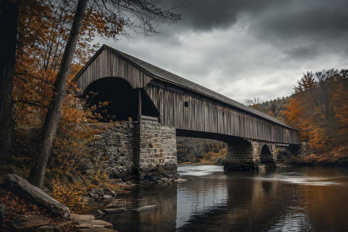
Hunsecker’s Mill Covered Bridge looks like a survivor from another century. Its enclosed wooden passage, long river crossing, and Burr arch structure fit the familiar image of a nineteenth-century Pennsylvania covered bridge. Yet the bridge travelers encounter today is principally a 1973 reconstruction.
That distinction is essential to understanding the landmark. The crossing has roots in the 1840s, although published accounts disagree about the original year and builder. Hurricane Agnes swept the preceding bridge from its abutments in June 1972. Local opposition then reportedly helped prevent an ordinary concrete replacement, preserving the crossing’s name and traditional covered-bridge form.
Hunsecker’s Mill is therefore historic without being an untouched nineteenth-century artifact. Its story is one of loss, reconstruction, and continuity.
Hunsecker’s Mill Covered Bridge at a glance
Hunsecker’s Mill Covered Bridge is a wooden covered road bridge across the Conestoga River in Lancaster County, Pennsylvania. It connects the Manheim Township and Upper Leacock Township sides of the river and is commonly described as a one-lane crossing approximately 180 feet long and 15 feet wide. A local community feature lists 1335 Hunsecker Road, Lancaster, Pennsylvania, as its location; that should be treated as a third-party visitor address, not a verified mailing address.TownLively reports the location, township connection, and dimensions
Approximate mapping coordinates are 40.0872, -76.2475. They are useful for identifying the crossing on a map, but they do not establish a legal stopping place, entrance, or current access route.The bridge entry provides the coordinates and identifies a single-span double Burr arch design
The bridge is widely described as Lancaster County’s longest single-span covered bridge. That wording is common across regional tourism and historical pages, but the supplied evidence does not include a current official bridge inventory confirming the comparison. The defensible formulation is therefore “commonly reported as Lancaster County’s longest single-span covered bridge,” not a verified county record—and certainly not a statewide one.Visit Lancaster PA repeats the 180-foot, county-level distinction
Most importantly, “historic Hunsecker’s Mill Covered Bridge” should not be read as “the intact bridge built in the 1840s.” The historical identity belongs to the crossing, its name, its traditional structural form, and the succession of bridges erected there. The visible structure dates principally to the post-Agnes reconstruction completed in 1973.
A source-qualified timeline of the crossing
A useful chronology must distinguish the age of the crossing from the age of the present structure. Secondary sources broadly agree that covered-bridge history at the site began in the nineteenth century, but they do not agree on its precise origin.
One account identifies 1843 and John Russell. Another gives 1848 and Joseph Russell. Both versions associate the original work with a cost of $1,988, but that shared figure does not resolve the conflicting year or builder.
| Date | Reported event | Confidence | Conflict or limitation |
|---|---|---|---|
| 1843 | John Russell reportedly built the original bridge; the original cost is reported as $1,988.The encyclopedia entry presents the 1843/John Russell account and the reported cost | Disputed | Conflicts with the 1848/Joseph Russell account |
| 1848 | Joseph Russell reportedly built the original bridge for $1,988.TownLively presents the 1848/Joseph Russell version | Disputed | Conflicts with the 1843/John Russell account |
| 1869 | On the 1848 chronology, a flood washed the bridge away 21 years after construction | Moderate, attributed | Reported by the same local feature; no underlying contract or contemporary report is supplied |
| After the earlier flood | The replacement was reportedly raised three feet | Moderate, attributed | Construction records and engineering details are not supplied |
| Before 1972 | The bridge was reportedly rebuilt more than once | Plausible but incomplete | The evidence does not support a complete reconstruction sequence; a reported 1948 rebuilding is not established |
| June 1972 | Hurricane Agnes floodwaters swept the preceding bridge from its abutments and carried it downstream.The Pennsylvania Center for the Book recounts the Agnes loss | High | Sources vary between “destroyed,” “almost completely destroyed,” and “washed away” |
| 1973 | A replacement covered bridge was completed.A 2022 travel history identifies the current bridge as a 1973 rebuild | High | The surviving structure dates principally to this reconstruction |
| 1973 | Reconstruction reportedly cost $321,302 | Secondary-source figure | No agency contract or project accounting is supplied |
The local account using the 1848 date says a flood washed that bridge away 21 years later, which yields 1869, and that the subsequent replacement was raised three feet. The narrative is internally coherent, but the supplied evidence does not include the construction contract, county bridge docket, payment record, or contemporary newspaper coverage needed to verify it independently.
Available secondary histories also say the bridge was rebuilt several times before Hurricane Agnes. They do not, however, provide a reliable and complete sequence. A date appearing in a derivative chronology should not be promoted into an established rebuilding event without stronger documentation.
The decisive event came in June 1972. Although descriptions differ over the exact extent of destruction, they agree on the practical result: floodwaters removed the bridge from its abutments, carried it downstream, and made replacement necessary. The evidence does not establish how much material survived or whether any components were reused.
A new covered bridge was completed in 1973. One secondary compilation reports a reconstruction cost of $321,302, but without the underlying contract or agency accounting, that amount should remain explicitly attributed. The most reliable summary is therefore limited: nineteenth-century origins, one or more earlier replacements, catastrophic loss in 1972, and the present reconstruction in 1973.
Why a covered bridge returned after Hurricane Agnes
The 1972 flood did more than damage a landmark. It forced a decision about what kind of bridge would replace it.
According to the Pennsylvania Center for the Book, transportation officials initially intended to install a concrete bridge. Local opposition reportedly changed the outcome, leading to construction of another covered bridge that retained the Hunsecker’s Mill name and used a traditional wooden truss approach.The Pennsylvania Center for the Book describes the proposed concrete replacement and the reported local response
That is meaningful evidence of a local preservation effort, but it remains a secondary narrative rather than a documented agency history. The supplied material does not include project plans, transportation-department minutes, public-hearing records, correspondence, or a formal preservation agreement. The episode should therefore be described as reported local opposition influencing the replacement—not as fully documented agency policy.
The distinction between preserving historic material and preserving traditional form is crucial. Saving an existing bridge usually implies retaining a substantial amount of its old physical fabric. Reconstructing one after a catastrophic loss can instead preserve other forms of continuity:
- the location and identity of the crossing;
- the Hunsecker’s Mill name;
- the familiar covered-bridge appearance;
- a traditional timber-truss system;
- the site’s historical association with local transportation.
The Pennsylvania Center for the Book defines an authentic covered bridge structurally as one employing a traditional wooden truss such as a Burr Arch, Queen Post, or Town Lattice. Its discussion says the Hunsecker’s Mill replacement was constructed in an authentic manner after Hurricane Agnes. That supports calling the present bridge a traditionally constructed covered bridge or a structurally authentic reconstruction. It does not support calling it an original nineteenth-century object.
No supplied source establishes that particular timbers, fasteners, arches, siding, or other components from the pre-1972 bridge were incorporated into the replacement. It would be equally unwarranted to claim that old material was reused or that none survived. The narrower conclusion is that the 1972 loss required a replacement and that the extent of any surviving or reused material remains unknown.
Nor does the reconstruction story prove a formal historic designation. Community preservation, traditional engineering, local significance, and listing on an official historic register are separate matters. The evidence documents a reported effort to retain the covered-bridge form; it does not include a current official register record for this bridge.
How the double Burr arch span works
Hunsecker’s Mill is described as a single-span wooden bridge using double Burr arch trusses. A Burr arch design combines two structural ideas:
- a timber truss—a connected framework of wooden members that distributes loads; and
- a large wooden arch that works with the truss to transfer forces toward the ends of the bridge.
The supplied evidence identifies the design as a double Burr arch, but it does not include engineering plans detailed enough to define the bridge’s exact member configuration or to support load calculations.
That long span is why tourism and historical pages frequently characterize it as Lancaster County’s longest single-span covered bridge.
Its commonly reported dimensions are approximately 180 feet long and 15 feet wide. A 2016 travel report also described the bridge as a single-span wooden structure with double Burr arch trusses, but its observations about traffic and condition apply only to that visit and are not current operating information.The 2016 account reports the dimensions and structural design
The roof and siding are functional as well as picturesque. By reducing direct exposure to sun and precipitation, the enclosure protects important wooden members and joints from weather. It does not eliminate deterioration or the need for inspection and maintenance, and the general principle does not justify assigning an exact lifespan to this particular bridge.
Historical descriptions differ slightly on overhead clearance. One gives 13 feet 10 inches, while another rounds the figure to approximately 13 feet. Neither is a current operational limit. Without a current official bridge record, this article cannot confirm present height, width, weight, or traffic restrictions. Any posted limit encountered at the approach supersedes a historical description.
Some secondary accounts also suggest that the deck has horizontal floorboards and that their orientation may be unusual among Lancaster County’s covered bridges. Because those accounts qualify the distinction rather than establish it through a countywide comparison, the floorboard detail should be treated as tentative—not as proof that the bridge is unique.
A useful interpretive illustration would label the:
- road deck;
- timber truss framework;
- Burr arches;
- roof;
- exterior siding;
- abutments;
- uninterrupted span across the river.
Any published diagram should be conceptual unless checked against engineering plans. It should explain the basic relationship of the bridge’s components without implying exact member dimensions, load paths, or current structural capacity.
What makes a 1973 reconstruction historic?
The word historic can describe several different things. Confusion begins when they are collapsed into a single claim.
First, there is the nineteenth-century origin of the crossing. A covered bridge was reportedly built at the Hunsecker’s Mill site in either 1843 or 1848. Whatever the unresolved date, the crossing became part of the area’s transportation history.
Second, there is the age of the structure now standing. The present bridge dates principally to 1973, after Hurricane Agnes removed its predecessor. It should never be presented as though its complete physical fabric has survived untouched since the 1840s.
Third, there is the traditional structural form. The replacement continued the covered wooden bridge concept and used a double Burr arch truss rather than substituting the ordinary concrete span reportedly proposed after the flood.
The bridge’s name is said to come from the former mill of Amos Hunsecker at the site. That association links the crossing to a landscape in which mills, waterways, and roads were closely connected, although the supplied evidence does not establish what survives of the former mill property.
This produces a more precise understanding of heritage. Hunsecker’s Mill can be historically significant because the site carries forward an old name, a long-established crossing, and a traditional bridge form through repeated episodes of destruction and rebuilding. That statement concerns historical continuity; it should not be taken as confirmation of the bridge’s current operating status.
The 1973 reconstruction is itself part of the history. It records a twentieth-century decision to continue a regional bridge-building tradition after a destructive flood. Reconstruction did not preserve the previous bridge intact, but it preserved the idea and identity of the crossing.
Structural authenticity and heritage significance should not be equated with National Register of Historic Places status. A bridge can possess local meaning or use a traditional truss without those facts alone proving federal listing. Because the supplied evidence does not include a current official database record, no claim is made here about whether Hunsecker’s Mill is presently listed or unlisted.
The most accurate description is therefore neither “an original 1840s bridge” nor “merely a replica.” It is a traditionally constructed 1973 replacement at a nineteenth-century covered-bridge crossing.
Resolving the bridge’s conflicting facts
Hunsecker’s Mill illustrates a common problem in local-history research: a detail can appear on numerous polished pages while still tracing back to a small number of uncertain or derivative sources.
| Question | Version A | Version B | Responsible conclusion |
|---|---|---|---|
| Original construction year | 1843 | 1848 | Disputed; do not choose one silently |
| Original builder | John Russell | Joseph Russell | Disputed; primary documentation is needed |
| Original cost | $1,988 | $1,988 | Agreement on cost does not settle the year or builder |
| Waterway | Conestoga River | Conestoga Creek | Use River as the predominant wording, while noting the variation |
| Length distinction | Longest single-span covered bridge in Lancaster County | Longest in Pennsylvania | Retain only the widely repeated county-level claim |
| Floorboards | Possibly unusual or the county’s only horizontal arrangement | No distinction reported | Treat as tentative |
| County bridge total | 28 | 29 | Publication date and counting method may differ; neither total is needed here |
Why repetition is not confirmation
Several tourism pages repeat the 1843 date, 180-foot length, Burr arch design, and county distinction. Repetition becomes weak evidence when pages copy one another or rely on a shared upstream source. One local tourism listing explicitly attributes its description to Wikipedia, so it cannot serve as independent confirmation of the encyclopedia account.
The 1848 version cannot simply be dismissed because it appears less often. Discover Lancaster uses that year in its itinerary, while the TownLively feature adds the Joseph Russell attribution and the account of an earlier flood. Frequency is not the same as archival proof.Discover Lancaster presents the 1848 date and identifies the bridge as the first itinerary stop
River or creek?
Most supplied descriptions call the waterway the Conestoga River, so that is the clearest primary wording for this article. Some tourism guides use Conestoga Creek.
Without an authoritative geographic-names record, the difference should not be explained away by claiming that the names are officially interchangeable at the bridge. The responsible approach is simply to acknowledge the variation.
County record, not state record
The defensible distinction is that Hunsecker’s Mill is commonly reported as Lancaster County’s longest single-span covered bridge. One tourism article expands the claim to all of Pennsylvania but supplies no official statewide inventory or comparative dataset.
Until such documentation is produced, the state-level superlative should not be repeated as fact.
Why bridge counts vary
Published totals for Lancaster County’s covered bridges vary between 28 and 29.
Neither total is needed to explain Hunsecker’s Mill. Choosing one would create an unnecessary appearance of certainty.
What would settle the history?
Resolving the original date, builder, and reconstruction sequence would require stronger records, such as:
- county bridge contracts and commissioners’ minutes;
- construction ledgers or payment warrants;
- nineteenth-century newspaper notices;
- road petitions and township records;
- flood-damage reports;
- transportation project files;
- engineering plans for the 1973 replacement;
- a current official bridge inventory.
Until those records are produced, the disagreement belongs in the history. It should not be edited away.
Planning a cautious stop on a Lancaster County drive
Third-party visitor material commonly identifies the bridge as 1335 Hunsecker Road, Lancaster, Pennsylvania. Approximate map coordinates are 40.0872, -76.2475. The address and coordinates are navigation aids, not guarantees of an entrance, parking area, public viewpoint, or current access.A Lancaster County lodging guide lists the visitor address and places the bridge north of Route 30
Sources place the bridge east of Lancaster and near Route 30, but the evidence does not support promising a particular drive time from central Lancaster. Travel time can vary with route selection and current conditions.
Travelers may also encounter two road-name spellings. One description says the crossing connects Hunsecker Road on the Upper Leacock Township side with Hunsicker Road on the Manheim Township side. Searching for the bridge name as well as both spellings may help identify the location, but a search result does not confirm present access.
Hunsecker’s Mill is a logical conceptual anchor for a Lancaster County covered-bridge drive. Several itineraries place it first, including a Discover Lancaster route that continues to Weaver’s Mill and Pool Forge. That itinerary position reflects its prominence as a visitor landmark, not a guarantee that the crossing or any stopping area is currently available.
A third-party photography guide recommends early-morning light. Treat that only as aesthetic advice. It does not establish lawful parking, a safe shoulder, pedestrian access, or an unobstructed viewpoint.
Current operating status was not verified through an official transportation record for this article. The supplied evidence does not establish:
- whether the bridge is currently open to motor vehicles;
- whether bicycle or pedestrian access is permitted;
- its present structural condition;
- current height, width, or weight restrictions;
- whether parking or a designated viewing area exists;
- whether construction or a temporary closure is in effect;
- The bridge is maintained by the state of Pennsylvania Hunsecker’s Mill covered bridge is a link to the past | TownLively.
A personal travel account reported that the bridge was open to traffic and in good condition in 2016. That is evidence only of what the writer observed or reported at that time; it is not proof of conditions a decade later.The dated travel report documents the conditions described during its 2016 visit
Because the evidence pack does not identify a verified current status page or responsible agency contact, this article cannot provide an authoritative pre-trip verification route. Before traveling, consult current official transportation and local-government information, confirm that any notice applies to this specific bridge, and treat signs and barriers at the approach as controlling.
If the bridge or approach is open to vehicles, this article does not recommend stopping in the travel lane for photographs. Do not infer that a roadside strip, driveway, field edge, or unmarked shoulder is public parking. If a lawful stopping place is not clearly identified, view the bridge only in a manner consistent with current signs and access controls.
Historical dimensions should never be used to decide whether a tall, wide, or heavy vehicle can cross. Only current posted restrictions or confirmation from the responsible transportation authority can answer that question.
Frequently asked questions
Was Hunsecker’s Mill Covered Bridge built in 1843 or 1848?
The original date remains disputed. One secondary account names John Russell and gives the earlier year; another names Joseph Russell and gives the later year. Both report the same original cost, but that does not settle the conflict. County contracts, payment records, commissioners’ minutes, or contemporary newspapers would be needed for a reliable resolution.
Is the bridge standing today the original nineteenth-century bridge?
No. The current structure is the replacement completed after Hurricane Agnes swept the preceding bridge from its abutments. The crossing and its name have nineteenth-century roots, but the bridge standing today dates principally to the reconstruction.
Is Hunsecker’s Mill the longest single-span covered bridge in Pennsylvania?
That is not established. The supported wording is that the bridge is widely reported as Lancaster County’s longest single-span covered bridge. The available evidence does not include an authoritative statewide comparison.
What is a double Burr arch truss?
A Burr arch system combines a timber truss framework with reinforcing wooden arches. The elements work together to carry and distribute loads toward the bridge ends. Hunsecker’s Mill is described as using this system across one uninterrupted span, although the supplied evidence does not include engineering plans for a more detailed analysis.
Can visitors currently drive across or park near the bridge?
Current vehicle access and parking have not been verified through an official operating record. Older travel reports cannot establish present conditions. Check current official notices, follow signs and barriers at the site, and do not assume that roadside parking or pedestrian access is permitted.
Hunsecker’s Mill rewards careful interpretation as much as careful trip planning. Its central paradox is the reason to remember it: the crossing has nineteenth-century roots, but the bridge visible today is principally a 1973 reconstruction. Its value lies not in an unsupported claim of untouched survival, but in the continuation of a historic crossing and traditional Burr arch form after Hurricane Agnes. Appreciate that continuity—but verify current restrictions and stopping rules before making it part of a Lancaster County drive.