
Plan Minnesota’s North Shore Scenic Drive Without Rushing the Return
Plan the 154-mile Minnesota North Shore Scenic Drive with realistic drive times, worthwhile stops, shorter day trips and 2026 construction checks.
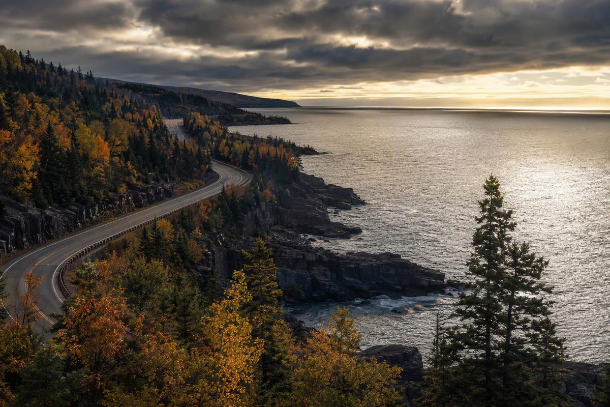
Minnesota’s North Shore Scenic Drive runs 154 miles from Duluth to the Canadian border, following Lake Superior. For a Duluth-based day trip, focus on Gooseberry Falls and either Split Rock Lighthouse or Tettegouche. For the full drive with walks and time in Grand Marais, allow two or three days—especially if you must return to Duluth. The Forest Service confirms the route’s length and endpoints.
| Route detail | Planning answer |
|---|---|
| Scenic alignment | County Road 61/old Highway 61 from Duluth toward Two Harbors; Highway 61 beyond Two Harbors |
| Full distance | 154 miles one way; roughly 308 miles out and back before detours |
| Driving allowance | About 3½–4 hours one way in favorable conditions, excluding stops and significant construction delays |
| Full sightseeing trip | Two days for a northbound visit; three days gives the Duluth return its own time |
| Vehicle choice | A standard passenger car is a sensible choice for the main paved route in dry conditions |
| Fuel plan | Start full in Duluth; plan a top-up in Grand Marais before the northern out-and-back |
| October 2026 concern | Duluth’s London Road work and Carlson Creek culvert replacement; check conditions before departure |
The driving allowances here are planning estimates, not live navigation times. The official scenic-route listing identifies the old Highway 61 alignment south of Two Harbors.
Take Scenic 61, not just the fastest route
Leaving Duluth, choose Scenic Highway 61/County Road 61 along the lake toward Two Harbors. A navigation app may favor the Highway 61 expressway instead. Minnesota DNR recommends the scenic alignment for lake views and notes that the expressway is faster but lacks those views. See DNR’s route directions.
Beyond Two Harbors, continue on Highway 61 through the Gooseberry Falls and Split Rock area, past Silver Bay and Tettegouche, then through Schroeder, Tofte and Lutsen to Grand Marais. Continue northeast for Grand Portage and the border-area state park.
Treat this as an out-and-back unless your onward trip continues into Canada. The 154-mile figure is not a loop, and reaching Grand Marais does not complete the full byway. Grand Portage State Park is on the Minnesota side of the border; visiting its High Falls does not require crossing into Canada. DNR’s park map shows the river forming the international boundary.
Check these 2026 restrictions first
As of October 11, 2026, these official project updates matter to the route:
- Duluth/London Road: North of 40th Avenue East, London Road is open only to northbound traffic, with southbound traffic detoured onto Superior Street to 40th Avenue East. MnDOT expects work through the end of October. Follow posted routing rather than trying to retrace your outbound drive. London Road project updates
- North of Grand Marais: MnDOT reports work underway at Carlson Creek and says traffic will use a bypass during culvert replacement. Other culvert work in that project is complete. Grand Marais culvert project
Cascade River Wayside needs a parking check, too. MnDOT’s summer notice specified lakeside parking restrictions and a partial inland-lot closure, with trailhead access maintained. The project schedule targeted completion between June and August 2026; those notices do not establish that restrictions remain in October. Check current reports and posted signs before counting on a quick roadside stop. Wayside access notice · Project schedule
Before setting out—and before the return—check Minnesota 511 for road reports, construction and cameras. Search MN 61 for the North Shore corridor, not US 61 farther south.
Stops that fit the available time
These visit allowances include walking and looking around, but not a long parking wait.
| Stop | Allow | Why choose it |
|---|---|---|
| Gooseberry Falls | 45–75 minutes | A manageable waterfall stop with short accessible routes to Upper and Middle Falls |
| Split Rock Lighthouse | 60–90 minutes | Lighthouse history; choose the historic-site visit or a separate state-park shoreline walk |
| Tettegouche/Shovel Point | 60–90 minutes | Lake-facing cliffs, with a more demanding walk than Gooseberry’s short falls paths |
| Grand Marais | 1–2 hours | A meal and harbor break rather than another trail commitment |
| Grand Portage State Park/High Falls | 45–75 minutes | A short paved-and-boardwalk waterfall walk near the northern endpoint |
At Gooseberry, DNR describes short accessible trails to Upper and Middle Falls, stairs to Lower Falls and a one-mile Falls Loop. Gooseberry trail descriptions. No vehicle permit is needed for the wayside/visitor-center lot, though that exception does not cover every lot in the park. Gooseberry parking information
Split Rock’s historic lighthouse is operated by the Minnesota Historical Society; a state-park vehicle permit does not replace historic-site admission. Check lighthouse hours and admission, particularly outside summer. Historic-site visitors have free parking during site hours; a state-park permit is required there during off hours. Parking rules
At Tettegouche, Shovel Point is a 1.2-mile outing with uneven surfaces, boardwalks and many stairs. The Baptism River High Falls hike from the visitor center is three miles round trip—make that a main activity, not an extra quick stop. DNR trail descriptions
Grand Portage’s 2026 park guide lists the High Falls Trail as 1.2 miles round trip, with paved trail and boardwalk access. No vehicle permit is required at this park. Grand Portage map and guide. Its rugged Middle Falls route is 4.5 miles and takes at least three hours on average; it does not fit the same visit allowance. Grand Portage trail information
Choose a day trip or a full-shore trip
One day from Duluth: Take Scenic 61 to Two Harbors, visit Gooseberry, then choose Split Rock or Tettegouche before returning. Budget roughly 7–9 hours overall for driving, two substantial stops, a meal and slack. Adding both a lighthouse visit and a long Tettegouche hike makes this a much longer day.
Three days, returning to Duluth:
- Day 1: Drive to Grand Marais, choosing two southern stops. Allow about 7–9 hours with sightseeing and lunch; stay in Grand Marais.
- Day 2: Continue to Grand Portage State Park for High Falls, then return to Grand Marais. Leave room for a harbor visit rather than filling the day with additional hikes.
- Day 3: Drive back to Duluth, using the return for a missed stop such as Tettegouche or Split Rock.
A full border run and return in one day means roughly 7–8 hours of driving alone under the favorable conditions assumed above. It is a distance-covering day, not a good plan for all five stops.
Season, fees and preparation
Spring is a useful waterfall season, but DNR warns of muddy trails and slippery wet or icy rocks. Bring shoes with good tread and warm layers: Lake Superior can bring cooler shoreline conditions. North Shore safety advice
For autumn, use the DNR Fall Color Finder rather than booking around a supposedly fixed peak weekend. Its future-date map shows historical averages, not a prediction for that year.
In winter, shorten the itinerary and preserve daylight for the return. Palisade Head’s summit changes from a drive-up stop to a walk in winter, according to Tettegouche’s visitor guidance. Do not assume every scenic spur has the same access as Highway 61.
As of October 2026, Minnesota’s standard state-park vehicle permits cost $7 for one day or $35 year-round, subject to the parking exceptions above. Buy ahead when possible; ranger stations may be closed and cellular coverage varies. DNR permit details
Before leaving Duluth, check tires, washer fluid and lights, and carry water, snacks and an offline route map. Set a return-time cutoff before your first hike. If parking delays consume the spare time, drop a stop—not the margin needed to drive back safely.