
Minnesota’s North Shore Scenic Drive: Route, Time and Stops
Plan the Duluth-to-border drive with realistic timing, a shorter day-trip option, useful stops, park fees and October 2026 roadwork notes.
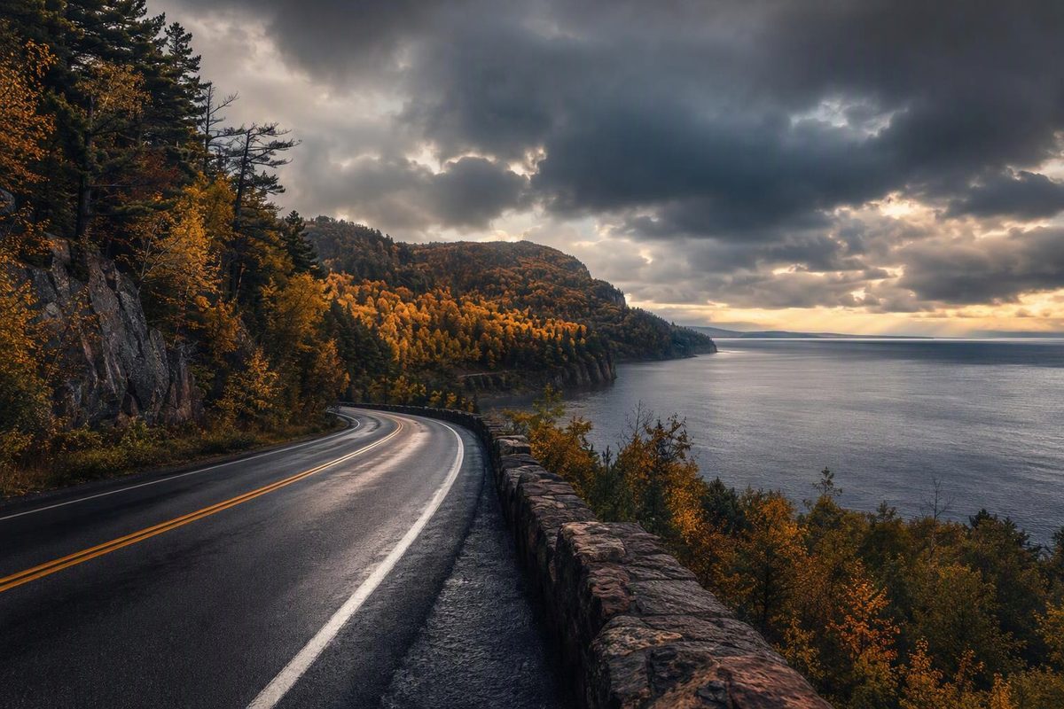
Minnesota’s North Shore Scenic Drive runs 154 miles from Duluth to the Canadian border, following Lake Superior. Allow 3½–4 hours one way for driving, not sightseeing. For waterfalls, a lighthouse visit and time around Grand Marais, an overnight makes the route much more workable than a Duluth out-and-back. Route length and endpoints.
Route at a glance
| Planning item | What to allow |
|---|---|
| Route | Duluth → Scenic 61 → Two Harbors → MN 61 → Grand Portage State Park near the border |
| Distance | 154 miles one way; roughly 308 miles out-and-back before stop-access roads |
| Driving allowance | 3½–4 hours one way in favorable conditions; 7–8 hours for the full return drive |
| With stops | About 7–9 hours one way with a few short visits and a meal; longer for substantial hikes |
| Best fit | One day for the southern shore; two days for the full route and return |
| Vehicle | A standard passenger car for the main route in suitable road conditions |
| Fuel plan | Start full; plan a top-up before the northern leg rather than running near empty |
These times are planning allowances, not live traffic estimates. They include room for slower town sections but not significant construction delays, snow or long parking searches.
Follow Scenic 61 before joining the main highway
From Duluth, choose old Highway 61, signed as Scenic 61/County Road 61, for the shoreline drive toward Two Harbors. Join MN 61 there and continue through Beaver Bay, the Silver Bay area, Schroeder, Tofte and Lutsen to Grand Marais, then onward toward Grand Portage and the border. Explore Minnesota identifies County Road 61 as the scenic route’s southern alignment.
Put Scenic 61 into your navigation plan deliberately: a quickest-route setting may favor the main highway instead. Use signed waysides and parking areas for lake views, not the highway shoulder.
Grand Marais is a useful overnight stop, but it is not the end of the drive. Continue to Grand Portage State Park for the northern endpoint outing. The Gunflint Trail is a separate inland excursion from Grand Marais; adding it requires additional time, not just another quick roadside stop.
October 2026 roadwork to factor in
As of October 11, 2026, two projects deserve attention before setting your departure time:
- Duluth’s London Road: North of 40th Avenue East, traffic is northbound only; southbound traffic uses a signed Superior Street detour. Work is expected through the end of October. MnDOT also schedules paving from October 12, with temporary closures at several intersecting streets. Follow the current bypass and detour signs rather than assuming your usual Duluth approach works. London Road construction update.
- Lafayette Bluff tunnel: Expect signal-controlled single-lane traffic during weekday work, with no weekend traffic impacts expected. Work is scheduled through mid-October; the Silver Creek tunnel work is complete. Check the current restrictions before departure. Tunnel project traffic impacts.
Check Minnesota 511 immediately before departure for MN 61 road reports, construction and cameras. Two Harbors’ major highway reconstruction is planned for 2027–2028, with some utility work in 2026; do not confuse future detour plans with today’s restrictions. MnDOT’s Two Harbors project.
Stops that earn their time
Choose a few stops rather than trying to visit every park. The allowances below include a modest amount of walking and looking around, not an extended hike. Check each park’s current visitor information before committing to a trail or access road.
Gooseberry Falls: 45–75 minutes
Make this the waterfall stop on a shorter trip. The park has accessible multi-use trails, and the wayside/visitor-center parking lot does not require a vehicle permit. That exception does not apply automatically to other parking areas in the park. DNR notes frequent heavy traffic and that parking longer than two hours is not always available at the visitor-center lots. Gooseberry Falls visitor information.
Split Rock Lighthouse: 60–90 minutes
Decide whether you want the historic-site visit or a state-park shoreline outing; they are different visits with different charges.
For May 1–October 19, 2026, the historic site lists daily hours of 10 a.m.–6 p.m. and adult general admission of $15. For October 20, 2026–January 4, 2027, the regular schedule changes to 10 a.m.–4 p.m. Thursday through Monday, closed Tuesday and Wednesday, with an $8 grounds pass that excludes lighthouse and keeper’s-home access. Holiday exceptions and separately ticketed tours apply; check availability if entering the buildings matters to you. Split Rock hours and admission.
Tettegouche or Palisade Head: 30–90 minutes
For a quick Tettegouche visit, choose the beach near the visitor center. For a longer walk, consider Shovel Point. Palisade Head has a separate highway entrance about 1½ miles southwest of the visitor center; DNR describes driving to the top and walking up in winter. Do not assume the summit road is available year-round. Tettegouche visitor information.
Grand Marais: 60–120 minutes
Use Grand Marais for a meal and harbor walk, or stop driving here for the night. It solves a real scheduling problem: combining every southern-shore attraction with the border leg leaves little time to enjoy either.
Grand Portage State Park: 60–90 minutes
Choose High Falls for a driving itinerary. DNR’s 2026 park map lists a 1.2-mile round trip, using pavement and boardwalk, with a wheelchair-accessible viewing platform. No vehicle permit is required: all parking is rest-area parking. The park is on the Minnesota side of the border, so this stop does not require crossing into Canada. Grand Portage map and guide.
Middle Falls is a different commitment: DNR describes a rugged 4½-mile round trip taking at least three hours. Grand Portage park information.
One day or two?
One day from Duluth: Follow Scenic 61, visit Gooseberry Falls and Split Rock, then return. Allow roughly 6–8 hours overall, more with a leisurely meal or extra walks. Add Tettegouche only if you are comfortable extending the day; skip Grand Marais and the border rather than rushing all the stops.
Two days for the full route: On day one, choose two southern-shore stops and overnight in Grand Marais. On day two, continue to Grand Portage State Park, walk to High Falls, then return south. The second day still includes a substantial drive back to Duluth, so leave long hikes out of that plan. A third day is useful if hiking, rather than roadside sightseeing, is the priority.
Fees, weather and preparation
Minnesota state-park vehicle permits currently cost $7 for one day or $35 for a year. Buy before leaving if your chosen parking areas require one, and display the temporary permit or purchase confirmation as instructed. A park permit is not a Split Rock historic-site ticket. DNR vehicle-permit details.
Carry a windproof layer even in summer: the lighthouse operator warns of cooler North Shore temperatures and unpredictable weather. For autumn trips, prioritize your outdoor stops before daylight runs short rather than adding an inland detour for color. In winter, use 511’s winter-driving reports and reduce the itinerary when road or trail conditions deteriorate.
Download your route, bring water and snacks, and check tires, washer fluid and lights before departure. Near Grand Portage, DNR warns that phones can connect to Canadian networks and change the displayed time. Keep track of Minnesota time if you are working around closing hours.