
Plan a Long Slide Falls Stop Without Rushing the Descent
Plan your Long Slide Falls visit near Pembine with access roads, county pass details, realistic timing, trail limits and the Smalley Falls option.
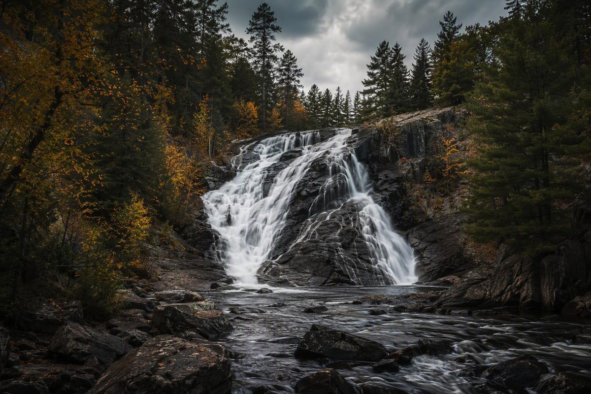
Long Slide Falls is a roughly 50-foot cascade in northern Marinette County, Wisconsin, reached from US 141 via Morgan Park Road and Long Slide Road. Allow 45–75 minutes for the stop, including parking, the short walk and time at the falls. The commonly mapped route is only about 0.3 mile out and back, but the descent toward the lower view is steeper and potentially more slippery than that distance suggests. Add about another hour if you also visit Smalley Falls.
Enter the minutes you expect to spend on each part of the stop; add Smalley Falls if it fits your schedule.
Stop-Time Planner
Planned Stop Time
45 minutes
Long Slide Falls only
Source note: Timing ranges are the article’s planning estimates; Marinette County Tourism lists the $5 county day pass. Smalley Falls time is approximate.
Long Slide Falls Planning Details
| Detail | Practical Answer |
|---|---|
| Location | Long Slide Falls Park, Town of Niagara, near Pembine |
| Map destination | Morgan Park Road, Niagara, WI 54151 |
| Approach | US 141 to Morgan Park Road, then Long Slide Road |
| Walk | About 0.3 mile out and back on the commonly mapped route |
| Waterfall | Cascade of about 50 feet |
| Time on site | 45–75 minutes |
| Park fee | $5 per vehicle for a county day pass |
| Main constraint | Steeper, potentially slippery terrain toward the lower view |
Travel Wisconsin lists the Morgan Park Road address, describes Long Slide Falls as a roughly 50-foot cascade and places Smalley Falls about half a mile northwest (Travel Wisconsin). Marinette County’s waterfall map identifies Long Slide as waterfall 13 and Smalley as waterfall 12. The map indicates that both require a county pass (Marinette County waterfall map).
Those details establish the general destination, but they do not make the entire stop a level roadside overlook. The short mapped distance includes terrain that may determine whether you visit only the easier viewing area or continue toward the lower view.
Reach the Parking Area From US 141
From US 141 north of Pembine, turn onto Morgan Park Road and then follow Long Slide Road toward the waterfall parking area. Save the route or the county waterfall map before leaving the highway so that the final turns remain available if mobile service becomes unreliable.
The Morgan Park Road address identifies the wider destination area rather than every turn leading to the trailhead. Morgan Park Campground is also in that area, but the campground is not the Long Slide Falls trailhead. A navigation app that recognizes Morgan Park while failing to identify the waterfall parking area can therefore leave you at the wrong endpoint.
Use the road sequence as a check on the electronic directions: US 141, Morgan Park Road, Long Slide Road and then the signed parking area. If the route tries to substitute an unmarked track or approach the falls without using the signed access, return to the established road rather than treating the map pin as permission to continue.
The cited visitor information does not establish a permanent road-surface condition or guarantee that every access road will be open after storms or during winter conditions. Snow, fallen trees, maintenance and temporary gates can change the practical approach. Check current county information and obey posted closures or restrictions even when a downloaded map still displays the road.
The Short Trail Has a Steeper Lower Section
The commonly mapped Long Slide Falls route is about 0.3 mile out and back, with modest total elevation change. Neither figure fully describes the physical difficulty. The basic walk is brief, but the descent toward the lower level concentrates the harder footing into a small part of the route.
AllTrails users reported a slightly steep gravel grade, slippery winter footing and a more difficult descent toward the lower view (AllTrails). These are community observations rather than an official condition report. They should not be read as a guarantee of current conditions, but they explain why the trail mileage alone can understate the effort.
Wet leaves can conceal uneven ground, while loose gravel, mud, snow or ice can reduce traction on both the descent and return climb. Footwear with tread is more appropriate than smooth-soled casual shoes. The return may take longer than the walk down because the same grade must be climbed after time spent near the falls.
The lower view should be treated as optional. Reaching the park and seeing part of the cascade does not obligate everyone in the group to descend as far as possible. If the grade, moisture or available handholds no longer match your comfort level, turn around from stable ground.
Smooth rocks beside moving water are not a substitute for the established route. Rock surfaces near a cascade can be wet even when the approach trail appears dry. Keep children away from moving water and unprotected drops, and do not use the edge of the cascade as a shortcut to a different viewpoint.
Accessibility Requires Confirmation Before the Detour
Do not assume that a short trail is wheelchair- or stroller-suitable. The reported gravel grade and more difficult lower descent are directly relevant to travelers who need a level, firm or barrier-free approach.
The available descriptions do not provide enough detail to promise an accessible viewing point, an accessible trail surface or assistance around the steep section. Travelers for whom those features determine whether the stop is workable should contact Marinette County Parks before making the detour. The county parks office lists 715-732-7530 as its contact number (Marinette County Parks).
Calling ahead is also the appropriate way to clarify a current gate, temporary closure or site-specific access question. Community trail reports can describe what previous visitors encountered, but they do not replace a current answer from the agency managing the park.
A County Day Pass Covers the Stop
As of September 27, 2026, Marinette County Tourism lists a $5 day pass per vehicle for county parks. Passes are available at most park entrances or parking lots and online. The same day pass covers other Marinette County parks for the remainder of that day. An annual pass is listed at $25 (Marinette County Tourism).
A Wisconsin state-park admission sticker is not the same product as the Marinette County pass. Having a state sticker therefore does not establish that the county waterfall fee has been paid. Follow the payment instructions posted at the parking area or use the county’s listed online option.
The day pass matters when combining waterfalls. You do not need a separate county day pass for Long Slide Falls and Smalley Falls when both visits occur on the same day, although each site still has its own access and walking time.
The cited fee is date-specific. It should not be assumed to remain unchanged indefinitely, and the source does not establish that every entrance always has the same payment equipment. Checking the county listing before departure is the safest way to confirm the current amount and purchase method.
Budget 45–75 Minutes Instead of Using Trail Time Alone
The walk itself is only one part of this stop. A practical schedule divides the visit into three blocks:
- 5–10 minutes to park, read notices and handle the county pass
- 15–25 minutes for the short walk and return
- 20–40 minutes at the viewpoints or moving carefully on poor footing
Allowing 45–75 minutes accounts for the transitions between those tasks as well as the time spent looking at the falls. That range is more useful for a road-trip itinerary than an estimate based only on walking 0.3 mile.
The lower end fits a straightforward visit in manageable conditions without a long stay at the viewpoints. The upper end leaves more room to assess the descent, move slowly over loose or wet ground and spend time near the cascade. It is not a promise that every visitor can complete the lower approach within that window.
Snow or ice can make the lower section unsuitable even when the parking area remains reachable. In that situation, adding minutes does not solve the traction problem. The appropriate adjustment may be to stop at the safer view or omit the walk rather than forcing the original itinerary.
For a multi-stop driving day, protect the full 45–75-minute block instead of placing the waterfall inside a gap equal only to the walking time. Parking, payment and deciding where to turn around all occur outside the simple trail-distance calculation.
Smalley Falls Adds About Another Hour
Smalley Falls is close enough to combine with Long Slide Falls, and the same county day pass covers both sites on that day. Travel Wisconsin describes Smalley Falls as about half a mile northwest of Long Slide Falls, while the county waterfall map labels the two sites separately.
That half-mile description establishes their relative location; it does not establish a half-mile road transfer, a direct walking connection or permission to travel cross-country between them. Follow current signs and the county map rather than drawing a shortcut between two map pins.
Allow about another hour to find the correct access, park, walk and view Smalley Falls. That makes the combined waterfall plan roughly the Long Slide Falls allowance plus the additional hour shown in the planner. The figure is a scheduling estimate, not a trail-condition guarantee.
Add Smalley Falls when you have enough daylight and your group is comfortable continuing after Long Slide. If footwear, footing or available time is marginal, make Long Slide the only waterfall stop. The county pass covering both sites is not a reason to rush the steeper descent or continue onto a second access road in deteriorating conditions.
Use the Upper View as the Turnaround Decision
The most useful decision point comes before committing to the lower descent. At that point, compare the visible grade and surface with the footwear, mobility and confidence of everyone who must climb back out.
Continue only if the route remains stable enough for the return. Otherwise, use the safer available view and preserve the rest of the road-trip schedule. This keeps Long Slide Falls a compact scenic stop rather than turning its modest mapped distance into an avoidable delay.