
Plan the Mt Lemmon Scenic Drive From Tucson
Plan Tucson’s Mt Lemmon scenic drive with clear endpoints, realistic round-trip timing, useful stops, day-use fees and mountain-road condition checks.
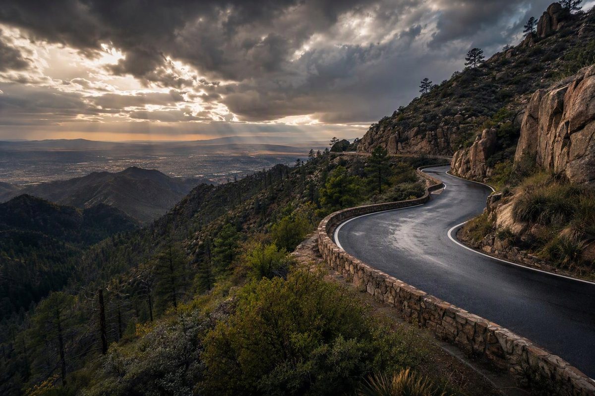
The Mt Lemmon scenic drive follows Catalina Highway from Tucson’s northeast side into the Santa Catalina Mountains. Plan it as an out-and-back to Summerhaven, not a mountain loop: the paved climb is the attraction, with desert vegetation giving way to pine and mixed-conifer forest.
Allow 4–5 hours for the round trip with viewpoints and a meal, plus the drive from your Tucson starting point to Catalina Highway. A hike or the optional road beyond Ski Valley makes this a longer outing.
Check access before setting out: call 520-351-3351, Pima County’s Sheriff’s Department road-closure hotline, for Catalina Highway conditions. Check forest alerts separately for recreation-area closures. Snow or fire danger can close the highway; “year-round” does not mean uninterrupted access. (Pima County Transportation; Forest Service recreation guide)
Route at a glance
| Planning detail | What to allow |
|---|---|
| Start and turnaround | Tanque Verde Road/Catalina Highway intersection to Summerhaven |
| Distance | About 30 miles each way; 60 miles round trip before detours |
| Driving only | Budget 1–1¼ hours each way in clear conditions, without stops |
| Scenic visit | About 4–5 hours with two or three viewpoints and lunch |
| Vehicle | An ordinary passenger car is suitable for the main paved route in clear conditions |
| Seasonal access | Year-round route, subject to weather and fire closures |
| Fuel plan | Refuel in Tucson before climbing; plan enough range for the return and detours |
Arizona Highways’ route guide measures approximately 30 miles from Tanque Verde Road to Summerhaven and lists no special vehicle requirements. The Forest Service recreation guide describes a shorter, 24-mile scenic byway and advises an hour of driving plus stops. Use the Tanque Verde–Summerhaven endpoints for the mileage above; the timing is a planning allowance, not a guaranteed travel time.
Follow the paved road—and return the same way
From Tanque Verde Road, head north on Catalina Highway, also called General Hitchcock Highway or Mt Lemmon Highway. Continue through the national forest to Summerhaven. Use that village as your main turnaround unless you have deliberately added another destination. (Forest Service route details)
Do not accept a mapping app’s alternative return through Oracle without checking the route. Control Road, Forest Road 38, is a separate rough, unpaved road down the mountain’s northeastern side. The Forest Service lists a seasonal gate closure from December 15 through February 28. It is not the paved scenic-drive return described here. (Control Road details)
Stops that fit a half-day
Choose a few stops rather than pulling into every overlook. The suggested visit times below are allowances, not operating schedules.
| Stop, in uphill order | Why stop | Suggested time |
|---|---|---|
| Molino Basin Picnic Area | An oak-woodland picnic break, with shaded tables and a vault toilet | 20–40 minutes |
| Windy Point | Broad Tucson-basin views and close views of granite pinnacles | 20–30 minutes |
| Palisades Visitor Center | Exhibits, a bookstore and visitor information, when open | 15–30 minutes |
| Aspen Vista | A northward mountain panorama | 10–15 minutes |
| Summerhaven | A meal and a village break before descending | 45–75 minutes |
Molino Basin has no potable water and does not permit trailers. Windy Point and Palisades are highlighted in the Forest Service recreation guide; Arizona Highways places Windy Point roughly 18 miles into its Tanque Verde-based drive and Aspen Vista around mile 27. These are approximate trip distances, not highway mileposts. (Molino Basin facilities and restrictions)
With less than three hours available from the highway’s start, consider turning around at Windy Point. That makes roughly a 36-mile return outing and preserves the main open-view stop without rushing to Summerhaven.
Optional upper-mountain extension
Ski Run Road branches off the main highway toward Ski Valley. Beyond it, the Mount Lemmon Day Use Area offers picnic sites, views and trail access near the summit. Add separate time for this branch rather than assuming Summerhaven is the summit.
The access road beyond Ski Valley closes in winter, even when the main highway is accessible. The day-use area has limited dirt-lot parking, no potable water and no trailers permitted. (Official access details)
Fees and an October 2026 access note
Budget for developed recreation stops, rather than treating every pullout as the same type of site. As checked October 30, 2026, Molino Basin Picnic Area and Mount Lemmon Day Use Area list $8 per vehicle for day use or $10 for a week. They accept qualifying Coronado and interagency passes; display the pass or proof of payment as instructed. Concessionaire-managed sites such as Rose Canyon have separate arrangements. (Molino Basin fees; Mount Lemmon fees; recreation guide)
Do not automatically add a Marshall Gulch hike. As of October 30, 2026, the forest’s posted alert lists pedestrian access to the Arizona Trail, Marshall Gulch Trail #3, Aspen Trail #93 and Sunset Trail #90 on Fridays, Saturdays, Sundays and federal holidays, with an area closure Monday through Thursday except federal holidays. Confirm the current closure order and its mapped boundaries before building a visit around those trails. That trail-access notice is not a Catalina Highway road-status report.
Conditions and preparation
- Winter: Check access restrictions after snow and follow the stated vehicle requirements. Do not substitute Control Road if the paved highway closes.
- Summer: Bring water and check the mountain forecast for thunderstorms. The Forest Service warns of monsoon storms and flash floods.
- Any season: Pack a warm layer. The scenic climb gains nearly 6,000 feet, and the forest guide notes that temperatures can differ from Tucson by as much as 30°F. (Seasonal guidance)
Check tires, brakes and coolant before the climb. On the descent, use an appropriate lower gear rather than holding the brakes continuously: sustained braking can overheat the brakes and reduce their effectiveness. (Mountain-driving guidance)
Expect blind bends, bicyclists and wildlife; use designated pullouts for photographs and to let faster traffic pass. If parking is full, continue to another legal stopping place rather than stopping in the travel lane. The Forest Service warns that upper-mountain parking can fill quickly. (Road-safety and parking guidance)