
Rim of the World Scenic Drive: Route, Time and Stops
Plan California’s 110-mile Rim of the World scenic drive with realistic timing, lake stops, route directions, parking fees and mountain-road checks.
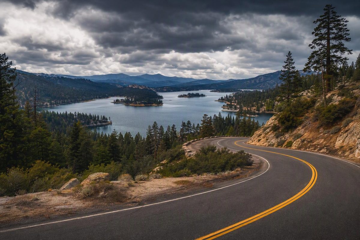
The Rim of the World scenic drive is a roughly 110-mile mountain crossing, not just the stretch of Highway 18 above San Bernardino. The full byway links Cajon Pass with the Mill Creek side of the mountains using portions of SR 138, SR 18 and SR 38. Lake Arrowhead Village is a side trip; Big Bear is part of the crossing. The Forest Service’s route description gives the full distance and highways.
| Planning item | What to allow for |
|---|---|
| Distance | About 110 miles one way, before side trips and your return |
| Driving allowance | Budget 3½–4½ hours in dry conditions without sightseeing stops |
| Full outing | About 6–8 hours with a short walk, viewpoints and lunch; add travel from home |
| Route | I-15/Cajon Pass → SR 138 → SR 18 → Big Bear → SR 38 → Mill Creek/Mentone |
| Season | Normally open year-round, subject to snow, chain controls and temporary closures |
| Fuel plan | Start full; assess fuel in Big Bear before continuing over Onyx Summit |
The time ranges are planning allowances, not measured travel times or live ETAs. Curves, town traffic, parking and roadwork can extend the drive. This is not a loop: the Forest Service visitor guide puts the round trip from San Bernardino at about 175 miles, before additional detours.
Check conditions before committing to the crossing
October 14, 2026 check: Caltrans reported no traffic restrictions on SR 18 or SR 138. On SR 38, it reported one-way controlled traffic at various locations between I-10 and 6th Street in Redlands, from 7 a.m. to 3:30 p.m., Wednesday through Friday, October 16, because of construction. That affects the Redlands approach or exit rather than indicating a mountain closure. Recheck the Caltrans highway report on your departure day.
Use Caltrans QuickMap for closures, incidents and chain controls, and check San Bernardino National Forest alerts before adding trails or forest-road detours. An open state highway does not mean every recreation site is accessible.
Follow the full route, not the fastest route to Big Bear
1. Cajon Pass to the mountain rim: SR 138
From I-15 at Cajon Pass, take SR 138 east toward Silverwood Lake and Crestline. Continue until it meets SR 18 beyond Crestline, then turn east onto SR 18.
This opening leg brings you past Silverwood Lake before climbing onto the rim. It is easy to miss if you simply ask a navigation app for the fastest route from Los Angeles to Big Bear. The Forest Service visitor guide documents this route sequence; use it for geography, not its older facility hours or fees.
2. Crestline area to Big Bear: SR 18
Follow SR 18 through the Lake Arrowhead area and Running Springs toward Big Bear Lake. Lake Arrowhead Village requires leaving the main byway, with access via SR 173. Return to SR 18 afterward rather than treating the village as the through-route. Visit California identifies it as a detour.
At Big Bear Dam, follow SR 38 along the north shore for the Forest Service’s described byway alignment. Visiting Big Bear Lake Village on the south shore is a separate routing choice, so include that in your mileage and schedule.
3. Big Bear to Mill Creek: SR 38
At the east end of the lake, SR 38 briefly shares SR 18 into Big Bear City before separating for the route toward Redlands. Follow the SR 38 route through these junctions; SR 18 toward Lucerne Valley is a different exit, not the crossing described here. AARoads’ route record documents the shared section.
SR 38 climbs over Onyx Summit, about 8,443 feet, then descends through Barton Flats, Angelus Oaks and Mill Creek Canyon to the forest boundary near Mill Creek Work Center. Connections toward I-10 are available through Yucaipa or Redlands. The Forest Service guide describes this final leg.
Stops that fit a single day
Pick a few rather than turning every turnout into a scheduled stop. These allowances are for visiting time; side-trip driving and parking come on top.
- Silverwood Lake Overlook: 10–15 minutes. A quick reservoir view off SR 138, identified by Visit California. Entering the state recreation area is a separate outing, not necessary for the overlook stop.
- Lake Arrowhead Village: 60–90 minutes, optional. Useful for a meal or browsing, with restaurants and shops listed by the local chamber. Do not assume visiting the village grants access to association beaches or shoreline facilities; those have member and guest rules.
- Heaps Peak Arboretum: 45–60 minutes. Near Skyforest on SR 18, its nearly mile-long nature trail makes a manageable walking break. The arboretum is free, but parking requires an Adventure Pass—$5 daily or $30 annually as checked in October 2026—or an accepted interagency pass. The Forest Service listing confirms the fees. Buy your pass ahead rather than relying on the volunteer booth being staffed; see the arboretum’s visitor information.
- Lakeview Point: 10–15 minutes. East of Snow Valley on SR 18, this overlook sits just above 7,100 feet and gives an approaching driver a view of Big Bear Lake. The Forest Service listing identifies the location.
For a balanced day, choose Silverwood, the arboretum and Lakeview Point, plus one meal stop. Adding a long hike or both lake villages calls for more time, not faster driving between them.
Season and vehicle preparation
For a first visit, choose a dry day with good visibility and aim to finish the mountain descent before dark. Winter changes the task from sightseeing logistics to traction and weather management. “Open year-round” is not a promise of uninterrupted access.
Under Caltrans chain-control rules, R2 requires traction devices except for AWD/4WD vehicles with snow-tread tires on all four wheels; those exempt vehicles must still carry traction devices in chain-control areas. R3 requires them on all vehicles. Follow posted controls and officers’ instructions, and check your vehicle manufacturer’s permitted devices before buying chains.
A well-maintained standard car is a reasonable dry-weather choice for the main paved highways. Check tires, brakes, coolant and lights; carry water, a warm layer and an offline map. Use an appropriate lower gear on sustained descents rather than riding the brakes, following your vehicle’s instructions; this is standard mountain-driving advice. Do not accept an unpaved navigation shortcut just to save a few minutes.
Start full and assess fuel again in Big Bear before continuing over Onyx Summit. GasBuddy’s Big Bear Lake listings identify several stations on Big Bear Boulevard, on the south side of the lake; plan any fuel detour rather than assuming a pump will appear beside the north-shore route. Use designated turnouts for photos and to let faster traffic pass; the Forest Service specifically cautions drivers about entering and leaving the highway.
If you only have half a day
Skip the full crossing. Enter via SR 18 from San Bernardino, visit Heaps Peak Arboretum and optionally Lake Arrowhead Village, then return by the same route. This leaves out Silverwood Lake, Big Bear and Onyx Summit, but keeps a mountain-rim drive and a short walk without forcing a late descent. Include the uphill and downhill legs in your schedule: time at the stops is only part of the outing.