
How to Plan the Pacific Coast Drive Without Rushing It
In about three weeks, a route from the Olympic Peninsula to San Diego is workable. Shorter trips should cut whole regions rather than shrink every stop.
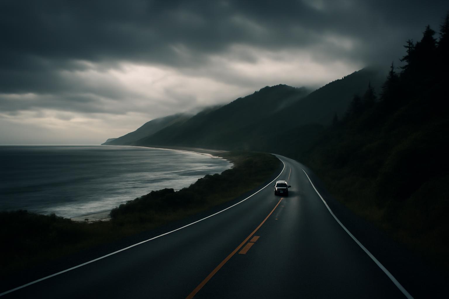
A West Coast road trip looks simple on a map: point the car toward the Pacific and follow the shoreline through Washington, Oregon, and California. In practice, the route is a chain of winding roads, small towns, major cities, forest corridors, viewpoints, beaches, and highway segments that may become unavailable.
The central planning decision is not where to stop. It is how much coast fits your available time. A compact trip should focus on one region; a longer trip can connect several regions, but every added city, hike, attraction, or beach day reduces the distance you can cover comfortably.
Traffic, weather, closures, lodging, activities, and personal driving tolerance can all change what is realistic. The frameworks below are planning examples rather than guaranteed itineraries. They show how to choose a scope, understand the highways, build workable driving days, prepare for changing conditions, and leave enough flexibility to enjoy the coast rather than merely pass through it.
Define the trip: Pacific Coast, not the entire American West
A genuine Pacific Coast road trip is oriented toward the shoreline and coastal regions of Washington, Oregon, and California. It is not primarily an inland circuit through Las Vegas, Death Valley, Arizona, or Utah, even though those destinations sometimes appear in trips marketed as “West Coast” itineraries.
The core route generally uses US 101 through Washington, Oregon, and Northern California, followed by California Highway 1 for major coastal sections where that road is accessible. A classic route can extend from Port Townsend near Olympic National Park to Southern California. Seattle, Portland, Los Angeles, and San Diego can also serve as flight and rental-car gateways rather than strict highway endpoints. The broad highway progression is outlined in this Pacific Coast route overview.
“Coastal” does not mean the road remains beside the ocean continuously. Washington’s US 101 circles much of the Olympic Peninsula but runs inland in places. In and around cities, the practical route may use freeways or local streets. Construction, storms, wildfire effects, or repairs may also require temporary inland routing.
This distinction matters because the experience is fundamentally different from an inland western road trip. A coast-first itinerary emphasizes rainforests, beaches, headlands, fishing towns, redwood forests, coastal cities, and ocean-facing roads. A Southwest itinerary emphasizes deserts, canyons, high plateaus, and inland parks. Both can be worthwhile, but combining them without substantially increasing the schedule makes route and pacing advice misleading.
Useful outer anchors include:
- North: Port Townsend, the Olympic Peninsula, or Seattle as an air gateway
- South: Los Angeles, the broader Southern California coast, or San Diego
- Primary highways: US 101 and California Highway 1
- Supporting highways: Urban connectors, inland bypasses, and Interstate 5 when transportation takes priority over coastal scenery
This guide addresses route design and realistic pacing. It does not establish live road status, current prices, reservation rules, or a promise that every coastal segment will be accessible. Verify those operational details for your dates shortly before departure and again before driving any vulnerable segment.
The coast-wide route, region by region
The complete corridor is easier to understand as a sequence of regions than as one uninterrupted highway. The progression below is an itinerary spine, not a checklist. Select the sections that fit your time and interests, then remove destinations until the daily plan works.
Olympic Peninsula and Port Townsend: Port Townsend is a useful northern anchor near the Olympic Peninsula. Olympic country can justify several days for forests, beaches, lakes, or hiking. Travelers making a faster trip may instead use it as the beginning of a southbound journey.
Washington coast: US 101 loops around much of the Olympic Peninsula, although it is not continuously oceanfront. This section rewards travelers who accept that coastal geography includes forests, river valleys, and inland stretches as well as beaches.
Astoria and the Oregon Coast: Astoria marks a useful transition near the Columbia River. From there, US 101 follows much of Oregon’s coast through communities, viewpoints, beaches, and headlands. Portland is a useful gateway or city addition, but it lies inland and requires leaving the direct coastal line.
Oregon dune country: The central and southern Oregon Coast brings longer beach landscapes and dune areas. This is also where a trip can slow unexpectedly: short distances on the map may contain multiple towns, viewpoints, walks, and roadside stops.
Northern California redwoods: US 101 continues into Northern California redwood country. Redwood parks and groves are recurring route anchors, while Avenue of the Giants is a frequently suggested intermediate drive. Travelers interested in hiking or spending substantial time beneath the trees should plan more than a quick roadside stop.
Mendocino and the North Coast: Near Leggett, travelers can transition between US 101 and California Highway 1. The coastal option toward Mendocino is slower and more winding than remaining on the broader inland corridor. Verify the available routing before departure rather than assuming the preferred connection will be usable.
San Francisco: San Francisco is both a major destination and a practical division between Northern and Central California. A city stay changes the rhythm of the trip: parking, urban traffic, hotel logistics, and full-day attractions do not fit neatly into a coastal driving schedule.
Monterey and Big Sur: Monterey and the surrounding peninsula form the northern approach to Big Sur. South of the area, Highway 1 becomes an experience in itself, with winding road, overlooks, trail access, and limited opportunities to recover time after a delay.
San Simeon and San Luis Obispo: Hearst Castle at San Simeon is a frequently suggested stop, but an attraction visit should be treated as a scheduled activity rather than a quick photo break. San Luis Obispo can serve as an overnight base or regional transition.
Santa Barbara: Santa Barbara is a natural pause between the Central Coast and the Los Angeles region. It can be a meal stop, an overnight, or a multi-night destination depending on whether the traveler wants beach, architecture, food, or city time.
Malibu and Los Angeles: Malibu provides a coastal approach to the Los Angeles area, but urban congestion can overwhelm simple map estimates. Los Angeles should be treated as a destination with substantial internal travel time, not as one compact roadside stop.
San Diego: San Diego provides a practical southern finish for a coast-wide trip. Ending there can eliminate the need to retrace the route, provided a suitable one-way rental and return flight are available.
Travel guides and traveler accounts repeatedly build routes around the Olympic Peninsula, Oregon Coast, redwood country, San Francisco, Big Sur, Los Angeles, and San Diego. They also frequently include Astoria, Oregon’s dune country, Avenue of the Giants, Mendocino, Monterey, Hearst Castle, San Luis Obispo, and Santa Barbara. That broad geographic sequence appears in the Washington-to-California route presented by Road Trip USA.
None of these places is objectively mandatory. A traveler focused on hiking might reduce city stays. Someone interested in museums and restaurants might skip several beach towns. A photographer may want flexible sunrise and sunset stops, while a family or group may prefer fewer hotel changes. Use the route spine to create options, then make deliberate cuts.
Choose the right scope for 7, 10, 14, or 21 days
Duration should determine geographic scope. It is usually better to remove an entire region than to preserve every destination by reducing each stop to a few waking hours.
The following frameworks assume a one-way trip and do not guarantee that every listed coastal segment will be open. “Moving day” means a day that changes lodging; “activity day” means little or no relocation; and “transit day” means a longer connection with a deliberately limited sightseeing list.
| Time available | Practical scope | Illustrative framework | First logical cut |
|---|---|---|---|
| 7 days | One compact region | San Francisco to Los Angeles by the coast | San Diego, far Northern California, or extra city nights. A scenic San Francisco–Los Angeles trip is commonly allotted about five to seven days in published guidance. Travel Nation provides that planning range. |
| 10 days | One extended region | Oregon Coast and redwoods, or an expanded California route | A distant gateway, secondary city stay, or inland detour. This is an editorial expansion of the shorter regional approach used in a seven-day California Highway 1 guide, not a guaranteed minimum. |
| 14 days | One broad half of the coast | Pacific Northwest to Northern California, or San Francisco to Southern California | One major city or one end region. Traveler discussions show that even longer Portland-to-San Diego proposals produce disagreement about whether the pace is reasonable. The competing views are summarized in this Pacific Coast discussion. |
| 21 days | Coast-wide framework | Seattle or Olympic Peninsula to San Diego | Extra city nights, wine-country additions, or minor coastal bases. A Seattle-to-San Diego account recommends splitting the route when time or budget is limited. Its planning guidance also favors a one-way structure. |
Seven days: choose one coherent region
For a seven-day trip, concentrate on one part of the coast. The clearest California example is San Francisco to Los Angeles through Monterey, Big Sur, San Simeon or San Luis Obispo, and Santa Barbara.
A non-guaranteed framework could look like this:
- Day 1 — San Francisco activity day: Arrive before the trip begins if possible, or use the first day for the city rather than collecting a vehicle and immediately driving.
- Day 2 — Monterey or Carmel moving day: Leave time for the peninsula rather than treating it only as a place to sleep.
- Day 3 — Big Sur activity or short moving day: Explore from the accessible side of the corridor and verify the next day’s route before committing south.
- Day 4 — Central Coast transit day: If through travel is available, continue toward San Simeon or San Luis Obispo. If not, use the verified inland connection and remove a secondary stop.
- Day 5 — San Luis Obispo or nearby activity day: Use the day for the selected town, coast, or scheduled attraction.
- Day 6 — Santa Barbara moving day: Keep the sightseeing list moderate so the arrival does not become a late-night check-in.
- Day 7 — Los Angeles finish: Treat arrival as the end of the coastal drive unless additional city days have been added outside the seven-day framework.
The main cuts are straightforward. Do not add Washington, Oregon, the redwoods, and San Diego. If San Francisco and Los Angeles both need substantial city time, either add days or shorten the coastal portion.
A week can also be organized around the Oregon Coast, Olympic Peninsula, or Northern California redwoods, but those are illustrative regional frameworks rather than validated day-by-day minimums. The principle is to keep the geography compact enough for walks, meals, weather changes, and at least one multi-night base.
Ten days: expand a region rather than claiming the whole coast
Ten days can support an Oregon Coast and redwood-country journey or a longer California itinerary. It should not be presented as a comfortable three-state trip.
One Oregon-and-redwoods framework is:
- Day 1 — Arrival gateway: Collect the vehicle, confirm the next section’s conditions, and avoid pairing arrival logistics with a long coastal drive.
- Day 2 — Astoria or northern Oregon Coast: Begin the coastal route.
- Days 3–4 — Central Oregon Coast: Use one base or two nearby overnights, depending on whether the priority is exploring or covering distance.
- Days 5–6 — Southern Oregon Coast: Reserve one day for a shorter relocation or outdoor activity.
- Days 7–8 — Northern California redwoods: Use a multi-night base if hiking or visiting more than one grove or park area.
- Day 9 — Avenue of the Giants or southward transition: Choose between a slower scenic day and a more direct departure connection.
- Day 10 — Departure gateway: Protect the flight or return appointment with an appropriate buffer.
The weak point is the final transport connection. Choose the departure gateway before booking the intermediate lodging, then work backward. If the final day requires an ambitious drive, remove the southernmost overnight rather than assuming the flight schedule will absorb a delay.
An expanded California alternative could allocate early city time to San Francisco, continue through Monterey and the accessible Big Sur corridor, pause near San Luis Obispo and Santa Barbara, and finish with Los Angeles or San Diego—but not extensive stays in both. The first cuts should be an inland detour, a secondary city, or the farther southern endpoint.
Fourteen days: choose one broad half
Two weeks is suited to one broad half of the corridor. A north-focused example could be:
- Day 1 — Seattle or Port Townsend gateway
- Days 2–4 — Olympic Peninsula
- Day 5 — Washington coast
- Day 6 — Astoria
- Days 7–9 — Oregon Coast, using northern, central, and southern bases
- Days 10–12 — Redwood country
- Day 13 — North Coast transition
- Day 14 — San Francisco finish
This framework gives Olympic country, the Oregon Coast, and the redwoods more than a drive-through appearance, but San Francisco is principally an endpoint. Add city days after the framework or cut one northern region to make room.
A southern alternative could allocate time among San Francisco, Monterey, Big Sur where accessible, the Central Coast, Santa Barbara, Los Angeles, and San Diego. If Los Angeles and San Diego both receive several activity days, reduce the San Francisco stay or start farther south.
The complete three-state route may be technically possible under favorable conditions, but it requires major omissions and more transit-heavy days. Do not shorten every stop equally. Finish in San Francisco instead of Los Angeles, fly into San Francisco instead of beginning in Washington, or separate the Pacific Northwest and California into different trips.
Twenty-one days: build a coast-wide framework
With about three weeks, a Seattle- or Olympic-to-San Diego journey becomes a workable coast-wide framework. It still does not provide unlimited time for every city and outdoor region.
A southbound allocation might be:
- Day 1 — Seattle or Port Townsend arrival
- Days 2–3 — Olympic Peninsula
- Day 4 — Washington coast
- Day 5 — Astoria
- Days 6–8 — Oregon Coast
- Days 9–10 — Northern California redwoods
- Day 11 — Mendocino or another North Coast base
- Days 12–13 — San Francisco
- Day 14 — Monterey or Carmel
- Day 15 — Big Sur activity or moving day, subject to access
- Day 16 — San Simeon or San Luis Obispo
- Day 17 — Santa Barbara
- Days 18–19 — Los Angeles and Malibu
- Days 20–21 — San Diego
This allocation contains very little slack. A full additional day in Olympic country, San Francisco, Los Angeles, or San Diego has to come from somewhere else. The cleanest cuts are usually Mendocino, an extra Oregon base, one city night, or San Diego as the final extension. The worst response is to preserve every destination while turning several consecutive days into long relocations.
The final test is what you want to do after parking. Hiking, wildlife viewing, beach time, museums, wine tasting, and city exploration require more time than using a destination mainly as an overnight stop. If the trip contains many activity days, reduce the geographic span.
Build overnight stops around experiences, not map estimates
A navigation app’s drive time is not a complete day plan. It usually does not represent the combined effect of viewpoint stops, meals, fuel, roadwork, town traffic, parking searches, short walks, or checking into lodging.
Coastal roads often have two-lane sections, curves, limited passing opportunities, and traffic through small communities. Urban approaches create a different form of delay. Even when the mileage looks modest, the elapsed day can be long.
As a planning baseline, one West Coast travel account recommends scheduling around four to five hours of driving on an ordinary moving day and using substantially longer days only occasionally. That is itinerary guidance, not a universal safety limit; personal tolerance, road conditions, weather, the vehicle, and the number of drivers all matter. The recommendation appears in this Seattle-to-San Diego planning account.
Use four types of days:
- Ordinary moving day: Moderate driving, meals, several stops, and an evening at the destination
- Activity day: Little or no relocation, with time for a park, city, beach, or hike
- Transit day: Longer driving with a deliberately limited sightseeing list
- Buffer period: Time that can absorb a late arrival, closure, weather change, or postponed activity
Do not attach a major hike, timed attraction, and sunset viewpoint to every transit day. If a long drive is unavoidable, protect it by making the sightseeing list optional.
Big Sur illustrates why distance alone is misleading. One travel writer describes the 76-mile segment from Bixby Bridge to Hearst Castle as approximately two hours without stops, while recommending a full day when viewpoints and hikes are included. The distinction appears in Mike Shubic’s Big Sur guidance.
Apply three separate time concepts whenever you build an itinerary:
- Nonstop drive time: Approximate time with the vehicle moving under expected conditions
- Realistic travel time: Driving plus congestion, food, fuel, parking, short walks, and delays
- Experience time: The additional time required to do what drew you to the destination
If Monterey to the next overnight appears to take only a few hours, that does not mean the day has room for every Big Sur stop. Likewise, a nominally short urban leg through Los Angeles can consume much of a day once traffic, parking, and activities are included.
Multi-night stays break the cycle of packing and unpacking. They are particularly valuable in Olympic country, the Oregon Coast, redwood country, San Francisco, Monterey or Big Sur, Los Angeles, and San Diego when the traveler wants more than a quick overview.
Finally, do not treat a prepaid hotel as evidence that the road will cooperate. Build extra time before important reservations, flights, or vulnerable segments. Identify at least one stop that can be removed without damaging the rest of the itinerary.
Southbound or northbound: choose direction deliberately
Southbound travel is commonly recommended because the southbound lane is nearer the ocean on many coastal stretches. That positioning can improve the passenger-side view and make some ocean-facing pullouts easier to enter and leave.
It is a preference, not a universal rule. Roads curve inland, change orientation, overlap with other highways, and pass through urban areas. Detours can erase the advantage. A southbound vehicle does not automatically have easier access to every viewpoint, and direction should never outweigh current road instructions or safe driving.
Compare these factors before choosing:
- Arrival airport: Which gateway offers the most useful flight schedule?
- Departure airport: Where do you want to finish, and how much flight buffer is required?
- Rental availability: Can the chosen vehicle be returned at the destination?
- One-way charge: Does it cost less than the extra fuel, lodging, food, and time required to backtrack?
- Events and reservations: Are fixed dates pulling the route in one direction?
- Weather progression: Does beginning north or south better suit the expected conditions for your dates?
- Desired finish: Would you rather end with a major city, beach time, or a quieter coastal section?
Northbound may be more sensible when the traveler begins in Southern California, finds a substantially better rental arrangement, has a fixed event, or wants to finish in Seattle or Portland. Viewpoint convenience is only one part of the decision.
A one-way rental combined with a flight home can preserve vacation time by eliminating the return drive. Verify vehicle availability, geographic restrictions, drop-off rules, and fees directly with the rental company before booking. Campervans, specialty vehicles, and international rentals may have different terms.
Compare the full trip cost rather than the rental price alone. A round trip may avoid a one-way charge but require extra fuel, lodging, food, and vacation days. A one-way trip may cost more upfront while producing more usable time on the coast.
Know what Highway 1, US 101, and Interstate 5 are for
The West Coast does not have one coastal highway with one identity from Washington to Southern California. Three road types serve different planning purposes.
US 101 is the principal coastal connector through much of Washington and Oregon and into Northern California. It provides continuity between coastal regions, although it is not always beside the ocean.
California Highway 1 is the scenic coastal road associated with Mendocino, Monterey, Big Sur, San Luis Obispo, Malibu, and other California coastal communities where the route is accessible. Near Leggett, travelers can transition between Highway 1 and US 101.
Interstate 5 and other inland highways are transportation tools. They can save time, connect airports and cities, or bypass an unavailable coastal segment. They are not equivalent scenic substitutes for Highway 1 or coastal US 101.
Highway 1 and US 101 connect or overlap in parts of California. Informal use of “Pacific Coast Highway” may refer to Highway 1, particular named sections, or the wider coastal route. When checking directions or road conditions, use the highway number, nearby communities, and exact segment rather than relying on the general “PCH” label.
The San Francisco-to-Los Angeles comparison shows why highway choice matters. One commercial route guide estimates about 5.5 hours nonstop via Interstate 5, compared with roughly 14 hours of driving on the scenic Highway 1 and US 101 route before sightseeing stops. Those are approximate planning figures, not promises. Travel Nation provides the route-time comparison.
Travelers with limited time should preserve the coastal sections they value most and use inland highways selectively. Someone focused on Big Sur and Santa Barbara might use a faster road elsewhere rather than attempting every coastal mile. A traveler most interested in Oregon and the redwoods might fly home from Northern California instead of rushing through the rest of the state.
Do not save a fixed Big Sur detour months in advance and assume it will remain correct. Identify the affected section through current official information, determine which side remains accessible, and then select an inland alternative suitable for that day’s destination and conditions.
Plan for seasons, fog, storms, and road closures
There is no single best month for the entire Washington-to-San Diego corridor. Washington, Oregon, Northern California, Big Sur, Los Angeles, and San Diego have different weather patterns, crowd cycles, daylight, and road vulnerabilities.
One California Highway 1 guide recommends spring or fall and warns of heavier traffic and higher temperatures in summer. That is California-specific travel guidance, not a rule for the full three-state coast. The seasonal recommendation appears in California Through My Lens.
Fog is also regional and variable. Travelers in one forum discussion identify May and June as potentially cool and foggy on parts of the California coast, but that is anecdotal context rather than a forecast. Conditions can vary by day and location.
Storms can affect the Monterey-to-San Simeon corridor, and repairs after damage may be lengthy. Similar planning problems can arise elsewhere from landslides, flooding, fallen trees, wildfire effects, or construction. An older Pacific Coast Highway traveler discussion records those concerns, but it must not be used to determine current access.
Winter is a separate planning problem. Shorter daylight reduces sightseeing time, while rain or winter conditions on inland alternatives can make a coast-plus-inland itinerary more complicated. The coastal road and its fallback route may face entirely different conditions.
Before each potentially affected leg, check:
- The relevant state transportation agency for the exact highway segment
- The applicable park authority for park roads, trails, and facility changes
- The weather service for forecasts, watches, and warnings
- Current official wildfire information for closures, smoke, or evacuation effects
- The ferry operator if a ferry is included
- The lodging or attraction directly for operating status and arrival implications
Use the official tool for the state and agency involved rather than a cached search result, old article, forum post, or saved map. Repeat the checks shortly before driving the segment. Research completed when the trip was booked may no longer describe the situation on departure day.
A useful closure-planning method is:
- Identify the exact closure limits, not merely “Highway 1 closed.”
- Determine whether the planned destination remains approachable from the north, south, or both.
- Decide whether the affected coastal section can become an out-and-back visit.
- Check whether lodging can be moved without creating another excessively long day.
- Remove one optional stop before compressing the rest of the itinerary.
- Verify the alternative again on the day of travel.
Keep an inland bypass in mind, but do not lock in an unverified fixed detour. The appropriate route depends on the closure boundaries, conditions, vehicle, and next overnight.
Prepare the vehicle, navigation, reservations, and budget
Long coastal trips combine rural roads, city traffic, variable weather, and places where services or cellular coverage may be less convenient than expected. Organize preparation into six categories.
Vehicle
Check tires, pressure, tread condition, and the spare. Review engine oil and other fluids, battery condition, lights, brakes, wipers, warning lights, and overdue maintenance. Do this early enough to allow inspection and repairs rather than discovering a problem immediately before departure. Bridgestone includes those items in its general pre-departure vehicle checklist.
Documents
Carry a valid driver’s license, proof of insurance, and vehicle registration, along with rental documents and roadside-assistance information. International travelers should verify current government requirements and rental-company terms for every relevant jurisdiction instead of assuming that a domestic license, international permit, or insurance arrangement will be accepted. These document and navigation categories also appear in Skyscanner’s general US road-trip preparation guide.
Navigation
Download offline maps for the full corridor and any potential inland fallback. Carry a paper map as a secondary backup. Save lodging addresses, phone numbers, vehicle-support details, and critical reservations somewhere that does not depend on cellular service.
Offline maps do not establish that a route is open. Treat them as navigation backups, then compare the proposed route with current official road information before driving.
Emergency gear
Pack water, nonperishable food, a first-aid kit, flashlight, chargers, roadside equipment, and some cash. Add season-appropriate clothing and gear. The correct equipment depends on the route, forecast, vehicle, and occupants, so treat generic packing lists as starting points rather than guarantees of readiness.
For a concise companion checklist, see Road Listings’ long-drive tire and gear preparation article. It is informational guidance, not a guarantee that a vehicle or packing list is safe or suitable for every condition.
Reservations
Confirm lodging, campground, ferry, park, and attraction requirements directly. Do not assume that an older article accurately reflects current booking windows, operating days, timed-entry systems, or cancellation policies.
Avoid scheduling an inflexible attraction immediately after a closure-prone or congestion-prone drive. If a reservation is important, arrive in the area the previous day or leave a substantial buffer.
Budget
Build the budget from current quotes rather than a generic total. Include:
- Vehicle rental or vehicle preparation
- One-way rental charge, if applicable
- Fuel
- Lodging or campsites
- Food
- Parking
- Park or attraction fees
- Tolls
- Ferries, if used
- Emergency or contingency funds
Price the alternatives as well. A more expensive flight may save a hotel night. A one-way charge may cost less than retracing the route. A city-center hotel may reduce driving while increasing parking costs. A longer trip reduces pressure on each day but increases accommodation and food expenses.
Route information and operating conditions can change. Recheck the plan for your dates, vehicle, driver qualifications, and reservations immediately before departure.
Keep inland parks and desert routes as separate extensions
Yosemite, Joshua Tree, Death Valley, Las Vegas, the Grand Canyon, and Utah’s national parks are inland additions. They are not components of the core Pacific Coast route.
The distinction is practical, not semantic. Each inland extension adds driving and introduces different terrain, weather, access questions, and reservation considerations. Treating Yosemite as a quick coastal side trip, for example, can hide the time needed to leave the shoreline, reach the destination, explore it, and reconnect with the coast.
Add an inland destination only after the coastal itinerary already has workable driving days and buffer time:
- Build the coast-only route.
- Confirm that moving days and activity time are realistic.
- Preserve a buffer for road or weather changes.
- Add one inland module.
- Recalculate every affected overnight and transport day.
- Remove the extension if it creates a chain of rushed days.
A California coast trip and an inland Southwest trip work better as separate modules. One can focus on San Francisco, Big Sur, Santa Barbara, Los Angeles, and San Diego. Another can connect Las Vegas with desert parks or the Grand Canyon. Combining the modules is possible with substantially more time, but the result should not be mistaken for a shoreline itinerary.
Avoid combining several inland parks with the complete Washington-to-San Diego coast unless the schedule extends well beyond the standard frameworks in this guide. Inland additions should not be financed by eliminating every buffer and reducing each coastal region to a single night.
Frequently asked questions
How many days do you need for a West Coast road trip?
There is no single required duration. Use the frameworks in the table above: one compact region for a short trip, one extended region with additional time, one broad half of the coast for a longer itinerary, or a coast-wide route only when the schedule can support repeated moving days and selected multi-night stays.
Hiking, museums, beaches, wildlife viewing, wine tasting, and city exploration all increase the time required. If the schedule feels crowded, remove an entire region before shortening every overnight.
Is it better to drive the West Coast southbound or northbound?
Southbound is commonly preferred because the vehicle is in the lane nearer the ocean on many stretches, which can make some coastal pullouts more convenient. The advantage is not universal.
Choose northbound if it produces better flights, rental terms, event timing, starting logistics, or weather progression for your trip. Compare the total cost and usable vacation time, not only viewpoint convenience.
Are Pacific Coast Highway, Highway 1, and US 101 the same road?
No. US 101 is the major coastal connector through much of Washington and Oregon and through Northern California. California Highway 1 serves major scenic coastal sections of California. The roads connect or overlap in places, and informal references to “Pacific Coast Highway” may describe Highway 1, named local sections, or the broader coastal route.
For navigation and road-condition checks, identify the exact highway number, nearby communities, and affected segment. Do not rely on “PCH” alone.
What should I do if Highway 1 or Big Sur is closed?
Confirm the exact closure limits through the relevant state transportation agency. Determine whether your destination remains approachable from the other side, whether the accessible portion can be visited as an out-and-back, or whether an inland connection is required.
Do not follow an old fixed detour without verifying it. Contact affected lodging or attractions, move the overnight if practical, remove an optional stop, and avoid compressing every remaining day to recover lost time.
Can I combine the Pacific Coast with Yosemite, Death Valley, or Las Vegas?
Yes, but treat each destination as a separate inland extension. Add it only after the coastal route has realistic moving days, activity time, and a buffer. One inland module may fit a longer regional itinerary; several inland parks combined with the complete coast require substantially more time.
Choose scope before choosing stops: one region for a short trip, one broad half of the coast for a longer itinerary, or the wider Washington-to-San Diego corridor when the schedule can support it. The strongest West Coast road-trip plan is not the one containing the most destinations. It is the one that leaves enough time for the roads, viewpoints, towns, and inevitable changes that make a Pacific Coast drive different from a simple highway transfer.