
Choose a Pacific Coast Drive You Can Finish Without Rushing
With fewer than 7 days, choose one region: Olympic Peninsula, Oregon Coast, redwoods and Mendocino, Big Sur and the Central Coast, or Southern California.
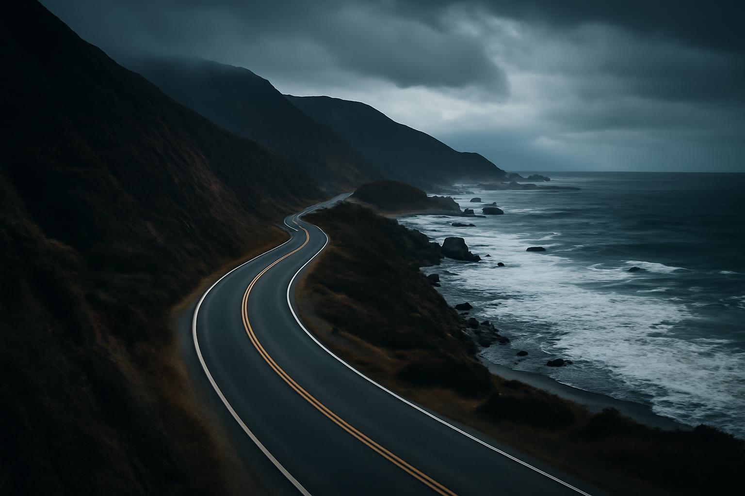
Choose a Pacific Coast drive you can finish without rushing.
A successful West Coast road trip is not the itinerary with the most map pins. It is the one that leaves enough room for winding roads, viewpoint stops, cities, meals, parking, changing conditions, and unexpected delays.
For most travelers, that means choosing among three route families:
- A California coast trip, usually between San Francisco and Los Angeles
- A Portland-to-Big-Sur drive through Oregon and Northern California
- A multi-state route from Seattle to Los Angeles or San Diego
Seven days can support a satisfying California drive. Three weeks makes the full Washington-to-Southern-California corridor more practical without requiring a new hotel every night.
The itineraries below are editorial planning templates, not validated schedules or statements of current access. No road, park, ferry, trail, campground, or attraction should be assumed open because it appears here. Check each transfer in a live mapping tool and verify operating conditions with the responsible transportation, park, ferry, weather, and emergency-management authorities before booking and again before travel.
What Counts as a West Coast Road Trip?
In this guide, the core West Coast corridor follows the Pacific-facing parts of Washington, Oregon, and California. It includes coastal communities, forests, beaches, cities, and nearby park detours that fit naturally into a north–south drive.
Arizona, Nevada, Utah, Yosemite, Death Valley, Joshua Tree, and the Grand Canyon belong to broader Western road trips. They can be added as explicit inland loops, but combining several of them with the full coast changes the trip’s purpose and substantially increases the driving.
There is no single numbered coastal highway running continuously from Washington through California:
- US 101 carries much of the coastal route in Washington and Oregon and continues through parts of Northern California.
- California Highway 1 supplies prominent California coastal sections through areas such as Mendocino, the Bay Area, Big Sur, and parts of Southern California.
- Interstate 5 is the faster inland connector. It can recover time, replace a selected coastal transfer, or help route around an unavailable section when current authorities identify it as part of the appropriate alternative.
California Highway 1 does not extend north to Washington. A California route guide describes it as approximately 655 miles from Dana Point to its junction with US 101 at Leggett; travel toward Oregon and Washington then relies principally on US 101 rather than the same numbered highway. California Through My Lens describes the Highway 1 termini.
“Pacific Coast Highway” is nevertheless used loosely. Depending on the writer, it may mean California Highway 1, a named portion of that road, or the complete multi-state coastal journey. When building directions, ignore the marketing label and confirm the actual highway numbers for every segment.
This guide uses three practical route families:
- California Highway 1 trip: San Francisco to Los Angeles, with Monterey, Carmel, Big Sur, Cambria or Morro Bay, and Santa Barbara.
- Portland to Big Sur: Oregon Coast, redwood country, Mendocino or Point Reyes, San Francisco, Monterey, and Big Sur.
- Seattle to Southern California: Washington, Oregon, Northern California, the Bay Area, Central California, and an optional extension through Los Angeles to San Diego.
Choose the Route Before Choosing the Stops
Start with the number of nights available, then choose a route. Saving dozens of attractions before setting the route often produces a schedule that appears plausible on a map but fails once meals, parking, walks, viewpoints, and hotel check-in are included.
For travelers prioritizing coastal scenery over extended city stays, a seven-day San Francisco-to-Los-Angeles drive is the most practical short framework in this guide. Travel Nation suggests allowing five to seven days for the scenic route and its stops rather than treating the trip like an inland freeway transfer. Its California itinerary explains that planning range.
A 10-day Portland-to-Big-Sur route is possible but active. It can connect the Oregon Coast, Northern California redwoods, San Francisco, Monterey, and Big Sur, provided the traveler accepts several one-night bases and removes secondary stops when transfer days run long. A published 10-day itinerary follows this general structure and also illustrates how quickly hikes, viewpoints, and activities can fill a day. Meet Me Off Grid documents that compressed route.
A 14-day Seattle-to-Los-Angeles itinerary is an editorial compromise rather than a universal minimum. It can include Olympic National Park, several Oregon Coast stages, redwood country, San Francisco, Monterey, Big Sur, Santa Barbara, and Los Angeles. It remains selective, but careful use of two-night bases can prevent every night from becoming a relocation.
For approximately 21 days, Seattle to San Diego becomes a more flexible framework. The additional week is better used for two-night bases, city stays, beaches, hikes, and recovery time than for adding distant inland parks. Published seven-day Seattle-to-Southern-California plans characterize that pace as compressed and recommend more time for additional stops. Deep Arrival presents seven days as a fast version and suggests extending the trip.
The following durations are editorial planning ranges based on those source-supported route patterns. They are not guarantees of feasibility for a particular date.
| Route | Suggested duration | Start and finish | Defining landscapes | Likely pace | Candidate airport gateways* | What shorter trips must omit |
|---|---|---|---|---|---|---|
| California coast | 7 days | San Francisco to Los Angeles | Monterey Bay, Big Sur cliffs, Central Coast towns, Southern California beaches | Moderate, with one substantial Big Sur day | San Francisco and Los Angeles | Extended city stays, Northern California, San Diego |
| Portland to Big Sur | 10 days | Portland to Monterey, Carmel, or a separate departure base | Oregon headlands, dunes, redwoods, Mendocino coast, Big Sur | Active; several complex transfer days | Portland and San Francisco; investigate San Jose or Monterey only if current service and rental arrangements fit | Seattle, Olympic Peninsula, Southern California, many hikes |
| Seattle to Los Angeles | 14 days | Seattle to Los Angeles | Olympic Peninsula, Oregon Coast, redwoods, Bay Area, Big Sur | Selective; some demanding transfers | Seattle and Los Angeles | San Diego, long city stays, numerous secondary beaches |
| Seattle to San Diego | About 21 days | Seattle to San Diego | Three-state coast, forests, dunes, redwoods, cliffs, urban beaches | Varied, with useful two-night bases | Seattle and San Diego; compare Los Angeles if it improves flight or rental terms | At shorter durations, Washington, Southern California, or several city days |
*These are candidate gateways, not claims about current routes, schedules, vehicle inventory, or one-way rental availability. Confirm flights and rental returns directly.
A traveler who wants full-day hikes, museum visits, restaurant reservations, or several nights in each city will cover less coast than someone focused on driving and viewpoints.
With fewer than seven days, choose one region: the Olympic Peninsula, the Oregon Coast, Northern California redwoods and Mendocino, Big Sur and the Central Coast, or Southern California. A short vacation does not need to prove that the complete three-state corridor can be crossed.
Four Modular Itineraries for 7, 10, 14, and 21 Days
These day divisions do not establish current mileage, wheel time, access, or opening status. Before booking, map every transfer for the intended travel date. If the route is already long without stops, add a night, move the overnight base, or shorten the geographic scope.
The intensity labels are comparative:
- Light: local travel or a short relocation
- Moderate: a transfer with room for one principal activity
- High: a complex or stop-heavy transfer that should be validated carefully
- Very high: the route may need another night or a revised base, especially when access or traffic is unfavorable
Hikes and paid attractions are optional. Replace them with beaches, roadside viewpoints, scenic streets, or time at the overnight base when the drive itself is the priority.
Seven days: San Francisco to Los Angeles
This is the preferred short framework for travelers who want a concentrated California coast trip. It gives Big Sur a substantial day rather than treating it as a quick transfer.
| Day | Overnight base | Main transfer and intensity | Priority experience | Optional stop | First item to cut |
|---|---|---|---|---|---|
| 1 | San Francisco | Arrival and local travel — light | One focused city area | Waterfront or neighborhood viewpoint | Any attraction requiring a cross-city detour |
| 2 | Monterey or Carmel | San Francisco to Monterey Bay — moderate | Monterey or Carmel waterfront and town time | Santa Cruz or one beach | Santa Cruz if traffic or parking consumes the afternoon |
| 3 | Monterey or Carmel | Local peninsula day — light | One substantial peninsula experience | Short coastal walk or scenic drive | A second paid attraction |
| 4 | Cambria or Morro Bay | Monterey or Carmel through Big Sur — high | Big Sur as the central experience | One short walk where access permits | The final southern viewpoint |
| 5 | Santa Barbara | Central Coast to Santa Barbara — moderate | Town or beach time | San Simeon-area attraction if booked and accessible | The attraction or an inland detour |
| 6 | Los Angeles | Santa Barbara to Los Angeles — moderate | Santa Barbara morning or one Los Angeles-area beach | Malibu stop | Additional beach hopping |
| 7 | Los Angeles | Local travel and departure — variable | One neighborhood, museum, or beach district | A second city district | Anything requiring a long cross-city transfer |
If Highway 1 is unavailable for through travel, Day 4 must be rebuilt rather than merely delayed. Confirm that Cambria or Morro Bay remains practical before preserving the same overnight booking. If the available detour creates an excessive day, add an inland overnight or use Monterey as a base for a shorter out-and-back.
Ten days: Portland to Big Sur
This route offers substantial geographic variety, but limited recovery time. Days 4, 6, and 7 deserve particular scrutiny when mapped.
| Day | Overnight base | Main transfer and intensity | Priority experience | Optional stop | First item to cut |
|---|---|---|---|---|---|
| 1 | Astoria or Cannon Beach | Portland to northern Oregon Coast — moderate | Reach the coast and settle into one town | Astoria riverfront or a short beach visit | Portland sightseeing |
| 2 | Central Oregon Coast | Northern to central coast — high | One headland, beach, or viewpoint cluster | Tillamook-area stop | A second northern-coast park |
| 3 | Florence or nearby | Central-coast transfer — moderate | Central-coast viewpoints or dunes | Lighthouse or short walk | A time-fixed activity |
| 4 | Brookings or southern Oregon Coast | Florence area to southern Oregon — high | Southern Oregon shoreline | Small-town lunch stop | Extra dune or beach detour |
| 5 | Redwood country | Southern Oregon to Northern California — moderate | One redwood grove or scenic park road | Coastal overlook | A second forest walk |
| 6 | Mendocino or Fort Bragg | Redwood country to Mendocino coast — high | Avenue of the Giants or another redwood drive | Small-town stop | The optional walk after the scenic drive |
| 7 | San Francisco | Mendocino area to San Francisco — high | Mendocino coast or Point Reyes, not both in depth | One roadside coastal stop | Point Reyes if arrival would become late |
| 8 | San Francisco | Local day — light | Focused city sightseeing | Additional neighborhood | Any attraction with difficult parking |
| 9 | Monterey or Carmel | San Francisco to Monterey Bay — moderate | Monterey or Carmel | Santa Cruz | Secondary Bay Area stop |
| 10 | Monterey or Carmel | Big Sur out-and-back — moderate to high | Big Sur road experience and selected viewpoints | Short park walk | The farthest viewpoint |
Use Monterey or Carmel as the final overnight base, not as a same-day launch point for a distant flight. A separate departure morning materially improves this itinerary. If a flight must occur on Day 10, shorten Big Sur and move to a departure base on Day 9.
Adding an 11th night is most useful between southern Oregon and Mendocino or after the Big Sur day. It converts one of the route’s highest-intensity transfers into a more manageable stage.
Fourteen days: Seattle to Los Angeles
Olympic National Park is a deliberate peninsula detour, not a roadside addition. The transfer from the peninsula to northern Oregon is one of the itinerary’s most complex days and must be mapped from the exact Olympic base.
| Day | Overnight base | Main transfer and intensity | Priority experience | Optional stop | First item to cut |
|---|---|---|---|---|---|
| 1 | Seattle | Arrival and local travel — light | One Seattle district or waterfront area | Viewpoint or market visit | Cross-city attraction |
| 2 | Olympic Peninsula | Seattle to the chosen peninsula base — moderate | Reach one Olympic zone | Ferry routing if current operations make it practical | Extra Seattle morning |
| 3 | Olympic Peninsula | Local park travel — moderate | One park zone rather than the entire peninsula | Short beach or forest walk | A distant second zone |
| 4 | Astoria or Cannon Beach | Peninsula to northern Oregon — very high | Complete the transfer before evening | One brief Astoria stop if time remains | Secondary Washington beach |
| 5 | Central Oregon Coast | Northern to central Oregon — high | Cannon Beach or one headland, then continue | Tillamook-area stop | Second northern-coast viewpoint |
| 6 | Southern Oregon Coast | Central to southern Oregon — high | Dunes or central-coast scenery | Lighthouse stop | Extra beach walk |
| 7 | Redwood country | Southern Oregon to Northern California — moderate | One southern Oregon viewpoint and a first redwood stop | Short coastal detour | Final Oregon viewpoint |
| 8 | Redwood country | Local or short transfer — light | Redwood walk or scenic drive | Additional grove | Longer hike |
| 9 | San Francisco | Redwoods to San Francisco — very high | Avenue of the Giants or Mendocino-route scenery | Small-town stop | Point Reyes detour |
| 10 | San Francisco | Local day — light | One complete city day | Additional neighborhood | Anything requiring major backtracking |
| 11 | Monterey or Carmel | San Francisco to Monterey Bay — moderate | Peninsula town and coastline | Santa Cruz | Late city attraction |
| 12 | Cambria or Morro Bay | Monterey or Carmel through Big Sur — high | Full Big Sur scenic day | One short walk | Final planned pullout |
| 13 | Santa Barbara | Central Coast to Santa Barbara — moderate | Santa Barbara or a relaxed beach afternoon | San Simeon-area stop | Paid attraction |
| 14 | Los Angeles | Santa Barbara to Los Angeles — moderate | One Los Angeles-area finish | Malibu stop | Multiple beach districts |
Day 4 becomes substantially easier if the Olympic stay is on the southern or southwestern side of the peninsula before departure. Otherwise, add a night in southwest Washington or Astoria.
Day 9 is also vulnerable to overload. If San Francisco is important, add a night between the redwoods and the city or use a more direct current route instead of combining Mendocino, Point Reyes, and a city arrival.
To spend two full days in Seattle, San Francisco, or Los Angeles, remove Olympic, shorten Oregon, or finish farther north.
Twenty-one days: Seattle to San Diego
The three-week version slows the same corridor. It uses two-night bases and extends through Southern California rather than diverting to Yosemite, Death Valley, or the Southwest.
| Day | Overnight base | Main transfer and intensity | Priority experience | Optional stop | First item to cut |
|---|---|---|---|---|---|
| 1 | Seattle | Arrival — light | Settle in and explore one nearby district | Waterfront walk | Formal attraction |
| 2 | Seattle | Local day — light | Full city day | Second neighborhood | Distant day trip |
| 3 | Olympic Peninsula | Seattle to peninsula — moderate | Reach the chosen park base | Ferry route if current operations fit | Long Seattle morning |
| 4 | Olympic Peninsula | Local park travel — moderate | One Olympic zone in depth | Short second stop | Remote second zone |
| 5 | Astoria or Cannon Beach | Peninsula to northern Oregon — very high | Complete the southbound transfer | Brief Astoria stop | Washington coastal detour |
| 6 | Astoria or Cannon Beach | Local northern-coast day — light | Beach, headland, or town time | Short walk | Multiple park entrances |
| 7 | Central Oregon Coast | Northern to central coast — moderate | One viewpoint cluster | Tillamook-area stop | Secondary beach |
| 8 | Florence or nearby | Short central-coast transfer — light | Dunes or lighthouse-area scenery | Additional headland | Time-fixed tour |
| 9 | Brookings or southern Oregon Coast | Central to southern Oregon — high | Southern Oregon coast | Small-town stop | Extra central-coast walk |
| 10 | Redwood country | Oregon to Northern California — moderate | First redwood experience | Coastal viewpoint | Second forest stop |
| 11 | Redwood country | Local park day — light | Redwood walk or scenic road | Another grove | Long hike |
| 12 | Mendocino or Fort Bragg | Redwoods to Mendocino coast — high | Avenue of the Giants | Coastal town stop | Additional inland detour |
| 13 | San Francisco | Mendocino to San Francisco — high | Mendocino coast or Point Reyes | Roadside viewpoint | Attempting both in depth |
| 14 | San Francisco | Local day — light | Full city day | Evening neighborhood | Second major attraction |
| 15 | Monterey or Carmel | Bay Area to Monterey Peninsula — moderate | Carmel or Monterey waterfront | Santa Cruz | Extra San Francisco stop |
| 16 | Monterey or Carmel | Local peninsula day — light | One substantial peninsula activity | Scenic drive or short walk | Second paid attraction |
| 17 | Cambria or Morro Bay | Big Sur southbound — high | Full Big Sur day | Short park walk | Final viewpoint |
| 18 | Santa Barbara | Central Coast transfer — moderate | Relaxed Santa Barbara afternoon | San Simeon-area attraction | Inland detour |
| 19 | Los Angeles | Santa Barbara to Los Angeles — moderate | Malibu or one city district | Second beach | Cross-city sightseeing |
| 20 | San Diego or La Jolla | Los Angeles to San Diego area — moderate | Southern California coastal extension | One Orange County stop | Multiple beach-town stops |
| 21 | San Diego or departure base | Local day or departure — variable | La Jolla, beach time, or one city attraction | Second district | Any stop that threatens departure timing |
For a slower San Diego finish, move the Los Angeles transfer earlier or add a 22nd day. Three weeks should create room for weather, laundry, fatigue, and spontaneous stops rather than an obligation to fill every opening.
A seven-day Seattle-to-San-Diego version should be treated as a fast connecting drive, not the default recommendation. It leaves little room for the activities and stops that motivate most coastal itineraries.
The Anchor Stops—and How Much Time They Deserve
Stop priority should reflect geography and the kind of trip you want, not a universal destination ranking.
Washington
Seattle works as a one- or two-night urban base. One night gives you an arrival evening and part of a day; two nights allow a fuller city visit before a long transfer.
Olympic National Park requires a deliberate peninsula plan. Its coast, forests, lakes, and mountain approaches lie along different roads. Choose one or two zones and stay nearby rather than assuming the park can be sampled quickly between Seattle and Oregon.
Oregon
Cannon Beach can be a short visit or an overnight base. Farther south, central-coast viewpoints, dunes, and the southern shoreline divide naturally into several stages.
US 101 links many communities, but the itinerary should treat it as a scenic route rather than an express transfer. Town traffic, viewpoint entrances, beach parking, and repeated stops can turn a modest-looking map day into a full day.
Northern California
Redwood National and State Parks can support a scenic drive, a forest walk, or a complete local day. Decide which experience matters before allocating time; driving through redwood country and walking in a grove are not interchangeable.
Avenue of the Giants suits a lower-hiking itinerary because the road itself can be the main experience. One source describes it as a 31-mile scenic highway running parallel to US 101 through Humboldt Redwoods State Park. Ready, Set, PTO outlines the route and its place in a coastal itinerary.
Mendocino can be an overnight town or part of a coastal transfer. Point Reyes is a separate detour with enough local travel to warrant a half or full day. Do not insert it casually between Mendocino and San Francisco while preserving numerous other stops.
Bay Area
San Francisco deserves one night when it is mainly a logistical base and two or more when city sightseeing matters. Build parking, hotel access, and cross-city travel into the plan rather than treating arrival at the city boundary as the end of the transfer.
Travelers who are not prioritizing major-city sightseeing can stay outside the center or limit the visit to one district, preserving more time for Point Reyes, Monterey, or the Central Coast.
Central California
Monterey and Carmel work well as a two-night cluster. That creates one arrival day and one peninsula day before the Big Sur transfer.
Big Sur should be treated as a substantial scenic day whenever the route is available. Source descriptions note curves, narrow lanes, steep roadside terrain, and limited shoulders on parts of Highway 1, reinforcing the need to use designated stopping areas and avoid a rushed itinerary. California Through My Lens describes those road characteristics.
San Simeon, Cambria, and Morro Bay serve different planning roles. San Simeon can support a booked attraction or coastal stop; Cambria and Morro Bay are useful overnight bases. Santa Barbara can be a half-day visit, an overnight base, or a longer city-and-beach break.
Southern California
Los Angeles-area beaches and San Diego or La Jolla are extensions, not compulsory parts of every itinerary. Ending in Los Angeles is logical for a seven- or 14-day route. Continue to San Diego only when the schedule leaves time to enjoy the extension rather than merely complete it.
| Place or cluster | Typical planning role | Why it fits | Verify before relying on it |
|---|---|---|---|
| Seattle | Overnight base or full-day destination | Urban arrival point and candidate flight gateway | Parking, attraction bookings, local events |
| Olympic National Park | Full-day destination or multi-night base | Dispersed park zones and peninsula routing | Roads, park alerts, ferries, trail access |
| Cannon Beach | Quick stop, half day, or overnight | Beach and town near the northern Oregon route | Parking and local access |
| Central Oregon Coast | Half day to overnight | Viewpoints, headlands, and towns along US 101 | Park and road conditions |
| Oregon dunes | Half day | A different landscape within an Oregon Coast stage | Activity reservations and site access |
| Southern Oregon Coast | Half day to overnight | Repeated coastal stops and slower routing | Weather, road status, services |
| Redwood parks | Half day to full day | Scenic roads and optional forest walks | Park roads, trailheads, vehicle restrictions |
| Avenue of the Giants | Scenic drive or half day | Car-based redwood experience | Road conditions and stop access |
| Mendocino | Half day or overnight | Coastal town and slower Highway 1 approach | Lodging and route status |
| Point Reyes | Half or full day | Deliberate peninsula detour | Park roads and destination access |
| San Francisco | One- or two-night base | Urban stop and candidate airport gateway | Parking, bookings, traffic |
| Monterey and Carmel | One- or two-night base | Peninsula activities and Big Sur staging | Reservations and local access |
| Big Sur | Full scenic day | Numerous pullouts and optional walks | Highway status, traffic controls, park alerts |
| Cambria or Morro Bay | Overnight base | Divides the Central Coast into manageable stages | Lodging and local events |
| Santa Barbara | Half day or overnight | City-and-beach break before Los Angeles | Parking and reservations |
| Los Angeles beaches | Half day to overnight | Southern terminus or urban extension | Traffic and parking |
| San Diego or La Jolla | One- or two-night extension | Slower finish beyond Los Angeles | Local access and bookings |
For a low-hiking trip, prioritize urban attractions, beaches, scenic roads, roadside viewpoints, Avenue of the Giants, and overlooks reached largely by car. “Low hiking” is not an accessibility guarantee. Confirm surfaces, grades, parking, restrooms, and step-free access with the destination responsible for the site.
Southbound or Northbound?
Several travel sources favor southbound travel because the ocean and many coastal pullouts are on the right side, particularly along California Highway 1. One driver who completed the California route in the opposite direction said they would choose north-to-south in hindsight for easier viewpoint access. California Through My Lens explains that preference.
That is a convenience, not a safety guarantee. Southbound travel does not remove curves, congestion, construction, limited shoulders, or the need to stop only in designated areas.
Direction also affects the rest of the trip:
- Airfare may be more practical in one direction.
- A one-way vehicle may be available for one airport pair but not another.
- Drop charges, mileage terms, and geographic restrictions can change the total cost.
- Current closures may make one direction inconvenient.
- Your home location may eliminate the need for an open-jaw flight.
Before choosing a direction, compare:
- Northbound and southbound flights
- Total one-way rental price, including the drop charge
- Vehicle availability at both endpoints
- Mileage and geographic restrictions
- Arrival and departure times
- The first and last hotel nights required by each option
Do not accept a substantially worse rental arrangement solely to drive south. Either direction can work when the day plans are realistic.
When driving northbound, do not cross traffic for a viewpoint unless the maneuver is permitted and comfortable. Skip any pullout that would require an abrupt, illegal, or uncertain turn and use a later designated stopping area only if one is available.
Plan for Coastal-Road Time, Not Interstate Time
Mileage alone is a poor measure of a coastal day. Curves, two-lane sections, towns, traffic lights, viewpoint entrances, parking searches, fuel, meals, and short walks all extend the schedule. Urban stops add another layer: reaching San Francisco is not the same as parking, checking in, and arriving at an attraction.
The San Francisco-to-Los-Angeles comparison illustrates the difference. Travel Nation estimates about 5.5 hours nonstop via Interstate 5, compared with approximately 14 hours of driving on the scenic Highway 1 and US 101 route before sightseeing stops. These are illustrative third-party estimates, not dependable schedules for a future trip. The source provides the inland-versus-coastal comparison.
I-5 is useful when the coast is not the day’s priority. It can recover time between cities, replace a selected transfer, or form part of a current closure detour. It should not replace every scenic segment when the coast is the reason for the trip.
A useful editorial rule is to schedule one major experience on a substantial transfer day, then add minor stops only if time remains. This is not a measured universal limit. It is a planning method that prevents several “quick” attractions from creating a late arrival.
Build each day in this order:
- Check live-map driving time for the actual route and travel date.
- Compare the fastest route with the intended scenic route.
- Add fuel or charging and a proper meal.
- Add realistic parking and check-in time.
- Add the principal activity, including the walk from the parking area.
- Add no more than one or two optional pullouts at first.
- Preserve a buffer for traffic, construction, weather, or an unplanned stop.
- Identify the first stop to remove before departure.
Several segments deserve extra scrutiny:
- Olympic Peninsula: the day depends heavily on the exact park base, and destinations may require separate approaches.
- Olympic Peninsula to northern Oregon: this can become a very high-intensity transfer; add a southwest Washington stop if the mapped day is excessive.
- Oregon Coast: frequent viewpoints can turn one transfer into many short stops.
- Redwood country to San Francisco: combining redwood drives, Mendocino, Point Reyes, and a city arrival is usually too ambitious for one day.
- San Francisco: parking, traffic, and hotel access can dominate an arrival day.
- Big Sur: winding road, parking, controls, and repeated viewpoints make it unsuitable for a rushed transfer.
If a day slips, cut the optional stop. Do not preserve an overloaded checklist by forcing a late arrival on an unfamiliar winding road.
Closures, Weather, and the Big Sur Backup Plan
Highway 1 around Big Sur can be restricted by landslides, storms, construction, repairs, or traffic controls. No future itinerary should assume through travel will be available. Third-party route guidance likewise advises checking live conditions and retaining an inland alternative. Deep Arrival summarizes the closure risk and recommends current-condition checks.
When a closure or restriction appears, follow this sequence:
- Check the responsible transportation authority. For California state highways, consult Caltrans resources. Use the corresponding state transportation authority in Oregon or Washington.
- Identify the exact segment. “Highway 1 is closed” is not specific enough to rebuild an itinerary.
- Determine whether through travel is possible.
- Check whether local access remains possible from either side. A through closure does not by itself establish access to every community, park, or viewpoint.
- Confirm that the planned overnight base is reachable.
- Map the current authorized alternative and its reconnection point.
- Recheck the route on the morning of travel.
US 101 may sometimes form part of an inland alternative around an unavailable Highway 1 segment, but the valid route depends on the exact closure. Do not rely on an old screenshot, an archived article, or a reopening date published by a commercial travel site.
Which official resource answers which question?
Use the responsible agency’s current website or app rather than treating this article as an operational source:
| Planning question | Resource to consult |
|---|---|
| Is a California state highway open or controlled? | Caltrans road-condition and map resources |
| What is happening on an Oregon state route? | Oregon Department of Transportation travel information |
| What is happening on a Washington state route? | Washington State Department of Transportation travel information |
| Is a national park road, trail, or facility available? | The relevant National Park Service park-alert page |
| Is a state park site or facility available? | The relevant state park authority |
| Is a ferry operating, delayed, or reservation-controlled? | The ferry operator responsible for that route |
| What weather is forecast for the route? | National Weather Service forecasts and alerts |
| Are wildfire or smoke conditions affecting the region? | Current state and federal incident or smoke-information systems |
This guide does not establish the present status of any of those services. Search for the named authority directly, confirm that the page is official, and note when its information was updated.
A closure-ready itinerary should include:
- An inland transfer that can replace a coastal day
- One removable overnight or attraction
- A two-night base from which plans can be reversed
- Lodging cancellation terms that match the route’s exposure
- Offline directions for the likely inland alternative
- A clear decision point beyond which the original overnight is no longer practical
Weather also requires regional treatment. Fog, rain, wildfire and smoke, winter storms, shorter daylight, inland heat, and high-demand crowds do not occur uniformly across Washington, Oregon, and California. Treat them as risks to investigate, not predictions for your dates.
Check conditions at three stages:
- When booking: investigate seasonal road exposure, reservation rules, and cancellation terms.
- Several days before departure: review roads, parks, ferries, forecasts, wildfire and smoke information, and booked attractions.
- Each morning during disruption-prone periods: confirm the route before leaving reliable service.
If a ferry, park road, trail, or attraction becomes unavailable, preserve the coherent route rather than every activity. Replace the closed item with a nearby beach, town, scenic road, or rest period instead of manufacturing a distant substitute.
Budget, Vehicle, Reservations, and the Final Planning Checklist
Generic daily budgets are weak planning tools. Published figures often combine different years, group sizes, lodging standards, vehicle types, and exclusions. Historical personal spending and commercial “starting prices” are not current quotes for your itinerary.
Build the budget from dated prices for your route.
| Budget category | What to price |
|---|---|
| Rental vehicle | Base rate, taxes, airport fees, one-way charge, additional drivers, mileage terms |
| Insurance | Existing coverage, rental-provider options, exclusions, deductibles |
| Fuel or charging | Vehicle efficiency, route, current prices, charging-network costs |
| Lodging or campsites | Nightly rate, taxes, destination fees, parking |
| City parking | Hotel parking, garages, attraction lots, street restrictions |
| Food | Groceries, restaurant meals, coffee, travel-day snacks |
| Parks and public lands | Entrance, parking, camping, permit, or reservation fees |
| Ferries | Vehicle, driver, passenger, and reservation costs |
| Attractions and tours | Admission, booking fees, cancellation terms |
| Contingency | Detours, an extra hotel night, changed flights, replacement reservations |
Price the route in stages:
- Obtain two or more complete rental quotes for the same airport pair and dates.
- Compare the reverse direction.
- Add every lodging night, including any required arrival or pre-flight night.
- Add parking rather than assuming it is included.
- Estimate fuel or charging from the selected vehicle and mapped route.
- Add fixed attractions and ferries.
- Create a contingency amount for a detour or changed overnight.
Car, campervan, or RV?
A standard car generally pairs with booked lodging or campsites. It usually involves fewer size-related questions, but it still requires a legal overnight location every night.
A campervan combines transportation and sleeping space while adding planning questions about campgrounds, parking, height, utilities, and one-way rental terms.
An RV adds interior space and increases the importance of route-specific checks. Do not infer that a road, garage, park approach, trailhead, campground, turnout, or parking area is suitable merely because it appears large on a map. One traveler reported that an RV could not reach a Northern California trailhead because of the approach road, illustrating why vehicle access must be confirmed for each destination. Ready, Set, PTO describes that experience.
For any larger vehicle, confirm directly:
- Height, length, and width
- Campground site limits
- Utility and generator rules
- Urban parking options
- Road, park, and trailhead restrictions
- One-way rental conditions
- Waste-water and refill logistics
- Overnight-parking permission from the authority controlling the property
Never assume that overnight parking is permitted because a turnout or lot has enough physical space.
What to reserve
Begin lodging searches early when your route depends on a small coastal base or when demand is high. This does not mean a particular town will sell out; it means fewer alternatives can create a long detour or an impractical transfer.
Confirm current requirements directly for:
- Lodging and campsites
- Vehicle ferries
- Park entrances, parking, permits, or timed-entry systems
- Guided tours
- Popular paid attractions
- Activities with fixed departure times
- Rental vehicles and one-way returns
Avoid placing a fixed-time tour in the middle of a long coastal transfer unless the preceding night is nearby.
Prepare for limited service
Before entering a remote or winding section:
- Download offline maps.
- Save official transportation, park, ferry, weather, wildfire, and smoke pages.
- Retain hotel addresses and confirmation numbers offline.
- Save rental-agency and roadside-assistance contacts.
- Record the next planned fuel or charging stop.
- Identify an inland alternative.
- Tell someone the intended overnight base when the day crosses a limited-service area.
For a separate preparation review, see Road Listings’ long-drive vehicle and gear guide. Use it as a checklist prompt, then follow the vehicle manufacturer, rental provider, and qualified service professionals for vehicle-specific requirements.
Compact pre-departure checklist
Before leaving—and again before a disruption-prone day—confirm:
- [ ] Exact highway numbers and mapped route
- [ ] Current road status and traffic controls
- [ ] Weather, wildfire, and smoke information
- [ ] Park and ferry alerts
- [ ] Lodging and campsite confirmations
- [ ] Attraction and tour reservations
- [ ] Rental return location, hours, mileage rules, and one-way terms
- [ ] Fuel or charging plan
- [ ] Offline navigation and saved addresses
- [ ] Inland alternative for vulnerable coastal segments
- [ ] One optional stop to remove if the schedule slips
Frequently Asked Questions
How many days do you need for a West Coast road trip?
As editorial planning frameworks, allow about seven days for San Francisco to Los Angeles, 10 active days for Portland to Big Sur, 14 selective days for Seattle to Los Angeles, or approximately 21 days for Seattle to San Diego.
The first two ranges align with published California and Portland-to-Big-Sur itineraries; the 14- and 21-day versions deliberately slow the multi-state corridor and add two-night bases. Published Seattle-to-Southern-California guidance characterizes a seven-day version as compressed and recommends more time for additional stops.
These durations are not guarantees. Hikes, city stays, traffic, closures, and sightseeing preferences can require more time. With fewer than seven days, select one coastal region instead of attempting the full three-state corridor.
Is it better to drive the West Coast north to south?
Southbound is often more convenient because the ocean and many pullouts are on the right, particularly along California Highway 1. It is a viewpoint-access preference, not a guarantee of easier or safer conditions.
Compare flights, one-way rental availability, drop charges, mileage rules, and current road access before deciding. A northbound trip with a practical rental arrangement is preferable to paying substantially more solely to keep the ocean on the passenger side.
Is the Pacific Coast Highway the same road through Washington, Oregon, and California?
No. The broader coastal route uses several highways. US 101 carries much of the Washington and Oregon route and parts of Northern California; California Highway 1 supplies major California coastal sections; Interstate 5 is the faster inland connector.
Because “Pacific Coast Highway” is often used loosely for the complete journey, map actual highway numbers rather than relying on the name alone.
What should you do if Highway 1 is closed near Big Sur?
Check current Caltrans information, identify the exact restricted segment, determine whether through travel or local access is possible, and confirm that the planned overnight base remains reachable. Only then should you choose a detour.
US 101 may form part of an inland alternative, but the correct route and reconnection point depend on the live closure. Do not follow an old detour or assume that a previously announced reopening date still applies. Recheck conditions on the morning of travel.
Should you take a car, campervan, or RV on a West Coast road trip?
Choose a car if you want the fewest size-related parking and access questions and plan to use lodging or booked campsites. Choose a campervan when sleeping and cooking space justify additional campground and parking research. Choose an RV only after checking dimensions, campground availability, urban parking, destination access, and one-way rental terms.
No vehicle type removes the need for reservations and route verification. Never assume that overnight parking is allowed merely because a turnout or parking area is physically large enough.
Choose the shortest route that still leaves room for the experiences you value. Use the route-comparison table to select an itinerary family, validate every high-intensity transfer, and complete the pre-departure checklist before committing to nonrefundable bookings.
The strongest Pacific Coast drive is not the one with the most stops. It has manageable transfer days, two-night bases where they help, an expendable stop for delays, and a verified alternative when the coastal road is unavailable.