
Choose a Smokies Scenic Drive by Views, Time and Conditions
Compare Newfound Gap, Cades Cove, Roaring Fork and Foothills Parkway with realistic timing, worthwhile stops, parking rules and seasonal checks.
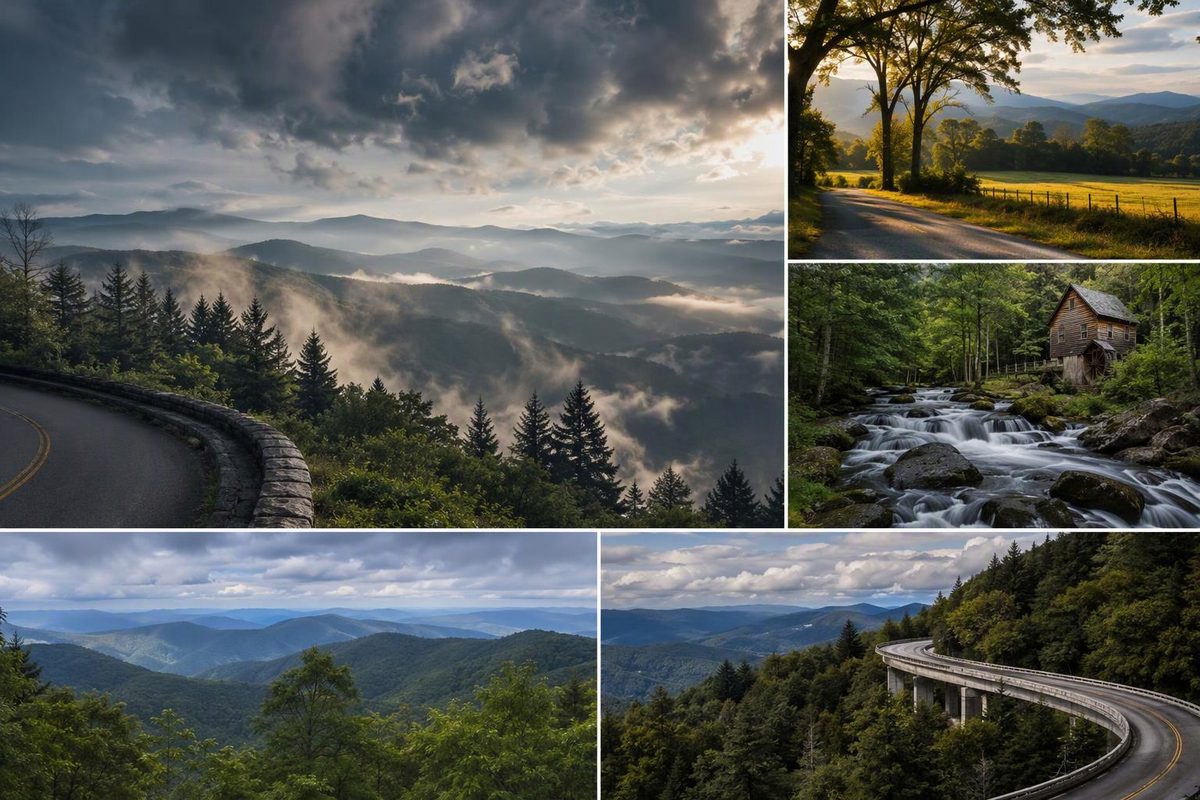
Choose Newfound Gap Road for a first visit with mountain views and a drive through the park. Choose Cades Cove for an unhurried valley tour with historic buildings, Roaring Fork for a shorter forest drive near Gatlinburg, or Foothills Parkway for overlooks away from the park’s busiest sightseeing loops.
The important distinction is between a road’s mileage and the outing it creates. Cades Cove’s 11 miles can take longer than the entire Newfound Gap crossing.
Choose your route
| Drive | Scenic-road distance | Moving-time allowance | Allow with stops |
|---|---|---|---|
| Newfound Gap Road, US 441 | About 31 miles through the park, one way | 1–1½ hours | 2–3 hours one way, without Kuwohi |
| Cades Cove Loop Road | 11 miles, one-way loop | Too traffic-dependent for a useful short ETA | At least 2–4 hours, as NPS recommends |
| Roaring Fork Motor Nature Trail | 5.5 miles, one way | 30–45 minutes | 1–2 hours, without a waterfall hike |
| Foothills Parkway: Wears Valley–Walland | 14.75 miles, one way | 30–45 minutes | 1–2 hours one way |
Except for the NPS Cades Cove recommendation, these are planning allowances for ordinary traffic, not measured journey times. They exclude approach roads, travel from your lodging, meals and major delays. Add the return leg wherever you finish away from your starting point.
Before setting out: check NPS current conditions and the seasonal road schedule. A scheduled operating season does not establish that a road is open today.
Newfound Gap Road: the strongest first-visit choice
Follow US 441 between Gatlinburg, Tennessee, and Cherokee, North Carolina, crossing the park at Newfound Gap. This works particularly well if you are changing bases between the two sides rather than returning to the same hotel.
Make Newfound Gap Overlook your main stop. At 5,046 feet, it offers mountain views without requiring a summit hike. Bring a layer: rain in Gatlinburg or Cherokee can be snow at the gap, and temperatures are considerably cooler than in the lowlands. NPS’s overlook guide lists parking and seasonal restrooms.
The optional Kuwohi detour, formerly called Clingmans Dome, adds seven miles each way from Newfound Gap Road. The observation tower is not beside the parking lot: reaching it requires a steep, one-mile round-trip paved walk. Reserve roughly another 1½–2 hours for the detour and walk, with more time if parking is congested. NPS describes the road access and tower walk. Kuwohi Road is seasonal; its 2026 schedule is April 1–November 29, subject to weather closures.
For a same-base outing, allow roughly 4–6 hours for the US 441 crossing and return with modest stops, before adding Kuwohi or a meal. With less time, visit Newfound Gap and return rather than treating Cherokee as a compulsory endpoint.
Cades Cove: choose it for the valley, not quick mileage
Cades Cove, south of Townsend, is the choice for open fields framed by mountains, historic churches, cabins and the Cable Mill area. The loop is one way, and the park recommends at least two to four hours to tour it. Summer, fall and weekends can bring heavy traffic. Stop in paved pullouts rather than blocking the lane. NPS’s Cades Cove guide explains the loop and visiting conditions.
The 11-mile figure excludes the approach and return. Treat it as a half-day commitment once those legs and a few building stops are included, not as a quick addition after a full park crossing.
The loop operates sunrise to sunset, subject to closures. It is normally vehicle-free all day on Wednesdays during part of the warmer season; the 2026 dates were May 6–September 30. Check the vehicle-free-day schedule for your travel year rather than relying on older advice about morning-only restrictions.
Roaring Fork: a shorter forest outing from Gatlinburg
From Gatlinburg traffic light #8, follow Historic Nature Trail Road toward Cherokee Orchard. Beyond the Rainbow Falls parking areas, take the signed one-way Motor Nature Trail. Expect a narrow, winding road through forest, beside streams and past historic structures. The Place of a Thousand Drips is a roadside waterfall toward the end. NPS provides directions and stop details.
The table’s mileage and timing cover the Motor Nature Trail itself, not the Cherokee Orchard approach or your return to central Gatlinburg. Do not count Rainbow Falls as a brief drive stop: its hike is 5.4 miles round trip. A driving-focused visit should stay with roadside scenery and selected short stops.
October 31, 2026 access note: the Cherokee Orchard Road approach was closed to pedestrians because of bear activity. Motorists must remain in their vehicles between the park boundary and Ogle Homesite; observe the posted restrictions rather than assuming the approach is available for walking. Current NPS closure details explain the affected stretch.
Roaring Fork is steep and seasonal. The 2026 operating schedule runs April 17–November 29. Motorhomes, buses, vans longer than 25 feet, and passenger vehicles towing trailers are prohibited. NPS seasonal road restrictions are the deciding reference before bringing an oversized vehicle.
Foothills Parkway: an overlook-focused alternative
For a shorter Tennessee-side outing, drive the 14.75-mile Wears Valley–Walland section, accessible from US 321 at either end. Its ten waysides and overlooks include views of Little River, Townsend and the Smokies; you do not need a hike to make this drive worthwhile. NPS lists the access points and overlooks.
If you have more time, continue from Walland toward Chilhowee Lake. That section adds 16.6 miles one way, with Look Rock as a useful stopping point. Its lower viewing platform is beside the parking area but requires stairs; the tower requires a paved walk with a steep ramp to the top. NPS’s Chilhowee–Walland guide separates those options.
NPS recommends Foothills Parkway as a less-crowded alternative to the popular loops. It is an alternative for congestion—not a guaranteed escape from hazardous weather or road closures.
Parking, fuel and departure time
- Entry is free; longer parking stops usually are not. As of October 31, 2026, parking for more than 15 minutes generally requires a tag: $5 daily, $15 weekly or $40 annual. Vehicles displaying state-issued disability plates or placards are exempt. An America the Beautiful pass does not cover parking, and a tag does not reserve a space. See NPS parking rules for purchases and exemptions, including designated fee-free days.
- Fuel before entering. There are no gas stations in the park, and cell coverage is extremely limited. Carry food and water, and download an offline map before leaving your gateway town. NPS facilities and navigation advice.
- Start early rather than stacking routes. NPS recommends entering by 8 a.m. during busy periods, earlier for popular trailheads. Pick one principal drive, then add a second only if traffic, daylight and parking cooperate. NPS traffic guidance.
If staying in Pigeon Forge, include the town-to-park approach in your schedule; our Pigeon Forge–Gatlinburg distance guide helps separate that leg from the scenic drive itself.