
Salt River Canyon Scenic Drive: Route, Time and Stops
Plan Arizona’s US 60 canyon drive with realistic Globe–Show Low timing, a shorter return trip, useful stops and November 2026 approach-road closures.
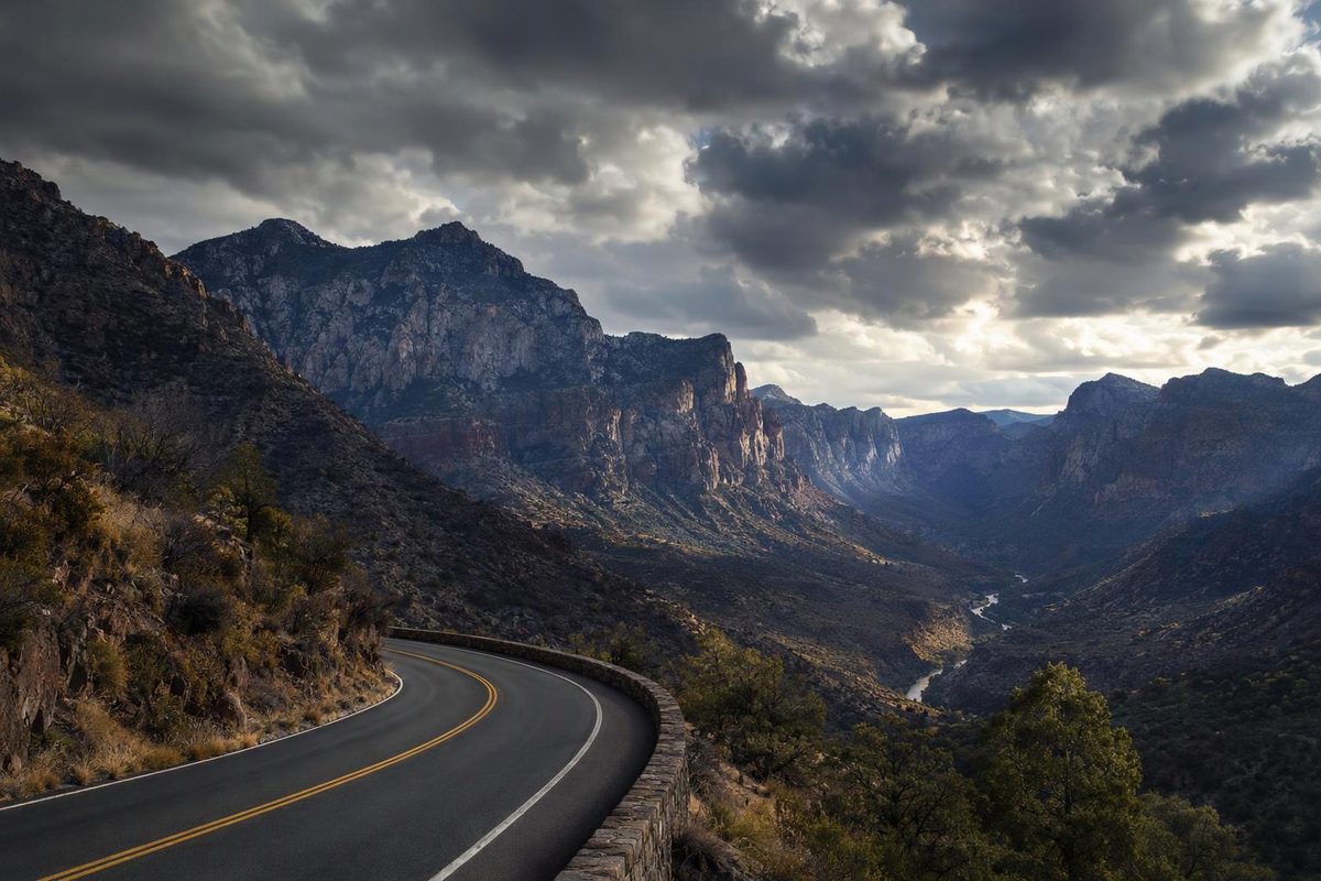
The Salt River Canyon scenic drive follows US 60 between Globe and Show Low, Arizona. Its main attraction is the descent to the Salt River, the bridge crossing at the canyon floor, and the climb up the opposite wall—not a separate park loop. Allow 3–4 hours one way with scenic stops, rather than treating it as a quick highway transfer.
For a shorter outing from Globe, drive to the canyon-floor rest area and return. That gives you the descent and river views without committing to Show Low.
Route and realistic timing
From Globe, follow US 60 northeast toward Show Low. Stay on US 60 for the canyon crossing and onward journey; reverse those directions if starting in Show Low.
| Trip | Approximate distance | Driving allowance, without stops | Total with scenic stops |
|---|---|---|---|
| Globe → Show Low via US 60 | About 90 miles one way | 2–2½ hours | 3–4 hours |
| Globe → Salt River Canyon bridge/rest area → Globe | About 86 miles round trip | 2–2½ hours | 3–4 hours |
Globe and Show Low are roughly 90 highway miles apart; ADOT places the bridge 43 miles north of Globe. Distances vary with your town endpoints. The times above are planning allowances for dry conditions, not measured travel times, and exclude closure delays.
Budget roughly 45–75 minutes across two or three viewpoint stops and a short bridge walk. Add meal time separately. Returning from Show Low to Globe means another complete highway crossing: allow a full day if you want stops in both directions.
This is a paved highway outing suited to an ordinary passenger car in good condition when roads are dry. The challenge is mountain-road driving, not ground clearance. The route descends more than 2,000 feet through sharp curves and steep grades before climbing again; much of it is two lanes, with passing lanes in some steep sections. TravelAwaits’ route account describes those conditions and established canyon pullouts.
Three useful stops
1. Globe: prepare before the canyon
Use Globe for fuel, food and a restroom break before heading northeast. If driving southbound, make those preparations in Show Low instead. Start with enough fuel for your entire planned leg—including the return if you are turning around at the river—rather than making an unfamiliar roadside business essential to the trip.
2. Established canyon overlooks
Choose a roomy, established pullout where you can park entirely clear of traffic. Views from above show the river and the road’s descent more clearly than the canyon-floor stop alone. There are pullouts on both sides of the canyon, including an established paved viewing stop on the north side, described in the route account.
Skip any stop that requires abrupt braking or an uncertain turn across traffic. On the shorter Globe outing, continuing to a north-side viewpoint adds mileage beyond the bridge-return estimate. Turn around only where the layout and signs permit it—not on a canyon bend.
3. Salt River Canyon Rest Area and old bridge
The main canyon-floor stop is between US 60 mileposts 292 and 293. ADOT’s rest-area directory lists it on the banks of the Salt River, on the San Carlos Apache and White Mountain Apache reservations.
Allow 20–30 minutes for river views and, where access is open, the old bridge. The original bridge opened in 1934; a higher-capacity bridge beside it took over traffic in 1996. ADOT describes the older span as available for pedestrian walks. Follow posted access restrictions when you arrive.
Conditions to check before leaving
Check the whole journey on AZ 511, including roadwork, closures, weather and rest-area closures. A canyon itinerary should not depend on every viewpoint or facility being available.
Phoenix approach-road alert, as of November 6, 2026: The Queen Creek and Waterfall Canyon bridge project affects US 60 between Superior and Miami, before you reach Globe. ADOT announces closures from 9 p.m. November 17 to 4 a.m. November 18, and 9 p.m. November 18 to 4 a.m. November 19. Its project page also warns of intermittent restrictions and closures during construction. These are approach-road impacts, not closures at the Salt River bridge. Check the current project notice before fixing your departure time.
For the scenic drive itself, favor daylight and a dry forecast. Spring and fall are sensible starting choices, but the forecast matters more than the month. In summer, avoid entering the canyon during a thunderstorm; in winter, check conditions toward Show Low as well as Globe. ADOT’s winter-driving guidance recommends a full fuel tank, warm clothing, water and a prepared vehicle before travel in snow or freezing conditions.
Before departure, check tires, brakes, coolant and wipers. Follow your owner’s manual for downhill speed control; using an appropriate lower gear on sustained descents helps avoid riding the brakes. Leave room behind slower vehicles and use passing lanes patiently; the driver should save sightseeing for parked stops.
Keep river recreation separate from the roadside itinerary. Before adding a riverbank picnic, hike, fishing or camping on the White Mountain Apache side, check the tribe’s Special Use regulations. Adults need a Special Use permit for outdoor recreation in the designated Salt River canyon corridor, and some areas are closed. A Special Use permit does not include Cibecue Falls access.