
Plan Michigan’s M-22 Scenic Drive Without Rushing the Stops
Plan Michigan’s 117-mile M-22 scenic drive with realistic driving time, worthwhile stops, a shorter Traverse City option and seasonal access checks.
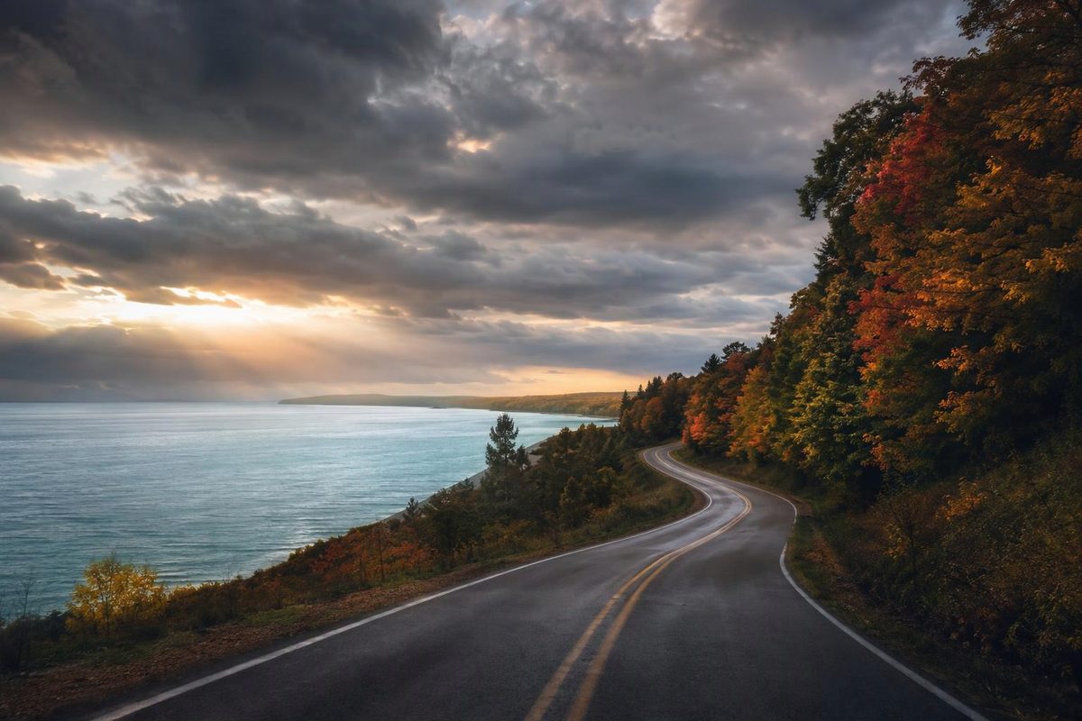
Michigan’s M-22 is best treated as a full-day coastal drive, not a quick connection between Manistee and Traverse City. As a planning allowance, budget 3½–4½ hours behind the wheel and 6–8 hours with a few stops, one way. If you want a substantial Sleeping Bear Dunes visit as well as the towns farther north, split the route over two days.
Route at a glance
- Distance: About 117 miles on M-22 itself, excluding attraction detours and travel to the starting junction.
- Endpoints: US-31 about three miles northeast of Manistee; US-31/M-37/M-72 at Division Street and Grandview Parkway in Traverse City.
- Shape: A U-shaped route around the Leelanau Peninsula—not a closed loop.
- Road: Paved, with numerous hills, curves and town sections. Route details and mileage
- Timing: The allowances above assume reasonable weather and no major delays. Add time for long hikes, beach visits or extra stops, and budget any return journey separately.
- Seasonal update, November 5, 2026: Pierce Stocking Scenic Drive, a separate Sleeping Bear Dunes detour, is closed to vehicles for winter and spring. That closure is not a closure of M-22. NPS current conditions
Follow the coast, not the fastest navigation result
From the southern junction, follow M-22 through Onekama → Arcadia → Elberta and Frankfort → Empire → Glen Arbor → Leland → Northport → Suttons Bay → Traverse City. At Northport, the road turns south along the west arm of Grand Traverse Bay.
M-22 does not deliver uninterrupted open-water views: it also passes inland lakes, woods and agricultural land. A navigation app set only to the endpoint may shortcut the scenic route. Enter the towns as waypoints if you intend to drive the whole highway.
There is also a distinction between the numbered highway and the broader byway itinerary. The M-22 Pure Michigan Byway includes M-109 through the Sleeping Bear Dunes area and the M-204 cross-peninsula connector. Those roads are useful options, but they are not all part of the 117-mile M-22 mileage. Byway route description
Useful driving legs
| Leg, staying on M-22 | Approximate miles | Driving allowance, without stops |
|---|---|---|
| Southern US-31 junction to Frankfort | 20 | 35–45 minutes |
| Frankfort to Empire | 32 | 50–65 minutes |
| Empire to Glen Arbor | 8 | 15–20 minutes |
| Glen Arbor to Northport, through Leland | 30 | 50–65 minutes |
| Northport to Traverse City, through Suttons Bay | 27 | 45–60 minutes |
Distances are rounded from the highway’s junction mileage; times are planning allowances, not measured travel times. The full-route budget rounds up from these legs to leave a little margin. Keep extra time for traffic, parking and detours.
Choose a few stops, rather than stopping everywhere
Arcadia Scenic Turnout: allow 15–30 minutes. Just north of Arcadia, this MDOT turnout has parking and observation decks overlooking Lake Michigan and the village. It is a useful early stop without a long side-road excursion; the byway lists dawn-to-dusk hours. Turnout details
Frankfort or Point Betsie: allow 45–75 minutes for one. Use Frankfort for a town-and-meal break, or detour to Point Betsie Lighthouse. The lighthouse’s published 2026 regular tour season ended October 11, so a November itinerary should not count on interior access. For a future visit, check the operator’s schedule before building the day around a tour. Point Betsie visitor information
Sleeping Bear Dunes: choose your commitment. A quick stop near Empire is different from an afternoon exploring the national lakeshore. M-109 is the byway option through the dunes area; Pierce Stocking is a separate scenic drive, not something you automatically pass through on M-22. Check park conditions before detouring. For its loop, overlooks and timing, use our dedicated Sleeping Bear Dunes scenic-drive guide.
If you stop to recreate in the national lakeshore, budget for a park pass. As checked November 5, 2026, the private-vehicle pass is $25 for seven days, and the park is cashless. An applicable America the Beautiful pass also covers entry. NPS fees and passes
Leland’s Fishtown: allow 45–60 minutes. The fishing shanties, smokehouses, docks and fish tugs along the Leland River make this a distinct waterfront stop rather than another roadside viewpoint. Add more time if you want lunch or shopping, and check individual business hours for an off-season visit. Fishtown Preservation
Those choices can fill a day. If Sleeping Bear is the priority, overnight around Empire or Glen Arbor and save Leland, Northport and Suttons Bay for the next day.
A shorter outing from Traverse City
With only half a day, drive Traverse City → Suttons Bay → Northport and back on M-22. This is roughly 55 miles round-trip; allow about two hours of driving and 3–4 hours overall with town stops. You get the Grand Traverse Bay side without committing to the western coast or a dunes visit. It does repeat the same road on the return, so choose it for a manageable outing rather than full-route coverage.
Season and departure checks
For autumn color, use current reports rather than a fixed “peak weekend.” The byway notes that Manistee County’s inland terrain generally peaks before the coast; NPS reported most Sleeping Bear Dunes areas past peak by November 1, 2026. Byway seasonal notes and NPS update
Before leaving, check M-22 and your approach roads on MDOT Mi Drive for incidents and lane or total closures. Check attraction access separately: an available highway does not mean a lighthouse, scenic loop or museum is open.
Start with enough fuel for the planned mileage and detours rather than relying on a last-minute stop. Carry water, a windproof layer and an offline route map. In snow or freezing weather, shorten the itinerary instead of trying to preserve the fair-weather timing; keep photographs and viewpoint stops inside designated parking areas.