
A Scenic Drive in Sedona: SR 179 or Oak Creek Canyon?
Choose Sedona’s SR 179 or Oak Creek Canyon drive with realistic return times, short-walk stops, parking fees and the 2026–27 West Fork closure.
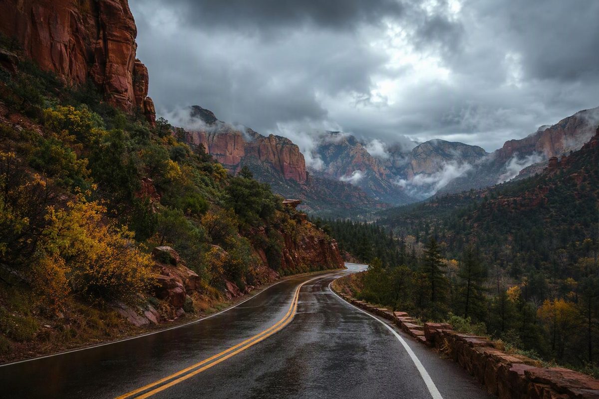
For a first scenic drive in Sedona, choose SR 179 between the Village of Oak Creek and Sedona. It gives you red-rock views and worthwhile stops without committing to the switchbacks above Oak Creek Canyon. Choose SR 89A north to Oak Creek Vista instead if you want a winding canyon drive, forest scenery and a rim overlook.
Both use paved highways; neither requires an off-road vehicle in normal, dry conditions. The main planning mistake is treating the short driving distance as the length of the outing.
Choose your route and time budget
| Drive | Distance reference | Driving allowance, without stops | Outing with stops |
|---|---|---|---|
| SR 179 / Red Rock Scenic Byway | Designated byway: 7.5 miles one way; your starting point affects actual mileage | Allow 25–40 minutes each way | 2–3 hours for an out-and-back with two stops |
| SR 89A / Oak Creek Canyon to Oak Creek Vista | About 13 miles north of Sedona to the vista; starting point affects mileage | Allow 35–50 minutes each way | 2.5–4 hours for a return drive with an overlook and picnic stop |
These are planning allowances, not live traffic estimates. FHWA lists a 20-minute drive for the Red Rock Scenic Byway, before activities. The Forest Service places Oak Creek Vista about 13 miles north of Sedona. Add time for town traffic, parking and any walks. Red Rock route reference · Oak Creek Vista directions
Before choosing either route, check SR 179 and SR 89A on AZ511 for roadwork, closures and weather alerts. A viewpoint’s opening status does not establish that the entire road is clear.
SR 179: the simpler red-rock outing
Start in the Village of Oak Creek and follow SR 179 north toward its junction with SR 89A in Sedona. If you are already staying in Sedona, reverse the route and return along the same highway. Arriving from I-17? Take exit 298 for SR 179; the approach from the interstate adds driving beyond the short scenic section. Forest Service access directions
Keep the stop list short:
- Bell Rock Pathway/Vista or Courthouse Vista: Pick one parking area for views of Bell Rock and Courthouse Butte. Walk a short section of the pathway, then return the same way. You do not need to climb Bell Rock or complete the full trail to make this a useful scenic stop. The Forest Service describes mostly wide, hard surfaces, but also steep hills and rough sections. Bell Rock Pathway details
- Yavapai Vista: Choose this if you want a defined short walk rather than a longer hike. The Forest Service lists the trail as 0.5 mile out-and-back, with vault toilets but no potable water. Budget roughly 30–45 minutes for parking, walking and photographs. Yavapai Vista details
A workable two-hour plan is roughly an hour of return driving, a short Bell Rock stop and the Yavapai walk. Give yourself a third hour if parking is difficult. If a lot is full, skip the stop rather than improvise roadside parking: buying a pass does not reserve a space. Parking guidance
Oak Creek Canyon: allow for switchbacks and the return drive
From Sedona, take SR 89A north through Oak Creek Canyon, continuing up the switchbacks to Oak Creek Vista. Turn around there for a Sedona-based outing rather than automatically adding Flagstaff. The road changes from red-rock canyon scenery to a rim-top view; FHWA identifies the designated canyon scenic road as 14.5 miles, a different measurement from the Forest Service’s Sedona-to-vista directions. Canyon route reference
Make the vista your main stop. It has vault toilets and a view down into the canyon. The Forest Service listed the site as open as of October 30, 2026, with year-round operation subject to closures; Thanksgiving and Christmas are exceptions. Its seasonal information booth is not a guaranteed staffed service. Vista facilities and hours
For a longer break, choose a designated picnic area rather than stopping on a narrow shoulder. Grasshopper Point, about 2.5 miles north of Sedona’s SR 179/SR 89A junction, works as an outbound stop: access is by a right turn while northbound, and there is no left turn into it from southbound SR 89A. The Forest Service lists a $15 daily fee per vehicle for up to five people as of October 30, 2026; ordinary Red Rock and America the Beautiful passes are not accepted. No RVs or trailers are allowed, and the maximum vehicle length is 24 feet. Grasshopper Point access and fees
November 2026–February 2027 planning: Do not build this drive around a West Fork hike. The signed Forest Service order closes West Fork Trail No. 108 within the wilderness and the described drainage area from November 1, 2026, through February 28, 2027, unless rescinded, because of post-Pocket Fire rockfall and flood-debris hazards. This is a West Fork area closure, not an order closing SR 89A. Closure order
Parking, weather and vehicle preparation
At Bell Rock Pathway/Vista, Courthouse Vista and Yavapai Vista, plan on a Red Rock Pass or an accepted America the Beautiful pass. Red Rock passes are listed at $5 daily, $15 weekly and $20 annually as of October 30, 2026. State parks and concessionaire sites have separate rules; this is not one admission pass for every Sedona stop. Covered sites · Pass prices
For summer visits, do the short walks early and carry water even if the day is mostly driving. Monsoon storms can bring flash flooding, high winds and lightning. For winter visits, remember that Oak Creek Vista sits at 6,437 feet: check the rim forecast, not only Sedona’s weather. If snow or ice affects the canyon road, keep the outing on SR 179 only if its conditions are suitable. Forest weather guidance · Vista elevation
Check tires and brakes before the canyon drive, use an appropriate lower gear as needed on the descent rather than riding the brakes, and leave photography to passengers until safely parked. For these short routes in dry conditions, water, suitable walking shoes, a warmer layer for the rim and an offline map are more useful than off-road equipment.