
How to Choose and Combine the Pacific States’ 13 National Parks
There are 13: nine in California, one in Oregon and three in Washington. Match desert, alpine, coastal and volcanic parks to season and access.
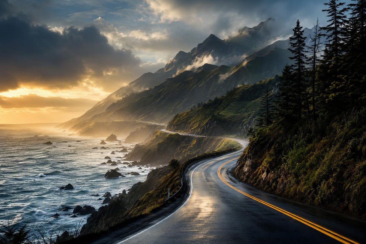
The national parks of California, Oregon, and Washington range from Pacific beaches and temperate rainforest to giant-tree groves, volcanic plateaus, alpine basins, offshore islands, and low desert. That variety is the attraction—and the reason there is no single “best” route through them.
A practical trip starts by narrowing the geography, matching parks to the season, and grouping destinations that do not demand constant long-distance repositioning. The goal is not to collect the highest possible park count. It is to leave enough time to experience the landscapes that justified the drive.
This guide is therefore a regional planning framework, not a source of current operating rules. Entry systems, permits, transportation, roads, campgrounds, and closures can change. Verify those details through the National Park Service, responsible road agencies, reservation systems, and authorized transportation providers for your dates.
What Counts as a U.S. West Coast National Park?
In this guide, the U.S. West Coast means the three contiguous Pacific states: California, Oregon, and Washington. It does not mean every national park in the broader western United States.
That distinction matters because many itineraries marketed as “West Coast” trips include Zion, Bryce Canyon, Grand Canyon, Yellowstone, and Grand Teton. Those parks can anchor excellent western road trips, but they sit outside this article’s three-state scope. Including them turns a Pacific-states itinerary into a much larger Southwest or intermountain West journey.
California, Oregon, and Washington contain 13 national parks: nine in California, one in Oregon, and three in Washington, according to a national-parks inventory organized by state.
California
- Channel Islands National Park
- Death Valley National Park
- Joshua Tree National Park
- Kings Canyon National Park
- Lassen Volcanic National Park
- Pinnacles National Park
- Redwood National Park
- Sequoia National Park
- Yosemite National Park
Oregon
- Crater Lake National Park
Washington
- Mount Rainier National Park
- North Cascades National Park
- Olympic National Park
Several naming and geography details can otherwise make the count confusing:
- Death Valley spans California and Nevada. It belongs in this guide because part of the park lies in California and it is included in California’s park inventory.
- Sequoia and Kings Canyon are separate national parks. They adjoin one another and are routinely managed and planned together, but they still count as two parks.
- Redwood is commonly presented as Redwood National and State Parks. The name reflects a connected federal-state complex, not several separate national parks.
- Only some parks have a direct marine or coastal identity. Olympic, Redwood, and Channel Islands do. The other parks are inland destinations located within West Coast states.
“West Coast” therefore describes the states in scope, not a route that stays beside the ocean. It includes Death Valley’s desert basins, Joshua Tree’s boulder fields, the Sierra Nevada parks, Oregon’s volcanic lake, and Washington’s alpine landscapes.
The 13 Parks at a Glance: Match the Landscape to the Trip
Choose parks by landscape and trip style before drawing a route. A traveler primarily interested in rainforest and beaches needs a different itinerary from someone seeking giant trees, volcanic geology, desert roads, or sustained alpine hiking.
The access column below avoids a single “easy” or “hard” rating. Instead, it identifies the principal planning complication: fixed transportation, separated park districts, seasonal mountain roads, long internal distances, or a dispersed corridor. These descriptions are comparative planning cues, not current operating reports.
| State and park | Coastal or inland setting | Defining landscape | Representative experiences | Broad seasonal constraint | Principal access consideration | Logical regional pairing |
|---|---|---|---|---|---|---|
| Washington — Olympic | Coastal and inland peninsula | Pacific coastline, temperate rainforest, lakes, and glaciated mountains | Hoh area, Hurricane Ridge, Lake Crescent, Rialto Beach, short rainforest walks | Rain affects coastal plans; snow can affect higher areas | Major landscapes occupy different parts of a large peninsula | Mount Rainier and North Cascades; Highway 101 coast |
| Washington — Mount Rainier | Inland | Glaciated volcano, forests, waterfalls, and alpine terrain | Sunrise, Nisqually Vista, Myrtle Falls, Skyline; Wonderland Trail for a much longer undertaking | High-country access is strongly seasonal | Different approach areas require deliberate route planning | Olympic and North Cascades |
| Washington — North Cascades | Inland | Jagged peaks, forested valleys, lakes, and extensive glaciated terrain | Scenic overlooks, lake walks, mountain hiking, backcountry routes | Snow narrows the mountain travel season | Remote terrain and dispersed access matter more than annual visitation | Mount Rainier and Olympic |
| Oregon — Crater Lake | Inland | High-elevation volcanic caldera and lake | Rim viewpoints, lake overlooks, walks, and longer hikes when accessible | Snow can restrict roads and trails beyond winter | Approach and rim travel depend heavily on seasonal conditions | Lassen Volcanic; Redwood as a coastal transition |
| California — Redwood | Coastal | Coastal old-growth forest, rivers, prairie, and beaches | Grove walks, coastal viewpoints, Highway 101 travel | Rain, fog, and storms can shape the visit | Attractions are distributed along a corridor | Oregon coast; Lassen as an inland transition |
| California — Lassen Volcanic | Inland | Volcanic peaks, hydrothermal areas, lakes, meadows, and cinder formations | Hydrothermal walks, lakes, Cinder Cone, Painted Dunes | High-elevation snow can persist into summer | Road and trail access can open in stages | Crater Lake; Redwood |
| California — Yosemite | Inland Sierra Nevada | Granite cliffs, waterfalls, forests, and high country | Yosemite Falls, Cook’s Meadow, Mirror Lake, Mist Trail, Four Mile Trail, Glacier Point corridor | Snow affects high-country roads and trails; other conditions vary by season | Major attractions are spread among valley, grove, overlook, and high-country areas | Sequoia and Kings Canyon |
| California — Sequoia | Inland Sierra Nevada | Giant sequoia groves, granite terrain, forests, and canyons | General Sherman area, Moro Rock, waterfalls, overlooks, longer hikes | Snow and mountain-road conditions can restrict access | Mountain approaches and separated attractions add travel time | Kings Canyon and Yosemite |
| California — Kings Canyon | Inland Sierra Nevada | Giant-tree groves, river canyon, forest, and high Sierra | General Grant area, overlooks, waterfalls, canyon travel, longer hikes | Mountain roads and high-country routes are seasonal | Adjoining Sequoia does not make every district a quick stop | Sequoia and Yosemite |
| California — Pinnacles | Inland Coast Ranges | Volcanic-rock formations, cliffs, and talus caves | Hiking, rock scenery, cave routes when available, possible condor viewing | Heat and area closures can change activity choices | Choose the intended entrance to suit the wider route | Central Coast or broader California itinerary |
| California — Channel Islands | Offshore | Islands, sea cliffs, coves, marine ecosystems, and grassland | Santa Cruz Island hiking, paddling, snorkeling, wildlife viewing, camping | Marine conditions and transport availability can disrupt plans | Boat or plane arrangements replace ordinary drive-in access | Mainland base around Ventura; separate from the driving sequence |
| California — Joshua Tree | Inland desert | Desert vegetation, boulder fields, and rock formations | Hidden Valley, climbing, Keys View, Park Boulevard, short walks | Cooler periods generally suit broad exploration better than peak summer | Heat and distances between stops shape the day | Death Valley; Southern California gateways |
| California — Death Valley | Inland desert spanning California and Nevada | Salt flats, desert basins, mountains, dunes, and badlands | Badwater Basin, Artist’s Drive, Zabriskie Point, Dante’s View | Extreme heat favors cooler-season planning; storms can affect roads | A very large area creates long internal travel stages | Joshua Tree; Sierra only when the selected route is practical |
Washington’s parks illustrate three very different travel commitments. Olympic combines coastline, temperate rainforest, lakes, and mountains. Mount Rainier offers short viewpoint walks and alpine routes as well as the much longer Wonderland Trail. North Cascades emphasizes mountain scenery, remote terrain, and seasonal access. Representative Washington locations and landscapes are described in this three-state West Coast parks overview.
Crater Lake is a high-elevation volcanic-lake destination, not an ordinary roadside lake stop. Snow may still restrict roads and trails after lower elevations have entered summer. A traveler who encountered extensive snow and closures during a June visit provides a useful illustration of why the calendar alone cannot establish access, though one trip does not predict another year’s conditions.
Lassen has a related seasonal issue. Its peaks, hydrothermal areas, meadows, lakes, Cinder Cone, and Painted Dunes make it a natural partner for Crater Lake, but lingering snow can narrow what is practical. One July trip report described unusually deep snow in a wet year; that experience demonstrates uncertainty, not a normal July forecast.
The tree-focused parks should not be treated as interchangeable. Redwood is a coastal old-growth corridor closely connected to Highway 101. Sequoia and Kings Canyon protect giant sequoia groves in Sierra terrain, including the General Sherman and General Grant areas. Yosemite combines some giant-tree areas with granite walls, waterfalls, valley scenery, and extensive high country.
Yosemite also demonstrates why a park name is not a sufficient daily plan. Yosemite Falls, Cook’s Meadow, Mirror Lake, Mist Trail, Four Mile Trail, Glacier Point Road, and high-country areas represent different locations and levels of effort.
Channel Islands differs from every drive-in park on the list. The park encompasses five islands and is reached by boat or plane. Santa Cruz Island is commonly associated with hiking, paddling, snorkeling, wildlife viewing, and camping, but the available transportation determines which island, schedule, and activities are realistic. A third-party Channel Islands planning overview also notes that transportation and camping may fill, although current availability must be checked with authorized providers.
Pinnacles is more compact, but its volcanic formations, talus caves, hiking, and association with California condor recovery do not guarantee that every route will be open or that wildlife will be seen. “Less visited” is not the same as “empty”: annual totals do not reveal whether a particular campground, parking area, cave route, ferry, or trailhead has capacity.
Joshua Tree and Death Valley fit cooler-season planning more naturally than peak-summer park hopping. Joshua Tree’s rock formations, Hidden Valley, Keys View, climbing areas, and Park Boulevard create a drive-and-walk itinerary. Death Valley’s major stops include Badwater Basin, Artist’s Drive, Zabriskie Point, and Dante’s View.
The desert-to-Sierra transition needs special care. The period that offers more manageable desert conditions may not coincide with open high-elevation Sierra crossings. A route that appears direct on a map can therefore require a substantial lower-elevation detour. Do not treat Death Valley as a simple extension of Yosemite without checking the exact roads available for the intended dates.
There is no defensible overall ranking because the parks answer different travel goals. Use narrower labels instead:
- Consider Olympic for rainforest and coast.
- Consider Redwood for coastal old-growth forest.
- Consider Sequoia and Kings Canyon for giant trees and Sierra terrain.
- Consider Yosemite for granite walls, waterfalls, and varied hiking commitments.
- Consider Lassen or Crater Lake for volcanic terrain.
- Consider Mount Rainier or North Cascades for alpine scenery.
- Consider Joshua Tree or Death Valley for a cooler-season desert trip.
- Consider Pinnacles for volcanic-rock and cave-oriented hiking.
- Consider Channel Islands when the offshore journey is part of the experience.
Build the Trip Around Regional Clusters, Not a 13-Park Checklist
Regional clusters reduce backtracking and preserve time for walks, viewpoints, weather delays, and unplanned stops. An all-park route is possible, but it requires substantial mileage, repeated accommodation changes, and several days whose main purpose is repositioning.
A useful route should answer three questions:
- Which parks share a workable season?
- Which parks connect without a disproportionate detour?
- Which parks need more than one day because their attractions occupy separate districts?
Washington cluster: Olympic, Mount Rainier, and North Cascades
Olympic, Mount Rainier, and North Cascades are commonly proposed as a one-week Washington circuit. A commercial planning guide uses this trio as a concentrated Pacific Northwest route and suggests that seven days can support three or four parks in one region, but it presents that timing as a broad heuristic rather than a guarantee in its national-park road-trip guide.
“Concentrated” is relative. Olympic spreads its coast, rainforest, lakes, and mountain areas around a large peninsula. Mount Rainier has distinct approaches, while North Cascades rewards travelers willing to do more than stop at one overlook.
The circuit’s feasibility depends on the gateway city, seasonal roads, desired activities, and tolerance for changing accommodations. A week built around viewpoints and short walks is materially different from a week containing a major hike in each park.
Sierra cluster: Yosemite, Sequoia, and Kings Canyon
Yosemite, Sequoia, and Kings Canyon form the clearest three-park California cluster. Sequoia and Kings Canyon adjoin and are routinely planned together, while Yosemite extends the trip northward through the Sierra Nevada.
Adjacency does not eliminate internal travel. A sound Sierra itinerary gives each day a geographic focus rather than combining famous sites scattered across different districts. If Yosemite is the priority, allocate more time there instead of dividing nights evenly for symmetry.
Northern volcano cluster: Lassen Volcanic and Crater Lake
Lassen and Crater Lake form a logical volcanic pairing. Both are high-elevation destinations where snow can affect roads and trails later than travelers may expect.
Mount Rainier can extend the volcanic theme northward, but it is not a casual nearby addition. It requires another major travel stage through Oregon and Washington. One four-week personal itinerary estimated approximately 600 miles from Yosemite to Crater Lake and 625 miles from Crater Lake to North Cascades; those are route-specific examples, not universal distances, but they illustrate the scale separating major regions in the trip report.
Highway 101 coastal corridor: Olympic, Oregon coast, and Redwood
A coastal itinerary can connect Olympic’s beaches and rainforest with the Oregon coast and Redwood National and State Parks. It offers continuity through marine scenery, forests, headlands, beaches, and coastal communities, but many worthwhile stops along the way are not national parks.
Cape Disappointment and Oswald West are state parks. Cannon Beach is a community, and other beaches and viewpoints may fall under different land managers. Labeling them accurately prevents a coastal road trip from becoming a misleading national-park checklist.
A personal Highway 101 account combined Olympic locations with Oregon coastal stops while also reporting long driving days and pressure on campground availability. That experience is useful for thinking about pacing, but it does not establish current road, parking, or campsite conditions.
Southern California deserts: Joshua Tree and Death Valley
Joshua Tree and Death Valley pair most naturally during cooler periods. They should not be treated as effortless summer additions to a Sierra itinerary merely because all three destinations are in California.
The best desert season often conflicts with the period when high Sierra roads are most accessible. Check the complete connection—not only conditions inside each park—before committing to the pairing. If the desired route requires a closed mountain crossing, the alternative may involve a much longer lower-elevation approach.
Channel Islands as a mainland-based side trip
Treat the mainland departure point as a base, not as a drive-through entrance.
A tightly scheduled “boat in the morning, long drive that evening” plan has little resilience. Island choice, check-in requirements, marine conditions, and the available return determine what can fit into the day. Camping does not remove the transportation problem; the boat or plane and campsite must align.
Pinnacles as a selective add-on
Pinnacles can fit an inland Central Coast or Coast Ranges itinerary, a broader California trip, or a dedicated hiking stop. It is not itself a coastal park, and it does not automatically belong in every Sierra or Highway 101 route.
Select it when the intended entrance, planned activities, and onward direction make sense. Do not add it merely because it appears geographically between larger California destinations.
What a comprehensive loop really requires
A published California–Oregon–Washington itinerary outlines a 3,900-mile, 19-night loop. The same itinerary says roughly three weeks are needed to spend even a day at each highlighted park and suggests four to six weeks for more thorough exploration. Those figures show that a comprehensive route is possible—not that three weeks makes it relaxed—according to the Fodor’s route framework.
The tradeoff is straightforward: the more regions included, the more days become transfer days. An efficient multiweek trip should still identify priority parks and accept that outliers may need to be skipped.
Seven-, Fourteen-, and Twenty-One-Day Planning Frameworks
These are modular planning templates, not fixed turn-by-turn itineraries. Travel time changes with the gateway city, traffic, closures, construction, weather, rest stops, and the exact park district visited. Recalculate the route shortly before departure rather than relying on generic point-to-point estimates.
As a broad planning heuristic, one source suggests three to four days for one or two nearby parks, seven days for three or four parks in a concentrated region, and 10 to 14 days for a major regional loop. Those figures are useful starting points, not promises.
Seven days: choose one region
A one-week trip should normally stay within one cluster.
Option A: Washington sampling circuit
- Olympic: choose a coastal, rainforest, lake, or mountain emphasis
- Mount Rainier: concentrate on one principal approach area
- North Cascades: use a scenic corridor with selected walks
- Preserve at least one period for transfer or weather disruption
This version suits travelers comfortable with frequent moves. For deeper hiking, remove one park and spend longer in the other two.
Option B: Sierra trio
- Yosemite: at least two nights as an editorial starting point
- Sequoia and Kings Canyon: plan as an adjoining pair
- Preserve an arrival, departure, or road-condition buffer
If Yosemite is the primary reason for the trip, give it more time instead of forcing an equal split.
Option C: two parks
Examples include Lassen and Crater Lake, Joshua Tree and Death Valley in suitable conditions, or Redwood with a northern California coastal route. Two parks create more room for separate districts, longer walks, rest, and weather adjustments.
Fourteen days: deepen one region or connect compatible clusters
Two weeks can support a deeper California trip or an ambitious northern route. It should not become an excuse to include every famous park.
California framework
- Start with Joshua Tree and Death Valley only if the season and onward route work.
- Alternatively, begin with Channel Islands or an inland Pinnacles stop.
- Continue to Yosemite, Sequoia, and Kings Canyon.
- Include a non-park day for resupply, laundry, or recovery.
- Remove the desert component if heat or road conditions undermine the route.
Northern volcanic and Pacific Northwest framework
- Lassen Volcanic
- Crater Lake
- Olympic
- Mount Rainier
- North Cascades only if access and pacing remain credible
A personal van trip covered Lassen, Crater Lake, Olympic, and Mount Rainier in 14 days, but its travelers concluded that another four or five days would have improved the itinerary. They also encountered extensive high-elevation snow, making the account a useful illustration of how ambitious schedules lose flexibility when conditions change in a two-week trip report.
Twenty-one days: use a directional framework
Three weeks can support a northbound inland route and a southbound coastal return, but it still does not guarantee meaningful time in all 13 parks.
A possible structure is:
- Begin with selected Southern California parks appropriate to the season.
- Move through Yosemite, Sequoia, and Kings Canyon.
- Continue to Lassen and Crater Lake.
- Choose two or three Washington priorities.
- Return south through Olympic’s coastal side, Oregon coastal stops, and Redwood.
- Add Pinnacles or Channel Islands only if the route and remaining buffers support them.
This structure limits some backtracking, but it remains driving-heavy. Channel Islands is especially easy to underestimate because it requires a fixed mainland departure rather than a flexible highway stop.
As an editorial pacing recommendation, consider two to three nights around priority parks when hiking or visiting multiple districts matters. This is not a universal requirement. It reflects the recurring lesson in trip reports that one-day visits and constant relocation can leave little time beyond transport and orientation.
Every framework should leave room for:
- Arrival and orientation
- Food and fuel resupply
- Laundry on longer journeys
- Weather and closure changes
- Recovery after demanding walks or long drives
- Reorganization before ferries, camping transitions, or remote legs
Avoid making the longest repositioning drive the first day, particularly after a flight or vehicle pickup. One multiweek traveler who generally allocated two or three days per park identified an overly long opening drive to Kings Canyon as a planning mistake in a three-week hiking itinerary.
The most useful decision rule is simple: remove a park before removing every buffer day. That matters most when a route depends on ferries, mountain roads, desert conditions, or a chain of campground reservations.
When to Go: Snow, Desert Heat, Rain, Fire, and Marine Weather
There is no universally best month for all 13 parks. The inventory spans deserts, offshore islands, coastal rainforest, volcanic plateaus, and high alpine terrain. A month that improves access in one region can create serious constraints in another.
Summer: better alpine prospects, not a guarantee
Summer generally provides longer daylight and better prospects for high-elevation access. It does not guarantee that every road, pass, trail, or campground will be available.
First-person accounts illustrate the uncertainty:
- One traveler encountered extensive snow and trail closures at Crater Lake in June.
- Another reported deep snow around Lassen during July in an unusually wet year.
- A separate northern trip found enough snow at Crater Lake to prevent completion of a planned trail.
These are individual experiences, not typical annual predictions. Their value is narrower: a calendar date is not proof of current access.
Higher-elevation routes can be restricted in winter or early season, including Yosemite’s eastern approach, Crater Lake’s northern approach, and the principal highway through the North Cascades area. Those general seasonal limitations are also identified in the published three-state loop cited earlier, but the current status must be checked for the specific date.
Spring and fall: useful but conditional
Shoulder seasons may reduce desert heat or seasonal visitor pressure, but they introduce tradeoffs:
- Lingering or new snow at elevation
- Rain in coastal and rainforest areas
- Shorter daylight
- Reduced services or operating periods
- Early or late storms
- Greater uncertainty around mountain roads
A spring trip may combine comfortable desert conditions with inaccessible high-country routes. An autumn trip may offer cooler hiking temperatures but less daylight and a greater chance of early mountain weather. Build around the dominant regional constraint instead of choosing dates from a generic “best season” chart.
Desert conditions
Joshua Tree and Death Valley generally fit cooler-season itineraries better than peak-summer park hopping. High temperatures can undermine plans built around long outdoor stops or midday walking.
Do not import a warning from another park and treat it as evidence for Joshua Tree or Death Valley. Check forecasts, park alerts, and road reports for the exact location and activity planned.
Wildfire and smoke
Visibility, air quality, road access, accommodation demand, and the practicality of strenuous activity may all shift.
The strongest backup is often a different region rather than another attraction in the same affected corridor. Depending on current conditions, that may mean shifting from inland mountains toward the coast, shortening the route, or postponing strenuous plans. Check both the destination and the roads required to reach it.
Rain and marine weather
Olympic and Redwood should not be rejected automatically because rain is possible; wet weather is part of their coastal setting.
Channel Islands is more sensitive to marine transportation. A ferry or flight is not equivalent to driving through an entrance station.
The pre-departure rule
Before each major travel leg, verify:
- Official park alerts
- Road and pass status
- Trail and area closures
- Fire and smoke conditions
- Local weather
- Coastal or marine conditions
- Transportation operation
- Accommodation status
Repeat the review during the journey. Conditions checked before leaving home may no longer be current when a multi-state route reaches its later parks.
Reservations and Access: Separate Entry From Everything Else
“Do I need a reservation?” is not one question. It is a collection of separate questions that must be answered for each park, activity, and date.
Check independently for:
- General park entry
- Vehicle or timed entry
- Campgrounds
- Lodging
- Shuttles or internal transportation
- Ferries or flights
- Tours
- Activity and trail permits
Do not infer one category from another. A traveler might be able to enter a park without a timed reservation yet still need a campground booking, shuttle ticket, ferry seat, tour reservation, or permit for a particular hike.
Because operational policies change, this guide does not publish a definitive park-by-park reservation status. Check current National Park Service pages and the authorized reservation or transportation provider for the intended dates. Record a “checked on” date beside every operational detail saved in personal notes.
Channel Islands: transportation is the entrance plan
Channel Islands is the clearest example of why entry and access are different. The park is reached by boat or plane, and transportation and camping availability must be coordinated. Third-party planning material identifies no visitor lodging on the islands, but current overnight and transportation arrangements should be confirmed directly with the park and authorized operators.
A day trip may be practical only after answering:
- Which island does the available service reach?
- How much time does the schedule allow ashore?
- Does that time support the intended hike, paddle, snorkel, or wildlife-viewing plan?
- What are the operator’s weather and cancellation procedures?
- Is a mainland night available before or after the trip?
Camping does not solve the transportation question. A campsite and transport booking must work together.
Activity permits are separate from entry
Angels Landing offers the same lesson outside this guide’s 13-park scope: an activity permit does not establish the entry rules for the entire park.
Search for the exact activity, not merely the park name. Backcountry travel, cave routes, tours, climbing, paddling, and popular hikes may operate under separate systems.
Lodging, camping, and transportation
Camping and in-park lodging can require advance booking regardless of entrance rules. A park described as less visited can still have a full campground because annual visitation says little about the number of sites available on a particular night.
Transportation systems must also be checked separately. Zion, although outside this article’s geographic scope, illustrates the broader principle that shuttle logistics may shape a visit independently of general entry arrangements.
Reusable reservation checklist
For every park, record:
- Official alerts: closures, emergency restrictions, construction
- Operating period: facilities, roads, campgrounds, and tours
- Entrance control: pass, vehicle reservation, or timed entry if applicable
- Overnight accommodation: campground or lodging confirmation
- Transportation: ferry, flight, shuttle, or tour
- Activity permit: trail, cave, backcountry, paddling, or another controlled activity
- Road status: approach roads and internal park roads
- Cancellation terms: deadlines, refunds, and weather provisions
- Date checked: when each detail was last verified
An older personal travel account similarly distinguishes admission from lodging, but current terms and prices should be verified through the responsible federal source rather than inferred from a travel blog.
Road-Trip Logistics and a Failure-Resistant Planning Checklist
A resilient route assumes that at least one condition will change. The itinerary should still function if a road opens late, smoke shifts, transportation is canceled, or a campground is unavailable.
This emphasis on realistic driving, seasonal conditions, and practical preparation also reflects Road Listings’ stated editorial approach.
Route sequence
Arrange the trip so each major move advances the overall direction. Avoid adding a park that requires leaving the main route and returning along the same road unless it is a clear priority.
Before finalizing the sequence:
- Map the intended entrance or district, not merely the park name.
- Identify seasonal roads and mountain crossings.
- Separate coastal, inland, and desert alternatives.
- Mark ferries and other fixed-time transportation.
- Decide which park will be removed first if conditions deteriorate.
Treat long repositioning days as travel days. Listing a major drive and a full park program on the same date does not reduce the burden; it only hides it.
Fuel, water, and food
Confirm fuel and resupply opportunities before long rural legs. Do not assume that every visitor center, entrance, or labeled community provides fuel, groceries, or late operating hours.
Carry food and water appropriate to the actual travelers, weather, vehicle, route, and activities. Avoid adopting a universal quantity from a personal itinerary. Refill before entering a remote leg rather than waiting until supplies become urgent.
Navigation
Download maps for offline use and carry a paper map or road atlas as a second system. A national-park planning source recommends paper backups where cellular service may be unreliable, along with advance fuel planning and schedule buffers.
Save more than a destination pin. Keep offline records of:
- Lodging and campground addresses
- Entrance and district names
- Ferry or tour check-in locations
- Reservation numbers
- Emergency and roadside-assistance contacts
- Alternate routes
- Confirmed alternative accommodations
Vehicle preparation
Before a multi-state drive, inspect the vehicle and address known maintenance concerns. Check tires, fluids, lights, the spare or repair system, and required documents. Carry basics appropriate to the route without treating any packing list as a guarantee against breakdowns or hazardous conditions.
Rental travelers should understand the company’s roadside-assistance procedures and restrictions concerning unpaved or remote roads. A vehicle category alone does not establish that every park road is suitable.
Overnight accommodation
Distinguish confirmed campgrounds and booked lodging from anecdotal accounts of sleeping at trailheads, visitor centers, pullouts, or on public land. A traveler’s past experience does not establish current permission.
Use locations whose current overnight rules have been confirmed with the responsible land manager or property operator. If a campground is full, move to a verified alternative, shorten the route, or use another confirmed base rather than relying on an old personal account.
Four contingency scenarios
1. An alpine road remains snowbound
Shorten the high-elevation portion. Concentrate on an accessible district, move to lower-elevation forest or coast, or switch to another regional cluster. Do not preserve every park by replacing meaningful visits with repeated detours.
2. Wildfire smoke affects the next region
Check conditions at both the destination and the approach route. If the wider corridor is affected, switch regions rather than moving to another park under the same smoke pattern. Modify strenuous plans according to current conditions and official guidance.
3. Channel Islands transportation is canceled
Use the day on the mainland. Keep a list of coastal walks, cultural stops, rest activities, or resupply tasks that do not depend on marine transportation. Rebook only if doing so will not eliminate essential buffers later in the trip.
4. A campground is unavailable
Use a confirmed alternative, shorten the route, or move to the next verified base. Do not force the original schedule through unconfirmed overnight parking or an exhausted late-night drive.
Do not use annual visitation as a crowd forecast
Annual visitation totals do not predict conditions at a specific ferry, campground, entrance, parking area, or trailhead. Lassen, Pinnacles, Channel Islands, and North Cascades may receive less total visitation than more famous parks, but constrained access points can still fill.
Plan around the capacity of the resource actually needed: a boat seat, campsite, parking area, tour, or permit. “Less visited” is not a reservation strategy and does not promise solitude.
Final 72-hour check
As an editorial planning practice, complete a final review within 72 hours of each major departure:
- Park alerts and closures
- Weather forecasts
- Air-quality and wildfire information
- Road-agency reports
- Ferry, flight, shuttle, or tour status
- Lodging and campground confirmations
- Permit details
- Fuel and resupply plan
- Offline maps and paper backups
- Vehicle readiness
- The first park or region to remove if the plan fails
A good itinerary does not merely work under ideal conditions. It contains a clear response for when conditions are not ideal.
Frequently Asked Questions
How many national parks are in California, Oregon, and Washington?
There are 13: nine in California, one in Oregon, and three in Washington, as confirmed by the state-by-state inventory cited earlier.
California has Channel Islands, Death Valley, Joshua Tree, Kings Canyon, Lassen Volcanic, Pinnacles, Redwood, Sequoia, and Yosemite. Oregon has Crater Lake. Washington has Mount Rainier, North Cascades, and Olympic.
Death Valley also extends into Nevada. Sequoia and Kings Canyon remain separate parks even though they adjoin and are commonly planned together.
Can I visit all 13 West Coast national parks in three weeks?
The published 3,900-mile, 19-night framework cited above provides roughly a day at each highlighted park and suggests four to six weeks for more thorough exploration.
For a stronger three-week trip, select two or three priority clusters and treat the remaining parks as optional. Remove outliers before eliminating all weather and recovery buffers.
Which West Coast national parks combine well for a one-week trip?
The most logical one-week combinations are:
- Olympic, Mount Rainier, and North Cascades for a Washington sampling circuit
- Yosemite, Sequoia, and Kings Canyon for a Sierra itinerary
- Lassen Volcanic and Crater Lake for volcanic landscapes and longer stays
- Joshua Tree and Death Valley during a suitable cooler period
- Redwood with a northern California or southern Oregon coastal route
Three parks in seven days should be treated as a sampling trip. For longer hikes or multiple districts, choose two.
Can Channel Islands National Park be visited as a day trip?
A day trip may be possible when transportation schedules, marine conditions, island choice, and the intended activity align. Santa Cruz Island is commonly considered for hiking, paddling, snorkeling, wildlife viewing, or camping, but the available schedule determines how much can realistically be done.
Reserve transportation separately, confirm check-in and return details, and retain a mainland alternative in case service is disrupted. Avoid placing an inflexible long-distance drive immediately after the planned return.
Is a national-parks annual pass enough for the whole road trip?
No. A pass may cover qualifying entrance charges, but it should not be assumed to cover camping, lodging, ferries, flights, tours, shuttles, or special activity permits.
Build the budget and reservation plan by category. Verify current pass terms and each park’s separate transportation, accommodation, and permit requirements through the responsible official sources.
Conclusion
Choose one regional cluster first, then identify the two or three parks that matter most within it. Match those priorities to the season, verify the roads and access systems involved, and leave enough flexibility for weather, fire, closures, and transportation changes.
The strongest West Coast national-park trip is not the one with the highest park count. It is the one whose season, access requirements, and driving days leave meaningful time in the landscapes you came to experience.