
Choose a Pacific Coast Drive That Fits the Time You Actually Have
Allow 5-7 days for a selective San Francisco, Los Angeles route, 10 sightseeing days for Portland, Big Sur, at least 14 for a selective Seattle, Los Angeles route.
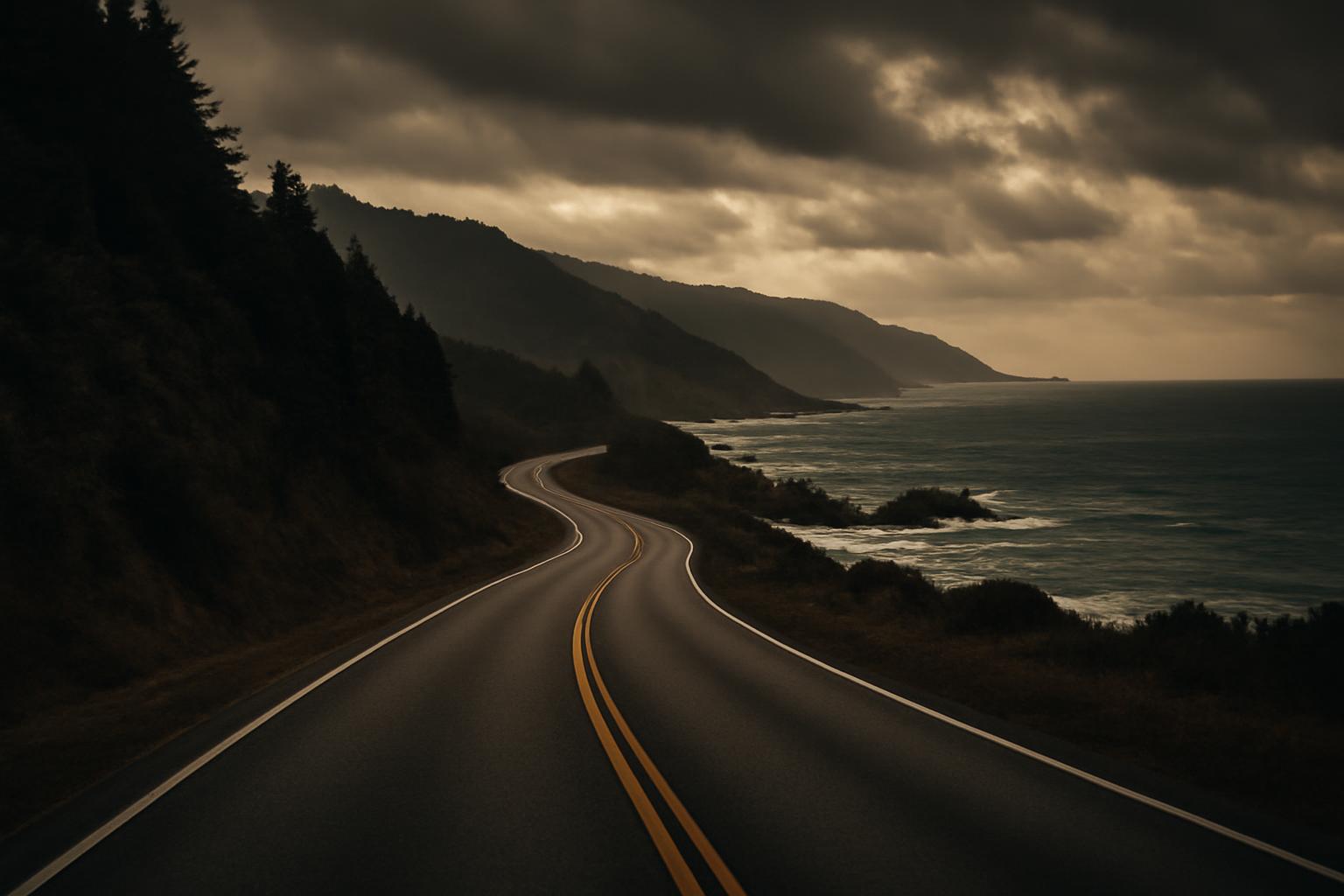
A West Coast road trip can mean a focused drive from San Francisco to Los Angeles, a forest-and-coast journey from Oregon into California, or a multi-state route from Seattle to Southern California. Those are fundamentally different trips. Trying to fit the longest version into the shortest schedule usually produces long driving days, frequent hotel changes, and little time at the places that justified taking the coastal road.
The practical approach is to choose endpoints first, protect time for the regions that matter most, and then remove optional detours. US 101 and California Highway 1 can form the backbone of the journey, but neither follows the ocean continuously. Navigation estimates also represent wheel-turning time—not a complete sightseeing day with viewpoints, meals, traffic, walks, roadwork, and changing access.
The itineraries below are editorially synthesized planning frameworks, not rankings, live route reports, or guarantees. Adjust them for current conditions, your activity level, vehicle restrictions, confirmed accommodations, and tolerance for changing hotels.
Choose your route by time, not by the length of the coastline
Start by deciding how much usable trip time you have. Count full travel days carefully: an evening arrival and an early departure do not create two complete sightseeing days.
| Trip length | Endpoints | Regions covered | Likely overnight pattern | Principal scenic anchors | Main compromise |
|---|---|---|---|---|---|
| 5 days | San Francisco to Los Angeles | Monterey Bay, Big Sur, Central Coast, Santa Barbara | A different base most nights: Monterey or Carmel, Big Sur area, Morro Bay or San Luis Obispo, Santa Barbara | Monterey or Carmel, Big Sur, San Simeon area, Santa Barbara | Selective rather than comprehensive; limited city time, hiking, and optional detours |
| 7 days | San Francisco to Los Angeles | The same California corridor at a slower pace | An extra night around Monterey or Carmel, Big Sur, San Simeon, or Santa Barbara | Monterey Bay, Big Sur, San Simeon, Morro Bay, Santa Barbara | Still requires choosing between lengthy urban visits and numerous coastal stops |
| 10 days | Portland to Monterey or Big Sur | Oregon Coast, Northern California redwoods, Mendocino coast, San Francisco, Monterey Bay, Big Sur | Mostly one-night coastal bases, with a possible second San Francisco night | Cannon Beach, Oregon Coast, redwoods, Mendocino, San Francisco, Big Sur | Little room for Seattle, Los Angeles, or major inland excursions |
| 14 days | Seattle to Los Angeles | Olympic Peninsula, Oregon Coast, redwood country, Northern and Central California | Frequent one-night stops with selected two-night bases | Olympic Peninsula, Oregon Coast, redwoods, San Francisco, Monterey or Carmel, Big Sur, Santa Barbara | Few inland detours, limited hiking, and only one or two substantial city stays |
| 21 days | Seattle to Southern California | Washington, Oregon, Northern California, Central Coast, Los Angeles region; San Diego optional | A mix of transition nights and multi-night regional bases | Olympic Peninsula, Oregon Coast, redwoods, San Francisco, Big Sur, Santa Barbara, Southern California | Greater accommodation and rental demands; inland parks still require trade-offs |
The five- and seven-day California options reflect published coastal itineraries that allow several days rather than treating the route as a quick transfer. One California route account recommends allowing approximately five to seven days for the scenic journey between San Francisco and Los Angeles (Travel Nation).
A five-day San Francisco-to-Los-Angeles trip works when treated as a selective drive. It is not enough time to explore both cities extensively, hike throughout Big Sur, tour every major attraction, and stop in every Central Coast community. The route works because its endpoints and geographic scope are restrained.
With seven days, the same corridor becomes less compressed. You can add a dedicated Big Sur day, spend longer in Monterey or Carmel, and make a deliberate choice among Hearst Castle, the San Simeon area, Morro Bay, and San Luis Obispo. The additional time is most useful when it reduces rushing rather than simply adding more stops.
For 10 days, Portland to Monterey or Big Sur is a more coherent framework than trying to include both Seattle and Los Angeles. A documented 10-day journey follows that general sequence through Astoria, the Oregon Coast, Brookings, the redwoods, Point Arena, San Francisco, Monterey, and Big Sur (Meet Me Off Grid).
A 14-day Seattle-to-Los-Angeles drive is possible only as a selective coastal trip. Keep inland detours to a minimum, choose a few hikes rather than collecting trails, and limit multi-night city stays. Adding Mount Rainier, Mount Hood, Napa, Yosemite, Paso Robles, Palm Springs, or Joshua Tree changes the route from a coast-focused trip into a broader Western itinerary.
At roughly 21 days, the same backbone can support more multi-night stays. Additional nights can go to the Olympic Peninsula, Oregon Coast, redwood country, San Francisco, Monterey or Big Sur, and Southern California. A long-route travel account similarly recommends using multi-night bases and splitting the coast when the full sequence exceeds the traveler’s time or budget (Hello HENRYs).
For most travelers with fewer than two weeks, a regional segment will be more usable:
- California introduction: San Francisco to Los Angeles
- Forests and rugged coast: Portland to Monterey or Big Sur
- Pacific Northwest: Seattle, Olympic Peninsula, and the Oregon Coast
- Redwood-focused trip: Brookings to San Francisco, with extra time around Crescent City and Humboldt County
These options are not objectively ranked. The right route depends on whether you value cities, beaches, forests, hiking, food, photography, or the driving experience itself.
How the coastal roads connect—and why direction matters
“Pacific Coast Highway” is a useful travel label, but it can disguise how the actual roads connect. There is no single road number that stays beside the Pacific from Washington through Southern California.
US 101 supplies the principal corridor around much of the Olympic Peninsula, along the Oregon Coast, and through Northern California redwood country. California Highway 1, also written as CA-1 or State Route 1, supplies prominent California coastal sections, including parts of the Mendocino coast and Big Sur. Both roads move inland in places.
A simplified north-to-south sequence looks like this:
- Seattle to the Olympic Peninsula: Reach the peninsula either by an appropriate vehicle-ferry connection or by an all-road route, then use US 101 around much of the peninsula. A ferry-dependent plan must be checked against current operations, reservations, and vehicle rules.
- Olympic Peninsula to the Oregon Coast: Continue south on the US 101 corridor toward Astoria and the Oregon Coast.
- Oregon to Northern California: Follow US 101 through southern Oregon, Crescent City, and the redwood region.
- Northern California coastal choice: Stay on US 101 for the faster principal corridor or use selected connectors to reach Highway 1 through Mendocino and other coastal areas.
- Mendocino to San Francisco: Continue through the coastal corridor and its connectors, recognizing that the chosen alignment can materially change the day.
- San Francisco to Monterey Bay: Select the route according to desired coastal stops, traffic, and current access.
- Big Sur: Use Highway 1 when the intended segment is accessible.
- Central Coast to Southern California: Continue on Highway 1 where practical, reconnecting with faster inland corridors when access, time, or the endpoint requires it.
Travelers discussing the broader route likewise distinguish US 101 through the Olympic Peninsula, Oregon, and Northern California from CA-1 through coastal California and Big Sur (Rick Steves Travel Forum).
Many travelers prefer driving southbound. The Pacific is generally on the passenger side, the coastal scenery may remain more directly in view, and some ocean-side pullouts may be simpler to enter without crossing opposing traffic. Dylan Jones, writing from two personal drives of the California corridor, preferred north-to-south travel for those sight lines and southbound viewpoints (Shoot from the Trip).
That preference should not override the rest of the trip. Northbound may be more practical because of:
- Airfare for your dates
- Rental availability and permitted return locations
- The specific one-way quote and contract
- Confirmed lodging
- Weather or access affecting one end of the route
- A preferred arrival or departure city
- Commitments before or after the drive
For a long itinerary, an open-jaw flight—arriving in one city and departing from another—combined with a one-way rental can reduce backtracking. The amount saved depends on the endpoints, available flights, and permitted vehicle returns. Check the exact quote and rental agreement rather than assuming that every vehicle can be returned at every airport.
Five- and seven-day California coast routes
The San Francisco-to-Los-Angeles corridor is a practical introduction to West Coast road trip routes when vacation time is limited. The key is to treat Monterey or Carmel and Big Sur as structural route breaks, not incidental roadside stops.
The sequences below are suggested frameworks based on the five-to-seven-day planning range documented for the corridor. They are not predictions of current access or guaranteed daily timing.
Representative five-day sequence
| Day | Route | Planning focus |
|---|---|---|
| 1 | San Francisco to Monterey or Carmel | Explore one Monterey Bay base rather than collecting every nearby town |
| 2 | Monterey or Carmel to the Big Sur area | Scenic overlooks, one or two short walks, and an overnight convenient to the accessible route |
| 3 | Big Sur area to San Luis Obispo or Morro Bay | Ragged Point and a choice among San Simeon-area stops |
| 4 | Central Coast to Santa Barbara | Use the morning for the selected Central Coast base, then continue south |
| 5 | Santa Barbara to Los Angeles | Santa Barbara time followed by a selective Malibu or Los Angeles-area finish |
This is a selective itinerary. If San Francisco and Los Angeles sightseeing must fit inside the same five days, the coast receives less time. A long hike, a Hearst Castle visit, and substantial stops around Monterey, Big Sur, San Simeon, Morro Bay, and San Luis Obispo cannot all receive equal attention in one compressed trip.
The principal stop menu includes:
- Monterey or Carmel: Core route break
- Big Sur: Core scenic segment
- Ragged Point: Useful transition stop when accessible
- Elephant-seal viewing area near San Simeon: Optional wildlife stop; sightings and activity vary
- Hearst Castle: Appropriate when history and architecture match your interests, but it requires dedicated time and current reservation checks
- Morro Bay or San Luis Obispo: Choose according to whether you prefer a coastal or inland-town base
- Santa Barbara: Core southern break for most five- or seven-day versions
- Malibu: Optional final coastal stop
- Los Angeles: Endpoint rather than a single attraction
Do not build the itinerary around guaranteed wildlife. Elephant seals, whales, monarch butterflies, and other natural phenomena vary with season, conditions, and chance.
Representative seven-day sequence
| Day | Route or base | Planning focus |
|---|---|---|
| 1 | San Francisco to Monterey | Waterfront, town time, or one nearby coastal stop |
| 2 | Monterey and Carmel | Choose a focused activity, then stay locally or reposition toward Big Sur |
| 3 | Big Sur | Dedicated scenic day with viewpoints and short walks |
| 4 | Big Sur to the San Simeon or Cambria area | Ragged Point and a limited number of coastal stops |
| 5 | San Simeon area to Morro Bay or San Luis Obispo | Hearst Castle if reserved, or a slower coast-and-town day |
| 6 | Central Coast to Santa Barbara | Allow a meaningful Santa Barbara afternoon or evening |
| 7 | Santa Barbara to Los Angeles | Malibu or one Los Angeles beach area if time permits |
A California coast guide recommends seven days while acknowledging that a shorter trip can still cover many sights, illustrating how duration depends on priorities rather than establishing one mandatory schedule (California Through My Lens).
The extra two days do not need to produce more stops. Their main value is reducing compression. They can support:
- A second Monterey or Carmel night
- A full Big Sur day
- Time around San Simeon or Hearst Castle
- A relaxed Morro Bay stop
- A less hurried Santa Barbara visit
- Spare capacity when traffic or access changes
Keep the distinction between core anchors and optional additions clear.
Core route anchors
- Monterey or Carmel
- Big Sur
- One Central Coast base
- Santa Barbara
Optional additions
- Silicon Valley
- Multiple Monterey Bay attractions
- Paso Robles
- Lengthy urban attraction lists
- Several Los Angeles beach communities
- Multiple major hikes
- Both Morro Bay and San Luis Obispo as substantial stops
Published estimates illustrate why the scenic route should not be treated as a simple transfer. One account estimates approximately 5.5 hours nonstop by Interstate 5 versus roughly 14 hours of pure driving for its scenic coastal alignment; those figures exclude sightseeing, meals, traffic, construction, weather, and closures (Travel Nation).
When Highway 1 is accessible, give Big Sur more than a hurried pass-through if short walks and several overlooks are priorities. A mapped leg can consume most of a sightseeing day once repeated stops are included. If the schedule cannot absorb that, reduce the number of stops rather than racing between them.
A 10-day Oregon Coast, redwoods, and Big Sur route
For 10 sightseeing days, Portland is a practical northern gateway and Monterey or Big Sur is a sensible southern focus. Adding Seattle at the start and Los Angeles at the end would turn this framework into a succession of longer transfers.
The version below assumes that Day 10 ends back in the Monterey area after Big Sur and that departure occurs on Day 11. If the entire trip, including the flight home, must fit within 10 calendar days, move Big Sur to Day 9 and reserve Day 10 for the airport transfer.
| Day | Route or overnight base | Main choices |
|---|---|---|
| 1 | Portland to Astoria and the northern Oregon Coast | Astoria, Cannon Beach, then Rockaway Beach or another northern-coast base |
| 2 | Northern Oregon Coast | Beaches, headlands, and a limited number of viewpoints |
| 3 | Northern coast to Florence or the central Oregon Coast | Choose only the stops that fit your interests |
| 4 | Central coast to Brookings | Southern Oregon Coast, with hikes optional |
| 5 | Brookings to Crescent City or Eureka | Redwood parks and short forest walks |
| 6 | Eureka area through Avenue of the Giants to Mendocino or Point Arena | Redwoods followed by a demanding coastal transition |
| 7 | Mendocino or Point Arena to San Francisco | Point Reyes optional; avoid overloading the arrival day |
| 8 | San Francisco | Full or partial city day |
| 9 | San Francisco to Monterey or Carmel via Santa Cruz | Selective coastal stops |
| 10 | Big Sur out-and-back from the Monterey area | Scenic day followed by a Monterey-area overnight; no same-day flight assumed |
The principal stop pool includes Cannon Beach, selected central Oregon viewpoints, Brookings, Northern California redwood parks, Avenue of the Giants, Mendocino, Point Reyes, San Francisco, Monterey, and Big Sur. “Stop pool” is intentional: trying to visit every named place in depth defeats the purpose of narrowing the trip.
Keep hikes and viewpoints optional until conditions are clear. Weather, traffic, wildfire effects, park restrictions, and road-access changes can consume time. The Meet Me Off Grid account on which this overnight pattern is based reported that wildfire closures disrupted planned visits around Point Reyes and Big Sur.
The Avenue of the Giants-to-Fort Bragg transition deserves particular care. That same firsthand account described the road as extremely winding. This is an individual traveler’s assessment, not an official road classification or universal difficulty rating, but it is a useful prompt for drivers concerned about motion sickness, fatigue, or a long day behind the wheel.
Do not repeat informal trail directions as authoritative. Use current park information, signed routes, posted closures, and on-site instructions. If a trailhead road, parking area, or access route is unsuitable for your vehicle, choose another stop.
Airport planning creates a concrete trade-off:
- San Jose-area departure: Requires a northbound transfer from Monterey and must be planned as a separate travel leg.
- San Francisco departure: Provides another possible flight endpoint but involves more northbound backtracking.
- Return to Portland: Undermines the one-way structure and adds a major retracing leg.
- Continue to Los Angeles: Adds another substantial coastal segment and belongs in a longer itinerary.
The documented trip returned from Monterey to San Francisco International Airport while suggesting that travelers also investigate Monterey or San Jose airports. Treat those as options to compare, not endorsements or assurances of current flights and rental returns.
One-way rentals can reduce backtracking, but availability, return locations, and contractual terms vary. Check the exact vehicle class, airport, dates, and agreement before committing to nonrefundable lodging.
Fourteen- and 21-day routes for the broader coast
A 14-day route can connect Seattle and Los Angeles, but it requires restraint. The framework below assigns nearly every day to a distinct regional movement or anchor.
For the Seattle-to-Olympic Peninsula leg, choose either a ferry-dependent route or an all-road route before booking the next overnight. The ferry version requires a separate check of current operations and vehicle arrangements; it should not be treated as interchangeable with the all-road option.
| Day | Route or base |
|---|---|
| 1 | Seattle |
| 2 | Seattle to the Olympic Peninsula |
| 3 | Second Olympic Peninsula day |
| 4 | Olympic Peninsula to Astoria or Cannon Beach via the US 101 corridor |
| 5 | Central Oregon Coast |
| 6 | Southern Oregon Coast |
| 7 | Northern California redwoods |
| 8 | Mendocino or Point Arena |
| 9 | Mendocino coast to San Francisco |
| 10 | Second San Francisco day |
| 11 | Monterey or Carmel |
| 12 | Big Sur and the Central Coast |
| 13 | Santa Barbara |
| 14 | Los Angeles |
This is an editorially suggested framework, not a claim that every traveler can complete the route comfortably under all conditions. Forum contributors disagree about whether similarly long coastal itineraries are satisfying in approximately 16 to 18 days, with some finding them workable and others considering them too driving-intensive (Rick Steves Travel Forum).
The 14-day version is possible because it omits much more than it includes. Most inland detours have to go. Choose only a few meaningful hikes, avoid several extended city stays, and accept that some destinations will be scenic transitions rather than full explorations.
The easiest detours to remove are:
- Mount Hood
- Columbia River Gorge, if the trip is strictly coastal
- Napa and other wine-country loops
- Paso Robles
- Palm Springs
- Joshua Tree
- Yosemite and other inland national parks
- Multiple Southern California beach communities
Seattle and Los Angeles also need to function mainly as endpoints. If either city requires three or four complete sightseeing days, shorten the coastal segment or add time.
For a 21-day version, retain the same backbone and add nights where activity density is greatest:
- Olympic Peninsula: One additional night for a forest, mountain, lake, or beach focus
- Oregon Coast: One additional central- or southern-coast night
- Redwood country: One additional night between Brookings, Crescent City, and the Avenue of the Giants area
- San Francisco: One additional city or rest day
- Monterey or Big Sur: One additional night so Big Sur is not merely a transit road
- Southern California: Two or more nights for Los Angeles-area beaches or city attractions
San Diego can be added to the longer itinerary, but it is not automatic. It requires another southbound leg and deserves meaningful time after arrival. If the route already includes substantial Seattle, San Francisco, and Los Angeles stays, ending in Los Angeles may be more balanced.
Ask yourself:
- Do you enjoy changing hotels almost every night?
- Are four or five driving days in succession energizing or tiring?
- Do you want several hikes or mostly overlooks?
- Are Seattle, San Francisco, and Los Angeles brief stops or major destinations?
- Will you be disappointed if weather removes a planned viewpoint?
- Does the trip structure support a one-way rental and numerous lodging bookings?
If the answers point toward slower travel, split the coast into multiple trips. A California journey followed by a later Pacific Northwest-to-redwoods route can provide more usable time than one ambitious drive dominated by packing and checkout deadlines.
Prioritize the stops that define each region
An overfilled itinerary becomes easier to edit when destinations are organized by region and labeled by function.
Use three labels:
- Essential to the selected route: Defines the route or creates a practical overnight break.
- Worthwhile if interests align: Deserves time for a particular interest, such as hiking, architecture, food, or wildlife.
- Optional when time is tight: Can be removed without breaking the route.
Repeated inclusion in travel guides shows popularity, not objective proof that one destination is superior.
Washington
- Essential to a nature-focused broader-coast route: Olympic Peninsula
- Worthwhile if interests align: Additional Seattle days
- Optional when time is tight: Mount Rainier, North Cascades, and the San Juan Islands
The Olympic Peninsula is not a single roadside attraction. Forest, beach, lake, and mountain areas can pull the itinerary in different directions, so a nature-focused visit benefits from more than one day. Mount Rainier, North Cascades, and the San Juan Islands should be treated as separate itinerary choices rather than quick additions.
Oregon
- Essential to a coast route: A sequence of coastal communities, beaches, headlands, and viewpoints along US 101
- Worthwhile if interests align: Extra time around Cannon Beach or the southern coast
- Optional when time is tight: Columbia River Gorge and Mount Hood
Oregon works as a sequence rather than one headline destination. Select a northern, central, and southern coastal experience instead of stopping at every beach. Independent travel coverage frequently highlights both Cannon Beach and the southern Oregon Coast as distinct route anchors (Mike’s Road Trip).
Northern California
- Essential to a redwood-focused route: Crescent City area, redwood parks, and Avenue of the Giants
- Worthwhile if interests align: Mendocino and Point Reyes
- Optional when time is tight: A lengthy wine-country detour
Think of Crescent City, the redwood parks, Avenue of the Giants, Mendocino, and Point Reyes as a forest-and-coast segment. Redwood-focused travelers can add time between Brookings, Crescent City, and Humboldt County rather than dispersing those hours across unrelated inland detours.
Central California
- Essential to the selected coastal route: Monterey or Carmel, Big Sur, and one practical Central Coast base
- Worthwhile if interests align: San Simeon and Hearst Castle
- Optional when time is tight: Visiting every community between Morro Bay, San Luis Obispo, and Santa Barbara
Monterey, Carmel, Big Sur, San Simeon, Morro Bay or San Luis Obispo, and Santa Barbara form the central sequence. You do not need an extensive visit at every stop. Monterey and Carmel can function as one regional base; Morro Bay and San Luis Obispo can be treated as alternatives unless you have extra time.
Interest-based cuts are more useful than a generic must-see list:
- City-focused travelers: Reduce hiking stops and keep more time for Seattle, San Francisco, or Los Angeles.
- Hikers: Shorten urban stays and add nights near the Olympic Peninsula, redwoods, or Big Sur.
- Beach-focused travelers: Remove wine-country and desert detours.
- Redwood-focused travelers: Add nights between Brookings and Humboldt County.
- Food-and-wine travelers: Keep Napa or Paso Robles, but remove another region rather than treating the detour as free.
- Travelers who dislike frequent hotel changes: Establish two- or three-night bases and accept a shorter overall coastline.
The goal is not to maximize the number of famous names. It is to preserve enough time for the places that define your version of the trip.
Build realistic driving days and choose the right trip style
Navigation time and sightseeing-day duration are different measurements. A route planner may estimate the time the vehicle is moving under assumed conditions. It does not reserve time for:
- Slow or winding two-lane sections
- Congestion through towns
- Viewpoint queues or limited parking
- Fuel and meal stops
- Roadwork
- Short walks
- Weather delays
- Repacking and checking out
- Finding the correct entrance or trailhead
For scenic days, approximately four to five scheduled driving hours can serve as a planning ceiling rather than a safety rule or guarantee. The Hello HENRYs travel account uses roughly that range as a preference and places multi-night stays between longer travel days.
If the map already shows a long drive, adding several hikes and town visits may be unrealistic.
Alternate driving-heavy days with multi-night stays where possible. Useful candidates include:
- Olympic Peninsula
- Redwood country
- San Francisco
- Monterey or Carmel
- Big Sur or the Central Coast
- Santa Barbara
- Los Angeles or San Diego
Car and hotels
A smaller conventional car may be easier to place in some urban parking facilities and constrained parking areas than a larger recreational vehicle, although suitability depends on the specific vehicle and location. Hotels provide a defined sleeping arrangement and remove the need to locate an authorized overnight site, but each reservation creates an arrival deadline.
This style may suit travelers who prioritize:
- Cities and restaurants
- Predictable sleeping arrangements
- Less campsite planning
- Shorter setup and departure routines
- A smaller vehicle footprint
Campervan or RV
A campervan or RV combines transport and accommodation but introduces another planning layer. Check each location individually for:
- Campground availability
- Overnight-parking authorization
- Vehicle-length limits
- Road width and turning space
- Trailhead access
- Height restrictions
- Urban parking
- Water, waste, and power needs
- Rental-company geographic restrictions
Do not assume that an RV or campervan can park or sleep anywhere. Authorization and vehicle suitability depend on the municipality, park, campground, land manager, and individual parking area.
A personal West Coast route account described the road to one redwood-area trailhead as unsuitable for an RV, illustrating why vehicle-specific access should be verified rather than inferred from a general map (Ready, Set, PTO). Treat that as a prompt to investigate current access, not as a permanent status report.
Before departure:
- Confirm that the vehicle is in suitable condition.
- Save offline navigation for remote segments.
- Carry water appropriate to the route and conditions.
- Pack basic emergency supplies.
- Confirm hotels, campgrounds, and permitted arrival times.
- Save roadside-assistance details offline.
- Carry the documents required by your rental agreement and applicable authorities.
- Make sure luggage does not obstruct visibility or vehicle controls.
- Recheck vehicle restrictions for campgrounds, parking areas, and trailheads.
For a longer preparation checklist, see Road Listings’ guide to tires and gear for a long drive. Use any general checklist as a starting point and follow the vehicle manufacturer’s instructions and current local requirements.
Plan for closures, weather, and changing access
Every West Coast itinerary is conditional. Landslides, storms, wildfire effects, construction, ferry disruptions, and park restrictions can alter access before or during the trip.
Big Sur is the clearest example. Travel sources document past landslide-related disruption and subsequent time-sensitive reopening reports, but an old article cannot establish conditions for a later driving date.
Editorial road-status note — July 30, 2026: This article does not claim that Highway 1 through Big Sur, or any individual park road or trail, is currently open. Live status must be verified through the responsible public agency immediately before travel.
Immediately before departure—and again before entering a vulnerable segment:
- Find the responsible state transportation agency’s current road-status service.
- Identify the exact closure endpoints.
- Determine whether through travel is blocked or whether partial access remains possible.
- Use the agency-published detour rather than an unofficial shortcut.
- Recalculate fuel, accommodation, and arrival timing.
- Check the responsible park or land manager separately for attraction and trail access.
- Revise the route rather than attempting to bypass barricades or signed restrictions.
A generic statement that “Highway 1 is closed” may be too broad for planning. A disruption can block through travel while leaving some communities reachable from one direction. Conversely, a general statement that the highway is open does not establish access to every park, trail, viewpoint, or parking area.
An inland detour may require substantial backtracking. It can also remove Ragged Point, San Simeon, or other coastal stops from the practical sequence. Use flexible reservations where possible and avoid constructing the entire trip around the assumption that every coastal segment will remain passable.
Pre-drive verification
- California roads: Current state transportation alerts, closure endpoints, controls, and published detours
- Oregon roads: Current state transportation conditions for US 101 and connecting routes
- Washington roads: State highway alerts and the selected Olympic Peninsula approach
- Parks and public lands: Current entrance, road, trail, parking, and vehicle alerts from the responsible land manager
- Ferries: Current operations, reservations, vehicle rules, and same-day notices from the ferry operator
- Weather: Local forecasts for each region rather than one forecast for the entire coast
- Wildfire and smoke: Current incident information and air-quality reports
- Lodging and campgrounds: Access, check-in conditions, and closure notices
- Attractions: Reservation confirmation and current operating information
- Vehicle: Rental restrictions, campground limits, and trailhead suitability
Natural experiences also vary. Coastal fog, whales, elephant seals, monarch butterflies, and other seasonal phenomena are not guaranteed. Build the route around landscapes and places rather than a promised wildlife sighting.
Any article that publishes a live road-status statement should place a visible last-checked date beside it. Even then, travelers should repeat the official checks immediately before driving.
Frequently asked questions
How many days do I need for a West Coast road trip?
Allow approximately five to seven days for a selective San Francisco-to-Los-Angeles journey, about 10 sightseeing days for Portland to Monterey or Big Sur, and at least 14 days for a highly selective Seattle-to-Los-Angeles drive. Roughly 21 days creates more room for multi-night stays, although it still does not make every inland detour practical.
Those durations are planning frameworks rather than universal minimums. The right schedule depends on whether you want brief overlooks or substantial hikes, city visits, attraction reservations, and rest days. With fewer than two weeks, a regional segment will usually be more coherent than an attempt to include every major Washington, Oregon, and California stop.
Is it better to drive the West Coast northbound or southbound?
Southbound is often preferred because the Pacific is generally on the passenger side and some ocean-side pullouts may be simpler to enter. It can also keep coastal scenery more consistently in the line of sight.
Northbound may still be more practical when airfare, rental availability, contract terms, lodging, weather, or the final destination favors that direction. Logistics matter more than following a universal direction rule.
Is Highway 1 the same road as US 101?
No. US 101 and California Highway 1 are separate highways, although travelers commonly combine them into one coastal itinerary.
US 101 forms much of the route around the Olympic Peninsula, along the Oregon Coast, and through Northern California redwood country. California Highway 1 supplies prominent California coastal sections, including Big Sur and parts of the coast north of San Francisco. Neither road remains directly beside the ocean for the entire West Coast.
What should I do if Highway 1 through Big Sur is closed?
Check the responsible state transportation agency and identify the exact closure endpoints. Follow its published detour rather than relying on a broad statement that the entire highway is open or closed.
Then recalculate the itinerary. A closure may require backtracking to an inland corridor and can make planned coastal stops impractical. Confirm accommodation and attraction access separately because through-road status does not necessarily describe access to every community, park, trail, or viewpoint.
Can I drive from Seattle to Los Angeles in 14 days?
Yes, as a selective framework rather than an exhaustive coast vacation. A possible sequence includes Seattle, two Olympic Peninsula days, three Oregon Coast stages, redwood country, Mendocino or Point Arena, two San Francisco days, Monterey or Carmel, Big Sur and the Central Coast, Santa Barbara, and Los Angeles.
To keep that route realistic, remove most inland detours, limit major hikes, and avoid adding lengthy stays in several cities. If you want extensive outdoor activities or three- and four-night city visits, use roughly three weeks or divide the coast into separate trips.
The final planning rule is simple: choose the shortest route that still protects time for your highest-priority regions. Select endpoints first, limit each day to a manageable coastal segment, and remove optional detours before cutting the anchors that define the trip. Then verify roads, parks, ferries, weather, reservations, and vehicle restrictions as departure approaches.