
Choose the Right Western North Carolina Base for the Trip You Want
Choose Brevard for waterfalls, hiking and biking; Bryson City for a family trip with rail and water activities; or the Boone area for a High Country circuit.
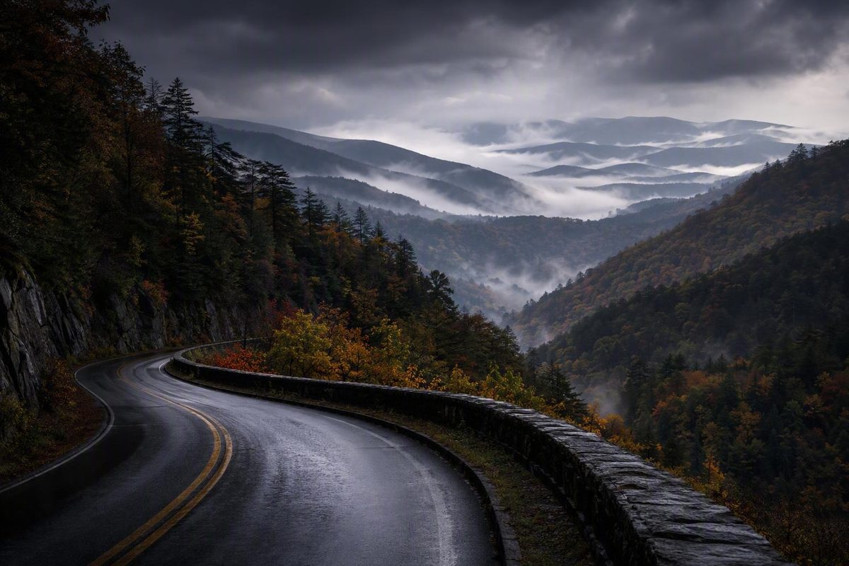
North Carolina mountain towns work best as regional bases, not entries in a beauty contest. The useful question is not which destination is universally “best,” but which one puts the right combination of downtown amenities, outdoor recreation, scenic roads, and all-weather activities within reach.
How to choose a North Carolina mountain base
Start with the experience you want most, then choose the geographic cluster that supports it. The table uses qualitative comparisons because lodging prices, operating hours, road conditions, and crowd levels change too quickly for a durable ranking.
| Destination | Region | Place type | Defining town experience | Nearby outdoor anchor | Strongest trip fit | Notable driving consideration |
|---|---|---|---|---|---|---|
| Asheville | Asheville area | City and regional hub | Food, breweries, arts, architecture, and indoor attractions | Blue Ridge Parkway and regional recreation | Broadest mixed-interest itinerary in this guide | Major-highway access does not guarantee easy cabin access |
| Black Mountain | Asheville area | Small town | Compact, walkable downtown | Broader Asheville-area recreation | Small-town excursion near city amenities | Check the exact route to rural lodging |
| Hendersonville | Asheville area | Larger regional base | Historic downtown with cafés, galleries, and shops | Regional hiking and waterfall excursions | Downtown stay plus day trips | Western excursions may involve winding roads |
| Brevard | Waterfall corridor | Small regional base | Shops, galleries, restaurants, and an outdoor focus | Pisgah National Forest and DuPont State Recreational Forest | Waterfalls, hiking, and mountain biking | Forest roads and scenic side routes may be slower than mileage suggests |
| Cashiers | Highway 64 corridor | Compact community | Small commercial center and downtown park | Highway 64 waterfall and hiking country | Short outdoor-focused stay | Travelers have described parts of Highway 64 as narrow and winding |
| Highlands | Highway 64 corridor | Small town | Main Street shops, galleries, restaurants, and garden visits | Nearby trails and waterfalls | Shopping plus outdoor excursions | Approach roads may feel demanding to curve-averse drivers |
| Boone | High Country | College town and regional base | Lively, service-rich atmosphere | Pisgah National Forest and Grandfather Mountain area | High Country circuit with varied amenities | The final rental road may differ greatly from the highway approach |
| Blowing Rock | High Country | Small town | Parkway-oriented downtown stop | Blue Ridge Parkway | Scenery and a companion stay with Boone | Parkway access depends on current closures and weather |
| Banner Elk | High Country | Small town | Dining and lodging base between recreation areas | Beech Mountain and Sugar Mountain area | Organizing a winter-sports trip | Higher-elevation roads require current-condition checks |
| Beech Mountain | High Country | Mountain resort community | Elevation-focused recreation | Skiing, hiking, and mountain biking areas | Winter sports or warm-season trail activities | Weather can affect the final climb and local roads |
| West Jefferson | High Country vicinity | Small arts-oriented town | Murals, galleries, art walks, breweries, and a cheese stop | Broader Ashe County recreation | Arts-focused alternative | Rural lodging access varies by property |
| Bryson City | Smokies | Small regional base | Rail excursions and family-oriented outdoor activities | Deep Creek and Great Smoky Mountains National Park | Families, water recreation, and rail trips | Park and river plans depend on current access |
| Cherokee | Smokies | Cultural destination and park gateway | Cherokee-centered visit with nearby park facilities | Great Smoky Mountains National Park | Park access and cultural context | Newfound Gap Road plans require current-condition checks |
| Robbinsville | Far western mountains | Small remote-road base | Launch point for demanding scenic drives | Cherohala Skyway and US 129 | Experienced scenic-road travelers | Remote, curve-intensive routes require preparation |
The recommendations use five criteria:
- Concentration of supported activities: How many relevant experiences can be combined without repeatedly changing bases?
- Outdoor access: Does the destination logically connect to a national park, forest, waterfall area, trail network, ski area, river, or scenic road?
- Usefulness as a base: Does it support day trips in more than one direction?
- Downtown amenities: Is there enough food, shopping, arts, or indoor activity to balance outdoor plans?
- Route practicality: Can the town be grouped with nearby places without excessive backtracking, and what kind of driving lies between them?
For a quick decision, choose Asheville for the broadest food, arts, architecture, brewery, and rainy-day mix among the destinations covered here. Choose Brevard for waterfalls, hiking, and mountain biking; Bryson City for a family trip built around rail and water activities; or Boone and nearby communities for a High Country circuit. Consider Beech Mountain or Banner Elk when winter sports are central, Cherokee for Great Smoky Mountains access, and Cashiers plus Highlands for a focused Highway 64 trip. These are editorial recommendations based on trip fit, not objective rankings of quality, value, safety, or charm.
Asheville needs a categorical distinction: it is a city and regional hub, not a small mountain town. Hendersonville is also a larger base rather than a tiny village. Foothill and mountain-edge communities can be useful parts of a road trip, but they should not be presented as unqualified mountain towns.
Nothing here establishes that one destination is safer, cheaper, quieter, or less crowded than another. Nor does it predict the conditions you will encounter on a particular weekend. Current lodging rates, restaurant rankings, attraction hours, and numerical road-difficulty scores have intentionally been left out.
Four mountain regions that produce very different trips
Visit NC broadly divides the state’s mountain tourism area into the High Country, Asheville and the Foothills, and Smoky Mountains and Cherokee. For road-trip planning, it helps to add a fourth working category: the Brevard–Cashiers–Highlands waterfall corridor along and around Highway 64 (Visit NC’s mountain-region overview).
These are planning tools, not strict municipal, cultural, or geographic boundaries. A town may reasonably fit more than one itinerary. Brevard, for example, can be connected to Asheville-area travel or treated as the eastern base of a waterfall trip. The point is to limit backtracking and make the road itself part of the decision.
The High Country centers on Boone-area amenities, Blue Ridge Parkway access, hiking, elevated scenery, and winter sports. Boone, Blowing Rock, Banner Elk, and Beech Mountain make a coherent group. West Jefferson works as an arts-oriented variation, although adding it changes the shape of the route.
Asheville and nearby communities provide the broadest amenity range in this comparison. Asheville contributes restaurants, breweries, arts, architecture, history, and indoor options, while Black Mountain, Hendersonville, Flat Rock, and Hot Springs offer more concentrated identities. This region suits mixed-interest groups because a city day can be separated from hiking, history, or a small-town excursion.
The Brevard–Cashiers–Highlands corridor is a forest-and-waterfall trip. Brevard has the strongest case as a full outdoor base, while Cashiers and Highlands form a natural pairing farther west. The tradeoff is the road: mileage alone understates how long a winding mountain corridor may feel, particularly when the itinerary includes trailheads, roadside stops, or slow traffic.
The Bryson City–Cherokee–Robbinsville side is oriented toward Great Smoky Mountains National Park, rail excursions, rivers, lakes, and remote scenic roads. Bryson City and Cherokee combine naturally for many visitors. Robbinsville serves a more specialized traveler who actively wants remote, curve-heavy driving rather than merely tolerating it.
The Blue Ridge Parkway, Highway 64, Newfound Gap Road, and Cherohala Skyway can tie these areas together conceptually. They should not be treated as guaranteed through-routes. Weather, construction, storm recovery, and seasonal closures can change how—or whether—they fit into a particular trip.
High Country: Boone, Blowing Rock, Banner Elk, Beech Mountain, and West Jefferson
Boone: the most versatile base
For this guide, Boone is the most service-rich base in the High Country cluster. Appalachian State University gives it a college-town character, and the town is associated with Pisgah National Forest and Grandfather Mountain State Park. Banner Elk lies near the Beech Mountain and Sugar Mountain areas, while Beech Mountain is associated with skiing, hiking, and mountain biking (an outdoor traveler’s overview of these High Country communities).
Choose Boone when different travelers want different things. One person can prioritize trails, another can explore town, and the group can use Boone as the practical center of a broader circuit. Its advantage is breadth, not an assertion that it is the prettiest or most peaceful place in the region.
Blowing Rock: the Parkway-oriented companion
Blowing Rock makes the most sense as Boone’s Parkway-oriented companion. It supports a smaller-town stop and puts the scenic-road component more prominently into the itinerary. A traveler can stay in either community and visit the other, so changing hotels between them is rarely necessary unless the lodging itself is part of the experience.
The Blue Ridge Parkway is central to this pairing, but it should be treated as an optional scenic layer rather than the only available route. Road projects and Helene recovery have affected access, and regional trip-planning guidance directs travelers to National Park Service closure and detour information before departure (Blue Ridge Parkway closure and planning guidance).
Banner Elk and Beech Mountain: organize around recreation
Banner Elk’s position near the Beech Mountain and Sugar Mountain areas makes it a logical base for travelers organizing a winter-sports trip. Its role is practical: it can connect lodging, meals, and multiple recreation areas without requiring the entire stay to happen in one resort community.
Beech Mountain is associated with skiing as well as warm-season hiking and mountain biking. That does not establish that a particular ski area, trail, lift, or rental service will operate during your dates. Before booking, check current resort operations, weather, road advisories, and the exact approach to the property.
If skiing or mountain biking is the main reason for traveling, add Beech Mountain deliberately. If recreation there is merely a possibility, Boone, Blowing Rock, and Banner Elk already form a coherent multi-stop circuit without forcing another higher-elevation drive.
West Jefferson: an arts-oriented alternative
West Jefferson offers a different type of High Country-area trip. Travel coverage associates its downtown with murals, galleries, art walks, breweries, and Ashe County Cheese, making it a reasonable choice for travelers seeking a smaller arts-and-food stop rather than a route dominated by Parkway overlooks or ski areas (the same western North Carolina town overview).
West Jefferson can stand alone for a short stay or be paired with Boone when there is enough time to avoid turning the trip into a sequence of check-ins. Treat it as an intentional detour or second base rather than another stop to squeeze between Boone, Blowing Rock, and Banner Elk.
What the drive is—and is not
Participants in one traveler discussion suggested Boone or Asheville for people who prefer major-highway approaches. The same discussion shows disagreement about the Blue Ridge Parkway: some participants describe it as relatively wide and gradually graded, while others remain uncomfortable with its curves, bridges, heights, or exposed views. These are personal reactions, not official road-safety assessments (traveler discussion of mountain-road comfort).
Most importantly, an approachable highway journey to Boone says nothing about the final road to a cabin. A rental may be reached by pavement, gravel, switchbacks, a steep grade, an exposed edge, or some combination of them. Evaluate that final segment separately.
Asheville and nearby alternatives: Black Mountain, Hendersonville, Flat Rock, and Hot Springs
Asheville: choose breadth over a tiny-town atmosphere
Asheville is the strongest choice in this guide for travelers who want a wide range of urban amenities. Its recurring associations include restaurants, craft breweries, arts, architecture, the River Arts District, and nearby recreation. Indoor attractions and a larger dining base also make it easier to restructure a day when rain or road conditions disrupt an outdoor plan.
That breadth is the reason to choose Asheville. It is not the right fit for someone whose primary goal is to stay in a tiny mountain town. A city stay introduces more urban movement, parking decisions, and neighborhood choice, even while providing access to mountain recreation.
Asheville also works well for mixed-age or mixed-interest groups. One day can focus on downtown and arts; another can move outward toward a trail, scenic drive, or neighboring community. Family-oriented destination coverage similarly distinguishes Asheville through its restaurants, breweries, architecture, downtown, and River Arts District while pairing those amenities with outdoor activities (family comparison of Asheville, Brevard, and Bryson City).
Black Mountain: a compact downtown excursion
Black Mountain is a smaller alternative or day trip. One travel source describes it as having a walkable downtown and free parking, making it suitable for a visit built around browsing, eating, and spending time in one compact center.
Do not assume that smaller automatically means cheaper, quieter, less crowded, or easier to drive. Those comparisons require current evidence. Black Mountain’s defensible distinction is its scale and concentrated downtown identity, not an unverified promise about price or traffic.
Hendersonville and Flat Rock: downtown plus history
Hendersonville is a larger regional base with a historic downtown containing cafés, galleries, coffee shops, and stores. It can support its own stay or serve as an alternative to Asheville for travelers whose plans point south or west.
Avoid building an itinerary around an old farmers-market listing without checking its current schedule. Markets, events, and individual businesses are perishable details. The more durable pairing is geographic and thematic: downtown Hendersonville with nearby Flat Rock.
Flat Rock’s defining supported attraction is Carl Sandburg Home National Historic Site. This creates a straightforward day: spend part of it in Hendersonville’s commercial center and part at the historic site in Flat Rock. A first-person Highway 64 travel account describes both destinations, although its business and access observations reflect a 2021 visit and should not be assumed current (Hendersonville and Flat Rock travel account).
Hot Springs: make the trail the point
Hot Springs is the focused choice for Appalachian Trail travelers. One outdoor-travel account reports that the Appalachian Trail passes along Main Street, giving the town a direct trail identity rather than merely placing it near hiking.
Choose Hot Springs when the trail, river landscape, or a compact outdoor-oriented stay is central. It is less logical as a substitute for Asheville if the group expects a deep roster of arts venues, indoor attractions, and urban dining.
The tradeoff across this region is simple: Asheville offers breadth, while its surrounding communities provide more concentrated identities. Stay in Asheville and take a small-town excursion, or base in Hendersonville and devote a separate day to Flat Rock and outdoor access.
The waterfall corridor: Brevard, Cashiers, and Highlands
Brevard: the strongest all-around outdoor base
For this guide, Brevard is the best-supported all-around base in the waterfall corridor. That editorial conclusion rests on the concentration of repeatedly documented trip types, not on a claim that Brevard is objectively superior.
The town is consistently associated with Pisgah National Forest, DuPont State Recreational Forest, waterfalls, hiking, mountain biking, tubing, and a downtown with shops, galleries, and restaurants. It can support an outdoor-first trip while still giving travelers somewhere to eat or browse after a trail day. Independent coverage likewise positions Brevard for waterfall hikes and mountain biking while advising visitors to check trail status after storm impacts (Brevard destination guide and access caveat).
The often-repeated claim that the area has more than 250 waterfalls is unnecessary for planning and lacks a documented inventory in the supplied evidence. The practical point is narrower: multiple waterfall and forest destinations are associated with the Brevard area.
Do not assume a named waterfall, swimming area, forest road, or trail is open. Access may change because of rainfall, maintenance, weather, construction, or recovery work. Verify the specific destination through the relevant forest, state recreation area, or local authority shortly before departure.
Cashiers: a compact stop in outdoor country
Cashiers is a compact Highway 64 stop associated with a downtown park and access to waterfall and hiking country. It works well for travelers who want a modest commercial center without making downtown activity the entire trip.
Use Cashiers as a base when the daily plan points outward—to trails, waterfalls, and scenic roads. If the group expects extensive urban entertainment or numerous indoor alternatives, make that expectation explicit before booking.
Highlands: Main Street plus outdoor excursions
Highlands adds a more developed Main Street experience, with shops, galleries, and restaurants, as well as a botanical garden and nearby hiking and waterfall access. It balances outdoor plans with a town-centered afternoon more easily than a purely recreation-oriented stop.
Cashiers and Highlands form a logical short corridor. They can share one lodging base or be visited during the same segment of a longer trip, subject to road comfort and current access. Brevard deserves separate treatment. Trying to rush Brevard, Cashiers, and Highlands in one day can turn an outdoor trip into a windshield itinerary.
Highway 64 changes the calculation
Writers who spent two months traveling around Highway 64 in 2021 described the road as beautiful but stressful because of narrow, winding, two-lane sections. That is personal experience, not a universal road-safety judgment. A driver accustomed to mountain roads may react differently from someone who dislikes curves, narrow lanes, drop-off views, or repeated steering input (first-person Highway 64 driving account).
Before committing to a multi-town Highway 64 itinerary, review the actual route rather than judging it by mileage. Consider whether everyone in the vehicle is comfortable with sustained curves and whether the schedule has enough slack for slow traffic, weather, and unplanned stops. If not, use Brevard as one base and Cashiers or Highlands as a second, with a restrained transfer day between them.
This corridor rewards depth. One forest day, one waterfall-and-trail day, and one town-centered day usually produce a more coherent trip than collecting place names. Current conditions should decide the exact outdoor sites.
Smokies gateways: Bryson City, Cherokee, and Robbinsville
Bryson City: the mixed family itinerary
Bryson City is the strongest fit in this comparison for families seeking a mixture of town, rail, and water activities. It is associated with Great Smoky Mountains Railroad excursions, tubing, rafting, paddling, waterfall hikes, lake activities, and access to Great Smoky Mountains National Park.
The useful distinction is variety. A trip can include one structured rail activity, one flexible town period, and one outdoor day. That makes it easier to accommodate different interests than an itinerary requiring a major hike every morning.
A family-travel source describes the Deep Creek Loop near Bryson City as a 2.4-mile route passing three waterfalls and notes tubing as a popular area activity. Treat that as an itinerary example rather than a current trail report: verify the route, access, weather, and park advisories before departure (Bryson City family-trip account).
Cherokee: more than a park entrance
Cherokee is a gateway to Great Smoky Mountains National Park and Newfound Gap Road. The Oconaluftee Visitor Center and Mountain Farm Museum are among the nearby park-oriented stops identified along the corridor (overview of Newfound Gap Road and western scenic drives).
Cherokee should not be reduced to a convenient entrance. It is a culturally significant destination, and visitors should approach it as a place in its own right rather than treating the community as a parking lot for the national park. This guide does not attempt to compress Cherokee history or living culture into a roadside summary.
Choose Cherokee when national-park access is the organizing principle. It pairs naturally with Bryson City because the two bases support different emphases: Cherokee for park orientation and Bryson City for rail and water recreation.
Robbinsville: a specialized road-trip base
Robbinsville suits experienced drivers who are deliberately prioritizing remote scenic roads. It is associated with Cherohala Skyway and the curve-intensive section of US 129 commonly called Tail of the Dragon.
Cherohala Skyway requires advance preparation. A first-person scenic-drive guide reports no gas stations, restaurants, or hotels on the route itself, so travelers should confirm current services, fuel before entering, and carry what they need for the drive (scenic-drive guide to Cherohala Skyway).
Tail of the Dragon should not be described as safe, beginner-friendly, or mandatory. The relevant planning point is simply that it is a curve-intensive route associated with the Robbinsville area. Travelers who do not actively want that kind of driving lose nothing by skipping it.
The three bases serve different trips:
- Bryson City: mixed family itinerary with rail, water, town, and outdoor options.
- Cherokee: national-park access and a destination with cultural significance beyond its gateway role.
- Robbinsville: remote-road travel for drivers who intentionally seek demanding scenic routes.
Road trips that combine towns without excessive backtracking
These outlines organize nights and themes rather than guaranteeing drive times. Before departure, use current mapping and official road information to confirm each route.
Two nights in the High Country
First day: Arrive in Boone and use the town as the service base. Keep the evening flexible instead of committing to a long scenic drive after arrival.
Full day: Divide time between Blowing Rock, an outdoor stop, and an available section of the Blue Ridge Parkway. If the Parkway is closed or uncomfortable for the driver, use a conventional route and preserve the town visit.
Departure day: Add Banner Elk if it lies logically along the onward route. Add Beech Mountain only when skiing, mountain biking, or another specific recreation goal justifies the extra segment.
This structure keeps Boone, Blowing Rock, and Banner Elk coherent. West Jefferson is better reserved for another trip or an additional night.
Two or three nights around Asheville
City day: Focus on Asheville’s downtown, food, architecture, breweries, or arts. A city-centered day prevents the trip from becoming an exhausting sequence of mountain roads.
Excursion day: Choose either Black Mountain for a compact downtown visit or Hendersonville and Flat Rock for a historic-downtown-and-history pairing.
Optional third day: Add outdoor recreation or a Parkway segment only after checking current conditions. Do not assume a scenic route will remain open or fit comfortably around timed reservations.
This plan uses Asheville’s breadth without forcing every night to be urban. Travelers who prefer a larger-town base outside the city can reverse the arrangement and stay in Hendersonville.
Three nights on the waterfall corridor
First base: Brevard. Give it at least one full outdoor day, with the specific forest, waterfall, hiking, or biking plan chosen according to current access.
Transfer day: Travel toward Cashiers or Highlands without stacking multiple major hikes onto the drive. Highway 64’s curves, stops, traffic, and weather may make the transfer feel longer than its mileage suggests.
Second base: Cashiers or Highlands. Use one for lodging and visit the other as part of a focused corridor day. Balance a town stop with one or two verified outdoor destinations.
This plan resists the temptation to turn all three communities into a rushed day trip. It also provides a fallback if weather makes one outdoor area unsuitable.
Three nights in the Smokies
Bryson City day: Combine town time with a preselected rail or water activity. Verify schedules, reservations, and operating conditions directly.
Outdoor day: Choose tubing, paddling, rafting, lake recreation, or a waterfall hike according to season and current conditions.
Cherokee and park day: Shift the emphasis to Cherokee, the Oconaluftee area, and Great Smoky Mountains access. Check Newfound Gap Road and park advisories before relying on a through-drive.
Bryson City and Cherokee complement each other without requiring a long list of unrelated stops. Add Robbinsville only if remote scenic driving is one of the trip’s central purposes.
Optional Polk County approach
Travelers approaching from the southeast can consider a compact Columbus–Tryon–Saluda loop. These communities sit in Polk County’s foothill and mountain-edge context, so the loop is best described as an approach to or extension of a western North Carolina trip rather than a substitute for the higher mountain clusters.
A 2025 route guide describes White Oak Mountain as winding and residential and says it may make drivers unfamiliar with mountain roads nervous. The same guide reports that Green River Gorge recreation was affected by Hurricane Helene, making current recovery and attraction-access checks essential before building a day around it (updated Polk County route guide).
A week is still not enough for everything
For a weeklong trip, choose two geographic clusters instead of trying to cover every named town. Sensible pairings include:
- High Country plus Asheville
- Asheville plus Brevard
- Asheville plus the Smokies
- Brevard plus Cashiers–Highlands
- Bryson City–Cherokee plus Robbinsville, for road-focused travelers
The Blue Ridge Parkway, Highway 64, Newfound Gap Road, Cherohala Skyway, and Forest Heritage Scenic Byway can structure these trips. They can also disrupt them when closures, weather, construction, or slow scenic traffic intervene. Build an itinerary that survives the loss of its signature road.
Mountain-driving, seasonal, and current-condition checks
“Is the drive difficult?” is not one question. Separate it into four:
- The major-highway approach: How do you reach the region from home?
- Streets within town: Will you be navigating a city center, compact Main Street, or resort community?
- Optional scenic roads: Are you choosing the Parkway, Highway 64, Newfound Gap Road, Cherohala Skyway, or another mountain route?
- The final lodging approach: What happens after leaving the public through-road?
A route to Asheville or Boone may feel approachable on major highways while the last mile to a cabin is steep, narrow, unpaved, exposed, or weather-sensitive. Never let the first three hours of a route answer questions about the final ten minutes.
Before reserving rural lodging, ask the host:
- Is the final road paved for its entire length?
- How steep is the approach?
- Are there switchbacks, narrow bridges, one-lane sections, or exposed edges?
- Is there room to turn around?
- Does the driveway become difficult in rain, snow, or ice?
- Is a particular vehicle configuration recommended for the intended season?
- Are there alternate approaches, and is one preferable to the route suggested by navigation software?
Treat the answers as property-specific information, not a guarantee. Conditions can change between booking and arrival.
Road comfort is subjective
Travelers do not agree about the Blue Ridge Parkway. Some find its width and gradual alignment manageable; others are uncomfortable with curves, bridges, heights, or open views. The same disagreement applies to many mountain roads, and a passenger’s comfort can differ from the driver’s.
Highway 64 and the White Oak Mountain loop have both been described by travelers as winding and potentially uncomfortable for people unfamiliar with mountain roads. That does not make them universally dangerous, nor does scenic praise make them universally easy. If sustained curves cause anxiety, review route imagery and alternatives before making the road indispensable to the trip.
For related planning context, see Road Listings’ guide to planning a Blue Ridge Parkway drive. Use it for itinerary preparation rather than as a substitute for current official closure notices.
Seasonal tradeoffs
Winter supports skiing and snow-centered trips in the High Country, but it also introduces ice, snow, closure, and final-driveway concerns. Check the public road, resort, and lodging approach independently.
Warm months support tubing, paddling, rafting, and lake recreation. Water conditions, rainfall, access rules, and operator schedules still require current verification.
Fall brings foliage travel, but timing varies with elevation and weather. Traffic can undermine an itinerary that assumes rapid movement between overlooks or towns.
Rainfall and storms influence waterfalls, rivers, trails, and unpaved roads. More water does not automatically mean better or safer recreation. Follow official forest, park, river, and local advisories.
Official checks to make before departure
Use official sources for current conditions, even when a tourism page or travel article helped shape the itinerary:
- Check the National Park Service’s Blue Ridge Parkway closure and detour maps before relying on a Parkway segment.
- Consult Great Smoky Mountains National Park information before planning Newfound Gap Road, Oconaluftee, or park-trail access.
- Check the relevant transportation agency for public-road closures and detours.
- Review current notices from Pisgah National Forest or DuPont State Recreational Forest before selecting a trail, waterfall, forest road, or recreation area.
- Confirm river conditions with the responsible river manager or activity operator.
- Check ski-area operations, weather, and access directly when winter sports are central.
- Verify local recovery notices before visiting an area affected by Hurricane Helene.
Repeat these checks during the trip if the weather changes. Blue Ridge Parkway planning guidance specifically warns that ongoing road projects and Helene recovery may affect closures and detours (Parkway planning and closure guidance).
Carry essential directions in a form that remains available without a live connection, identify backup routes, and avoid scheduling every scenic segment against a fixed reservation. This is not a prediction that service or navigation will fail; it simply makes the itinerary less dependent on one device, road, or timing assumption.
Frequently asked questions
What is the best North Carolina mountain town for a first visit?
There is no single best choice. Pick the base that minimizes compromises for your group.
Choose Asheville for the broadest mix in this guide of restaurants, arts, architecture, breweries, indoor options, and nearby recreation. Choose Boone for a High Country circuit with college-town amenities, Parkway access, and nearby outdoor areas. Choose Brevard when waterfalls, hiking, and mountain biking are the priority. Choose Bryson City for a family trip combining rail, water, and outdoor activities.
For a short first visit, stay in one base rather than changing hotels nightly.
Which North Carolina mountain town is best for waterfalls?
Brevard is the strongest all-around waterfall base in this comparison because it is repeatedly associated with Pisgah National Forest, DuPont State Recreational Forest, waterfall access, hiking, and mountain biking. Cashiers and Highlands are also useful for a waterfall-oriented Highway 64 trip.
Do not rely on a fixed waterfall count or assume every site is accessible. Select specific destinations only after checking current forest, park, trail, and road conditions.
Which mountain towns are closest to the Blue Ridge Parkway?
Among the selected destinations in this guide, Blowing Rock is particularly useful for a Parkway-oriented High Country stay, with Boone serving as a nearby service-rich base. Asheville is a major regional gateway for Parkway excursions, while Brevard can connect to Parkway and Forest Heritage Scenic Byway itineraries. Cherokee sits near the Parkway’s southern end and Great Smoky Mountains National Park.
This is a list of useful planning bases, not an objective proximity ranking. “Closest” should not be the only criterion: the most convenient access point may be closed, and a short map distance can still involve a slower mountain approach.
Are North Carolina mountain roads difficult to drive?
Some can feel demanding; others may feel manageable. Difficulty depends on the exact road, weather, traffic, vehicle, and the driver’s comfort with curves, grades, narrow lanes, bridges, and exposed views.
Assess the major-highway approach, town streets, optional scenic roads, and final lodging road separately. Highway access to Asheville or Boone does not establish that a cabin driveway will be easy. Traveler descriptions of Highway 64, White Oak Mountain, Cherohala Skyway, or US 129 should be treated as planning context, not official safety ratings.
Which North Carolina mountain towns work well for families?
Bryson City supports one of the most varied family itineraries in this comparison, with rail excursions, tubing, paddling, rafting, lake activities, and waterfall hikes associated with the area. Asheville works well for families wanting restaurants, arts, architecture, indoor alternatives, and nearby recreation. Brevard suits active families prioritizing waterfalls, hiking, mountain biking, and a town center with shops and restaurants.
The right choice depends on ages, interests, weather tolerance, and road comfort. Verify attraction schedules, trail access, water conditions, and reservation requirements directly before travel.
Choose one regional base for a short visit or two neighboring clusters for a week. Match the destination to the activities and amenities that matter most, then evaluate the actual roads—including the final lodging approach—before booking. Mountain weather, construction, closures, and recovery work can change access, so the final planning step should always be a check of current official conditions.
Road Listings states that it publishes practical North American driving guidance without sponsored route guides or payments from lodging and attraction operators (Road Listings’ editorial positioning). Its articles are informational and are offered without a guarantee of accuracy or fitness for a particular purpose (Road Listings’ terms).