
Ross Maxwell Scenic Drive: Plan Around the Santa Elena Road Closure
Plan Big Bend’s Ross Maxwell Scenic Drive with realistic timing, paved-road stops, fuel advice and the October 2026 Santa Elena access closure.
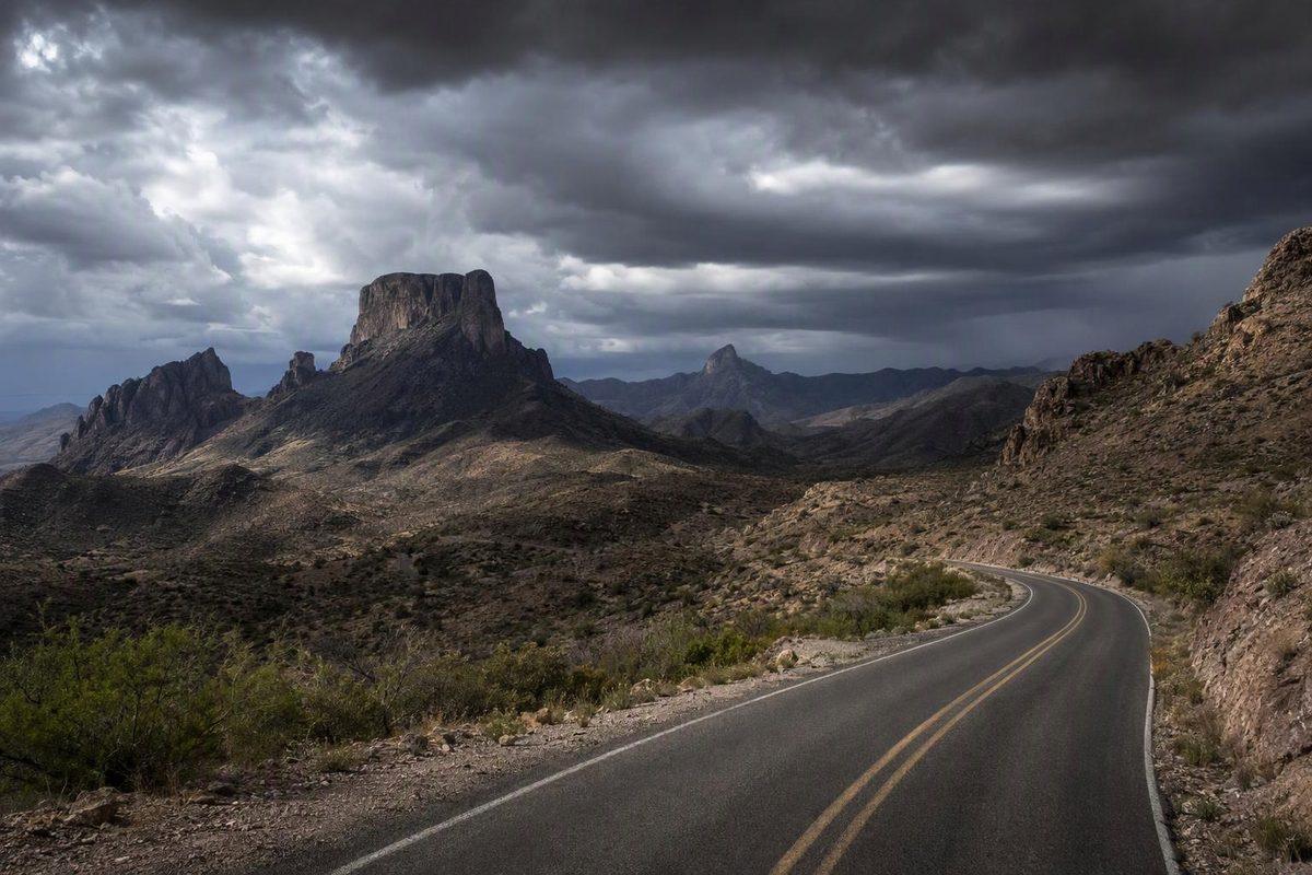
Ross Maxwell Scenic Drive is Big Bend National Park’s paved western sightseeing route, normally running 30 miles to Santa Elena Canyon. As of October 10, 2026, you cannot complete that drive to the canyon on pavement: NPS lists the road between Cottonwood Campground and Santa Elena Canyon as closed until further notice because of weather-related conditions. Plan an out-and-back visit to the overlooks and historic stops before the closure, rather than counting on a canyon hike. NPS road status
| Route detail | Planning answer |
|---|---|
| Normal distance | 30 miles one way; about 60 miles returning on the same road, excluding approach roads and side trips |
| Surface and vehicle | Paved main route; a normal passenger car is suitable when the road is open and conditions permit |
| Driving allowance, full route when open | About 1–1¼ hours each way; 2–2½ hours round trip without sightseeing |
| Sightseeing allowance | Reserve 3–5 hours for selected stops before the current closure; 5–7 hours for selected stops and Santa Elena hiking once paved access reopens |
| Current constraint | Paved access beyond Cottonwood toward Santa Elena closed; Old Maverick currently requires high-clearance 4WD and is not a sedan detour |
| Fuel on the scenic drive | None; fill before turning onto it |
NPS supplies the 30-mile route and paved-road description. Times above are planning allowances, not measured travel times: they leave room for curves and lower-speed sections rather than assuming the park’s maximum 45 mph throughout. Approach driving from your lodging is additional. NPS driving guidance
Follow the paved route—and return the same way
The northern turnoff is on the park road connecting Maverick Entrance Station with Panther Junction. Follow Ross Maxwell Scenic Drive south through the western desert toward Castolon; under normal conditions, the route continues to the Santa Elena Canyon trailhead. It is not a paved loop. Returning along the same road is the straightforward choice for a passenger car. NPS route description
The closure affects the final approach, not a published closure of the entire scenic drive. Check the current turnaround arrangements with a ranger and obey gates, cones and signs. The park’s October 9 daily report also lists the Santa Elena road as closed and warns against driving around barriers or across flooded or muddy roads. Big Bend daily report, October 9, 2026
Old Maverick is not an easy shortcut
Old Maverick Road connects Maverick Junction with Santa Elena Canyon over 14 miles of dirt. NPS describes rough, washboarded conditions and normally allows about an hour to drive it; rain can make it impassable. NPS dirt-road guide
An October 7 park Communications Center update reopened Old Maverick to high-clearance, four-wheel-drive vehicles, while keeping the other previously closed roads shut. The October 9 report retains that vehicle requirement. Do not use older advice that calls it generally passable for most cars. If you have a suitable vehicle and want canyon access, ask a ranger about the entire approach and trailhead access before treating it as a separate outing. It does not make the closed paved section a usable loop. October 7 road update · October 9 conditions
Choose stops that fit your day
These stops are listed north to south. The editorial time allowances include parking and a short visit, not just time outside the car.
| Stop | Why stop—and what it takes | Allow |
|---|---|---|
| Sam Nail Ranch | Historic homestead, vegetation and birding; the easy trail is a 0.5-mile loop | 20–30 minutes |
| Homer Wilson Ranch overlook | View the old ranch headquarters from above; walking down is an extra commitment | 10–15 minutes for the overlook |
| Sotol Vista | Broad western-park panorama, with Santa Elena Canyon visible in the distance | 10–20 minutes |
| Lower Burro Mesa Pour-off | A 1.5-mile side road leads to an easy, 1-mile round-trip walk into a box canyon | 45–60 minutes, including the side road |
| Mule Ears viewpoint | See the distinctive twin peaks without committing to the spring hike | 10–15 minutes |
| Tuff Canyon | Short walks to viewing platforms above the volcanic canyon | 20–30 minutes |
| Castolon | Historic district and a possible supply stop; check facility hours separately | 20–30 minutes |
Stop descriptions come from the NPS scenic-drive guide; walking distances use the more specific NPS desert-hike listings.
For the current closure-limited trip, make Sam Nail Ranch, Sotol Vista, Mule Ears and Tuff Canyon your core stops. Add Lower Burro Mesa if the weather is suitable for walking. Avoid narrow canyons and dry washes during thunderstorms because of flash-flood risk. You can see Santa Elena Canyon from Sotol Vista without reaching its trailhead. NPS hiking safety · Sotol Vista description
Do not mistake the Mule Ears viewpoint for the Mule Ears Spring hike: the latter is a moderate 3.8-mile round trip. Adding it changes a driving-and-overlooks visit into a hiking day. NPS trail details
Santa Elena Canyon needs separate access checks
When access permits, the Santa Elena Canyon Trail is 1.7 miles round trip, rated moderate, with a Terlingua Creek crossing, a steep sandy bank and paved steps. Reserve roughly 1–1½ hours as a hiking allowance, plus parking time. The trail is impassable when the creek floods; even with the road open, mud or flowing water can prevent the hike. Ask a ranger about the crossing, and do not attempt it if water levels are too high. NPS river-hike guide · Current trail guidance
Fuel, heat and vehicle preparation
Fill up in Study Butte or at Panther Junction before starting. NPS lists fuel at both locations, but none at Castolon. Panther Junction’s gas and diesel pumps are listed as available 24/7 with a credit card. Castolon’s store is listed as open 10 a.m.–5 p.m.; it is not a fuel stop. These are the concession hours effective June 2026. The Castolon visitor center is separately listed as closed for the summer on the conditions page checked October 10. NPS services · Concession hours · Facility status
Cooler months generally make the walking stops more workable. May through August are the hottest months, and July through September brings thunderstorms and possible flash flooding. Check conditions for the desert and river corridor, not just the cooler mountain elevations. October is not automatically cool: the October 9 report recorded a previous-day high of 92°F at Castolon. NPS seasonal weather · October 9 daily report
Before leaving:
- Carry drinking water and lunch rather than relying on store availability. NPS recommends at least one gallon of water per person per day. Keep reserve water in the car, but carry water on every walk; the October 9 report advises a minimum of 2 liters for short hikes, and one gallon or more for full-day hikes.
- Check tires, the spare and jack. A paved itinerary still deserves roadside preparation in this remote park.
- Download Big Bend’s content in the NPS app for offline maps before departure; cell service is limited or absent in many areas.
- Use designated pullouts, not the traffic lane, for photographs. Plan the return in daylight where practical; NPS specifically warns about wildlife along road shoulders at night.
NPS safety advice · October 9 heat guidance · Offline NPS app features
Park entry does not require a reservation. As checked October 10, 2026, the standard private-vehicle entrance fee is $30, valid for seven days, and the park accepts credit/debit cards rather than cash. NPS fees and entry rules