
Plan a Practical East Coast Road Trip Around the Blue Ridge Parkway
For non-campers, the full Blue Ridge Parkway needs 3-4 days to feel like a trip; 5-6 lets you stop without every overlook threatening the schedule.
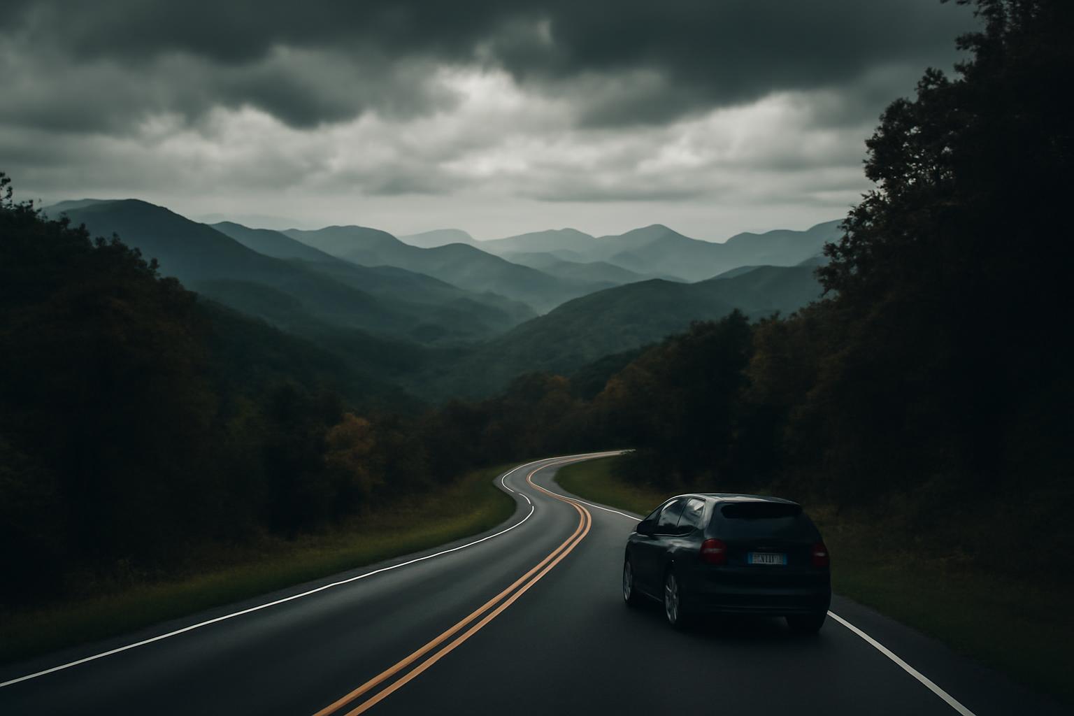
An east coast road trip can mean almost anything: a city-heavy run, a coastal hop between beach towns, or a mountain drive where the road itself is the attraction. That flexibility is useful, but it also causes a lot of bad planning. Too many “ultimate” itineraries treat every mile as equally rewarding, every season as equally drivable, and every driver as equally willing to burn long days for a short list of famous stops.
A more practical approach is to decide what kind of East Coast trip you actually want before you start dropping pins. If your priority is museums, neighborhoods, and food, build around cities. If your priority is beaches and maritime towns, plan a coastal route. If your priority is a slower scenic drive where the windshield view does most of the work, build around a mountain road worth driving on purpose.
That is where the Blue Ridge Parkway earns its place. It is not a stand-in for the whole East Coast, and it is not a coastal route. But it is one of the clearest examples of an eastern drive where the road itself is the reason to go. Used well, it can anchor a broader East Coast trip without turning the rest of your schedule into a rushed mess.
Related: Blue Ridge Parkway: What the Drive Actually Takes.
Why Focus on Practical East Coast Drives Like Blue Ridge Parkway
What makes an East Coast road trip memorable is not how many famous names you can force into one map. It is whether the route stays rewarding after the first-day excitement wears off. Good road trips have rhythm. They give you a reason to keep driving, not just a reason to arrive.
That is also why scope matters. A lot of East Coast advice collapses very different trip types into one bucket: city corridors, barrier-island runs, national-park loops, and Appalachian scenic roads. Those are all legitimate goals, but they are not the same experience and should not be planned the same way.
Road Listings is useful on that point because its About page says the site focuses on practical driving guidance: where to go, what the road looks like in a given season, how long legs really take with ordinary stops, and which gear matters versus which gear is just cargo. It also says it does not publish sponsored route guides or take payment from lodging or attraction operators.
That framing helps with the broader “east coast road trip” question. If you want a mountain-scenic route, you should judge it by different standards than a city-to-city trip or a beach run. Blue Ridge is a strong example because Road Listings’ homepage coverage describes the Parkway as a 469-mile drive with no trucks, no billboards, and a 45 mph limit, which immediately tells you this is meant to be driven slowly rather than consumed as a connector road.
The broader lesson travels well beyond the Appalachians. Not every named route deserves an end-to-end drive. Not every detour improves a trip. A practical East Coast planner asks the harder question first: is this stretch actually enjoyable enough to justify the time, fuel, and fatigue it adds? If yes, give it enough time to matter. If no, skip it without guilt.
Terrain realism matters too. Coastal driving, urban corridor driving, and mountain driving create different expectations for fuel timing, weather, attention, and pace. Blue Ridge teaches that lesson quickly. It is excellent precisely because it is slower, more deliberate, and less commercial than an ordinary highway route. If that sounds like the trip you want, it makes sense as an anchor. If it does not, you are better off choosing a different East Coast pattern from the beginning.
Blue Ridge Parkway Overview and Access
The Blue Ridge Parkway is best understood as an Appalachian scenic spine, not as a coastal East Coast route. It runs 469 miles from Shenandoah National Park at Rockfish Gap, Virginia, to Great Smoky Mountains National Park at Cherokee, North Carolina, and the speed limit is 45 mph for the entire length. It also has no commercial traffic and no billboards, which is a big part of why the drive feels so different from an ordinary corridor road (Road Listings Blue Ridge Parkway guide).
Those restrictions are not trivia. They explain the route’s character. You are signing up for curves, overlooks, elevation changes, and a slower pace that discourages “making up time.” If your mental picture of an East Coast road trip is harbors, boardwalks, and waterfront towns, this is not that trip. If your picture is mountain scenery without interstate clutter, it is much closer.
Access is more flexible than many first-time planners assume. You can drive the full route, but you do not have to. The Virginia section from Rockfish Gap to Roanoke is about 115 miles, and the Asheville-to-Cherokee North Carolina section is about 90 miles, which makes both segments realistic ways to use the Parkway as part of a larger East Coast trip (Road Listings Blue Ridge Parkway guide).
That flexibility is one of the route’s main strengths. A broader East Coast trip often needs modular planning: a scenic mountain section between city stops, family obligations, or other park visits. In that context, the Parkway works well as either a full multi-day commitment or a shorter reset built around one strong section.
The tradeoff is simple. The more you compress the route, the more it becomes a sampler rather than a full scenic drive. That is not a failure. For many drivers, it is the smarter choice.
Realistic Timing for Blue Ridge Parkway
The easiest way to underestimate the Blue Ridge Parkway is to divide the mileage by the speed limit and call the math finished.
At the posted 45 mph, a no-stop run works out to about 10.5 hours, but the realistic average on curvier sections is closer to 35 to 40 mph, and that is before you add overlooks, meals, short walks, weather delays, or traffic at popular pull-offs. In practical terms, the full route is usually a 3- to 6-day drive, not a one-day transit exercise (Road Listings Blue Ridge Parkway guide).
A separate park-focused comparison is useful here because it confirms the basic scale from another angle: More Than Just Parks summarizes the Blue Ridge Parkway as a 469-mile route with about 10 to 12 hours of driving before stops, which lines up with the distinction between theoretical drive time and actual trip time. That same practical gap is why so many rushed plans feel worse in the car than they look on paper.
For travelers not camping, the cleanest rule is this: 3 to 4 days is the minimum if you want the full route to feel like a trip, and 5 to 6 days is the more forgiving version that lets you stop without treating every overlook as a scheduling threat (Road Listings Blue Ridge Parkway guide). Three days can work, but it is the compressed version: long hours, selective stopping, and little margin for weather or drift.
Shorter sections are easier to pace honestly. The Virginia section can make sense as a long one-day drive if you start early and keep your stop count disciplined. The Asheville-to-Cherokee section is a strong 1- to 2-day option because the terrain is dramatic enough that even a shorter stretch feels substantial (Road Listings Blue Ridge Parkway guide).
This is also where the article widens back out to the broader East Coast question. Many readers do not need an end-to-end Parkway plan. They need a worthwhile scenic section that fits inside a larger trip. If that is your situation, resist the urge to force the full route into the schedule just because the road is famous. A shorter section enjoyed properly is far more useful than a longer section rushed into irrelevance.
One more timing rule helps: do not confuse available daylight with comfortable driving capacity. Mountain roads create a different kind of fatigue than interstate miles. The distances can look modest while the concentration cost stays high.
Key Stops and Mileposts on Blue Ridge Parkway
If you only keep one planning principle for the Blue Ridge Parkway, make it this: choose a few anchor stops and let the rest happen naturally. Trying to stop everywhere turns a scenic drive into a constant parking-and-restarting exercise.
A good Virginia anchor is Mabry Mill at milepost 176.2. Road Listings describes it as the most photographed operational mill on the Parkway and advises arriving early on fall weekends because parking gets tight as the morning builds (Road Listings Blue Ridge Parkway guide). It is a strong stop because it changes the subject a little: not just another overlook, but a place with visual identity and crowd-management implications.
Linn Cove Viaduct at milepost 304.4 is the stop to prioritize if you care about the road as an engineered object, not just the scenery around it. The short trail beneath the structure helps you understand why it is memorable. On a route full of view pull-offs, that structural perspective is part of what makes it stand out (Road Listings Blue Ridge Parkway guide).
Craggy Gardens at milepost 364.6 sits around 5,500 feet and shows how elevation changes the feel of the Parkway. It is one of the clearest examples of why spring deserves more attention than it usually gets: the rocky high-elevation landscape is distinctive on its own, and the late-May rhododendron bloom makes that section especially appealing (Road Listings Blue Ridge Parkway guide).
Waterrock Knob at milepost 451.2, at about 6,000 feet, is one of the best broad-view stops toward the southern end of the drive (Road Listings Blue Ridge Parkway guide). It is also a useful reminder that the Parkway does not save all its payoff for one final overlook. Good views keep appearing late enough that pacing still matters near the end.
A practical way to use these stops is to give each one a role. Mabry Mill is the heritage stop. Linn Cove is the engineering stop. Craggy is the spring-bloom and high-elevation stop. Waterrock is the panoramic stop. Once you think in anchors instead of equal-weight pins, your days get easier to shape.
That matters on a longer East Coast road trip because decision fatigue is real. Famous scenic roads tempt you to debate every pull-off. Picking one or two non-negotiable stops for the day preserves room for spontaneity without making every overlook a scheduling referendum.
Vehicle Preparation Checks for East Coast Road Trips
Before any long East Coast drive, the vehicle prep that matters most is the unglamorous stuff: tires, fluids, and battery health. That is especially true once the trip gets beyond about 300 miles (Road Listings tire-and-gear guide).
Tires come first for good reason. Road Listings says to check pressure when the tires are cold, meaning the car has been sitting for at least 3 hours, because warm tires usually read about 4 to 6 psi higher. The correct target is the pressure on the driver’s door-jamb sticker, not the number on the tire sidewall, which shows maximum pressure rather than recommended operating pressure (Road Listings tire-and-gear guide).
For tread, the same guide uses two quick checks. If a quarter shows the top of Washington’s head, the tread is around 4/32 inch and is already borderline for a long trip in wet or mountainous conditions. If a penny shows Lincoln’s head fully, the tread is around 2/32 inch and effectively worn out (Road Listings tire-and-gear guide). The useful takeaway is not the coin trick itself; it is the reminder to stop rationalizing borderline tires before adding rain, grades, and long braking zones.
Fluids are the next simple win. If your oil change is within about 2,000 miles of coming due, do it before departure. Check coolant only when the engine is cold and confirm the reservoir is at the full-cold line. Top off washer fluid, because highway bugs, road spray, and mountain mist can turn windshield clarity into a safety issue very quickly (Road Listings tire-and-gear guide).
Battery confidence belongs on the same list. If the battery is 3 years old or more and you have noticed slow cranking, test it before the trip; Road Listings notes that most auto-parts stores will do that for free (Road Listings tire-and-gear guide). It is one of the easiest preventative errands you can do before a longer drive.
For most drivers, a solid pre-trip check does not require a shop-grade inspection sheet. It comes down to five questions: are the tires properly inflated, is the tread still credible, is the oil service close, is the coolant where it should be, and do you trust the battery? Handle those first. Accessories can wait.
Essential Gear for Road Trip Reliability
A useful road-trip packing list is not the longest one. It is the one that addresses the failures you are actually likely to have.
Road Listings’ core trunk list is refreshingly short: a tire inflator, jumper cables or a jump starter, a flashlight, reflective triangles or flares, and a basic tool kit (Road Listings tire-and-gear guide). That is a reliability list rather than a lifestyle list, and it is easier to defend for ordinary East Coast driving.
A tire inflator earns its place because it can turn some breakdowns into delays instead of rescues. If you have a slow leak, getting enough air back in the tire to reach a service town is a much better outcome than waiting on a shoulder. Jump gear matters for the same reason. If you travel solo often, a jump starter is usually more useful than cables because it reduces your dependence on another vehicle.
A flashlight still belongs in the car even in the phone era. Phones die, overheat, lose charge, or become your only navigation and communication device during a delay. The point of the flashlight is not nostalgia. It is redundancy.
Visibility tools deserve more respect than they usually get. If you are stopped after dusk, around a curve, or in fog, being seen becomes urgent before the mechanical issue is solved. Reflective triangles or flares help buy that margin.
Water is the other easy essential. Road Listings gives a useful floor of about half a gallon per person for a breakdown in moderate conditions, while noting the broader survival rule of 1 gallon per person per day.
What can you skip? This is where minimalist advice helps, as long as you read it with some common sense. That does not mean “carry nothing.” It means packing for likely roadside problems instead of imaginary expeditions.
The same conservative mindset applies to daily mileage. Road Listings warns against normalizing repeated 500-mile days because fatigue steadily degrades alertness and judgment (Road Listings tire-and-gear guide). You do not need a dramatic comparison to understand the planning point: if the whole trip works only when every day is a long slog, the trip is overbuilt.
In other words, the right gear supports a modest plan. It is not permission to run an aggressive one.
Best Seasons and Practical Constraints for Blue Ridge
The Blue Ridge Parkway looks season-proof in photos and season-sensitive in real life. That is not a flaw. It is part of the route.
Late October is the obvious draw if your priority is southern-section fall color. It is also the easiest time to underestimate crowding. Road Listings says the southern high-elevation sections peak late in October and that popular pull-offs can fill by 9 AM on weekends during the busiest foliage period (Road Listings Blue Ridge Parkway guide). If fall is your goal, the practical adjustment is not to avoid the season; it is to prefer weekdays, start early, and expect less spontaneity at famous stops.
May into early June is the quieter strong option. That is the rhododendron period, with Craggy Gardens standing out in late May, and crowd levels are generally lower than in peak fall (Road Listings Blue Ridge Parkway guide). If your main goal is a scenic drive rather than leaf peeping specifically, spring often offers the cleaner balance.
Summer is workable, especially if the Parkway is one scenic section within a broader East Coast trip. But it is not frictionless. Weekends are busier, and afternoon thunderstorms are common at higher elevations in July and August (Road Listings Blue Ridge Parkway guide). That makes morning hours more valuable than they first appear.
Winter is the least predictable season. Sections frequently close for ice and snow, and you should never assume the full route is open. Because exact open segments can shift with winter weather, maintenance, and storm recovery, verify the specific section you plan to drive on the National Park Service Blue Ridge Parkway road closures page before you build lodging or connecting-drive plans around it.
The route constraints deserve their own pass too. There is no fuel on the Parkway itself, and fuel detours can be roughly 50 to 80 miles apart. Cell service is spotty or absent on many sections. Some tunnels have 12-foot clearance limits. And the 45 mph speed limit is enforced by rangers (Road Listings Blue Ridge Parkway guide). None of those details are complicated, but all of them matter if you treat the road like a normal highway.
This is also where Blue Ridge differs from many East Coast urban corridors. In a city-heavy trip, loose planning usually costs convenience. On the Parkway, it can cost daylight, fuel confidence, or a rushed descent off the route after dark.
Applying Road Listings Principles to Your East Coast Trip
The most useful lesson from Blue Ridge planning is not that every East Coast road trip should include the Parkway. It is that every East Coast road trip improves when you apply the same planning logic.
Start with route quality, not route length. A shorter drive that is consistently scenic or consistently interesting is often better than a sprawling map stitched together from obligation and fear of missing out. That is especially true in the East, where traffic, parking friction, and developed coastlines can make a route sound better than it feels behind the wheel.
Second, plan around constraints before highlights. Ask the unglamorous questions early. Where are the fuel gaps? Will weather materially change the drive? Are you bringing a taller vehicle? Does cell coverage matter for your navigation habits? Are you trying to drive a famous road on the busiest possible weekend? Those answers shape success more than another list of restaurants.
Third, keep segment logic. If one section of a route is excellent and another is merely famous, you are allowed to take the excellent section and leave the rest. A surprising amount of East Coast road-trip frustration comes from people trying to “complete” a corridor when what they really wanted was one strong stretch.
Road Listings’ broader editorial approach is helpful here because it keeps returning to the same fundamentals: realistic leg times, seasonal conditions, terrain, and basic gear and vehicle readiness. Its independence policy says it does not take payment from lodging or attraction operators and will say when a road is rough, seasonally closed, or not worth the detour (Road Listings About page). For planning, that kind of skepticism is healthier than aspirational travel marketing.
Finally, keep a humility clause. The site’s Terms say its articles are informational only, offered without guarantees of accuracy or fitness for purpose, and that users are responsible for how they apply the information. That is legal language, but it is also good road-trip practice.
Conditions change. Closures happen. Storm damage lingers. Construction appears. The right way to use any guide is to narrow your choices, prepare properly, and then verify what is open and sensible right now.
That is the practical mindset for any east coast road trip. Choose the kind of trip you actually want. Prefer roads that justify the windshield time. Respect season and terrain. Prepare the vehicle. Carry the basics. Then confirm that the route you want is actually the route available today.
How long is the full Blue Ridge Parkway?
The full Blue Ridge Parkway is 469 miles, which is long enough to function as a real multi-day scenic drive rather than a casual detour (More Than Just Parks). In practical terms, many travelers drive only a section, but 469 miles is the full number to plan around.
What are the speed limits and restrictions on Blue Ridge Parkway?
The speed limit is 45 mph along the Parkway, and the route is known for having no commercial truck traffic and no billboards, which is a large part of its scenic character (Road Listings homepage). That slower, more controlled setup is also why “making up time later” is a poor planning assumption.
How to check tire tread and pressure before a road trip?
Check tire pressure when the tires are cold, ideally after the car has been parked for at least 3 hours, and use the pressure listed on the driver’s door-jamb sticker rather than the number on the tire sidewall. For tread, a quarter test puts borderline tread at about 4/32 inch when the top of Washington’s head is visible, and a penny test puts worn-out tread at about 2/32 inch when Lincoln’s head is fully visible (Road Listings tire-and-gear guide).
What water amount to carry for breakdowns?
A practical minimum is about half a gallon of water per person for a breakdown in moderate conditions, while the broader survival rule is 1 gallon per person per day (Road Listings tire-and-gear guide). For ordinary East Coast driving, the half-gallon figure is a reasonable floor, but hotter weather or longer delays argue for more.
Where to check Blue Ridge Parkway road closures?
That matters most in winter, after storms, and anytime you are building lodging or connecting drives around a specific Parkway segment.