
How to Plan the Desert Drive Without Underestimating It
No gas stations or vehicle-charging stations are available inside Mojave National Preserve, according to the National Park Service.
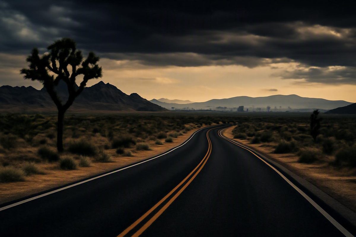
The drive from Joshua Tree to Las Vegas can be a straightforward transfer or a full desert sightseeing day. The difference depends on your exact starting point, your Las Vegas destination, the roads you choose, and whether you add viewpoints, access-road detours, or hikes.
For travelers leaving near Joshua Tree town, roughly four hours is a useful direct-drive baseline—not a promised arrival time. A route through Amboy, Kelso, the Cima area, and Mojave National Preserve may add relatively little wheel time on a map, but road checks, photography, walking, and long approaches to attractions can turn it into a much longer trip.
Decide first whether this is a transfer day or a sightseeing day. Then define the endpoints, check live routing and official road information, choose stops that fit your daylight and vehicle, and enter the remote section prepared to continue without fuel, charging, or dependable cellular coverage.
Start With the Right Distance and Drive-Time Estimate
For Joshua Tree town to Las Vegas, Rome2Rio lists a direct drive of 198.1 miles and 3 hours 51 minutes. It rounds the road distance elsewhere on the page to about 199 miles. Because the page contains inconsistent distance and price figures, use that estimate as a baseline rather than live navigation guidance (Rome2Rio’s Joshua Tree–Las Vegas comparison).
The estimate does not apply equally to every location described as “Joshua Tree.” Your starting point could be:
- Joshua Tree town
- A hotel or rental outside town
- The West Entrance to Joshua Tree National Park
- The North Entrance near Twentynine Palms
- The South Entrance near Interstate 10
- A campground, trailhead, or viewpoint inside the park
These origins are not interchangeable. If you spend the morning sightseeing inside the park, the drive to an exit belongs in your itinerary even when a generic route calculator does not display it clearly.
This endpoint issue explains why travelers sometimes see a much larger mileage figure. Travelmath calculates 229 miles from “Joshua Tree National Park” to Las Vegas, but it identifies Coachella as the origin city. That result reflects the calculator’s selected endpoint rather than a universal distance from every park entrance or trailhead (Travelmath’s park-based distance calculation).
Your Las Vegas endpoint matters too. A Strip resort, downtown hotel, airport rental facility, Henderson address, and Summerlin address can produce different final legs. Resort access, parking, congestion, and rental return procedures can also add time after the desert portion is over.
Before departure, enter your exact current location and exact destination into a current mapping service. Inspect the proposed route rather than relying only on its headline arrival time.
Keep these two time measurements separate:
- Wheel time: The time spent driving under the mapping service’s assumptions.
- Total travel time: Wheel time plus fuel or charging, meals, restrooms, congestion, photographs, access roads, parking, walking, and hikes.
A nominal four-hour route can become a five-hour travel day after ordinary stops. A scenic crossing can take most of a day when it includes a long attraction approach and a substantial walk.
Planning baseline
- Direct transfer: Begin with roughly four hours of wheel time from near Joshua Tree town, then add traffic and service buffers.
- Mojave sightseeing drive: Expect substantially more time for access roads, stops, walking, and possible rerouting.
- Park origin: Calculate from the actual trailhead, campground, visitor area, or exit.
- Arrival: Do not commit to a precise arrival until you have checked live routing, road conditions, weather, and your selected stops.
Choose Between a Direct Transfer and a Scenic Mojave Drive
There is no single route that suits every traveler. The practical choice is between two strategies:
- Efficient transfer: Follow the currently recommended paved route shown by a live mapping service after checking road and traffic information.
- Scenic Mojave itinerary: Deliberately travel through the Amboy and Mojave National Preserve corridor, accepting more time away from services and greater dependence on current road conditions.
Choose the direct option when reaching Las Vegas matters more than sightseeing. It is also the more conservative choice after a long morning in Joshua Tree, following a late departure, or when road and weather information is uncertain.
A scenic candidate, expressed as map-ready reference points in Joshua Tree-to-Las Vegas order, is:
Twentynine Palms or your relevant departure point → Amboy → Kelbaker Road → Kelso → the Cima area → Interstate 15 → Las Vegas
This is a traveler-reported corridor, not current official routing guidance. It does not establish that every connecting road is open, paved, or suitable for your vehicle.
In a Tripadvisor discussion, users estimated direct driving at about 3 hours 30 minutes to 3 hours 40 minutes. One user estimated approximately 4 hours 10 minutes for a Kelbaker Road itinerary that included travel toward the Kelso Dunes trailhead, before sightseeing. The same discussion placed a longer route through Hoover Dam, Kingman, Oatman, Laughlin, and Parker at roughly 6 to 7.5 hours before stops (Tripadvisor user route estimates).
Those user-generated estimates are planning ranges, not schedules. They can reflect different endpoints, speeds, routes, and road conditions. “Before stops” excludes photography, meals, facility visits, walks, and closure-related delays.
The Hoover Dam–Kingman–Oatman–Laughlin–Parker alternative is not a practical shortcut. It is an extended sightseeing circuit for travelers prepared to devote most or all of a day to driving and stops.
| Route strategy | Evidence-based baseline | Trip character | Typical stops | Service exposure | Principal tradeoff |
|---|---|---|---|---|---|
| Direct transfer | About 3.5–4 hours from near Joshua Tree town before meaningful stops | Transportation-focused | Necessary fuel, food, and restrooms | Depends on the live route; less intentional preserve exposure | Least sightseeing, but easiest to fit into a limited day |
| Mojave scenic route | One user estimated about 4 hours 10 minutes of wheel time, including travel toward Kelso Dunes but excluding sightseeing | Remote desert drive with optional landmarks and walks | Amboy, Kelso, dunes access, Cima-area scenery, Seven Magic Mountains | Significant time in an area without fuel, charging, or dependable cell service | More scenery, but road verification and disciplined timing are essential |
| Extended sightseeing route | User estimates of roughly 6–7.5 hours before stops | Full sightseeing day | Hoover Dam, Kingman, Oatman, Laughlin, Parker | Multiple long driving legs | Adds major destinations but leaves much less margin for delays |
Do not choose by mileage alone. Compare wheel time, road surface, services, daylight, closures, vehicle suitability, and the actual commitment required by each stop. A longer confirmed paved route may be more appropriate than a shorter line that depends on uncertain preserve roads.
Check Roads Before Committing to the Scenic Crossing
A Mojave crossing requires a fresh road check. An itinerary saved months ago—or even several days ago—cannot establish the current status of Kelbaker Road, Cima Road, or every connector needed for your stops.
Before leaving dependable internet service:
- Review the official Mojave National Preserve alerts.
- Open and save the official Mojave road-conditions page.
- Check the relevant state transportation systems for roads outside the preserve.
- Review current weather and hazard information.
- Save essential information for offline use.
A saved page records only what was posted when you downloaded it. Recheck close to departure whenever connectivity allows.
The National Park Service warns that navigation applications may direct passenger vehicles onto four-wheel-drive roads. It also advises visitors to save road information before entering and to confirm that the vehicle has a spare tire, jack, and emergency equipment.
For a standard passenger or rental car:
- Use only roads currently confirmed as suitable for that vehicle.
- Inspect the entire proposed route before starting navigation.
- Do not accept an apparent shortcut automatically.
- Recheck the next leg before leaving a confirmed paved road.
- Turn around while conditions permit if the surface differs materially from what you verified.
Keep the main scenic corridor separate from optional rough-road attractions. High clearance is recommended for Lava Tube access, while low-clearance vehicles should avoid specified unpaved portions of Black Canyon and Cedar Canyon roads. A site appearing close to your route on a map does not make its final approach sedan-friendly.
Rental-car users should review their agreement before using an unpaved road.
Older trip reports can generate ideas but cannot establish present conditions. For example, one forum discussion reported a Cima Road closure tied specifically to 2024. That report should not be treated as evidence that the road is closed now; it demonstrates why old itineraries need a fresh check.
Closure rule
If a key scenic road cannot be verified as open and suitable for your vehicle, abandon that scenic plan. Recalculate using currently confirmed paved highways rather than improvising a shortcut inside the preserve.
Missing a scenic stop is preferable to consuming fuel or battery reserve on an unsuitable road without cellular coverage.
Pick Stops by Their Real Time Cost
Compare stops by commitment, not popularity. A landmark beside the route may take only a few minutes. A trailhead reached by a long access road can consume nearly an hour before you start walking. A desert hike may add several hours and change your water, clothing, daylight, and contingency requirements.
Brief landmarks and photo stops
Amboy and Roy’s are recurring landmarks along the scenic corridor. Roy’s includes an old motel, café, gas-station, and auto-repair property, making it a recognizable roadside subject. That historical character does not establish that fuel, food, lodging, repairs, water, or restrooms are currently available.
Joshua tree viewing near the Cima area can provide a scenic focus without requiring a major hike. Choose the road and stopping point only after checking current access, road suitability, and a safe place to pull off.
Seven Magic Mountains can work as a final stop near the Las Vegas end of the trip. Its true time cost depends on current access, traffic, parking, direction of approach, and whether your final destination is the Strip, downtown, the airport, or an outer neighborhood.
Access-road detours
Some attractions appear “on the way” at a regional scale but require substantial driving away from the through route.
The National Park Service places Kelso Dunes 19 miles from Interstate 40 via Kelbaker Road, approximately 25 minutes each way. It places the Teutonia Peak trailhead 11 miles from Interstate 15 via Cima Road, approximately 15 minutes each way. These figures cover access driving—not parking, sightseeing, or hiking (NPS Mojave trip-planning guidance).
That distinction matters. Reaching the Kelso Dunes area can add nearly an hour of access driving before you step onto the sand. Teutonia Peak also requires an approach and return before the hike itself.
Kelso Depot can be a logical historic waypoint, but do not assume the building, visitor services, potable water, or restrooms are available. Verify current facility status before incorporating it into your service plan.
Substantial walks and hikes
Amboy Crater should be treated as a hiking destination rather than a quick photograph. One independent guide describes a four-mile out-and-back route with explanatory signs and shaded picnic tables. Road access, trail conditions, weather, parking, and facility status still require current verification (California Crossings’ Amboy Crater description).
Kelso Dunes is not a casual addition to a tightly timed transfer. Beyond the approach drive, movement on sand is slow and physically demanding. One preserve guide describes the return walk as approximately five kilometres and potentially a couple of hours. The same guide describes Teutonia Peak as approximately five kilometres return and around an hour, although individual pace and conditions vary (Time Travel Turtle’s Mojave guide).
Keep three different commitments separate:
- Seeing dunes from a distance is a viewpoint stop.
- Driving to the dunes parking area is an access-road detour.
- Walking meaningfully onto the dunes is a substantial activity.
Do not budget all three as though they were the same stop.
| Location | Stop type | Known access information | Activity commitment | Vehicle caveat | Facility caveat | Verify before departure |
|---|---|---|---|---|---|---|
| Amboy and Roy’s | Roadside landmark | On the Amboy corridor | Usually brief | Confirm approach roads and use an appropriate stopping area | Do not assume fuel, food, lodging, repairs, water, or restrooms | Road and property access; any claimed services |
| Amboy Crater | Hiking destination | Reached from the Amboy area | Four-mile out-and-back reported | Confirm the complete approach for your vehicle | Do not assume water or staffed facilities | Road, trail, weather, and parking |
| Kelso Depot | Historic waypoint | On some scenic itineraries | Brief exterior stop or longer visit if facilities are confirmed | Stay on verified roads | Building, water, restrooms, and visitor services may be unavailable | Facility and road status |
| Kelso Dunes | Access detour plus optional hike | 19 miles from I-40; about 25 minutes each way | Viewpoint, short walk, or multi-hour activity | Reject unverified shortcuts | Do not rely on trailhead services | Road, parking, weather, and alerts |
| Cima-area Joshua trees | Scenic drive or viewpoint | Exact location depends on the selected road | Flexible | Use roads suitable for the vehicle | Assume no services | Road status and a safe stopping place |
| Teutonia Peak | Access detour plus hike | 11 miles from I-15; about 15 minutes each way | Around an hour or longer for many travelers | Confirm Cima Road and trailhead access | Do not assume water or restrooms | Road, parking, weather, and trail conditions |
| Lava Tube | Rough-road attraction | Optional preserve detour | Variable | High clearance recommended | No services should be assumed | Road surface, access, weather, and vehicle suitability |
| Seven Magic Mountains | Landmark near Las Vegas | Added time depends on approach | Usually a focused final stop | Confirm access and parking | Do not build essential service plans around it | Access, restrictions, traffic, and parking |
A disciplined scenic itinerary combines one meaningful detour with one or two short landmarks. It does not attempt two substantial hikes plus every waypoint in the preserve.
Build an Itinerary Around the Hours You Actually Have
Begin with the hours you genuinely control. Subtract morning sightseeing in Joshua Tree, meals, rental deadlines, hotel obligations, and your preferred daylight cutoff. What remains is the usable travel window.
Direct-transfer plan
Choose this plan when you have little or no sightseeing margin.
- Enter your exact origin and destination into live navigation.
- Use a currently recommended paved route.
- Begin with approximately four hours of wheel time from near Joshua Tree town.
- Add a separate buffer for traffic and necessary services.
- Avoid preserve detours and remote attraction roads.
- Recalculate after any substantial delay.
A personal travel account illustrates the difference between mapped time and total travel time: a trip expected to take about 3.5 hours became a five-hour journey after stops, poor planning, and a final segment after dark (Luckey Alex’s Las Vegas–Joshua Tree account).
Light-scenic plan: roughly one or two extra hours
Use a modest amount of extra time for a limited set of landmarks or short viewpoints. Possible candidates include:
- Amboy
- An exterior look at Roy’s
- A confirmed Kelso waypoint
- A Cima-area viewpoint
- Seven Magic Mountains near Las Vegas
The goal is to retain some desert-drive character without committing to a long access road and hike. Calculate the route with your chosen waypoints, then add separate time for parking and photographs.
If one stop runs long, remove the next stop rather than consuming the daylight and contingency buffer.
Half-day scenic framework
A half-day itinerary may follow the Amboy–Kelbaker Road–Kelso–Cima corridor if every required road is currently confirmed open and suitable.
A practical framework is:
- Leave the Joshua Tree area with fuel or charge, food, water, and offline information already handled.
- Pause at one Amboy landmark.
- Continue toward Kelso on the verified route.
- Choose either a short Kelso-area stop or a Cima-area scenic focus.
- Join the currently appropriate route toward Interstate 15.
- Consider Seven Magic Mountains only if time, traffic, and daylight still support it.
- Continue to your exact Las Vegas destination.
“Half day” is not a fixed duration. Recalculate after selecting the origin, confirming roads, and deciding whether Kelso Dunes or Teutonia Peak is merely a waypoint or a physical activity.
Full-day framework
Reserve a full day if you want one substantial activity such as Amboy Crater or a meaningful walk at Kelso Dunes.
Use this calculation:
Wheel time + attraction access driving + parking + hike + service stops + delay reserve = realistic travel day
Access and hiking time do not disappear into the baseline drive. Kelso Dunes’ approach alone adds meaningful driving before the walk begins. Amboy Crater likewise deserves its own time block.
Avoid stacking multiple substantial hikes onto a remote transfer unless you have enough daylight, water, vehicle range, and contingency time. Two manageable hikes can create an inflexible day when combined with desert driving.
Extended sightseeing day
The Hoover Dam–Kingman–Oatman–Laughlin–Parker concept is a separate touring itinerary. User estimates of approximately 6 to 7.5 hours before stops make it a full sightseeing day, not a clever alternative to a four-hour transfer.
If those destinations are priorities, leave early, calculate each leg using current conditions, and treat Las Vegas arrival as the end of a long touring day.
When to consider an overnight
An overnight may be more realistic when:
- You are leaving Joshua Tree late.
- You plan extensive park sightseeing before departure.
- You want more than one substantial Mojave walk.
- A key road cannot be confirmed in advance.
- The itinerary would require prolonged driving on unfamiliar remote roads after dark.
- You have a fixed Las Vegas obligation with little tolerance for delay.
- Weather or vehicle range reduces your margin.
Use one decision rule throughout the day:
If delays would push an optional remote stop or unfamiliar preserve road beyond your daylight cutoff, skip the stop and recalculate.
The original itinerary is not a commitment. Change it when the conditions or available time change.
Plan Fuel, Charging, Water, Food, and Navigation
The National Park Service states that Mojave National Preserve has no gas stations or vehicle-charging stations. It also describes cellular service as minimal to nonexistent, including on paved roads. NPS recommends carrying food, water, a light source, weather-appropriate clothing, a spare tire, a jack, and emergency equipment (NPS preparation guidance).
Fuel, charging, navigation downloads, and communication planning therefore need to happen before the remote segment. Do not assume that a historic gas-station property, trailhead, or visitor facility will supply what you need.
Fuel and vehicle range
Enter the remote section with enough fuel for the planned route and a margin for a closure, missed turn, or retreat. A universal fraction of a tank is not useful because vehicles differ in tank size, fuel economy, load, and remaining range.
Before leaving, identify:
- The next verified fuel service on the selected route
- A backup that does not depend on the same preserve road remaining usable
- The distance between your position, stops, and those services
- The range needed if you abandon the scenic crossing
Do not name Roy’s, Kelso Depot, or another historic waypoint as your fuel plan unless current authoritative information confirms service.
Electric vehicles
An EV itinerary requires current, route-specific charger information. Confirm:
- Realistic range for the selected route
- Extra mileage created by attraction approaches
- Enough reserve for a closure or backtrack
- Current charger availability and compatibility
- A backup charger outside the preserve
The supplied evidence establishes that there are no chargers inside Mojave National Preserve. It does not support a universal charging itinerary for every EV. Build the plan around your vehicle and live network information.
Navigation
Download information before cellular coverage disappears. Save:
- An offline regional map, not only a narrow route strip
- Confirmed road junctions and attraction waypoints
- Your exact Las Vegas destination
- Current road conditions and park alerts
- Verified primary and backup services
- Emergency and rental-company contact information
A paper regional map is a useful backup when practical. It cannot show current closures, but it can preserve geographic context if an app loses data or proposes an unsuitable redirection.
Water and food
Carry enough water and food for the drive, planned activities, and a plausible delay. No single quantity suits every traveler, temperature, or itinerary. Driving through in a climate-controlled car is not equivalent to hiking on exposed sand.
Base the plan on:
- Number of travelers
- Current temperature and weather
- Length and difficulty of the activity
- Time away from verified services
- Possibility of delay or breakdown
- Individual health and hydration needs
Do not depend on Roy’s, Kelso Depot, or a trailhead for food, potable water, or restrooms unless current authoritative information confirms availability.
Vehicle and emergency checklist
Carry or confirm:
- Food and water
- A dependable light source
- Weather-appropriate clothing
- Offline navigation
- A paper map when practical
- A usable spare tire or the vehicle’s supplied puncture solution
- A compatible jack and necessary tools
- Basic emergency equipment
- A charged phone and charging cable
- Essential contact details saved offline
Rental-car users should locate the repair equipment before departure. For a broader preparation review, use this road-trip tire and emergency-gear checklist as a supplementary inspection prompt.
Remote-segment planning panel
- Departure fuel level or state of charge: ________
- Estimated range at remote-segment entry: ________
- Next verified fuel station or charger: ________
- Backup service: ________
- Offline regional map saved: Yes / No
- Road alerts and conditions saved: Yes / No
- Facility status checked: Yes / No
- Daylight cutoff for optional stops: ________
- Emergency contact plan: ________
- Someone outside the vehicle knows the route: Yes / No
If you cannot identify the next verified service and a workable backup, the scenic plan is not ready.
Make a Daylight, Weather, and Vehicle Decision
Driving after dark is not categorically safe or unsafe. Darkness does, however, increase the consequences of sparse services, poor cellular coverage, unfamiliar junctions, limited visibility, and a vehicle problem that is harder to assess.
Personal reports provide context rather than rules. One traveler described long dark stretches with few other vehicles while driving from Joshua Tree toward Las Vegas (Explore With Erin’s nighttime trip report).
For travelers unfamiliar with Mojave National Preserve, daylight is the conservative choice for optional scenic roads and sightseeing. That is a planning recommendation, not an official nighttime prohibition.
Before departure, check current:
- Weather warnings
- Flood and flash-flood information
- Fire and smoke alerts
- Wind warnings
- National Park Service alerts
- State road information
- Live traffic near Las Vegas
Never infer present conditions from an older travel report. Storm damage, maintenance, fire effects, and other restrictions can change a route after an itinerary is written.
Heat also changes the consequences of delay. A direct paved transfer and a substantial dune walk do not create the same exposure. If current conditions do not support a planned hike, convert it to a viewpoint stop or remove it.
Passenger-car decision checklist
Before taking a standard car onto a scenic itinerary:
- Verify the surface and status of every planned road.
- Confirm that attraction approaches suit the vehicle’s clearance and tires.
- Inspect the spare tire or puncture kit.
- Confirm that the jack and tools are present.
- Reject app-generated shortcuts onto unverified roads.
- Remove high-clearance attractions from a low-clearance plan.
- Preserve enough fuel or charge to reroute or backtrack.
- Review the rental agreement before using an unpaved road.
- Set a daylight cutoff for optional detours.
- Tell someone your route and expected arrival window.
Main-road suitability and attraction-access suitability are separate questions. Reaching the scenic corridor does not establish that your car can reach the Lava Tube or another rough-road site.
Late-departure contingency
If departure slips later than planned:
- Remove hikes.
- Remove remote access-road detours.
- Use currently confirmed paved roads.
- Recalculate from the actual departure time.
- Check traffic near your exact Las Vegas destination.
- Notify anyone expecting your arrival.
- Do not try to recover time by preserving the original sightseeing list.
A late start does not necessarily prevent the drive. It changes which version of the drive is sensible.
Route guidance is informational. It cannot replace current park alerts, state road information, weather warnings, vehicle limitations, rental terms, or personal judgment.
What to Know If You Are Not Driving
The supplied journey-planner evidence identifies no convenient direct public-transport connection between Joshua Tree and Las Vegas. The listed alternatives include:
- Driving the entire route
- Driving to Bloomington and taking a bus
- Taking local transit toward Palm Springs Airport and flying
- Driving toward Indio and combining multiple bus legs
Some nominally public-transport options still require an initial drive. Others involve multiple transfers and separate transportation at the destination. Door-to-door comparison is therefore more useful than headline travel time.
Rome2Rio labels driving as the cheapest listed option and a bus-plus-flight combination as the fastest. Its displayed distances, prices, and summaries are inconsistent in places, however, and schedules and fares are time-sensitive. Treat those labels as search prompts rather than booking conclusions.
When comparing options, include:
- Travel from your lodging or trailhead to the first station or airport
- Waiting and transfer time
- Baggage rules
- Rental-car pickup or return
- Transportation from the Las Vegas terminal to your destination
- The effect of delays on separate tickets
- Current operator schedules and fares
Verify schedules, fares, baggage policies, connections, and ground transportation directly with the relevant operators before booking.
Driving is the simplest option represented in the supplied evidence for travelers who also want to stop in Amboy or Mojave National Preserve. It is not necessarily the cheapest or fastest in every individual case once rental charges, parking, fuel, and one-way fees are considered.
Frequently Asked Questions About Driving From Joshua Tree to Las Vegas
How long is the drive from Joshua Tree to Las Vegas?
From near Joshua Tree town, allow approximately three and a half to four hours of wheel time before substantial stops, delays, or endpoint differences. Add separate time for traffic, fuel or charging, meals, restrooms, parking, and arrival logistics.
If you begin inside Joshua Tree National Park, calculate from your actual campground, trailhead, or park exit. A scenic Mojave itinerary will take longer once access roads and sightseeing are included.
Why do Joshua Tree-to-Las Vegas mileage estimates range from about 199 to 229 miles?
The calculations use different origins. Figures around 199 miles generally refer to Joshua Tree town. The 229-mile calculation uses a broader Joshua Tree National Park label and identifies Coachella as its selected origin city.
Joshua Tree town, the park entrances, and interior trailheads can produce materially different routes. Las Vegas endpoints also vary, so enter the exact origin and destination into a current mapping service.
Can I drive through Mojave National Preserve in a standard rental car?
Potentially, if every road in the itinerary is currently confirmed open and suitable for a standard passenger vehicle.
Do not assume all preserve roads or attraction approaches meet that standard. Navigation apps may suggest four-wheel-drive roads, high clearance is recommended for Lava Tube access, and low-clearance vehicles should avoid specified unpaved portions of Black Canyon and Cedar Canyon roads.
Review the rental agreement before using any unpaved road. If you cannot verify a road’s condition and suitability, remain on confirmed paved roads and recalculate.
Are there gas stations, EV chargers, or reliable cell service inside Mojave National Preserve?
No gas stations or vehicle-charging stations are available inside Mojave National Preserve, according to the National Park Service. Cellular service is minimal to nonexistent, including along paved roads.
Enter with ample fuel or charge, save maps and road information beforehand, and identify primary and backup services outside the remote section. Do not rely on historic properties or visitor facilities unless current authoritative information confirms the service you need.
Is Kelso Dunes a quick stop on the way to Las Vegas?
Not if you plan to reach the trailhead and walk on the dunes. The access drive is approximately 19 miles from Interstate 40 via Kelbaker Road and about 25 minutes each way before parking or walking.
Kelso Dunes belongs in a generously timed scenic itinerary rather than a tightly planned four-hour transfer.
The central choice is simple: treat Joshua Tree to Las Vegas as either a roughly four-hour transfer from near Joshua Tree town or a deliberately longer desert sightseeing day. Define the endpoints, select stops that fit your daylight and vehicle, enter Mojave with ample fuel or charge and offline information, and verify official road, weather, and facility conditions immediately before departure.