
U.S. Route 2: Driving the 2,575-Mile Highline Across Northern America
Route 2 is a genuine long-haul northern corridor, but it is best treated as two trips or two planning blocks, not as one seamless coast-to-coast line.
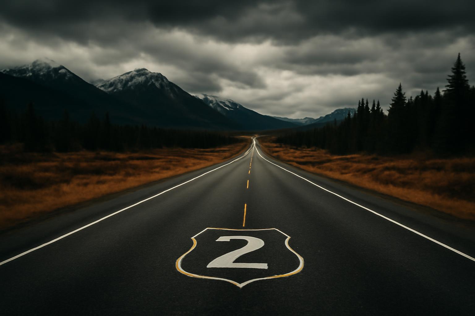
This guide covers U.S. Route 2 the highway, not local bus Route 2 services. As a road-trip route, it only makes sense once you stop expecting interstate logic from it. It is long, northern, useful, and scenic in flashes rather than nonstop spectacle. It is also not one continuous U.S. road from coast to coast: Canada splits it into two separate segments, and that break should shape how you plan the drive. (U.S. Route 2 route summary.)
For travelers, that is part of the appeal. Route 2 is less about stacking marquee attractions every hour and more about mountain passes, agricultural plains, lake country, working towns, and long stretches where preparation matters more than hype. If you want the practical version—what the route is, where it goes, what parts deserve time, and how to avoid planning it like an interstate—start there.
Overview of U.S. Route 2
U.S. Route 2 is commonly published at 2,575 miles across the northern continental United States, in two discontinuous segments separated by Canada: a western segment of about 2,115 miles from Everett, Washington, to St. Ignace, Michigan, and an eastern segment of about 459.5 miles from Rouses Point, New York, to Houlton, Maine (U.S. Route 2 route summary). The same standard summary also produces a small half-mile mismatch when the segment totals are added, so the cleanest way to use the figure is this: 2,575 miles is the standard published headline number, not a survey-grade exact total. (U.S. Route 2 route summary.)
The western segment crosses Washington, Idaho, Montana, North Dakota, Minnesota, Wisconsin, and Michigan; the eastern segment crosses New York, Vermont, New Hampshire, and Maine. The route is commonly described as the northernmost east-west U.S. highway, was established on November 11, 1926, is nicknamed “The Highline,” parallels the Great Northern Railway in places, and overlaps Adventure Cycling’s Northern Tier Bicycle Route for more than 600 miles. (U.S. Route 2 route summary.)
That overview matters because it gives you the right mental model before you plan anything else. Route 2 is a genuine long-haul northern corridor, but it is best treated as two trips or two planning blocks, not as one seamless coast-to-coast line. The much longer western run carries most of the mileage and most of the remoteness; the shorter eastern run is a northern New England connector with a different rhythm.
The “Highline” nickname fits the experience. Route 2 stays far north, often away from major interstates, and still feels tied to older transportation geography. In practical terms, that means mountain driving in Washington, long-distance planning in Montana and the northern plains, lake-country transitions in the upper Midwest, and northern small-town travel in New England.
If you want the cleanest comparison, think of Route 2 as a northern counterpart to the better-known transcontinental roads farther south: less continuous, less crowded, more dependent on weather and daylight, and more rewarding if you like the drive itself.
Western Segment: Everett WA to St. Ignace MI
The western segment is the backbone of Route 2. It begins in Everett, Washington, at I-5/SR 529, and runs about 2,115 miles to St. Ignace, Michigan, at I-75. Commonly published state mileages are Washington 325, Idaho 80, Montana 667, North Dakota 354, Minnesota 264, Wisconsin 120, and Michigan 305. As with the total-route figure, treat those as standard published numbers rather than flawless engineering totals. (U.S. Route 2 route summary.)
Washington is the section most travelers recognize first. Route 2 heads east through the Cascades by way of Stevens Pass, meets US 97 near Leavenworth, continues to Spokane, and then runs toward the Newport area near the Idaho line. That is why Washington deserves its own planning block instead of being treated as just the first leg of a much longer trip. Even before you reach the plains, this route has already asked you to think about grades, curves, daylight, and stop timing. (U.S. Route 2 route summary.)
Idaho is short on paper at about 80 miles, but it is not throwaway mileage. Route 2 crosses the Priest River area, follows the Pend Oreille River corridor toward Lake Pend Oreille, and overlaps US 95 from Sandpoint to Bonners Ferry. That matters for logistics: on a route built around long continuity, even a short state segment can still be a key refuel or regroup section. (U.S. Route 2 route summary.)
Montana is where the scale of Route 2 becomes real. At about 667 miles, it is the longest state segment by far, and that fact matters more than any single scenic-stop list. Long distances, changing weather, construction, and ordinary fatigue all become bigger planning variables once you are stringing together full northern-driving days. One of the most useful junctions is Shelby, where Route 2 meets I-15. (U.S. Route 2 route summary.)
North Dakota’s published mileage is about 354 miles, and the driving pattern changes again. The geometry can look simple on a map, but northern-plains driving creates its own problems: monotony, wind, and the temptation to keep extending the day because the road appears easy. Grand Forks, at I-29/US 81, is one of the best practical reset points on the entire corridor. (U.S. Route 2 route summary.)
Minnesota’s roughly 264 miles bring a transition many drivers welcome. The open-spaces rhythm starts giving way to more water, more trees, and more population clusters. Duluth, at I-35, is the obvious anchor because it works both as a service city and as a true change in the feel of the trip. (U.S. Route 2 route summary.)
Wisconsin is relatively brief at about 120 miles, but by that point the route is already in upper-Great-Lakes mode rather than western-long-haul mode. Michigan adds another 305 miles before Route 2 reaches St. Ignace at I-75, the natural finish to the western half. That endpoint matters because St. Ignace is not just another town on the route; it is the western segment’s clean logistical and symbolic stopping point. (U.S. Route 2 route summary.)
For planning purposes, the western run becomes much easier when you stop thinking county by county and start thinking in anchor towns:
- Everett/Monroe for the move out of metro traffic
- Leavenworth for Washington pass-country timing
- Spokane for a full-service junction reset at I-90/US 395
- Sandpoint or Bonners Ferry for northern Idaho practical stops
- Shelby for the Montana I-15 junction
- Grand Forks for plains resupply and lodging
- Duluth for upper-Midwest services and the I-35 junction
- St. Ignace for the western-segment finish
That is the right way to scale the trip. Route 2 stops feeling impossibly huge once it becomes a chain of dependable nodes.
Eastern Segment: Rouses Point NY to Houlton ME
The eastern segment begins at US 11 in Rouses Point, New York, near the Canadian border, and runs about 459.5 miles across northern Vermont, New Hampshire, and Maine before ending at US 1/I-95 in Houlton, Maine. (U.S. Route 2 route summary.)
This half is shorter and easier to underestimate. Its value is different: it connects northern New England through working towns, river valleys, forested approaches, and practical state-to-state movement.
In Vermont, Burlington is the major reference point because Route 2 meets I-89 and US 7 there. In New Hampshire, the key junction is Lancaster at US 3. In Maine, Houlton is the obvious logistical finish because US 1 and I-95 converge there. Those are the clearest route-planning anchors on the eastern run. (U.S. Route 2 route summary.)
Town transitions, weather, and ordinary two-lane rhythm matter more here than raw map distance suggests.
That makes this segment useful in three ways: as a standalone northern New England drive, as the eastern half of a broader Highline-style trip if you are independently bridging the Canada gap, or as a quieter alternative to the more famous and busier corridors farther south.
Scenic Highlights and Must-Stop Points
Washington gets most of Route 2’s scenic attention for good reason. Stevens Pass gives the route immediate visual credibility, but it also sets the tone for the whole highway: scenic first, efficient second. In an older Seattle-to-Leavenworth traveler discussion, posters consistently described US 2 over Stevens Pass as more scenic than I-90, but also slower, curvier, and better handled in daylight because of mountain grades and switchbacks (Seattle-to-Leavenworth Route 2 traveler discussion).
That is still the right mindset for the pass. If your only goal is to cover ground quickly, Route 2 can feel frustrating. If your goal is to make the drive part of the trip, Stevens Pass is one of the highway’s best arguments for itself.
The Seattle-to-Leavenworth stretch is also one of the few portions of U.S. Route 2 that works as a major through-highway and a realistic one-day outing at the same time. In that same traveler discussion, a round trip from Seattle was treated as doable in a day, with suggested stops including Lake Wenatchee, Cashmere, Roslyn, and Snoqualmie Falls depending on how you build a loop. Because that source is anecdotal and old, the best use for it is not exact timing but realistic expectations: same-day is possible, but scenic stops make the day fill quickly. (Seattle-to-Leavenworth Route 2 traveler discussion.)
Elsewhere on Route 2, the scenery is often less about one iconic viewpoint and more about changing corridor character. You feel the road move from Washington mountain country into northern Idaho river-and-lake territory, then into the scale of Montana, the open plains of North Dakota, the lake-country shift around Minnesota, and eventually the upper-Great-Lakes finish near St. Ignace. On the eastern segment, the pleasure is quieter: northern Vermont, northern New Hampshire, and Maine feel like connected country rather than headline scenery.
One of Route 2’s subtler strengths is thematic rather than photogenic. The road still carries traces of the older northern transportation corridor beneath it. The common “Highline” nickname, the route’s partial parallel to the Great Northern Railway, and its 600-plus-mile overlap with the Northern Tier Bicycle Route all reinforce that feeling. (U.S. Route 2 route summary.)
If you are building a stop list, keep it short. Route 2 usually rewards a few well-timed pauses more than a frantic attraction checklist. The natural candidates are:
- Stevens Pass approaches for mountain scenery and a clear change in road character
- Leavenworth as the best-known Washington base stop
- Lake Wenatchee area if your day allows a longer scenic pause
- Spokane as a practical urban break
- Duluth for the lake-country transition
- St. Ignace for the western-segment sense of arrival
Seasonal Conditions and Drive Timing
Route 2 does not require expedition driving, but it does punish lazy assumptions. It crosses enough latitude and enough terrain that you should treat it as a route where season, daylight, and current conditions matter every day, not just in obvious mountain sections. That general approach matches standard road-trip guidance to stay current on weather forecasts and road conditions before and during a drive. (AARP road-trip planning feature.)
The most common planning mistake is to assume the route behaves like an interstate because some long sections look simple on a map. It does not. Two-lane highways accumulate mental load faster. Passing takes more attention. Towns interrupt rhythm. Construction matters more. And the sections you most want to enjoy are often the sections least suited to rushed or after-dark driving.
Washington is the clearest example. Travelers in the Seattle-to-Leavenworth discussion described US 2 over Stevens Pass as scenic but slower and more demanding, with a daylight preference because of grades, curves, and switchbacks. Use that as a planning principle rather than as a fixed speed estimate: harder terrain deserves daylight margin. (Seattle-to-Leavenworth Route 2 traveler discussion.)
For trip timing, a realistic framework looks like this:
- Seattle to Leavenworth via US 2: workable as a same-day drive, including out-and-back, but much more comfortable with an early start and disciplined stops. (Seattle-to-Leavenworth Route 2 traveler discussion.)
- Washington across to Spokane: best treated as its own substantial driving day rather than casually added to a Seattle departure.
- The full western segment: better as a multi-week trip if you want to enjoy it, and still a serious undertaking even if you are mostly covering ground.
- The eastern segment: practical in a few days at an easy pace, or quicker if you are using it primarily as connective travel.
The fatigue rule is where many Route 2 plans fall apart. Once you start stacking repeated 500-mile days, you are planning an endurance exercise more than a pleasant road trip. (Road Listings tire and gear guide.)
Season by season, the route is best approached like this:
Spring: good shoulder-season potential, but variable. Higher or northern sections may still be dealing with late cold-weather issues even when lower stretches feel fine. Check current conditions before committing to long daily legs. (AARP road-trip planning feature.)
Long daylight can tempt you into overdriving the day, and lower-elevation western sections can still be hot enough that coolant, tires, and water deserve attention. Similar long western corridors routinely require heat planning in summer. (Road Listings tire and gear guide; US-93 route guide.)
Cooler temperatures help, traffic pressure can ease outside peak weekends, and scenery improves in several regions. The tradeoff is shorter daylight, which matters if you want to keep mountain driving out of darkness.
Winter: the season that most sharply separates flexible, well-prepared drivers from casual vacation planning. Route 2 stays far enough north that winter can become a defining variable across the western northern states and northern New England. If you are considering a cold-season trip, check current forecasts and road reports before each day instead of assuming yesterday’s conditions still apply. (AARP road-trip planning feature.)
The simplest operating workflow is plain: download offline maps before remote stretches, do harder terrain in daylight, and check current road and weather information before entering mountain or winter-sensitive sections. That is not glamorous advice, but it is exactly what keeps Route 2 enjoyable.
Fuel Stops, Intersections, and Logistics
On a route this long, the best fuel strategy is not “wait until the gauge gets low.” It is “treat the big junction towns as anchors, then manage the miles between them deliberately.” On the western segment, the most useful logistics nodes are Spokane at I-90/US 395, Shelby at I-15, Grand Forks at I-29/US 81, and Duluth at I-35. (U.S. Route 2 route summary.)
To make that advice more Route 2-specific, think of the western segment in layers. In Washington, major services become more predictable once you are clear of the pass country and approaching Spokane. In Montana, the challenge is less one dramatic no-service gap than the simple reality of sustained long distance. In North Dakota, Grand Forks is the obvious major reset. (U.S. Route 2 route summary.)
Between those anchors, a good planning habit is to think in 100- to 200-mile legs rather than in one giant day-long abstraction. (US-93 route guide.)
A few logistics rules matter more than any giant checklist:
- Refuel before mountain or sparse-service sections, not after.
- Know your next dependable fuel town before leaving the current one.
- Do not assume every marked roadside stop still has full services.
- Carry some cash, even if you mostly pay by card.
- Keep water in the vehicle instead of assuming a short breakdown wait.
For water, the long-road gear guide treats about half a gallon per person as adequate for a moderate-temperature car breakdown, while a full gallon per person per day is the bigger survival-rule framing; either way, the practical takeaway is the same: carry water before you think you need it. (Road Listings tire and gear guide.)
If you want a realistic benchmark for why this matters, the comparable US-93 guide notes that AAA response in rural Nevada can run 2 to 4 hours. That is not a Route 2 statistic, but it is a useful reminder of how ordinary mechanical problems feel different once you are on remote two-lane highways. (US-93 route guide.)
Route 2 logistics are not hard. They just reward older-school planning: tank, daylight, next town, backup plan.
Vehicle Preparation and Essential Gear
The best Route 2 prep is boring, and that is good news. You do not need an overland build or a cinematic emergency kit. You need a car in honest condition and a short list of items that matter when a normal highway problem happens far from home.
Start with tires. The most useful pre-trip guide here is Tires and Gear That Actually Matter on a Long Road Trip, and its core advice is simple: check all four tires and the spare cold, use the door-jamb pressure specification rather than the sidewall maximum, and remember that tire pressure typically reads 4 to 6 psi higher when warm. For tread, the quarter test is the practical borderline: if the top of Washington’s head is visible, you are around 4/32 inch and should think seriously about replacing the tire before a wet or mountainous trip. If a penny shows Lincoln’s head fully, you are at 2/32 inch, which is legally worn out. (Road Listings tire and gear guide.)
On Route 2 specifically, borderline tires are a bad bargain. Even if much of your trip is dry, this highway combines long distance with mountain sections and weather variability. That makes “one more season” logic less attractive than it might be for local driving.
After tires, check the ordinary fluids that become much less ordinary when neglected on a long trip:
- Engine oil, especially if you are within about 2,000 miles of a scheduled change
- Coolant, at the full-cold line
- Washer fluid, because highway bugs and spray use it faster than many drivers expect
Those are standard pre-departure checks for long drives, not overkill. (Road Listings tire and gear guide.)
Battery condition matters too. If the battery is three years old or more and has shown any slow cranking, testing it before departure is smarter than diagnosing it halfway through a long trip. (Road Listings tire and gear guide.)
What to carry is equally straightforward:
- tire inflator or 12V compressor
- jumper cables or, better for solo travel, a jump starter
- flashlight
- reflective triangles or flares
- basic tool kit and spare fuses
- water
- vehicle registration and proof of insurance kept physically in the car
That short list covers the most common, time-wasting failures without turning the trunk into a prop department. (Road Listings tire and gear guide.)
Just as important is what not to carry by default. The same guide argues against bloated packing lists: for a paved long-haul trip, you usually do not need a generator, a large expedition-style medical kit, an inverter for its own sake, or paper maps as your main navigation system if you already have reliable offline downloads. (Road Listings tire and gear guide.)
If you want the shortest useful Route 2 checklist, use this:
- Tires and spare checked cold
- Tread not borderline for wet or mountain travel
- Oil, coolant, and washer fluid topped off
- Battery tested if aging
- Inflator, jump help, flashlight, triangles, tools, and water packed
- Documents physically in the car
- Offline maps downloaded
- First fuel stop and backup fuel stop identified
For most drivers, that is enough.
Similar Northern Routes and Expansions
If Route 2 appeals to you, it usually means you like roads that sit between a pure scenic park drive and a pure transport corridor. A few other routes help define that niche.
That guide describes the drive as 540 miles, notes sparse fuel planning and intermittent cell coverage, and breaks it into practical legs rather than mythology. (US-93 route guide.)
The second is the Blue Ridge Parkway planning guide. It is almost the opposite of Route 2 in purpose, but similar in one crucial way: paper mileage tells you very little once curves, views, and stop frequency start dictating the day. The parkway runs 469 miles, has a 45 mph speed limit, allows no commercial traffic, and is realistically a 3- to 4-day drive minimum rather than a simple no-stop calculation. That is a good reminder that scenic mileage and practical mileage are two different things. (Blue Ridge Parkway planning guide.)
A third comparison is the US Highway 151 route guide. It is not a northern transcontinental route, but it is useful in style: a grounded highway guide focused on termini, cities, junctions, changing road types, toll notes, safety guidance, and official 511 resources rather than romanticizing the route. If you like Route 2 for its practical travel logic more than for its legend, that is a compatible kind of reading. (Road Listings homepage feature summary.)
That middle ground is exactly why people remember it.
How long is U.S. Route 2?
U.S. Route 2 is commonly listed at 2,575 miles total, split into two segments: about 2,115 miles from Everett, Washington, to St. Ignace, Michigan, and about 459.5 miles from Rouses Point, New York, to Houlton, Maine. Because the same standard summary produces a small mismatch when those segment figures are added, it is safest to use 2,575 miles as the published headline figure rather than as a mathematically exact total. (U.S. Route 2 route summary.)
Which states does Route 2 cross?
The western segment crosses Washington, Idaho, Montana, North Dakota, Minnesota, Wisconsin, and Michigan. The eastern segment crosses New York, Vermont, New Hampshire, and Maine. (U.S. Route 2 route summary.)
Is Stevens Pass on Route 2 scenic or challenging?
Both. Route 2 crosses Stevens Pass in Washington, and traveler accounts in the Seattle-to-Leavenworth discussion describe that section as more scenic than I-90 but also slower, curvier, and better handled in daylight because of grades and switchbacks. Treat it as a scenic mountain drive, not as the quickest way to cover miles. (U.S. Route 2 route summary; Seattle-to-Leavenworth Route 2 traveler discussion.)
What tire and gear prep for northern highways like Route 2?
Focus on basics that affect whether the trip goes smoothly: check tire pressure cold at the door-jamb spec, make sure tread is not borderline for wet or mountain travel, top off oil, coolant, and washer fluid, and test an older battery. Carry a tire inflator, jump help, flashlight, reflective triangles or flares, basic tools, water, and your vehicle documents. For most paved long-haul trips, skip oversized “just in case” cargo like generators and bulky expedition gear. (Road Listings tire and gear guide.)
Can you drive Seattle to Leavenworth on Route 2 in one day?
Yes. In the Seattle-to-Leavenworth traveler discussion, posters treated a same-day trip as doable, including an out-and-back from Seattle. The tradeoff is that US 2 over Stevens Pass is a scenic mountain road, so the plan works best if you start early, keep stops selective, and avoid expecting interstate pace. If you want a looser day with stops around Lake Wenatchee or Leavenworth itself, an overnight is easier. (Seattle-to-Leavenworth Route 2 traveler discussion.)
Route 2 is best when you respect what it actually is: a long northern highway with memorable mountain sections, practical junction towns, and just enough isolation to reward preparation. Plan around daylight and fuel anchors, prep the car before the remote miles start, and leave enough margin that the Highline feels like a drive rather than a chore.