
Plan a California Coast Drive Without Rushing Big Sur
Three days covers selected highlights, five balances a first trip, and seven lets Big Sur and the Central Coast breathe.
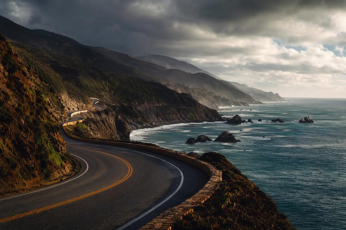
The Pacific Coast Highway works best as a flexible road trip, not a race between San Francisco and Los Angeles. Define the route, verify Highway 1 access before departure, choose a direction that fits your bookings, and leave enough time for the stops that make the coast worth driving.
Three days can cover selected highlights. Five days creates a balanced first trip. Seven days gives Big Sur and the Central Coast room to breathe.
What the Pacific Coast Highway Actually Refers To
For this guide, Pacific Coast Highway means California State Route 1, with detailed itinerary advice focused on the popular San Francisco-to-Los Angeles corridor.
That definition needs clarification because “Pacific Coast Highway,” “Highway 1,” “SR 1,” and “US 101” are often used as though they were interchangeable. They are not.
California State Route 1 is commonly reported as approximately 656 miles long, running between Interstate 5 near Dana Point and US 101 near Leggett. That measurement excludes some relinquished or otherwise non-state-maintained portions. The route also has gaps and concurrencies with US 101 rather than functioning as one administratively continuous, state-maintained highway from end to end. The detailed SR 1 route summary explains the listed length, termini, overlaps, and locally maintained sections.
“Pacific Coast Highway” is not the official name of the entire route. Depending on the section, travelers may encounter names including Pacific Coast Highway, Cabrillo Highway, Coast Highway, and Shoreline Highway. Signs, addresses, tourism guides, and navigation apps can therefore use different names for related stretches of road.
| Term | What it usually means | Planning implication |
|---|---|---|
| California State Route 1 / SR 1 | The designated California state route between the Dana Point area and Leggett, including official gaps, overlaps, and locally maintained portions | Use this term when discussing the formal California route |
| Highway 1 | The common conversational name for SR 1 | Usually refers to the same route, but confirm the exact segment |
| Pacific Coast Highway / PCH | An official or common name for portions of SR 1, especially in Southern California; also a loose tourism label | Do not assume every road described as PCH is formally named that way |
| US 101 | A separate federal highway that overlaps SR 1 in places and provides an inland or coastal alternative elsewhere | It may form part of a detour or broader coast trip, but it is not another name for Highway 1 |
| Pacific Coast road trip | An informal itinerary that may combine roads in California, Oregon, and Washington | Check the highways and endpoints included by the author |
A San Francisco-to-Los Angeles coastal itinerary is not the full length of SR 1. Likewise, a route advertised as roughly 1,600 to 1,650 miles is generally a broader tourism concept combining US 101, California Highway 1, and other roads through Washington, Oregon, and California. One such guide describes a 1,650-mile trip beginning near Port Townsend and following US 101 before joining Highway 1 near Leggett; that is a multistate itinerary, not a single officially named highway. Road Trip USA illustrates this broader use of “Pacific Coast Highway”.
For practical planning, enter individual overnight towns and attractions into your navigation app instead of searching only for “Pacific Coast Highway.” That reduces the chance of receiving a route that shifts inland, misunderstands a local road name, or directs you toward an inaccessible section.
Check Highway 1 and Big Sur Conditions Before Committing to the Route
Conditions checked on: not verified in the supplied record. Article reviewed September 5, 2026. This guide makes no claim that Highway 1 is currently open or closed through Big Sur. Obtain a current result from an official Caltrans road-status channel before relying on the route.
Highway 1 access through Big Sur can change because of landslides, erosion, storms, construction, traffic controls, and repair work. A travel article—even a recently updated one—cannot establish whether the road will be passable when you arrive.
Check Caltrans QuickMap or another official Caltrans road-status channel immediately before departure and again on the morning you enter Big Sur. If conditions are unsettled, recheck before leaving your overnight base. An RV-oriented route guide also directs travelers to Caltrans QuickMap because landslides and storm damage can periodically affect Highway 1 through Big Sur. Harvest Hosts summarizes that recurring closure risk and the need for a current Caltrans check.
A highway shown as open may still have:
- One-way traffic control
- Construction delays
- Temporary restrictions
- Closed or crowded pullouts
- Inaccessible trailheads
- Closed campgrounds or park facilities
- Canceled tours
- Separate reservation requirements
- Weather-related parking or trail limitations
Road status and attraction status are separate questions. Through traffic might be possible while a waterfall overlook, lighthouse tour, beach access road, campground, or park trail remains unavailable. Verify every high-priority stop through the relevant park, attraction, or operator before building the day around it.
Historical reopening reports require particular caution. Travel blogs reported that the Big Sur coast reopened to through travel in January 2026, but those reports describe one point in time and do not establish current access. One itinerary carrying that report also directs readers to check a current conditions page. The January 2026 reopening statement is explicitly time-sensitive.
If an official road-status source shows a closure, identify four things before changing the entire trip:
- The exact northern closure point
- The exact southern closure point
- Which planned stops remain legally reachable from each side
- Whether through travel is possible or an inland transfer is necessary
A Big Sur closure does not always make every attraction inaccessible. Northern stops may remain reachable from Carmel, while southern stops may remain reachable from Cambria or San Simeon. A closure between those areas can nevertheless prevent a continuous coastal drive.
Do not rely on an old blog’s fixed detour time. The appropriate alternative depends on the closure location, current restrictions, traffic, weather, and vehicle. Recalculate the trip using current official information and your actual overnight addresses.
A practical closure-response plan is to:
- Keep Monterey or Carmel as the northern base.
- Determine how far south you may legally travel and return.
- Retain Cambria, San Simeon, or Morro Bay as the southern base if reachable.
- Approach southern attractions from that side.
- Use an inland route only after confirming its current status and suitability.
- Remove lower-priority stops rather than forcing the original itinerary into fewer hours.
Treat a closure as an itinerary change, not a small delay. It may turn one continuous Big Sur day into two out-and-back visits separated by an inland transfer. Flexible hotel terms and a manageable number of fixed reservations can limit the disruption.
Southbound or Northbound: Choose the Direction That Fits the Trip
Southbound is the recurring practical preference for a San Francisco-to-Los Angeles drive. The Pacific is generally on the passenger side, and many ocean-side viewpoints can be approached without crossing opposing traffic. Several experienced route guides recommend this direction for its view orientation and pullout convenience. California Crossings explains the practical case for a southbound itinerary.
That does not prove southbound is universally better or safer. Some travelers also feel less comfortable sitting on the ocean-facing side of a cliff road, while others strongly prefer the clearer view.
Northbound may be the better choice when it produces simpler flights, a suitable rental car, better lodging dates, or preferred start and end cities. The principal destinations remain available in either direction, subject to current closures and legal access.
| Factor | Southbound | Northbound |
|---|---|---|
| View orientation | Ocean generally on the passenger side | Ocean generally across the opposite lane |
| Coastal pullouts | Many ocean-side pullouts can be entered with a right turn | Some stops may require crossing traffic or continuing to an appropriate turnaround |
| Rental logistics | Fits a San Francisco pickup and Los Angeles return | Fits a Los Angeles pickup and San Francisco return |
| Starting airports | Works naturally with a Bay Area arrival | Works naturally with a Los Angeles-area arrival |
| Itinerary flexibility | Follows the common San Francisco–Monterey–Big Sur–Central Coast–Los Angeles sequence | Works equally well when bookings or transport favor the reverse order |
| Best reason to choose it | View orientation and pullout convenience | Better flights, vehicles, lodging, or endpoints |
Choose the direction before booking scarce Big Sur-area accommodations. Once a night in Big Sur, Carmel, Cambria, or San Simeon is fixed, it becomes the anchor for the surrounding days.
If a one-way rental is impractical, compare it with a round trip using Highway 1 in one direction and US 101 for the return, subject to current road conditions. Compare the complete cost and schedule rather than assuming either arrangement will always be cheaper.
If you miss a viewpoint, continue to an appropriate place to turn around rather than making a sudden maneuver. No single photo stop is important enough to justify an unpredictable move on a winding road.
How Many Days to Allow: Three-, Five-, and Seven-Day Plans
A map’s nonstop estimate answers the wrong question. It measures movement between endpoints, not a road trip with parking searches, viewpoints, meals, short walks, traffic, construction, and possible rerouting.
One route guide estimates about ten hours of uninterrupted driving for its selected 479-mile San Francisco-to-Los Angeles route, then spreads the journey over six days. The useful lesson is the contrast: base driving time is not sightseeing time. Its itinerary shows how coastal stops turn a nominally short drive into a multi-day trip.
Do not plan by mileage alone. Recalculate each leg against:
- Current closures and traffic controls
- The exact location of your accommodation
- Check-in and parking arrangements
- Available daylight
- Reserved attraction times
- The number and length of walks
- Your tolerance for winding-road driving
- Urban traffic near Los Angeles or San Francisco
Three days: a compressed highlights trip
This plan works only if through access is confirmed and you accept that many stops must be omitted.
| Day | Route and overnight base | Priorities | Omit first if the day runs long |
|---|---|---|---|
| Day 1 | San Francisco to Monterey or Carmel | Half Moon Bay, one Santa Cruz stop, evening in Monterey or Carmel | Secondary beaches, extensive city sightseeing, multiple Santa Cruz attractions |
| Day 2 | Monterey or Carmel through Big Sur to San Simeon or Cambria | Point Lobos or Carmel, Bixby Creek Bridge, one Pfeiffer-area or McWay Falls-area stop if accessible | Extra trails, extended meals, repeated viewpoints |
| Day 3 | Cambria or San Simeon to Los Angeles | One Central Coast stop, Santa Barbara, Malibu or Santa Monica | Exploring Morro Bay, San Luis Obispo, Santa Barbara, Malibu, and Los Angeles in depth |
This follows the broad three-day sequence used by published itineraries: San Francisco to Monterey, Monterey to San Simeon, and San Simeon to Los Angeles. Weather on the Way presents that compressed structure while noting Big Sur’s sparse fuel options and seasonal variability.
The third day is especially easy to overload. Choose Morro Bay or the San Luis Obispo area rather than attempting both in depth. Treat Santa Barbara as a focused meal and walk, then decide before entering Los Angeles whether Malibu or Santa Monica matters more.
Three days provides coverage, not completeness. If through travel is unavailable, this structure may cease to be practical.
Five days: the balanced plan
Five days gives each major geographic section a purpose without requiring an extended vacation.
| Day | Route and overnight base | Priorities | Omit first if the day runs long |
|---|---|---|---|
| Day 1 | San Francisco to Santa Cruz or Monterey | Half Moon Bay, one coastal park or beach stop, Santa Cruz waterfront | Multiple short beach stops with similar experiences |
| Day 2 | Monterey and Carmel; overnight in either town | Cannery Row and aquarium area, Carmel-by-the-Sea, Point Lobos | A long scenic detour or second major ticketed attraction |
| Day 3 | Carmel through Big Sur to Cambria or San Simeon | Bixby Creek Bridge, one Pfeiffer-area stop, designated overlooks | Extra hikes, informal roadside stops, a distant dinner reservation |
| Day 4 | Cambria or San Simeon through Morro Bay or San Luis Obispo to Santa Barbara | Piedras Blancas, one Central Coast town, Santa Barbara | Extensive visits to both Morro Bay and San Luis Obispo |
| Day 5 | Santa Barbara to Los Angeles | Santa Barbara morning, Malibu, Santa Monica or another chosen endpoint | Multiple Malibu beaches and a full Los Angeles sightseeing schedule |
This is a strong starting point for many first-time visitors. It creates a dedicated Monterey–Carmel day, protects Big Sur from becoming only a transit leg, and reaches Los Angeles without adding unnecessary hotel changes.
Travelers who value walking and wildlife more than urban stops can stay in Monterey on the first night and use the saved time around Point Lobos or the aquarium area. Those prioritizing Santa Barbara should leave the Central Coast earlier on day four.
Seven days: a slower coastal trip
Seven days allows more time for weather, photography, longer meals, and meaningful walks.
| Day | Route and overnight base | Priorities | Omit first if the day runs long |
|---|---|---|---|
| Day 1 | San Francisco to Half Moon Bay or Santa Cruz | Coastal departure, one beach or lighthouse-area stop, relaxed arrival | A late start followed by several coastal stops |
| Day 2 | Santa Cruz to Monterey | Santa Cruz, Monterey waterfront, Cannery Row | Adding Carmel and Point Lobos late in the day |
| Day 3 | Monterey and Carmel | Aquarium area, Carmel-by-the-Sea, Point Lobos | An additional distant excursion |
| Day 4 | Carmel to Big Sur-area lodging, or continue to Cambria | Bixby Creek Bridge, Point Sur area, one longer park visit | Repeated viewpoints offering similar scenery |
| Day 5 | Big Sur or southern Big Sur to Cambria, San Simeon, or Morro Bay | McWay Falls-area access if available, designated viewpoints, Piedras Blancas | A tightly timed tour that pressures the entire day |
| Day 6 | Central Coast to Santa Barbara | Morro Bay or San Luis Obispo, relaxed Santa Barbara arrival | Visiting every Central Coast town |
| Day 7 | Santa Barbara to Los Angeles | Santa Barbara, Malibu, Santa Monica or another endpoint | A full Malibu beach circuit plus extensive Los Angeles sightseeing |
The main benefit is not merely seeing more places. It is being able to stay longer. Fog, full parking areas, wildlife activity, or a delayed meal can be absorbed without making the whole day feel late.
Changing hotels every night maximizes geographic coverage but consumes time. Packing, checking out, retrieving the car, finding the next property, parking, and checking in can displace the walk or sunset stop that justified the trip. On a seven-day plan, consider two nights in Monterey or Carmel and another two-night stay on the Central Coast or in Santa Barbara.
The Stops Worth Building the Schedule Around
There is no universal ranking of Pacific Coast Highway stops. A family prioritizing the aquarium will plan differently from a photographer, a wildlife watcher, or a traveler seeking short walks and quiet towns. Organizing stops geographically is more useful than calling every popular location essential.
San Francisco to Monterey
Half Moon Bay is a natural first pause after leaving San Francisco. It works for a beach walk, coffee, or a reset before continuing down the coast. On a short itinerary, select one stop rather than trying to cover several nearby beaches.
Santa Cruz can be a brief waterfront break or an overnight destination. The boardwalk area offers an energetic contrast to quieter sections of the coast, while shoreline stops support a slower nature-oriented day.
Monterey deserves time beyond a fuel stop. Cannery Row and the aquarium area provide convenient anchors for walking, food, and a major indoor attraction. Confirm admission requirements, hours, and parking before structuring the day around the aquarium.
Carmel-by-the-Sea is compact enough for a meal and walk but can occupy half a day when combined with the beach or galleries. Its proximity to Monterey makes the two towns practical as one lodging base.
Carmel and Big Sur
Point Lobos is a strong candidate for dedicated walking time near Carmel. Treat it as a park visit rather than a roadside pullout: parking, capacity, trail conditions, and operating rules can materially affect the schedule.
Bixby Creek Bridge is a classic photo stop and can be crowded. Use designated parking areas; if no suitable space is available, continue to another viewpoint. A personal travel account that recommends the bridge and other Big Sur stops also emphasizes the convenience of established southbound pullouts. Shoot from the Trip describes that southbound experience and the route’s designated viewpoints.
Point Sur adds a lighthouse focal point and a different coastal landscape. Tour schedules may be limited or affected by conditions, so do not build the day around an old timetable.
Pfeiffer-area stops can refer to different parks, beaches, trails, and access roads. Enter the complete destination name into your map. A vague instruction to “go to Pfeiffer” can send you somewhere other than the intended location.
McWay Falls is associated with Julia Pfeiffer Burns State Park, but viewing access can change during repairs. A 2026 travel account reported restrictions affecting the customary overlook route, illustrating why historic trail descriptions should not be treated as current access information.
Designated coastal viewpoints are usually more useful than a long checklist of named pullouts. Select those with clear entrances and established parking. If one is full, preserve the schedule and continue.
San Simeon and the Central Coast
Piedras Blancas near San Simeon is commonly recommended for elephant-seal viewing. November through March is reported as the main activity season, but wildlife presence, numbers, and behavior cannot be guaranteed for a particular date. The same travel account describes established viewing areas as free, open daily, and wheelchair accessible; those details are not a current accessibility guarantee and should be verified before reliance. Its Piedras Blancas description includes the seasonal pattern and viewing-area guidance.
Confirm current parking, path surfaces, restroom availability, platform conditions, and temporary restrictions. Remain within established visitor areas and follow posted wildlife instructions.
Hearst Castle should be treated as a possible reserved attraction rather than a spontaneous pullout. If it is important, confirm the current tour calendar and choose a realistic arrival window. Avoid placing an inflexible reservation too close to an unpredictable Big Sur drive.
Cambria is a practical overnight base with food and lodging outside the most isolated part of Big Sur. It also allows travelers to approach southern attractions without requiring a remote overnight.
Morro Bay offers a waterfront break and a landscape distinct from Big Sur. It works as an overnight base or a focused meal-and-walk stop.
San Luis Obispo provides broader services and an inland-leaning alternative to a small coastal town. Choose it when hotel, restaurant, or transport convenience matters more than sleeping beside the water.
Santa Barbara to Los Angeles
Santa Barbara can support anything from a lunch stop to two nights. Its central areas and waterfront make it possible to enjoy the city without designing an elaborate driving circuit.
Malibu is better treated as a corridor with selected stops than as a single attraction. Choose one beach, viewpoint, or meal in advance. Attempting to visit every named beach can turn the day into repeated parking searches.
Santa Monica is a flexible urban endpoint, especially when the hotel or rental return is on the west side of Los Angeles. It can also serve as the beginning of a northbound itinerary. If the final destination lies elsewhere in the metropolitan area, include the remaining city drive in the plan.
A practical prioritization framework is:
- One major stop between San Francisco and Santa Cruz
- One full Monterey or Carmel activity
- One longer walk near Carmel or Big Sur
- Three or four designated Big Sur viewpoints
- One San Simeon attraction
- One Central Coast town
- One Santa Barbara activity
- One Malibu or Santa Monica endpoint
Everything else is optional. This structure preserves variety without turning the trip into continuous parking and departure.
Big Sur Logistics: Fuel, Food, Lodging, Maps, and Pullouts
Big Sur is the route’s most demanding planning segment. Parts of Highway 1 are narrow, curving, and two-lane, with limited shoulders. Services are less frequent than in the towns on either side, mobile reception can be weak or absent, and access can change.
Fuel before the remote stretch
Southbound travelers should refuel around Monterey or Carmel instead of depending on a preferred remote station being open. Northbound travelers can use the same principle around Cambria or San Simeon, depending on their vehicle’s range and currently available services.
Remote fuel may be available, but hours, payment systems, and availability can change. The objective is not to identify the final possible station; it is to avoid needing the final possible station.
Carry food and water
Bring enough water and simple snacks to absorb a delayed meal. A restaurant may be busy, closed, outside mobile coverage, or farther away than expected.
Use established recreation or dining areas rather than assuming every roadside pullout is appropriate for a long break. Follow posted restrictions and remove all waste.
Save essential information offline
Before entering Big Sur, save or screenshot:
- Your route and a possible inland alternative
- Hotel or campground address
- Check-in instructions
- Reservation confirmations
- Attraction names and addresses
- Important phone numbers
- Insurance information
- Roadside-assistance details
- The latest road-status information
- A list of towns on either side of the remote section
Download offline maps, but remember that a downloaded route may not reflect a closure announced afterward. Commercial connectivity guidance acknowledges patchy or absent service in remote areas and recommends saving maps, addresses, and lodging information offline. Jetpac’s itinerary supports that offline preparation while acknowledging coverage gaps.
No carrier or eSIM should be treated as reliable throughout the corridor. Offline navigation is a backup, not a live road-status system.
Reserve the difficult nights first
Rooms and campgrounds can be competitive during summer, weekends, and holidays, although booking windows and cancellation terms vary.
If Big Sur lodging is unavailable or unsuitable, use Carmel, Monterey, Cambria, or San Simeon as a base. Each option changes the amount of backtracking and same-day driving, but none requires forcing an impractical overnight.
Book in this order:
- Big Sur or adjacent overnight
- Any essential reserved attraction
- One-way rental car
- Remaining hotels
- Restaurants that genuinely require advance booking
This prevents a low-priority reservation from controlling the entire route.
Protect the daylight
Build substantial slack into the Big Sur day. Slow traffic, temporary controls, full parking areas, short walks, and changing access can consume time unexpectedly.
Plan to complete unfamiliar winding sections in daylight when practical. If the day falls behind, remove a viewpoint or shorten a meal instead of preserving every planned stop at the expense of a very late arrival.
Verify volatile details
Fees, parking rules, tour schedules, reservation systems, trail access, and opening hours are not durable travel facts. Verify them directly for every attraction that would be disappointing to miss, particularly:
- Point Lobos access and parking
- Point Sur tours
- Pfeiffer-area roads and parks
- McWay Falls viewing access
- Campgrounds
- Hearst Castle tours
- Aquarium admission
- Beach warnings
- Accessibility features
Distinguish between anchors and possibilities. An anchor has verified access and enough time assigned. A possibility is added only if conditions, parking, and energy allow.
When to Go: Seasonal Tradeoffs Instead of a Single Best Month
There is no universally best season for the Pacific Coast Highway. The practical choice depends on your tolerance for crowds, fog, rain, prices, limited daylight, and road-disruption risk.
Spring
Travel sources commonly associate spring with mild conditions, green hills, and wildflowers. It can offer a useful balance between scenery and demand, but daily weather and access still vary. Wet-season road or trail damage may remain after a storm has passed.
Pack for cool wind and rain as well as sun. Use a recent forecast rather than relying only on monthly averages.
Summer
Summer provides longer days, which are valuable on a route built around outdoor stops. The tradeoff is generally heavier demand, busier coastal towns, crowded viewpoints, and potentially higher lodging prices. A weather-routing guide characterizes summer as peak season with longer days, larger crowds, and higher prices while emphasizing the coast’s variable conditions. Its seasonal overview also notes the route’s microclimates.
Long daylight does not eliminate fog. One location may be gray and cool while another section is sunny. Instead of waiting indefinitely for a viewpoint to clear, continue with the itinerary and use the remaining daylight as flexibility.
Early fall
Early fall is frequently recommended as a balance between weather and crowds, but clear skies are never guaranteed. Inland heat can also contrast sharply with a cool coast.
Weekdays may be easier to plan than weekends, but “shoulder season” should not be interpreted as “no reservations required.”
Winter
Winter can bring quieter roads and lower demand, but it also carries greater exposure to rain, storm effects, reduced daylight, and landslide-related disruption.
Do not build a winter trip around the assumption that every road section, trail, and campground will remain accessible. Review cancellation terms and maintain a workable inland alternative.
Weather can change within the same day
Coastal microclimates can produce fog, sun, wind, and temperature changes over a relatively short drive. San Francisco departure weather does not predict Big Sur, and a sunny lunch stop does not guarantee a clear evening in Santa Barbara.
Pack layers that can be added or removed quickly, with a wind-resistant outer layer kept accessible. A convertible is optional rather than automatically ideal; an open cabin can be cold, windy, and noisy.
Wildlife follows seasonal patterns rather than a visitor schedule. Piedras Blancas may show greater elephant-seal activity during the broadly reported November-to-March main season, but no itinerary can guarantee sightings or behavior on a particular date.
Check both weather and road status close to departure. A favorable forecast does not establish road access, and an open road does not guarantee clear visibility.
Vehicle Fit, Driving Difficulty, and a Practical Departure Checklist
Four-wheel drive is not presented here as a requirement, and a convertible is a preference rather than a necessary upgrade.
Smaller vehicles may feel easier to manage on curving sections and in compact parking areas, but familiarity matters more than novelty. Before leaving a rental facility, locate the lights, wipers, parking brake, fuel-door release, mirror controls, and driver-assistance settings.
Camper vans and RVs
Camper vans and motorhomes may be able to travel the route when current restrictions, vehicle dimensions, and driver capability permit. Large RVs and long trailers require more careful route evaluation.
An RV travel guide warns that vehicles over 30 feet may find the Carmel-to-San Simeon section stressful because of narrow sections, tight turns, grades, and pullouts favoring shorter vehicles. That figure is travel guidance, not a universal legal limit or proof that every shorter rig is suitable. Harvest Hosts gives the qualified over-30-foot warning and recommends vehicle-specific routing.
Do not infer legal permission or route suitability from a generic length threshold. Check current restrictions for the specific vehicle and route. Consider total length, trailer tracking, height, weight, temporary controls, weather, and driver experience.
US 101 may be a practical alternative for a larger vehicle or a disrupted coastal segment, but do not assume every connector between US 101 and Highway 1 is appropriate for a particular rig. Confirm the complete route using current, vehicle-specific information.
Departure checklist
Road and weather
- Check an official Caltrans road-status channel.
- Review the weather for each major leg, not only the departure city.
- Recheck conditions before entering Big Sur.
- Identify exact closure points if any are reported.
- Save a current inland alternative.
Vehicle
- Check tire pressure and visible tire condition.
- Confirm the required fuel type.
- Refuel before remote sections.
- Check for warning lights and obvious fluid or lighting problems.
- Confirm whether the vehicle has a spare tire or repair kit.
- Save the rental company’s roadside-assistance procedure.
- Adjust mirrors and seating before entering traffic.
For broader preparation beyond this route, Road Listings’ long-drive tire and gear guide offers a general vehicle-check framework. It is not evidence of current Highway 1 conditions or vehicle suitability.
Navigation and documents
- Download offline maps.
- Save lodging addresses and check-in details.
- Store insurance and roadside-assistance information offline.
- Carry required identification and vehicle documents.
- Keep a charging cable and power source accessible.
- Write down essential phone numbers if every other copy depends on one device.
Food and comfort
- Carry water and snacks.
- Pack layers for fog, wind, and temperature changes.
- Keep necessary medication readily available.
- Carry sun protection even when the morning is overcast.
- Avoid burying frequently needed items beneath all the luggage.
Bookings
- Confirm lodging dates and check-in deadlines.
- Verify campground reservations.
- Recheck attraction hours and tour times.
- Confirm parking instructions.
- Review cancellation terms if weather or access appears uncertain.
Schedule
- Leave slack around Big Sur.
- Avoid stacking several timed reservations into one coastal day.
- Decide in advance which stops are expendable.
- Plan the overnight base before committing to late-day activities.
- Treat the Los Angeles approach as a traffic-sensitive leg.
Use established parking areas and designated viewpoints. Follow posted beach warnings and wildlife-site instructions, and do not depend on cellular service as the sole basis of navigation or emergency planning.
Pacific Coast Highway FAQs
Is the Pacific Coast Highway open through Big Sur right now?
This article does not establish current open-or-closed status. Check Caltrans QuickMap or another official Caltrans road-status channel immediately before departure and again on the day you enter Big Sur.
Look for exact closure points, one-way controls, construction, and restrictions. A January 2026 reopening report is historical and does not prove present access. Even when through traffic is possible, trails, parks, campgrounds, tours, and pullouts require separate verification.
How many days do I need to drive from San Francisco to Los Angeles?
Allow three days for a compressed highlights trip, five days for a balanced trip, or seven days for a slower trip. These are planning recommendations rather than guaranteed schedules; published sources range from compressed three-day outlines to slower six-, seven-, and ten-day itineraries.
Three days requires strict prioritization and confirmed through access. Five days suits many first-time travelers. Seven days provides more flexibility for walks, weather, parking delays, and unplanned stops.
Should I drive the Pacific Coast Highway southbound or northbound?
Southbound is often preferred because the ocean is generally on the passenger side and many coastal pullouts are easier to approach without crossing opposing traffic. It is a practical preference, not a universal safety rule.
Choose northbound if it produces better flights, rental arrangements, lodging availability, or endpoints. The major destinations remain available in either direction, subject to current closures and legal access.
Where does California State Route 1 begin and end?
California State Route 1 is commonly reported as approximately 656 miles between Interstate 5 near Dana Point and US 101 near Leggett. Its listed length excludes some relinquished or otherwise non-state-maintained portions, and it includes overlaps with US 101 rather than forming one continuously state-maintained road.
Can a large RV drive Highway 1 through Big Sur?
Possibly, but suitability depends on the rig, current restrictions, weather, traffic controls, and driver experience. Large motorhomes and long trailers may find the Carmel-to-San Simeon corridor stressful because of curving sections, grades, road width, and compact pullouts.
Do not treat a generic length cutoff as either a legal prohibition or a guarantee of suitability. Check current restrictions and use vehicle-specific routing. US 101 may be a more practical alternative for some vehicles or disrupted segments, with Highway 1 side trips added only where current conditions and the vehicle permit.
The most workable Pacific Coast Highway trip is not the itinerary with the most pins. It is the one matched to current access, available days, vehicle, and tolerance for slow coastal driving. Immediately before departure, verify Caltrans conditions, weather, reservations, and individual attraction access—then protect enough schedule space to enjoy the coast without rushing Big Sur.