
Build a Driveable Itinerary Without Overloading Your Days
Choose a feasible route, set a workable pace, estimate costs, prepare the vehicle, and build alternatives for changing conditions.
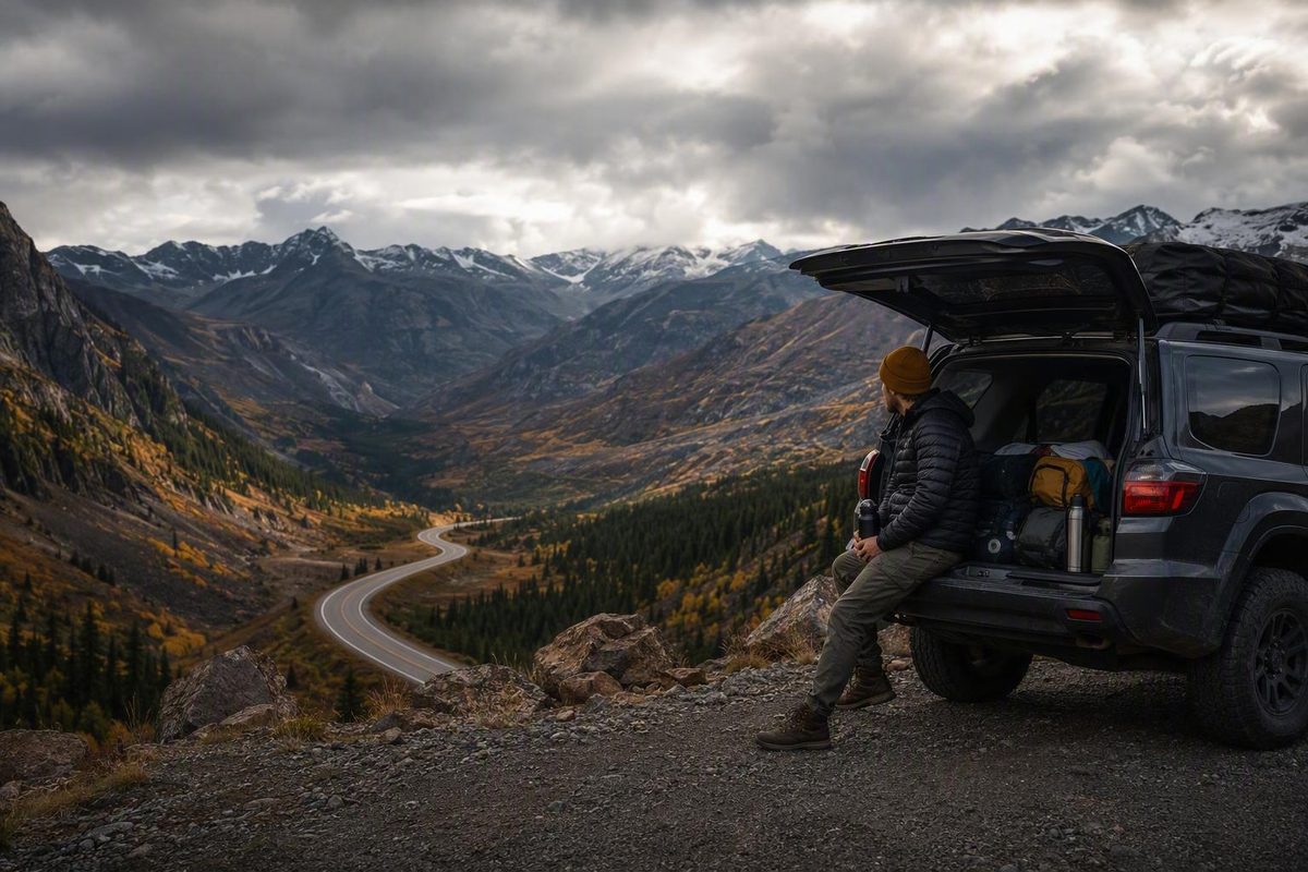
This guide concerns real-world road trip planning: choosing a feasible route, setting a workable pace, estimating costs, preparing a vehicle, and building alternatives for changing conditions. If you were looking for the 2000 comedy Road Trip, use the brief film FAQ at the end.
A successful road trip is not simply a line connecting attractions. It is a route that fits the available days, the travelers’ comfortable driving load, the vehicle, the budget, expected conditions, service availability, and a realistic margin for disruption.
Start With a Trip Brief, Not a Map Full of Pins
Before opening a routing app, write down what the trip must accomplish. This prevents the map from filling with attractive but incompatible destinations.
Start with these fundamentals:
- Departure and return dates
- Total number of travel days
- Starting point and ending point
- Round-trip, loop, or one-way format
- Number of qualified drivers
- Number and needs of passengers
- Nonnegotiable destinations or events
- Vehicle you expect to use
- Budget ceiling
- Fixed reservations or deadlines
The trip format matters. A round trip requires enough time to return without making the final days an exhausting replay of the outbound journey. A loop can reduce repetition but may add distance. A one-way itinerary can cover more territory, but flights and rental-car return rules may add cost or complexity.
Next, decide what kind of experience should dominate. A coastal trip, mountain drive, desert crossing, park tour, historic-road journey, and efficient transfer to a distant destination require different pacing. “See as much as possible” is not specific enough. Better goals include:
- Spend most days near the coast, with time for beaches and short walks.
- Connect three national parks without changing hotels every night.
- Follow historic-road towns and roadside attractions.
- Cross the country efficiently, with one meaningful stop each day.
- Drive a remote western corridor while avoiding travel after dark.
- Build a food-and-small-town trip within one compact region.
This dominant experience becomes a filter. If the goal is slow coastal exploration, an inland attraction requiring a four-hour round-trip detour may not belong. If the purpose is reaching a family event, scenic side roads must fit around the arrival deadline rather than dictate it.
Divide prospective stops into three categories:
- Must do: The trip would feel incomplete without it.
- Worth doing: Important, but removable if time or conditions deteriorate.
- Optional: A bonus stop only if the day is running comfortably.
Be strict about the first category. If every pin is a must-do stop, none is truly prioritized. An overloaded road trip often becomes continuous driving interrupted by hurried parking, photographs, and departures.
Record personal constraints at the same time. These may include:
- Hotel, campground, or vacation-rental preferences
- Mobility and accessibility needs
- Children’s meal, sleep, and activity schedules
- Pets and pet-friendly accommodation
- Essential or temperature-sensitive medication
- Border crossings and document requirements
- Fixed campsite, ferry, performance, or timed-entry reservations
- Discomfort with mountain roads, night driving, or remote highways
- Limited cargo space
- Dietary requirements
- The need for frequent restrooms or rest breaks
Put everything on a one-page brief. It can be a document, spreadsheet, or notebook page, but it should be easy to consult while evaluating routes.
| Planning field | Your answer |
|---|---|
| Dates and total days | |
| Start and end points | |
| Trip format | Round trip / loop / one way |
| Qualified drivers | |
| Priority experience | |
| Must-do stops | |
| Optional stops | |
| Vehicle | |
| Budget ceiling | |
| Fixed reservations | |
| Personal constraints | |
| Main backup option |
Use this brief as the standard for every route change. A new attraction does not belong merely because it looks interesting. It belongs only if it supports the trip’s priorities without making the timing, cost, or driving burden unreasonable.
Turn Mileage Into a Realistic Number of Travel Days
A mapping tool’s base drive time is useful, but it is not an itinerary. It represents movement between points, not the complete way a vacation day unfolds.
Begin by recording:
- Total route mileage
- Base driving time
- Mileage for each major leg
- Expected road type
- Time-zone changes
- Likely congestion points
- Known ferries, border crossings, mountain passes, or slow scenic sections
Then add non-driving time as separate blocks. Do not hide everything inside a vague contingency percentage. Estimate meals, fuel or charging, rest stops, sightseeing, walks from parking areas, attraction visits, hotel check-in, campsite setup, and likely delays individually.
For example, a map may show five hours between hotels. The actual day might include:
- 5 hours of moving time
- 45 minutes for lunch
- 30 minutes for fuel and restrooms
- 45 minutes at two viewpoints
- 2 hours at a primary attraction
- 30 minutes for traffic or parking uncertainty
- 30 minutes to reach, park at, and check into the lodging
That “five-hour drive” now occupies about ten hours between departure and settling in. It may still be feasible, but it is no longer a casual half-day.
The supplied evidence does not establish a universal number of hours that works for every road-trip driver. One experienced travel writer personally favors averaging about three hours of driving per day, but presents that figure as an individual planning preference rather than a safety standard (Live Like It’s the Weekend).
Another travel writer suggests limits of six hours on a short trip and eight hours otherwise. Those figures are also personal guidance, not legal limits or guarantees that a driver is fit to continue (One More Step).
Evaluate each day according to its circumstances:
- Driver count: A second qualified and rested driver may make a long transfer more manageable, but changing drivers does not eliminate passenger fatigue or the need for stops.
- Road type: Five interstate hours are different from five hours on winding two-lane roads, urban corridors, or mountain passes.
- Daylight: A schedule that works during long summer days may require unwanted night driving in another season.
- Weather: Rain, snow, ice, fog, wind, heat, smoke, or storms may change both travel time and driver workload.
- Traffic: A leg through a major city at peak time may be less predictable than its mileage suggests.
- Elevation and terrain: Steep or unfamiliar roads can require greater concentration.
- Sightseeing: A scenic route loses its purpose if the schedule allows no time to stop.
- Traveler needs: Children, pets, medication schedules, mobility limitations, and motion sensitivity may require more frequent or longer breaks.
Use a simple feasibility test:
If reaching the next overnight stop requires skipping meals, eliminating rest, abandoning every attraction, or assuming nothing will go wrong, the day is overloaded.
Shorten the route, move the overnight stop, or remove a destination.
On longer itineraries, consider at least one no-driving day or light-driving period when the schedule permits. This need not mean sitting in a hotel. It can be a walking day in a town, a park-shuttle day, a beach afternoon, or two nights in one lodging with only local driving.
Worked example: turning 1,480 miles into a six-day plan
Suppose two travelers have six full days for a 1,480-mile loop. A map estimates 25 hours of base driving. Dividing 25 by six creates an apparently easy average of just over four hours per day, but that average conceals the difficult days.
The first draft looks like this:
| Day | Base driving | Planned activity | Initial assessment |
|---|---|---|---|
| 1 | 4 hours | Historic district and dinner | Comfortable |
| 2 | 6.5 hours | Two overlooks and a two-hour hike | Overloaded |
| 3 | 2 hours | Park visit | Comfortable |
| 4 | 5.5 hours | Museum and scenic detour | Tight |
| 5 | 3 hours | Town and lake visit | Comfortable |
| 6 | 4 hours | Return home by evening | Reasonable |
Day 2 is the obvious problem. Add lunch, fuel, rest, trailhead parking, the hike, overlooks, and a modest delay allowance, and the day may exceed 11 hours. It also leaves no flexibility if the travelers start late or encounter congestion.
There are three reasonable fixes:
- Move the second night to a town 90 minutes earlier on the route.
- Keep the original lodging but drop the optional hike.
- Remove an outlying attraction and reduce the total route by 120 miles.
Assume the travelers care more about hiking than the original overnight town. They move the lodging closer, making Day 2 a five-hour drive with one overlook and the hike. The displaced 90 minutes move to Day 3, which originally had only two hours of driving. Day 4 remains tight, so the scenic detour becomes optional.
The revised schedule is not dramatically shorter in total mileage. It is better because the workload is distributed around the activities rather than averaged across the trip.
Build the Route Around Stop Clusters and Overnight Towns
Once the trip brief is clear, plot every candidate destination in a mapping tool. At this stage, include more possibilities than you expect to visit. The purpose is to see geographic relationships, not to commit to every pin.
Group nearby attractions into clusters such as:
- A city center and surrounding neighborhoods
- A park entrance, trail area, and gateway town
- Several historic-road stops along one corridor
- A coastal section with multiple overlooks
- A group of small towns within an hour of one another
- A museum, restaurant, and overnight district in the same metro area
Then remove obvious outliers. An attraction that appears nearby in a list may require crossing a mountain range, backtracking along a peninsula, or navigating a congested city. Compare actual routes between pins rather than estimating from straight-line distance.
Choose overnight towns only after identifying the clusters. A sensible overnight location should do at least one of the following:
- End the day after its primary experience
- Position the travelers for the next morning
- Provide needed fuel, food, charging, or lodging
- Break up a long or demanding road segment
- Avoid an unwanted night drive
- Offer a fallback if the next remote segment becomes impractical
Build most days around one or two priority experiences. Everything else should be marked optional. This gives the itinerary a defined purpose without requiring the travelers to race the clock.
Distinguish fixed commitments from flexible stops. Fixed commitments may include prepaid lodging, campsites, ferries, performances, guided tours, and timed admission. These form the schedule’s skeleton. Overlooks, roadside attractions, short walks, cafés, and many untimed museums can remain flexible.
Advance reservations are most useful when replacement options are scarce or demand is predictable: popular destinations, holiday periods, isolated lodging markets, campsites, ferries, and timed attractions. Reserving every meal and minor activity, however, can make a driving trip brittle. A delayed morning can then threaten the entire day.
Keep backup lodging areas in the plan even when reservations are confirmed. Record one or two towns before and after the intended stop, along with late-arrival rules and cancellation deadlines for the actual booking. A backup area is often more useful than one backup hotel, which may also be full when a closure or major event affects many travelers.
Do the same for roads. Identify whether a day has:
- A direct route
- A slower scenic route
- A shorter fallback
- A route avoiding a pass, ferry, or urban center
- A practical place to stop early
Save addresses, confirmation numbers, check-in instructions, and route notes offline. Take screenshots or export a simple trip document. Carry a paper map or backup GPS where cellular coverage or device power may be unreliable.
Route-planning platforms can organize stops, save itineraries, and support collaboration. Roadtrippers, for example, describes planning, discovery, and collaboration tools, but its features, prices, limits, and map data can change (Roadtrippers). Treat any platform as an organizing aid, not as the sole source of current access or road information.
A practical day-by-day entry might look like this:
| Field | Day 3 |
|---|---|
| Start | Hotel address |
| End | Campground or hotel address |
| Primary experience | Canyon trail |
| Second priority | Historic district |
| Optional stops | Overlook, roadside museum |
| Base driving | 4 hr 15 min |
| Planned non-driving time | 5 hr |
| Fuel or charging | Town A and Town B |
| Fixed time | Check-in before 8 p.m. |
| Shorter route | Highway bypass |
| Early-stop town | Town B |
| Drop first | Roadside museum |
| Offline information | Addresses, map, reservation code |
Choose a Route by Landscape, Season, and Service Level
There is no objectively best or most scenic North American road trip. Those labels depend on whether the traveler values ocean views, mountain roads, historic businesses, open desert, forests, cities, or solitude. Use established routes as comparison frameworks rather than rankings.
| Route idea | Primary character | Road and service considerations | Seasonal or access questions |
|---|---|---|---|
| Pacific Coast | Coastal towns, ocean scenery, cities, headlands | Frequent stops can make progress slower than mileage suggests; services vary by segment | Check coastal closures, storms, construction, and local access |
| Blue Ridge Parkway | Appalachian ridges, overlooks, forested landscapes | Scenic road rather than efficient transfer; access points and services require planning | Check park access, weather, and section closures |
| Route 66 | Historic-road culture, towns, roadside attractions | Uses surviving alignments, modern roads, and city streets | Confirm specific attractions, road segments, and detours |
| Great River Road | River communities and regional history | A broad corridor rather than one uniform road experience | Check flooding, construction, and local route choices |
| US-93 | Mountain-to-desert travel and long western corridors | Some sections may be remote or service-limited | Check weather, road conditions, and service availability by segment |
| US-2 | Northern landscapes and long-distance travel | Long distances and possible border-related routing choices | Check seasonal conditions and any contemplated Canadian crossing |
| US-20 | Oregon Trail-oriented transcontinental concept | Route scope can be shortened to match available time | Check weather, construction, and chosen historic stops |
| US-50 | Remote western corridors and desert landscapes | Careful fuel, lodging, and communications planning may be important | Check heat, winter conditions, closures, and services |
A Road Trip USA itinerary describes its Pacific Coast concept as approximately 1,650 miles from Washington to California. Its collection also organizes US-93, US-2, US-20, US-50, Route 66, and the Great River Road as separate long-distance trip ideas; those are editorial itineraries rather than definitive alignments (Road Trip USA).
The Blue Ridge Parkway is described as a 469-mile route connecting the Shenandoah and Great Smoky Mountains areas (Away). Mileage alone does not determine the required time because curves, viewpoints, access points, closures, and sightseeing affect the pace. Road Listings has also published a deeper Blue Ridge Parkway planning page, but its description should not be treated as confirmation of current conditions.
Named routes require careful interpretation. Historic Route 66 is not a single uninterrupted modern highway. Travelers may combine surviving alignments, modern roads, city streets, and detours. Likewise, “Pacific Coast” can refer to different highway combinations and endpoints. A US-20 or US-50 trip can begin and end wherever the traveler’s available time permits.
Choose among route concepts by asking:
- How many full travel days are available?
- Is the trip about the road itself or destinations along it?
- How comfortable are the drivers with two-lane, mountain, or remote roads?
- How frequently are fuel, charging, food, restrooms, and lodging needed?
- Could snow, storms, wildfire, flooding, heat, or seasonal closures affect the route?
- Does the itinerary depend on a park road, ferry, pass, or border crossing?
- Would crossing into Canada add document, rental, insurance, or timing complications?
- Is there a shorter parallel route if the scenic road becomes impractical?
US-93 can serve as a mountain-to-desert road-trip concept, but terrain and service patterns vary by segment. Road Listings’ published Las Vegas-to-Twin Falls US-93 guide is a starting point for researching that section, not a guarantee of current road, fuel, weather, or access conditions.
Before committing, identify the authority responsible for each question:
| Question | Source type to consult |
|---|---|
| Highway closure, construction, traction rule | State or provincial transportation department; official 511 service where available |
| Park road, entry, hours, permit, or closure | Responsible park authority |
| Weather warning or forecast | Official national or regional weather service |
| Wildfire, flood, or emergency access | Relevant emergency-management, land-management, or transportation authority |
| Border document or crossing rule | Official border agency for the countries involved |
| Ferry schedule or vehicle limit | Ferry operator or responsible transportation authority |
| Rental permission or prohibited road | Current rental agreement and rental provider |
| Fuel, charging, lodging, or attraction hours | Current operator or provider |
Recheck these sources near departure. A route description, including a recently published one, cannot establish that a road or service will remain available.
Build a Budget From Your Actual Route
Generic promises about what a road trip “should cost” are rarely useful. Cost depends on mileage, travel dates, vehicle efficiency, fuel or electricity prices, party size, lodging standard, location, parking, food choices, and activities.
Build the budget from the itinerary. Include separate lines for:
- Fuel or charging
- Vehicle inspection, maintenance, or preparation
- Rental base rate
- Rental taxes and fees
- Rental insurance, if selected
- Lodging or camping
- Food and drinks
- Tolls
- Parking
- Ferries or local transportation
- Attractions and tours
- Park, campsite, or other permits
- Souvenirs
- Pet-related expenses
- Emergency reserve
For a gasoline vehicle, use this transparent estimate:
Estimated fuel cost = total trip miles ÷ expected miles per gallon × expected average fuel price
Fuel, vehicle preparation, lodging, food, tolls, parking, activities, emergency costs, and rental expenses are among the categories included in The Hartford’s road-trip budgeting framework (The Hartford). The formula produces an estimate, not a guaranteed total, because actual mileage, efficiency, and fuel prices can differ.
If the main route is 1,500 miles, do not automatically use only 1,500 as the mileage input. Add local sightseeing, hotel-to-restaurant trips, trailhead access, planned detours, and an allowance for plausible route changes. Use an efficiency estimate suited to the loaded vehicle and expected driving rather than its best advertised result.
For electric vehicles, a comparable estimate begins with expected energy use and charging prices. Route feasibility also depends on vehicle compatibility, station availability, charging speed, weather, elevation, and fallback options. This general guide is not a complete EV charging plan; verify the route with vehicle-specific tools and current charging-network information.
Rental comparisons require more than the headline daily price. Review:
- Base rate and taxes
- Mileage allowance and overage charges
- One-way permission and drop fee
- Authorized-driver rules
- Additional-driver or age-related charges
- Fuel or charging return policy
- Insurance options and existing coverage
- Roadside-assistance terms
- Prohibited roads and geographic limits
- Late-return requirements
- Deposit or payment conditions
Compare scenarios instead of assuming one option is cheapest:
- Personal car versus rental
- Smaller car versus larger vehicle
- Hotel versus campground
- Direct highway versus scenic detour
- Restaurant-heavy plan versus packed breakfasts and lunches
- One-way trip versus loop
- Central lodging versus cheaper lodging with added driving and parking
A lower room rate outside a city may be offset by extra mileage, time, tolls, or parking. A rental may prevent wear on a personal vehicle but introduce taxes, insurance decisions, mileage restrictions, and drop fees. A campground may reduce lodging expenses while adding equipment, reservation, setup, and weather considerations.
Use three columns so uncertainty remains visible:
| Budget category | Low | Expected | Contingency |
|---|---|---|---|
| Fuel or charging | |||
| Vehicle preparation | |||
| Rental and fees | |||
| Lodging or camping | |||
| Food | |||
| Tolls and parking | |||
| Attractions and permits | |||
| Souvenirs and extras | |||
| Emergency reserve | |||
| Total |
The low column reflects favorable but plausible prices. The expected column is the working budget. The contingency column shows what happens if fuel rises, a hotel night is lost, parking costs more than expected, or the route changes.
Treat calculator results, app prices, subscriptions, discounts, and membership fees as dated inputs. Verify them when making the budget rather than assuming that a displayed price or feature will remain unchanged.
Match the Vehicle and Paperwork to the Route
The right vehicle is the one suited to the actual route and travelers—not the one that looks most adventurous.
| Vehicle | Potential advantages | Planning tradeoffs |
|---|---|---|
| Personal car | Familiar controls and known history; no rental return | Adds mileage and depends on current maintenance condition |
| Rental car | Can avoid wear on a personal vehicle; may suit a one-way plan | Contract rules, fees, insurance decisions, and unfamiliar controls |
| SUV or truck | More cargo room and possible terrain capability | Higher fuel use, larger dimensions, and parking constraints |
| RV or camper van | Combines transportation and sleeping space | Greater operating complexity, access limits, parking, hookups, and campsite planning |
| Motorcycle | Compact and highly road-focused experience | Weather exposure, luggage limits, fatigue, and specialized risk management |
A larger vehicle or all-wheel drive is not automatically required for mountains, parks, or winter destinations. Base the choice on actual road surfaces, forecast conditions, official access rules, clearance needs, passenger comfort, cargo, and the driver’s experience. Additional capability does not override closures, equipment rules, or unsuitable conditions.
For a personal vehicle, consider:
- Maintenance condition and service history
- Tire condition and suitability
- Known warning lights, leaks, noises, or starting issues
- Remaining service interval
- Expected trip mileage
- Passenger and luggage capacity
- Whether a breakdown would be unusually difficult on the proposed route
An unresolved mechanical problem should be assessed before the trip rather than used as a test of whether the vehicle can complete a long journey.
For a rental, read the current agreement rather than relying on general advice. Confirm authorized drivers, mileage restrictions, one-way permission, added fees, prohibited roads, geographic boundaries, insurance coverage, roadside assistance, and return requirements. Rules vary by provider, location, vehicle class, and contract.
Common planning checklists include a current driver’s license, vehicle registration, and proof of insurance. International driving permits, passports, visas, winter equipment, rental authorization, and border documents depend on the traveler and jurisdiction. Skyscanner’s commercial planning guide likewise advises checking state-specific document requirements, but it should be treated as a prompt to verify the law—not as the legal authority itself (Skyscanner).
For legal or contractual questions, consult the relevant licensing regulator, border agency, insurer, rental provider, or transportation authority. Do not assume that one rule applies across every U.S. state, Canadian province, rental contract, or traveler.
Specialized trips need specialized planning. The supplied evidence is not sufficient for a complete EV charging strategy, RV operation, towing, motorcycle touring, or accessible vehicle selection. Consult the vehicle manufacturer, rental operator, charging or campground providers, accessibility resources, and relevant authorities.
Prepare the Vehicle, People, and Navigation Backups
Divide preparation into three lists: vehicle checks, documents and personal essentials, and roadside supplies. This is easier to audit than one long packing list.
Vehicle checks
Common predeparture checklists cover:
- Tire condition and inflation
- Spare tire or manufacturer-provided alternative
- Jack and changing equipment
- Engine oil and other relevant fluids
- Brakes
- Headlights, brake lights, and signals
- Battery condition
- Windshield wipers and washer fluid
- Belts, hoses, or other service items where applicable
- Known mechanical problems
- Fuel level or initial charging plan
Follow the vehicle manufacturer’s instructions for specifications and service. If you cannot assess the vehicle confidently—or it has symptoms of a problem—consult a qualified mechanic. A generic checklist cannot certify roadworthiness or guarantee against a breakdown.
Road Listings has published a separate long-drive tire and gear checklist. Use it as a preparation prompt, not as a safety guarantee or substitute for vehicle-specific guidance.
Documents and personal essentials
Keep essential information accessible rather than buried under luggage:
- Driver’s license
- Vehicle registration
- Proof of insurance
- Rental agreement, if applicable
- Roadside-assistance details
- Emergency contacts
- Health and travel information needed by the travelers
- Essential medication
- Reservation confirmations
- Lodging addresses and check-in instructions
- Park, ferry, or timed-entry confirmations
- Payment methods
- Spare key, where practical
Store critical details in more than one form. A phone-only insurance card or reservation confirmation may be difficult to retrieve if the phone is lost, damaged, depleted, or offline.
Roadside and comfort supplies
Depending on the route, consider:
- Water
- Shelf-stable food
- First-aid supplies
- Flashlight and spare power
- Phone-charging equipment
- Jumper cables or a suitable jump starter
- Basic tools appropriate to the vehicle
- Warning devices
- Blankets
- Rain gear
- Warm or heat-appropriate clothing
- Sun protection
- Season-specific equipment
- Supplies for children, pets, or mobility needs
These categories also appear in commercial road-trip emergency and packing guidance, which commonly includes water, food, first-aid materials, a flashlight, charging equipment, jumper cables, warning devices, blankets, and seasonal supplies (The Hartford). What is appropriate still depends on the vehicle, climate, remoteness, traveler needs, and the user’s ability to operate the equipment.
Packing should reflect climate, trip length, passenger needs, cargo capacity, and access to services. A remote desert route, winter mountain drive, and populated summer corridor require different preparation. Avoid carrying equipment you do not understand merely because it appears on a universal checklist.
Navigation also benefits from redundancy. Before departure:
- Download maps for remote or low-service areas.
- Save written addresses for lodging and key stops.
- Carry a paper map or backup GPS.
- Save roadside-assistance and emergency contacts offline.
- Download music, podcasts, or audiobooks.
- Keep charging cables and a vehicle charger within reach.
- Share the broad itinerary with a trusted contact when appropriate.
Fatigue must be allowed to change the itinerary. Build in stopping opportunities and do not treat a reservation as a reason to continue when the driver no longer feels able to complete the leg. General cross-country planning guidance likewise recommends scheduling breaks, avoiding driving while tired, and retaining offline navigation backups (Skyscanner).
Check Conditions Again and Know What You Will Change
Road-trip planning is a repeated verification process, not a one-time research session.
Use three stages.
During initial planning
Check broad seasonal feasibility:
- Typical seasonal closures
- Likely snow, storm, wildfire, flooding, or heat exposure
- Park and ferry operating seasons
- Border-crossing implications
- Remote service gaps
- Whether the vehicle type is generally suitable
- Whether daylight supports the proposed pace
At this stage, the objective is to reject plans that rely on unlikely access or inappropriate timing.
Before departure
Recheck:
- Lodging, campsite, ferry, and attraction reservations
- Weather outlook
- Construction and closures
- Park access and operating hours
- Fees and permits
- Fuel or charging availability
- Border and document requirements
- Traction-device or vehicle restrictions
- Rental terms
- Major events that may affect traffic or lodging
Official park and transportation websites should be the primary sources for access, closures, hours, fees, and current restrictions. Rand McNally’s planning guidance also directs travelers to official park and state sources for current information (Rand McNally).
Before each major leg
Check conditions again, particularly before entering mountain, desert, coastal, park, or remote sections. Verify planned services with the responsible operator when the day depends on them being available at a particular time.
For every major day, identify three things in advance:
- A shorter route
- An alternate overnight area
- The stops that will be dropped first
Then create simple planning responses. These are decision prompts, not emergency instructions or guarantees of safety.
| Problem | Planning response |
|---|---|
| Road closure | Compare the official detour with the time available; use the early-stop plan if the revised leg no longer fits |
| Severe weather | Reassess the leg using current official warnings and forecasts; delay or shorten it if necessary |
| Extreme heat | Reconsider exposed optional activities and remote sections; verify current official guidance and available services |
| Lost connectivity | Use downloaded maps, written addresses, or paper navigation |
| Vehicle trouble | Use the vehicle’s instructions and appropriate assistance; activate the early-stop or alternate-lodging plan |
| Lodging unavailable | Contact options in the backup area rather than continuing without a defined destination |
| Traveler too tired | End or shorten the driving day and rebuild the following day |
| Attraction closed | Substitute a nearby optional stop or keep the recovered time as schedule margin |
Planning does not remove risk. Weather can shift, roads can close, travelers can become ill, and services can become unavailable after departure. The purpose of a contingency plan is to reduce the number of decisions that must be made while tired or under time pressure.
Before leaving—and again before a demanding leg—perform a concise go/no-go review:
- Is the driver rested and comfortable with the road?
- Is the vehicle free of unresolved warning signs?
- Do current official reports show acceptable weather and access?
- Are required documents available?
- Is the fuel or charging plan workable?
- Is lodging confirmed, or is a fallback area identified?
- Are communication and navigation backups ready?
- Can the day be shortened if conditions deteriorate?
Road Listings says its editorial focus includes North American routes, seasonal conditions, realistic travel timing, gear, and vehicle preparation. It also says it does not publish sponsored route guides or accept payment from lodging or attraction operators. These are the site’s own stated policies, not an external verification of independence (Road Listings About page).
The final predeparture test is straightforward: the route fits the available days without relying on nonstop timing; each day has logical stops and at least one removable option; the budget includes a reserve; the vehicle and documents fit the route; critical information has been checked with current official sources; and every major leg has a shorter or safer fallback.
If the plan passes that test, continue with route-specific and vehicle-preparation guides as needed—but recheck live conditions before departure and before each major leg.
Road Trip Planning FAQ
How many hours should I drive each day on a road trip?
There is no universal daily limit in the supplied evidence that suits every driver or trip. Published personal recommendations vary substantially, from an author’s preference for averaging about three driving hours per day to another writer’s suggested upper limit of eight hours. These are individual rules of thumb, not safety guarantees (Live Like It’s the Weekend).
Set each day according to driver condition and count, road type, weather, daylight, traffic, elevation, planned activities, and traveler needs. Include meals, fuel or charging, rest, parking, and sightseeing. If the overnight stop is reachable only by eliminating every break and contingency, shorten the day.
How do I calculate fuel costs for a road trip?
Use:
Total trip miles ÷ expected miles per gallon × expected average fuel price
This estimate uses the same core inputs—distance, expected efficiency, and fuel price—used by road-trip fuel-cost planning tools discussed in travel budgeting guidance (Cinders Travels).
Add detours, local sightseeing, and hotel-to-attraction driving to the mileage. Use a realistic efficiency estimate for the loaded vehicle and expected roads. Because mileage, efficiency, and prices can change, include a contingency rather than treating the result as exact.
What should I check on my car before a long drive?
Common checklists cover tires and inflation, the spare tire and changing equipment, fluids, brakes, lights, battery, wipers, and known mechanical issues. Also consider whether scheduled service will become due during the trip.
Follow the manufacturer’s guidance or ask a qualified mechanic to inspect any concern. No generic checklist can certify that a vehicle is roadworthy or guarantee that it will not break down.
Which road-trip routes are good starting points for planning a U.S. journey?
Useful starting concepts include:
- Pacific Coast for coastal travel
- Blue Ridge Parkway for Appalachian landscapes
- Route 66 for historic-road towns and roadside attractions
- Great River Road for a Mississippi River-oriented trip
- US-93 for a mountain-to-desert corridor
- US-2 for a northern route
- US-20 for an Oregon Trail-oriented journey
- US-50 for a remote western corridor
Treat each as a framework rather than a fixed itinerary. Endpoints, historic alignments, detours, services, access, and actual mileage vary.
Is this guide about the 2000 movie Road Trip?
No. This guide is for planning an actual driving vacation.
Road Trip is a 2000 R-rated comedy about college friends trying to intercept an illicit tape mistakenly mailed to a girlfriend. IMDb identifies Todd Phillips as director and co-writer with Scot Armstrong on its film page.
Streaming availability varies by country and changes over time. Check a current regional catalog rather than assuming that availability in one country applies elsewhere; Netflix maintains a regional listing for the film.